Category Archives: Logistics

Jumping Into Jaipur

March 23, 2024:

Dear Readers:

The Gringos are on the road again; this time on an epic journey which will take us from India to Japan, across the Bering Sea through Alaska, and ending in  Vancouver, B.C.

After 32 hours of travel, we landed yesterday afternoon in Jaipur, India (called the “Pink City”, because of all of its pink architecture). The city is divided into the old and new parts. The old part refers to the ancient communities which grew up around the Amber Fort atop the Arawali hills surrounding Jaipur.  The new part refers to the sprawling metropolis down in the flatlands which was established in 1727 by the Maharaja of Jaipur in 1727.  Today, Jaipur’s population is 4.5 million people.

As we drove from the airport, in the center of town, we saw huge ornamental structures which act as gates to a huge Central Park. Our first view was of the rear gates, before we went around the park and saw the very elaborate edifice called the Patrika Gate. This park and the Patrika Gate are right next to our hotel for the next couple of nights, the Taj Rambagh Palace. The hotel’s buildings and grounds are still owned by the Maharaja of Jaipur, but leased to the Taj Hotel to run.  Adjacent to the hotel are the polo grounds, and many of the Maharaji have been world class polo players.

Patrika Gate

As we walked to the hotel, we were greeted by a cloud of rose petals thrown; over us and given jasmine leis. The whole interior of the hotel is perfumed with a floral room scent, . We had a tour of the grounds, which were stunning, with gardens, fountains and peacocks on the lawn. The whole effect was very exotic, but magical.  Jim and I finished the day with dinner at one of the many restaurants on the property, called “Steam” because one of the dining rooms is in a converted railway carriage.

Hotel guests enjoying high tea while the peacocks grazed on the lawn.
Hotel workers creating flower mandalas for Holi.
The hotel by night
“Steam”

After great sleep last night, we woke up this morning and enjoyed a great breakfast in our hotel. Our hotel still belongs to the royal family of Jaipur, but after Indian independence in 1947, they no longer have any control over the government. Nonetheless, they appear to still be very influential (and rich).

“Our Lady of the Aggressive Schedule” has planned a doozy of a day today; our only day in Jaipur! Jaipur is actually two distinct cities; there is the old city, which is about 10 km outside of town and consists of the Amber Fort and the town surrounding it. The New City was a planned city, and was the first planned city in India. Construction began in 1727, by the Rajput ruler of Amer, Maharaja Sawai Jai Singh, who ruled from 1699 to 1743. The term “Sawai” is a term of respect connoting that the person with that title is unusually intelligent and learned (in Vip’s terms, a “super brain”) and Jai Singh clearly qualified as one! The move was necessitated by the growing population, and the increasing scarcity of water. When he moved to create the new city which became Jaipur, he also built a new palace and a royal observatory. We will be seeing all of those sites today. 

But first, we made a stop in the new city to see the Palace of the Winds.  Our guide, Vip, was very knowledgeable and connected. He told us the best views of the Palace were on the roof of a building across the street. We entered up a long flight of stairs into a nondescript entrance and then went  into the Tattoo Cafe. From its roof patio, you can see the Palace of the Winds, but also, the New Palace, the Tiger Fort atop a local hill, and the Ganesh Temple atop other hillside. The Palace of the Winds is right in the middle of the bustle of the Pink City. VIP told us the women of the Maharaja’s household used to like to stay there to watch what was going on, and the cunning design of the Palace allowed them to watch from their cantilevered windows while being sheltered from view of the people below.

The Palace of the Winds
Behind the clock tower is the New Palace, and the Tiger Fort is behind it
The Ganesh Temple
See how the Palace cantilevers out?

If you’re wondering how Jaipur came to be known as the Pink City, it happened because during the rule of Sawai Ram Singh II, the city was painted pink to welcome Albert Edward, Prince of Wales, in 1876. It proved so popular that many of the avenues in the Jaipur are still painted pink.

We then made a quick stop at flower and veg market. Here in India, everyone is preparing for Holi, the festival of colors. During the festival, people pelt each other with colored powders, as well as tossing flowers, leaves and flower petals. As you can imagine, this made the flower market particularly hectic, as Holi is on March 25th this year (in just two days). The Holi Festival begins with people making fires out of dried cow dung, and plenty of vendors had rings of the dung for sale. We saw both the wholesale and retail markets. The retail flower vendors just buy from wholesalers across the alley from where they are selling retail. Some people buy vegetables from the wholesalers and sell them door to door to housewives in the neighborhoods.

The vegetable market
The wholesale flower market
Colored powders for Holi
Dung rings for the Holi fires

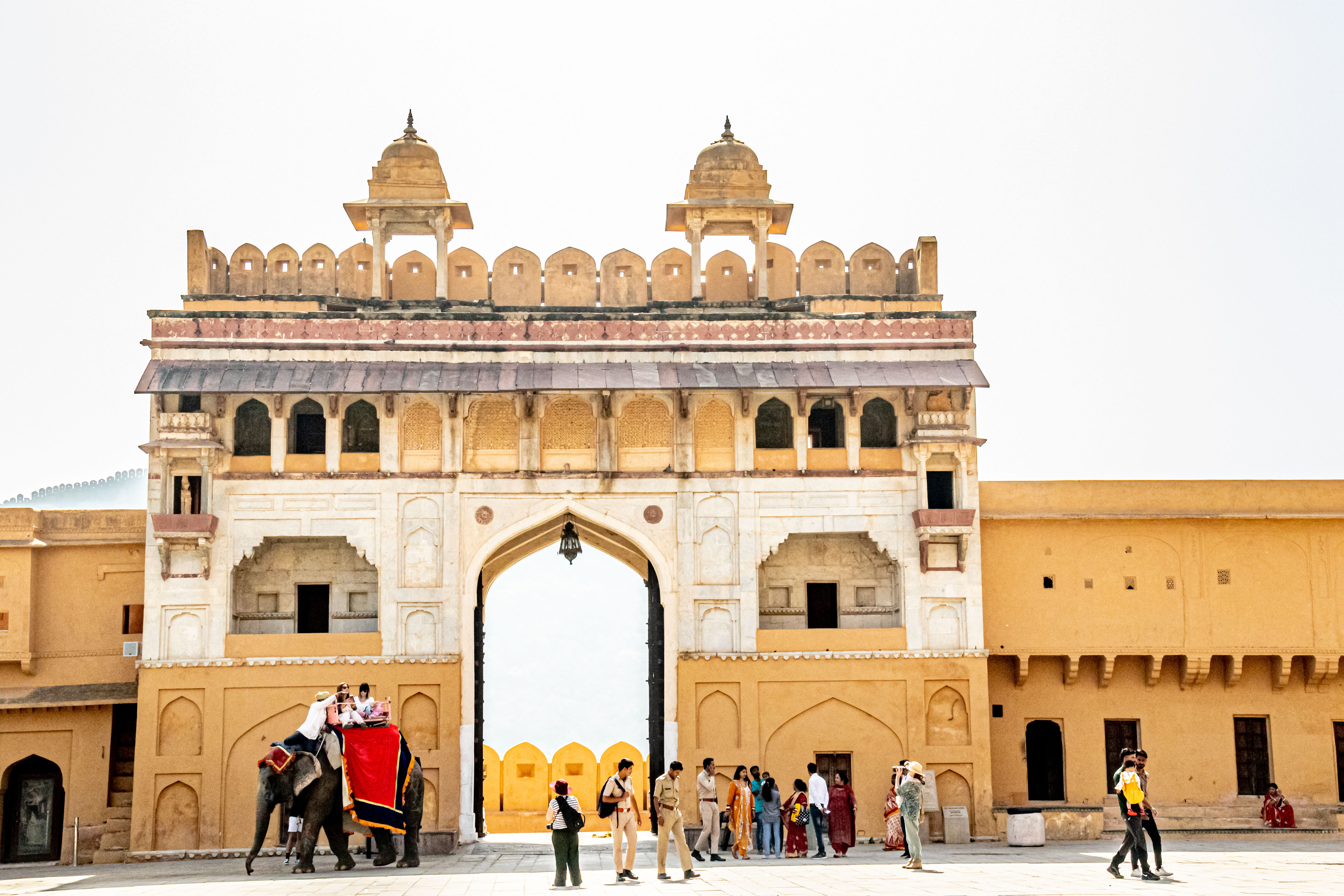
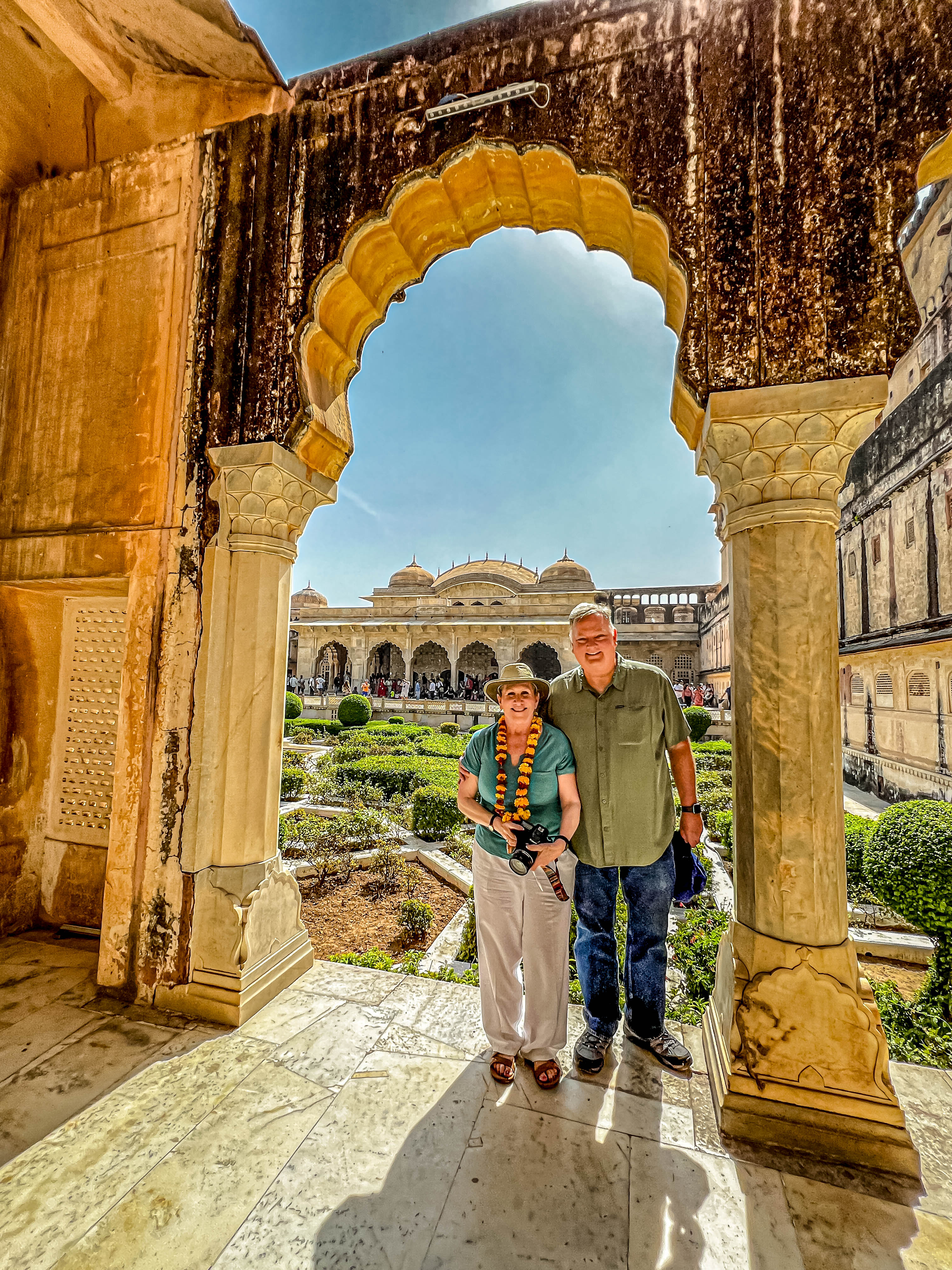
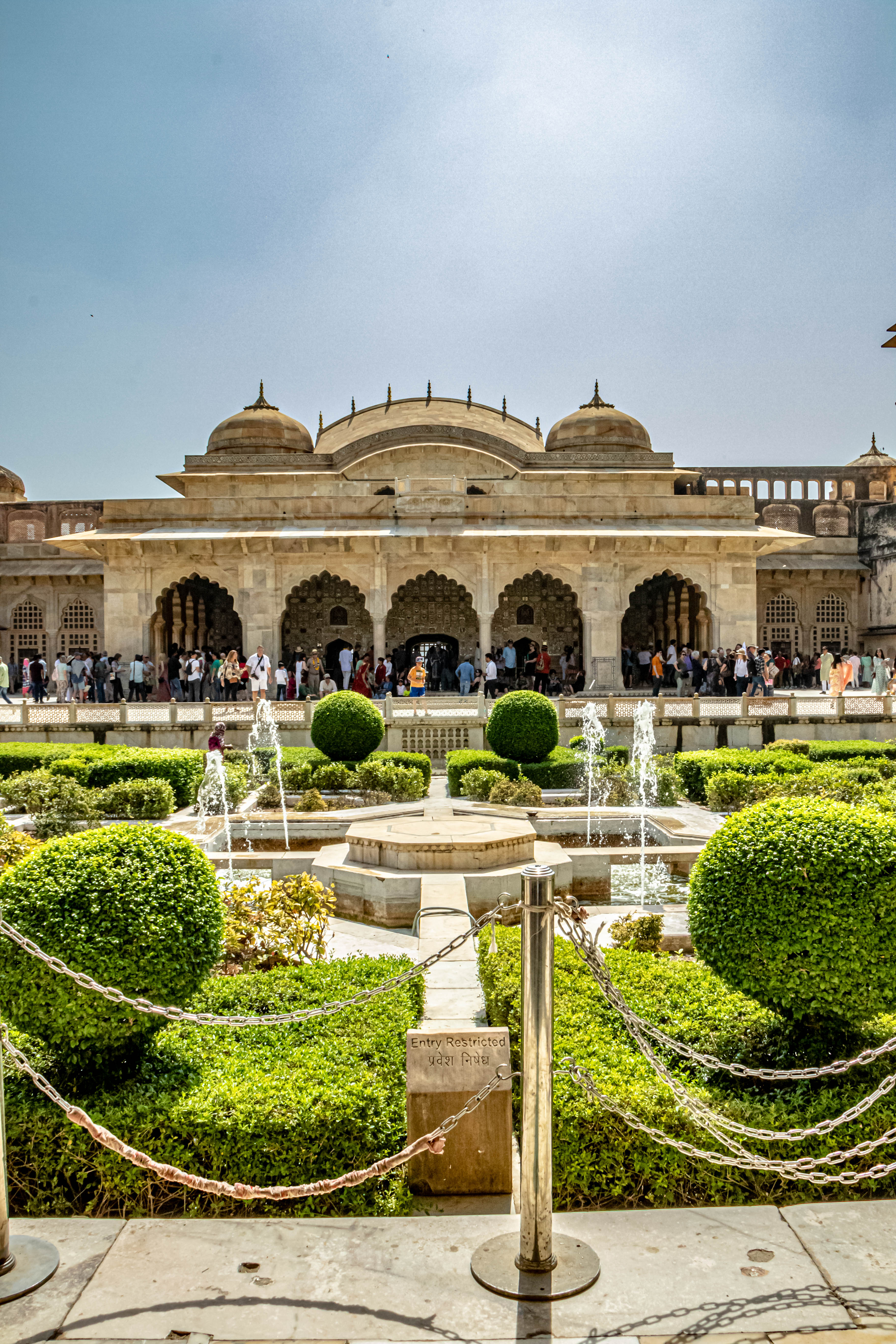
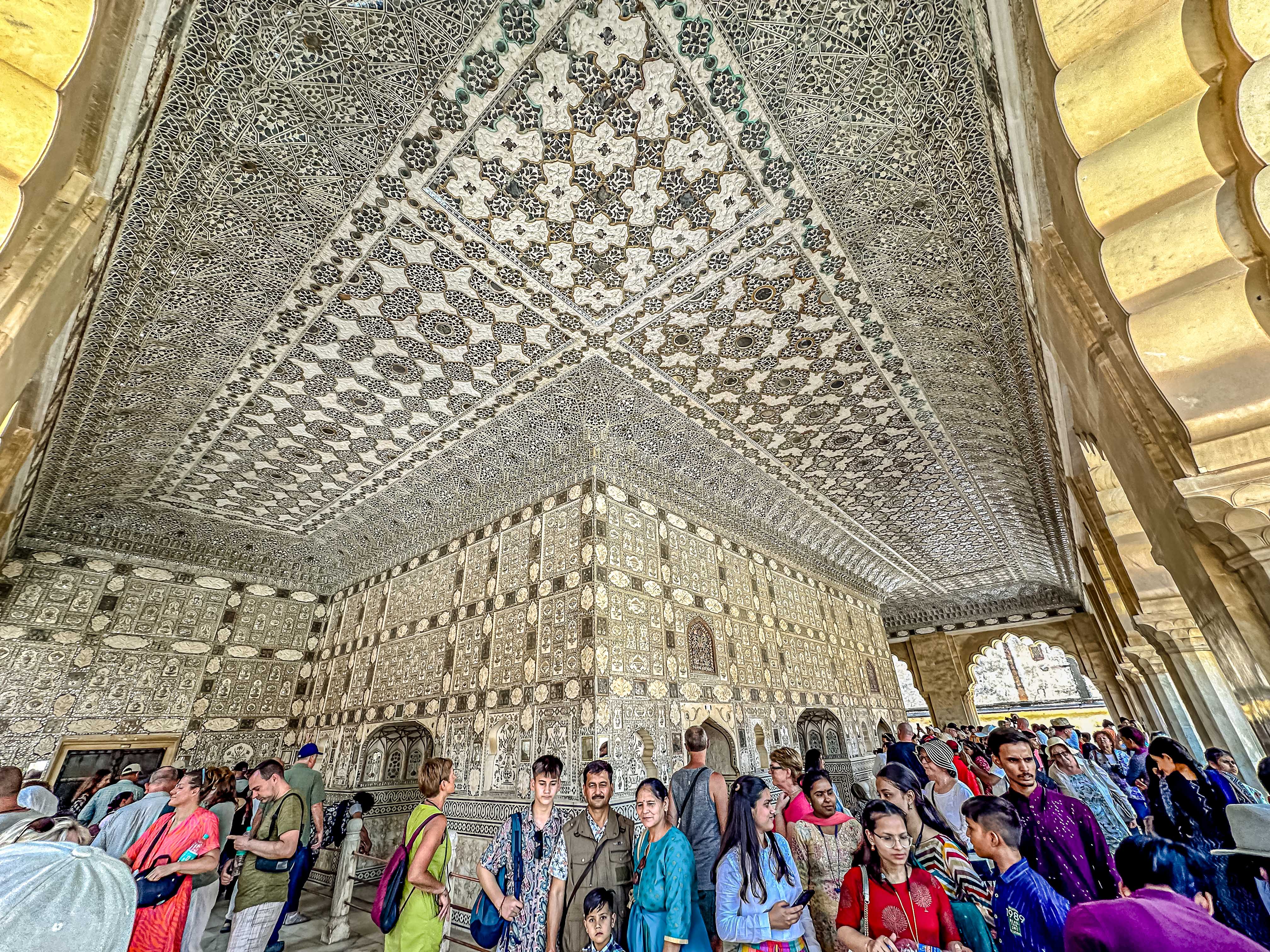
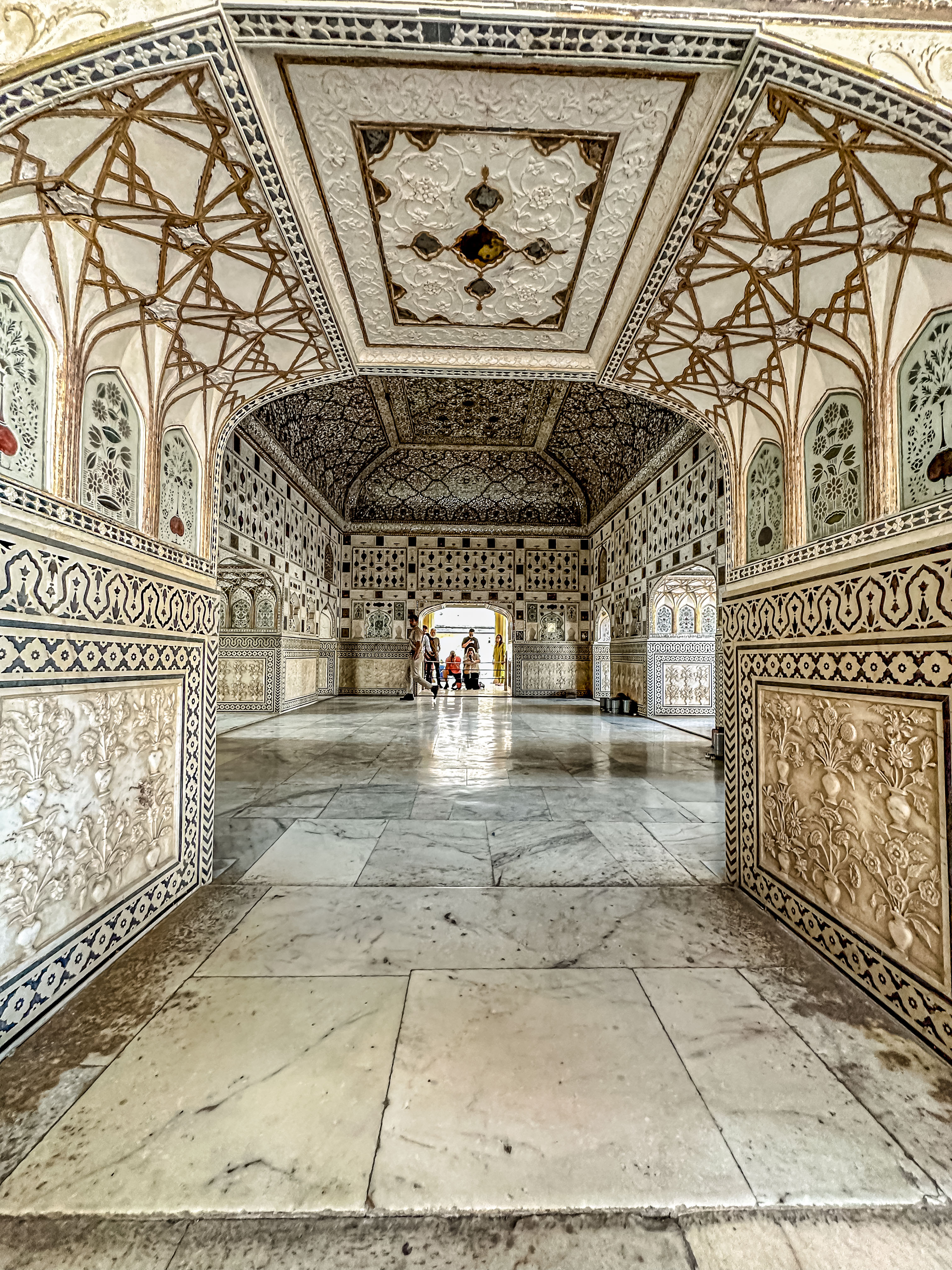
Our next visit was to the Amber Fort (pronounced Amer), which was built in the 1100s. This is a UNESCO World Heritage Site, and is a huge hilltop complex consisting of the Amber Palace (Amber Mahal); the fort complex, which housed 8,000 soldiers; and the town surrounding the fort. The whole thing is surrounded by the Great Wall of Jaipur, which runs 12 kilometers. This whole area comprises what is called the Amber City or the Old City. The Amber city about 10 kilometers from central Jaipur.

The Amber Fort and Amber Palace
The Amber Palace

Outside the fort, we saw a step well, which was used until the 1600s. These wells were about 200 meters deep, and were a popular design for constructing wells in India.  The steps allowed people to continue walking down to the water level as the level dropped or rise with seasonal fluctuations.

The step well
The town with the Amber Palace above
The main entrance gate to the Palace

The Palace itself is divided into four parts: 1. The stable area where the horses and elephants were kept; 2. The Hall of Reception, where the Maharajah received dignitaries and visitors; 3. The Royal residences (separated into summer and winter quarters); and 4. The Women’s quarters (which many consider the most beautiful part of the Palace).

The great courtyard through which you enter the Palace area. It was called the Jaleb Chowk, which means a parade ground for soldiers where the Maharaja could review his troops. The stables are behind the elephants.

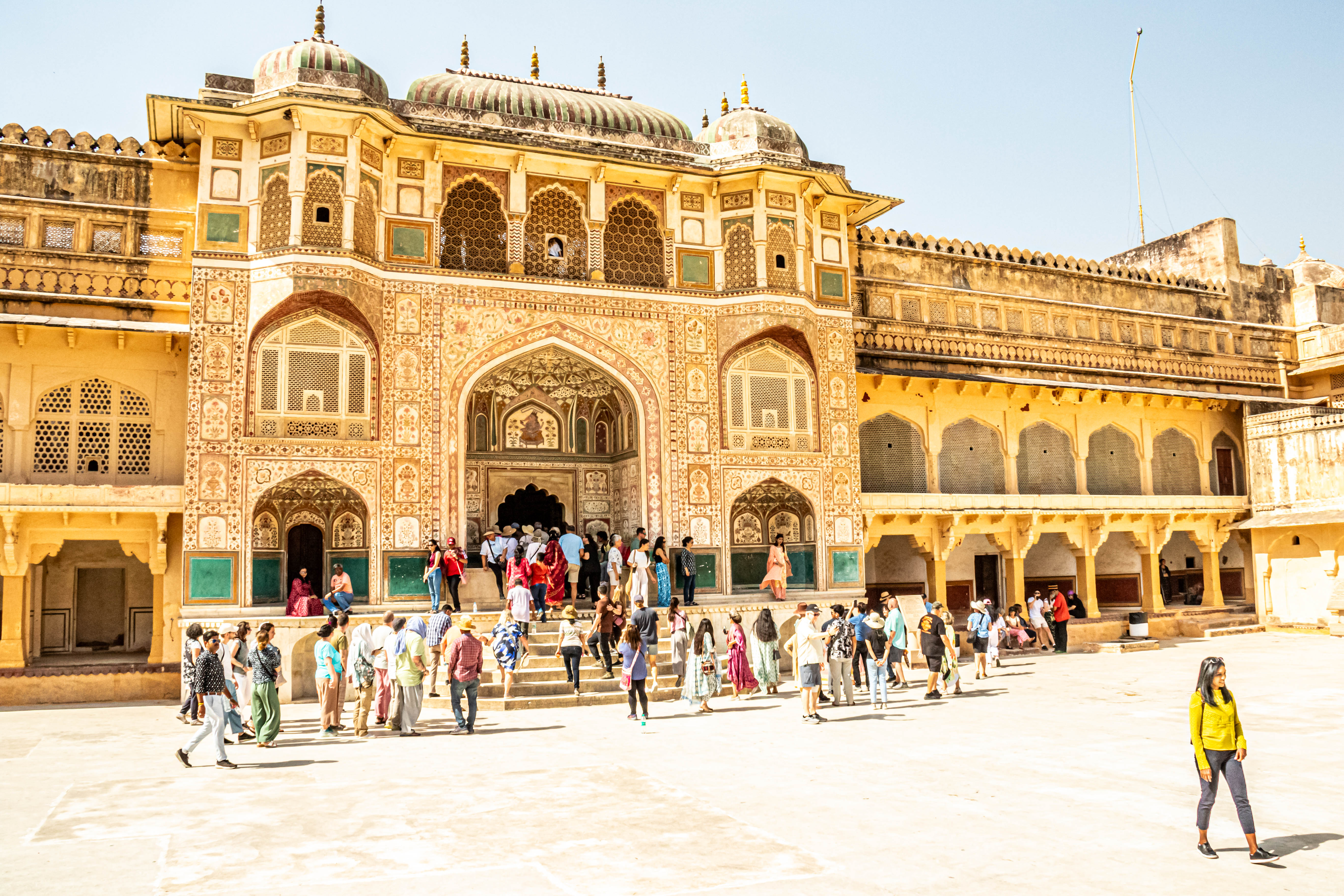
The Reception Hall was a great colonnaded building, which incorporated both Islamic (Mughal) and Hindu architecture.  But in my opinion, one of the outstanding features of the Palace is the Hall of Mirrors outside the private quarters of the Royal Residences! We ended our tour with a trip through the women’s quarters which featured a Turkish hamman-style bathing area. There was a private corridor used only by the Maharaja to visit his women, and the Maharaji apparently loved the hamman area.

The Women’s Quarters
Hall of Reception
Architectural details in the Hall of Reception
In the harman.
The private quarters surrounding the inner garden
The interior courtyard in the women’s quarters
An ancient air cooling system
First view of the Hall of Mirrors
The Hall of Mirrors

On our way back to the New City, we stopped briefly to see the Water Palace sitting in the middle of the lake, which was the main source of drinking water for Jaipur when Jai Singh moved the city to its present location.

The Water Palace

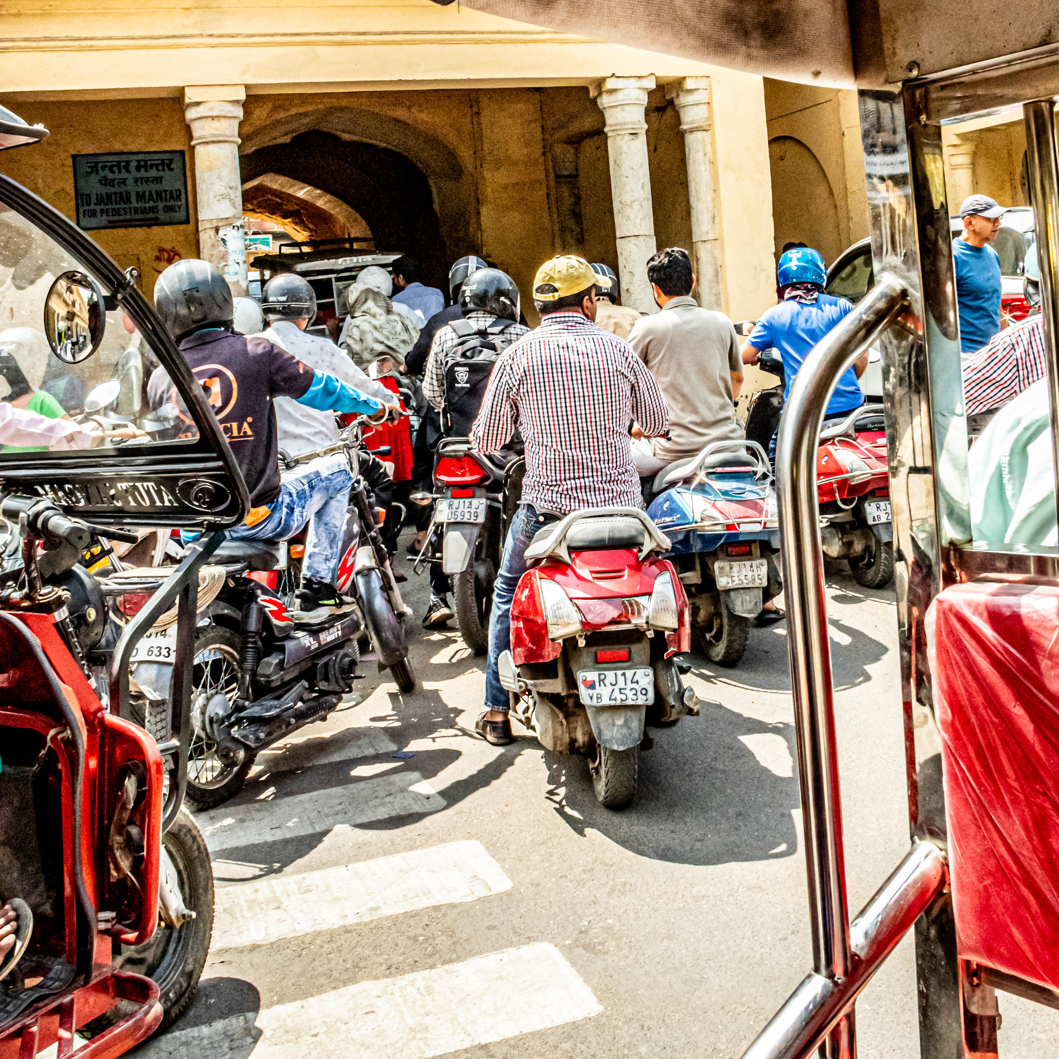
Unfortunately, we ran into a huge traffic jam when we discovered that the main road to access the New Palace, and the Royal observatory was closed to vehicular traffic so quickly rented us a ride on a Tuk Tuk, which apparently wasn’t covered by the road ban. This led us on a back road journey so we could experience Jaipur as “the real deal”. Given the plumbing work going on in the sewage system, it was perhaps a little too “real” for us to enjoy.

More vendors selling Holi colored powders
The sewer repairs (yes, that is a man’s arm sticking up out of the water).
???
Common traffic obstacles.
Tractors are also for transportation
More traffic obstacles
Doorway painted in peacock motif
The entrance to the royal city.

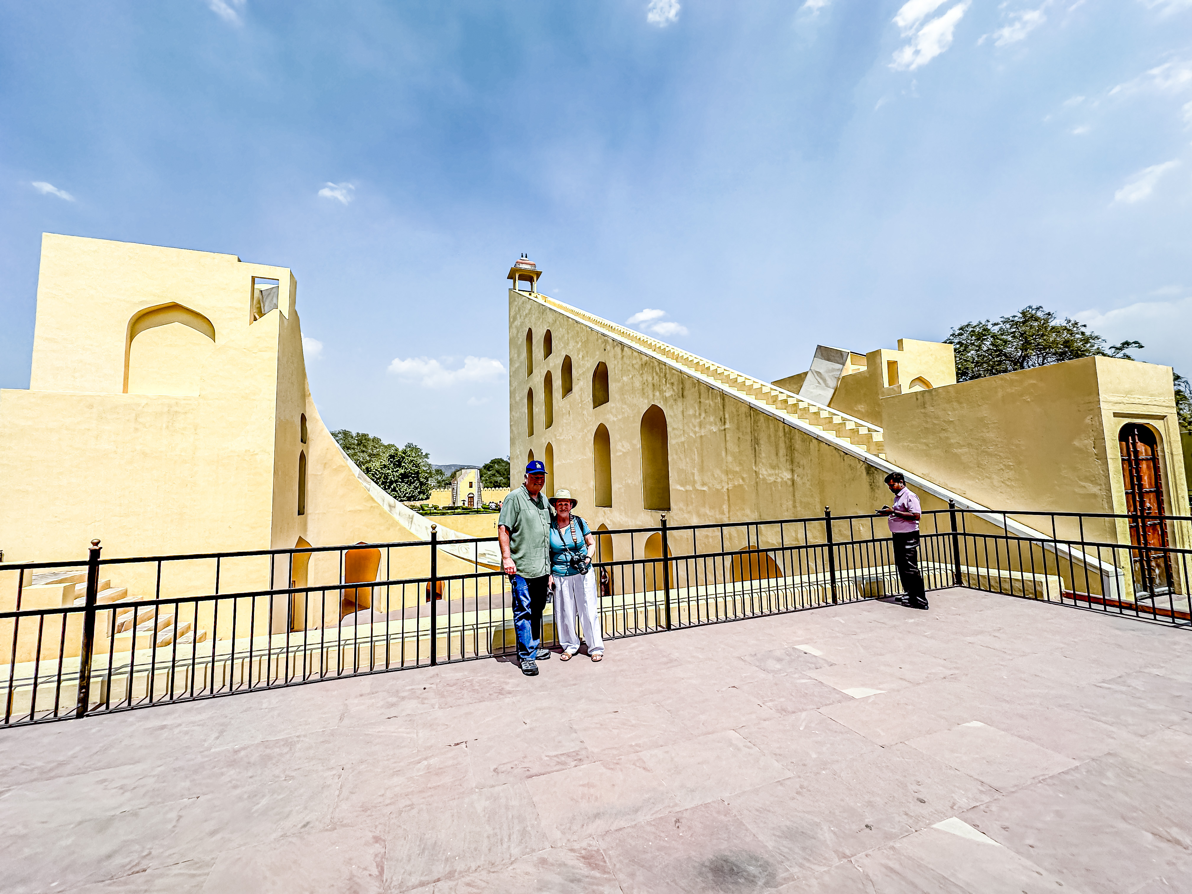
Our first stop in the New City was at the Jantar Mantar, Jaipur’s royal observatory. Unlike modern observatories, the Jantar Mantar (also built by Sawai Jai Singh), consists of a collection of 19 astronomical instruments. They are all located outside. This site is also a UNESCO World Heritage site, and features the world’s largest stone sundial. The instruments allow the observation of astronomical positions with the naked eye. These instruments are examples of the Ptolemaic system of astronomy upon which modern navigation was based. Jai Singh started building his astronomical instruments about the time he moved the city.

The outdoor observatory.
The New Palace in the background.
The astrolabe (Yantra Raj)

A cool thing was that he would first build scale models of the instruments to test his calculations about their efficacy. You can still see the scale models (which are fairly large in themselves) alongside the final full-size instruments. Among the instruments we saw were astrolabes, the 12 zodiac signs, and two sun clocks/dials. The amazing thing is that the smaller one (the model) is still accurate to within 22 seconds; and the larger one to within 2 seconds.

The scale model of the sun clock
The full size sun clock

Zodiac signs are extremely important to the Hindus, because in their culture, there is a strong correlation between astronomy and astrology. The latter is vital because if a child is born during the nighttime, the astrological instruments help to determine the child’s zodiac zodiac sign. The determination of the true zodiac sign helps determine the factors for such things as suitability for marriage.  Apparently, there are 36 factors to be considered, and there must be affinity with at least 18 of those factors for a marriage to be considered suitable. As I’m writing this, I can’t believe I’m sitting here saying this in the 21st century, but Vip said most Hindus still take it extremely seriously.

Jim in front of the Sagittarius instrument

We walked over into the grounds of the City Palace, but today, we are not allowed access to the main building because the Maharaja is in residence (you know, because his flag is flying over the Palace). Today, he is meeting with the governor of Delhi, hence the road closure and our Tuk Tuk ride. However, we were able to go to a museum in one of the outbuildings for the Palace, where numerous ceremonial items and attire of the former royal families are displayed. As you might imagine, they were incredibly lavish.

Part of the Palace complex.
The Palace grounds
The Maharaja used to travel with two of these silver urns filled with water from Jaipur when he traveled.
The museum with the Holi fire laid in front.

We also stopped at some craft workshops set aside and patronized by the Maharaja to support various traditional arts. We met with a gentleman who is an awarded artist who paints on rice paper and other traditional surfaces. He showed us his art, and created a small sketch for us.

The art galleries and workshops.

By that time, it was nearly 2:00, and we were famished. Vip had arranged for us to have lunch in a very chic restaurant on the Palace grounds called Baradari. The Maharaja is apparently an investor in this restaurant, and it is well-reviewed. Lunch was lovely, but we were beginning to flag. Note to the wise: if you ask an Indian person is a dish is spicy, inevitably, they will say it is not, but that is to their taste; not mine!

Entry to the restaurant complex

Vip had one final “surprise” in store for us; a stop at a textiles workshop and factory (aka, a shopping opportunity!).  That was fine with me, as Indian textiles are usually quite lovely. We did not give Jim an opportunity to chime in. We were first shown a workshop where they demonstrated the art of block printing on cloth, and I even got to  try my hand at it.  Then, they took us us some weavers who were making intricate woven wool rugs from camel hair. Although they were lovely, Jim and I have no need or desire to buy rugs and have them shipped home. But then we went in to the shopping mecca! Did someone say they do great textiles in India?! There were beautiful tablecloths, placemats, and even garments made to order.  Even better for us,  they  would ship a box to the U.S. for a flat rate!

We made our way back to the hotel using a “freeway”. Even it was not free of animals wandering around. On the way, we saw an elephant decorated for Holi in the traffic lanes, but all day, we’ve had to dodge cows, goats pigs and dogs on the roads. By this time, the jet lag was beginning to set in, and Jim and I were very happy to return to the oasis of the Taj Rambagh!

Since we’d had such a big lunch, we opted to dine more lightly, and after a cocktail in the Polo Bar, ate dinner out on the hotel’s terrace. The evening was lovely, and they even had live entertainment under the moonlight. What a great end to an exciting day!

The Raj and his peacock
Drinks in the Polo Bar

Stay tuned, dear Readers, for the adventures continue tomorrow, as we drive down to Ranthambhore National Park to try to film the tigers there!

Now We’re In Newcastle!

Feb. 15, 2024:

One of the weirdest things to happen with this cruise  caused by last week’s polar storm has been the changes in the ship’s itinerary which frankly, make no sense to the Gringos. We’ve been told that in order to sail in Norway’s waters, ships have to make at least two foreign ports of call. Our original itinerary neatly handled this requirement by having the cruise leave from England, and make one port call in Amsterdam before heading up to Norway for the main part of the cruise. But since we had to fly into Tromsø, we still had to make two port calls. The powers that be at Viking decided we would still travel down to the Netherlands to make a port call in Ljmuiden (which is now the closest port to Amsterdam since they have forbidden cruise ships to call there) and over an hour’s ride by bus from the port. To make matters worse, this itinerary required that we cross the North Sea three times in February, and making our other international call in Newcastle on Tyne in Great Britain. Worse, the sailing times to get to the Netherlands and England only gave us six hours in port each place. To quote an Irish guide we had once, “What gobshite came up with this itinerary?!”

We hit the port of Ljmuiden yesterday (Feb. 14th)  in the midst of torrential rains, so I opted to have a pamper day in the spa. 

We left port about 6:30, and beat feet to make it to Newcastle, which we did about noon today. The sail into the harbor was memorable in that you could see the ruins of Tynemouth Priory and Castle, a monastery whose construction began in the 1100s. Newcastle was actually the site of a sizable Roman settlement called Pons Aelius,  connected with the building of Hadrian’s Wall. It is believed that Hadrian actually visited this area in the second century A.D., which is why the settlement bears his familial name.

Tynemouth Priory & Castle

Jim and I opted to venture into the heart of Northumberland to see both the village of Stanhope, and Hexham Abbey in Hexham.  The Romans left Britain in 410 A.D.  Early Christians started Hexham Abbey in the 700s, making it one of oldest sites of Christianity in Great Britain. 

Fun fact: in the 1600s, the famous surveyor, Mason, and Royal astronomer, Dixon (who both hailed from Northumberland) sailed out of the port of Newcastle on their way to survey what became known as the Mason-Dixon Line, and set the territorial boundaries of Pennsylvania, Delaware, Maryland, and what became West Virginia. Bonus point: Mark Knopfler (formerly of Dire Straits) wrote and recorded a duet with James Taylor about their exploits called, “Sailing to Philadelphia”. Both Dire Straits and British rock star, Sting, have roots in Northumbria. People from the Newcastle area and Tyneside are referred to as “Geordies”,, which is also the name for fans of the local football club, Newcastle United.

Newcastle can trace its history back 2000 years to the Romans, and their most lasting mark on the land was Hadrian’s wall. It was originally about 15 feet high by 10 feet wide, but pieces of it still remain in Newcastle. The Danes invaded in the 800s, and basically trashed everything built by the Romans. However, after the Normans conquered the Saxons, the son of Norman king William the Conqueror (the son’s name was Robert Curthose) is credited with starting to rebuild the area, including a new defensive outpost called the New Castle. These are a few of the remains of Hadrian’s Wall.

Remains of Hadrian’ Wall

The modern history of Newcastle was built upon three industries: coal mining (for over 400 years), ship building, and production of steam engines.  Today, none of those industries remain. But its most famous export is Newcastle Brown Ale.

Newcastle is the biggest city between Edinburgh (100 miles to the north) and Leeds (100 miles south). The city proper has a population of about 200,000, but is much larger with all surrounding towns. 

We drove out into the countryside through an area called the North Pennines in the County of Durham. The countryside of Northumberland has been heavily dependent on cattle farming, but a really bad outbreak of hoof and mouth disease in recent years caused thousands to be slaughtered to prevent the spread. After that, several farmers converted parts of their farms to bed and breakfasts, and we saw far more sheep than anything else. Also, several large wind turbines dotted the countryside.

Sp many sheep!
Driving through the North Pennines
the new cash crop.

Stanhope was in a particularly scenic part of County Durham; the area was called the Land of the Prince Bishops, because the King in London was stretched too thin to rule and safeguard the area, so he granted all the powers of the king to the Bishop of Durham, so the bishop could protect the area for the king. This situation continued for about 800 years. Stanhope was a quaint town, and there’s not much more to say about it.

Stanhope Castle
Stanhope’s main street
St. Thomas’ medieval church
Along the high street in Stanhope.

There has been a church on the site of Hexham Abbey for almost 1350 years. The site of the church was granted to Bishop Wilfred by Queen Etheldreda in 674 A.D. The Abbey was originally built entirely out of stones from the Roman fort at Corbridge. Only the crypt remains from the original church. The whole thing was sacked by the Vikings, so the parts of the church that you see today is mainly from the 12th and 13th centuries, although the east end had to be rebuilt in 1860, and the nave wasn’t finished until 1908. Henry VIII took possession of the Abbey’s monastic buildings in 1537, and closed the monastery.  Ownership of the monastic buildings was only returned to the Abbey in 2012.

Hexham Abbey

Sadly, we had barely any time for our visit, and only got to see about three of the noteworthy sites within; the crypt; the Chantry Chapel; and the Flavinius Stone. That stone slab was discovered lying face down in the Abbey long after the Abbey was sacked by the Vikings and closed down by Henry VIII, and was later determined to be a sculpture of Flavius, who was killed on horseback.

Timeline of major events in the Abbey’s history. Interestingly, neither the rebuilding of the Abbey during the 11th and 12th centuries is mentioned, nor Henry VIII’s closing of the monastery.
The Crypt
Inside the crypt
These stones were carved by the Romans
Climbing out of the Crypt
Classic barrel-vaulted ceiling of the medieval period, and the organ.
The Night Stairs which the monks descended from their dormitory to pray in the middle of the night.
In the Chantry Hall
Paintings of all the bishops
The Flavinius Stone

Then it was time to return to the ship. We will be sailing back to Bergen, Norway, and will cross the North Sea for the third time this trip. To make matters worse, another storm has rolled in, which means we’ll have a pretty rough 48 hours of sailing before docking in Bergen, and disembarking the following morning. Fortunately for us, we booked an extra day in Bergen after we get off the ship, so at least we’ll be able to enjoy that beautiful city again! 

The River Tyne

Tales from Tromsø

February 6, 2024:

After a very long day of travel yesterday (Feb. 5th), we arrived last night, and whisked straight to our ship, the Viking Venus. Because of the massive Storm Ingunn, she has been docked here in port for several days riding out the storm, which is why we had to fly to Tromsø.

We overnighted in Tromsø, and then got up to explore Tromsø.  We have two objectives today: to see the town and check out two of its main sights; the observatory, which is one of the premier Northern Lights research centers in the world; and the Arctic Cathedral. Tromsø is a city of 76,000 citizens, which includes 18,000 university students. The university here is one of the premier institutions in Norway, and boasts students from140 nations.

Tromsø is the largest city in northern Norway, and the center of much of the culture of the indigenous people of this part of the Arctic, who are now known as the Sami people.  These peoples are common to northern Norway, Sweden and Finland (and in Sweden, used to be known as Laplanders). There are several Sami languages, and fortuitously,  today is national Sami day in Norway. Like many indigenous peoples the world over, the Sami people suffered their own share of marginalization and attempts to “assimilate” them into the greater Norwegian culture.  Fortunately, the country of Norway saw the error in their ways, and celebrates this diverse culture now, along with offering classes in the Sami languages in the elementary and university classes.

We didn’t really see the sun before we ventured out for our tour at 9:45 in the morning. We went first to the Planetarium, where we saw a great movie about the Northern Lights, which was the love project of a local photographer, with images collected over five years. The auditorium was almost like an IMAX theatre, and the images arced over the full rounded ceiling.

Welcome to Tromsø!
Local woman dressed in traditional Sami attire.
The sun just coming up over the horizon at about 10:15.
Icicles at the Planetarium
The Planetarium in Tromsø.

They next drove us to the Cathedral of the Arctic , which is a very modern (relatively) building, with great acoustics.  Out guide demonstrate by singing a Sami chant, and the sound was amazing.

Glorius morning here.
Cathedral of the Arctic
This design was intended to evoke the mountains here in northern Norway, and the sea ice which mounds up in the polar regions.

I didn’t realize it, but most of the main town of Tromsø is on an island, which is accessed by a huge bridge built in the last fifty years. The entire island is only about 7 miles long by four miles wide, so we saw the whole thing in short order, but we enjoyed the snowy landscapes of the strait passing by.  We also got a better view of the airport as we passed by than we had seen last night.

Our panoramic tour then took us through the Old town, where you could see several traditional buildings built in the 1800s.  Along the way, our tour guide gave us various historical tidbits, like the fact that Teddy Roosevelt came here on his yacht in 1901, and he hiked the highest peak in town. In the center of the old town is a statue of Roald Amundsen, the famous polar explorer who was not only the first to make it through the Northwest Passage, but also the first to make it to the South Pole. Many of his Arctic explorations set off from Tromsø, including his final ill-fated flight to the North Pole. Neither his plane nor body has ever been discovered.

Old town Tromsø
Roald Amundsen Statue
Norway has an annual contest which selects the ugliest new building each year. This was a recent winner.
The airport where we arrived last night
Yes, that is the sun heading down at just after noon!

We returned to the ship and fueled up, because we had another, more challenging exploration later in the day.  But in the meantime, I was curious to see whether I could could experience some of the Sami culture in town this afternoon. I took the shuttle bus into town, and walked around in the old part of town. I did see a few people dressed in traditional Sami costumes, but there were no organized activities that I could find. Nonetheless, many shops were flying the Sami flag, and more than one shop was offering samples of traditional Sami food, like reindeer salami.  Of course, I had a a sample, and it was good.

Tromso town center
A shop advertising Sami Art and the Sami flag outside
A shop selling traditional Norwegian and Sami attire.
Traditional Sami garments
This was the third stuffed polar bear I saw in shops in Tromso; probably why there are no polar bears left in Norway, except in the far remote polar island of Svalbard, where they outnumber humans by 3:1.
Reindeer salami and traditional Sami mugs.
The old town square

At 6:45 we left on a tour to try to find the Northern Lights.   Mind you, it had been fully dark since 3:00!  We drove all over trying to find the Northern Lights, but we were somewhat handicapped by the fact that many tours which try to do this drive all the way to the Finnish border from Tromsø, while we had to be back by 11:45 for the ship’s departure. Put simply, it was not to be!  We drove all over and made a few stops, but the visibility steadily worsened as the night went on, and it was snowing heavily by the time we were driving back. But apparently, this is what chasing the Northern Lights is all about!  We are still optimistic that we will find the Lights when we are in Alta tomorrow night, so stay tuned!

This was the only glimmer of the Northern Lights we saw.
While we had them, the stars were really lovely!

Greeting the Grandeur!

November 18, 2023:

Yesterday (Nov. 17, 2023), we flew out of Rome to Trieste, which is now the port of call for Venice (about 2 ½ hours away by bus). Our flight only took 50 minutes!  We stayed in the beautiful hotel, Savoia Excelsior Palace, right on the waterfront in Trieste. We couldn’t have asked for better lodgings, as we looked right at the cruise terminal. We ate dinner in a restaurant called Al Bagatto. Most of their menu selections feature fish, and fishy fish at that (in the Venetian style). Needless to say, it was not my favorite restaurant of the trip!

This morning, Jim was like a kid on Christmas morning, and he popped awake at 5:30 to catch the sight of the brand-new Regent Grandeur sailing into port. I tried to go back to sleep, but Mr. Excitement was done sleeping by shortly after 7:00.

Grandeur coming into port at 5:30 a.m.
All tied up at 7 a.m.
First sunlight breaking over her!
She’s so shiny!

The morning light looked beautiful on the ship, and we ate a good breakfast at the hotel, before being able to walk our luggage over to the ship. Naturally, we were too early to check in, but we had good company as about 15 fellow clients of our travel agency also showed up early to board. The wait was worth it as we finally got to see the ship! 

First look at Compass Rose.
Our cabin
The deck
The bathroom; incredibly spacious with lots of storage space!
This is one of the main improvements; the deck behind the spa area. It is open to all passengers, but almost never in use. The old unheated infinity pool has been replaced with two hot tubs (one on each side next to the respective men’s and women’s spa areas, and a heated rear facing pool in the middle.
There is tons of seating back here, with plentiful sun access, and hot and cold drinks available on order from the spa personnel.
One of the whirlpools
Outdoor relaxation area. Check out the comfy rocking chairs!
View coming down the grand staircase into Compass Rose
Compass Rose

We were also happy to see many of the world cruise travelers again as we boarded. It looks like it’s going to be a great cruise!

Leaving Trieste
Deck 12 above the Pool Grill area
Sail away party on the Pool Deck (Deck 11)
Farewell, Trieste; Hello, Grandeur!

Making an Appearance in Mozambique

May 1, 2023:

We sailed into Maputo, the capital of Mozambique, on May 1, 2023. We initially had great anticipation to see another African nation, and from the water, Maputo looked like a gleaming, modern city.  However, what we experienced was a day of disfunction.  

We left the ship to begin our overland journey to Kruger National Park. The border of Mozambique runs parallel to that of South Africa, and it took us about thirteen hours to travel the relatively short distance to our final destination in the Park.

High quality homes near the center of the capital

For starters, it was a national holiday in Mozambique, the International Day of the Worker. For a government which is a Communist-based democracy, you’d better believe everything in the capital was closed down for a day of marches. Fortunately, we got out of the capital relatively quickly before the marching started, but every mile further from the city center showed a deteriorating level of well-being for the populace.  

After over 400 years as a Portuguese colony, in 1975, the people of Mozambique declared independence. The movement was predominantly led by Communists, and when they came to power, they nationalized all Portuguese holdings.  Most investors left then, but our local guide said some are beginning to return.  She was very well informed, and shared quite a lot of information about the country on our drive towards the border. As is usually the case with these trips, our fellow travelers had lots of questions about systems in the country of Mozambique. There is no universal healthcare system in the country, and many people in the villages still rely on traditional healers. Education is mandatory through Grade 12, but because of the lack of school facilities, school is taught in 4 shifts of two hours each. Not surprisingly, the literacy rate is only about 55% in the country. There are 28 official languages, and  Portuguese and English are among the official languages. In 1977, Civil War broke out in the country, and lasted for 16 years, ending with a peace treaty and the introduction of UN peacekeepers in 1992.

Today, Mozambique sells electricity from huge hydroelectric power plant on a dam upstream to South Africa, Malawi, and Zimbabwe. It also exports aluminum, cotton, and minerals, cashews, and tobacco. However, the population of country is 32 million (with 5.5 million living in Maputo), and the GDP is only $48 billion, or about $1450 per person. 

It only took us about an hour to drive to the border, but that is where the challenge began.  There were cars lined up to cross the border for over a a kilometer before you even got to the border. Our local guide suggested it would be faster to walk to the border, so we piled out of our van and walked up to masses of people queued to make the crossing.  Thank goodness for our Mozambiccan guide, who exerted some pressure and charm to get an immigration official to take our group as a whole and process us through. All in all, we got through the Mozambiccan side in about 45 minutes.

Then we had to drive a short ways to the South African entry point at Komatiport. Then the fun began. Our South African guide, Tanya, was not as fortunate finding a sympathetic immigration official to process our group, and we stood around in the hot sun for about an hour and a half before an immigration official showed up and took our group.  As frustrating as this experience was, we heard that other overland groups from the ship waited up to five hours to get through the gauntlet.

In the teeming masses at the border

It was about a 45 minute drive to the Crocodile Bridge entry to Kruger National Park. There, two park rangers flexed their power, and were going to deny us entry on the grounds that it wouldn’t be safe for us to drive into the park without an escort. Fortunately, they were overruled, but they got their revenge by delaying our entry into the park for over an hour. 

 We entered the park just about sunset, and the driver put his pedal to the metal. However, it was still about another three hours to get to our safari camp, Imbali.  There were some consolations as we got to see several animals along the way, but it was a grueling day, and we didn’t get to bed until about 11, with a 5 am wake up call. But our cabin was very comfortable and we slept like babies!

First wildebeest sighting! Yay!
Hippos in the river at dusk

Looking for Lemurs in Madagascar

April 27, 2023:

We have been particularly fortunate this leg of the trip to have had biologist/naturalist lecturer onboard, Bill Toone, who has spent extensive time in Madagascar. According to his presentations, 90% of the species in Madagascar are endemic, but 90% of their natural habit has been destroyed. Further, it is one of most impoverished countries in world. Even with those caveats, we are very eager to explore on our one day in this fascinating country. 

The tiny red outline off the northwest coast of Madagascar is Nosy Be.
You can see Hell-ville and Ambatozavary. The dark green area next to Ambatozavavy is the Lokobe Nature Reserve.

Although we were originally signed up to do one of the ship’s excursions, our friends onboard (the “James Gang”; a family of Jim, Sue and their 14 year old son, Buck) had signed up to explore the nearby Lokobe Nature Preserve with one of the guides from ToursByLocals, a company which provides local tours all over the world.  Our guide for the day was Jean Claude, and he picked us up in the port on Nosy Be, which is called Hell-ville. This was our “plan” for the day:

•Drive directly to Ambatozavavy village and passing by Ylang ylang perfum plant. short visit
Photos,

•Ambatozavavy fishermen village – meet local people, walk inside for further information and photos then ride speedboat from there to Lokobe village

• Drop off of the Boat and walking slowly into the reserve. The spotting walk inside of the reserve, will take about 2hrs

• 12:00pm, Lunchtime, enjoy a traditional meal at a restaurant of Lokobe village.

However, we were late getting into port, and late meeting our guide, JC. According to JC, Nosy Be (pronounced Nosy Bay) is the most wealthy place in Madagascar, because most of the people are employed here, and there are no beggars. A huge percentage of the island is planted with ylang ylang trees, whose flowers are harvested and distilled for their essential oil to make perfume. On this island, about 25% of the population is Muslim, while 75% is Christian, but Muslims are much more of a minority on the main island of Madagascar. French is the official language, but English began to be widely used in 2002. A person must be able to speak English to guide. “Nosy” means island, and “Be” means big. However, the main island of Madagascar is much bigger, so go figure! It takes about 45 minutes by speedboat to get there.

Our drive to the village of Ambatozavavy took about 45 minutes over progressively worse roads. Along the way, we passed countless ylang ylang plantations. Right in the middle of the road, we saw an amazing chameleon which was bright green with red zig zags around his eyes. We were able to walk right up to him (and his cousin) and get some great shots.

Finally, after we had been driving over gravel roads for about 10 kilometers, we arrived at the village. We saw lots of families had cattle, which are the Zebu cattle; the largest animal in Madagascar. Our first shock awaited us in the village, when we found out that our boat was in reality a narrow outrigger canoe with an outboard, and that we would have to wade out to it. Since we were all dressed in safari attire for our walk in the jungle reserve, we had to take off our shoes, and roll our pants up as best we could, before walking across the mud flats to the boat. Of course, we all got wet, and it was very difficult to climb into the boat, but we finally all made it.  The trip by boat is necessary because there are no roads going into the nature reserve. 

Elementary school

About 45 minutes later, we arrived at the village outside the reserve (Lokobe village?), and we again had to wade in to shore and then walk across the sand to get to the village.  By this time, it was already after noon, so our “schedule” was badly blown. We decided to do the nature hike first.

Jackfruit

Having cleaned off our feet and gotten ready for the hike, we had our second rude shock, which was that he trails were not nearly as accessible to people who had mobility limitations like our friend, Jim.  Nonetheless, our local guide was very good, and very soon, he spotted a pair of nocturnal lemurs for us.  

Our local guide showing us how easily the ylang ylang grows here.
The blossoms which will be harvested in a few days
This is pretty close to life size.
Welcome to the jungle primeval.
Vanilla growing wild
Two nocturnal lemurs bunched together
They sleep with their eyes open

We walked on an he found us a different kind of lemurs to photograph.  He also pointed out a very large sleeping boa constrictor coiled up in the roots of a tree right next to the path. We capped our explorations with a view of a different kind of chameleon, and by this time, we were all completely soaked with sweat and somewhat muddy. Most of the people in the village supplemented their income with handicrafts, and we braved the sales gauntlet on the way back into the village.  

The second set of lemurs
All together now … Awwww!
Yikes! Boa constrictor.
Another lemur jumping through the trees
This lizard is a master of disguise!
A different type of chameleon

While not a restaurant by western standards, there was an open air eating area in the village set up with picnic tables, and most importantly, with cold beer! We had a very good lunch of grilled fish and shrimps served with an avocado salad and fresh fruit. According to JC, THB  (Three Horses Beer) is the best local brand of beer, and we would have had to agree for as good as it tasted that afternoon!

We waded back out to the boat and motored back to Ambatozavavy. These young people all seemed to be practicing their boating skills. Then we returned to the pier, just a half hour before it was time to depart. It was a little hair raising for our tastes, but the day really fulfilled with this little taste of Madagascar’s wildlife!

Free at Last!

Jan. 21, 2023:

After leaving the port of Guayaquil on Jan. 17th, we pulled into the port city for Lima, Peru (Callao) on the morning of Jan. 19th. Only to be greeted by the the Captain’s unwelcome news that we would have to ride at anchor about four miles off the shore until further notice as the port was experiencing “unsafe large swells”. It turned out that was code-speak for the fact that Lima had been hit with widespread demonstrations following the impeachment and removal of the President Castillo.  After failing to take the airport in Cusco and the port of Arequipa in the south of the country, the protests had arrived in Lima, and they were violent. Even though all shore excursions had been canceled, the port was temporarily closed. That was a problem for us because our ship was awaiting over 100 pallets of food and supplies, and desperately needed to refuel before setting off across the Pacific.

As time progressed with no change from the port authorities, everyone was on pins and needles. Finally, about 3:00 on the 20th, we learned we would be allowed to dock, off-load some staff to go home (and pick up their replacements), and resupply. Finally, we were able to leave about 2 am on the 21st.  Everyone on board was visibly relieved!  The even better news was that we learned we would still be stopping at Easter Island; a “bucket list” destination for many of our fellow passengers. The Captain has his “pedal to the metal”, as we’re doing 20 knots/hour (about the fastest we’ve ever experienced). However, we’ll still be a full day late in Easter Island. No word yet on what that will do our following ports, but the Gringos don’t care, as we have “paciencia and flexibilidad”; necessary traits for all travelers, as we have learned!

First ship leaving the port.

Passing Though the Panama Canal

Jan. 12, 2023:

We made our call at the pilot station on the Caribbean side of the Panama Canal before dawn this morning, and brought our pilot aboard, along with a representative from the Canal Authority who will narrate our transit through the canal from north to south (that’s right; it’s not east to west, as you might think).

We approached the Gatún Locks from the Colon side of the Canal

No matter what I might tell you about the engineering marvel which is the Panama Canal, it will not be adequate to describe it to you. The transit must really be experienced to be understood!  Originally completed in 1914, the canal came to be largely because of the political machinations of President Teddy Roosevelt, who helped the Panamanians declare their independence from Colombia in 1903. The contract for the United States to build the canal was signed the next day in 1903.  The conditions for the construction were horrific, and thousands of men (mostly people of color) lost their lives building it. In particular, the canal had to be dug through over 200 feet of rock making up the Continental Divide to get the water levels to work.  Over its first 100 years of existence, the Canal was used constantly, and became essential for world commerce, not to mention travel.  However, when human ingenuity created container ships too wide and long to fit within the existing locks, and with waits to transit exceeding several hours on both sides, Panama decided to created a third set of locks to accommodate the increased traffic at a cost of approximately $6 billion. The new locks have only been open a few years and traffic through them has already paid for their construction. For a really good documentary about the building of the original canal, check out: “A Man, A Plan, A Canal, Panama” or you can read David McCullough’s great book about the subject. BTW, A Man, A Plan, A Canal, Panama is also the longest palindrome known.

A Majestic Frigate Bird floating overhead.
The Princess ship going through the Agua Clara Locks next to us.

Jim and I have transited the canal a few times, and visited Panama even more (we love it here!), but the transit experience never fails to amaze. We were out early on the deck as we approached our first set of locks, but apparently not early enough to get a spot at the front-facing rails on the top deck. Nonetheless, we stayed outside until we had passed through the three locks which lead into Gatún Lake.  We were fortunate to see a fellow cruise ship (the Caribbean Princess) passing the same way in the new third set of locks. Though she’s huge at over 3,000 passengers, she wasn’t large enough to have to use the bigger third channel, but there was so much extra traffic backed up, they probably needed to use that third channel just to keep traffic moving. From the aft deck of the ship, we were able to see the new bridge built high over the entrance to locks as part of the construction of the third channel. Previously, road traffic on the Caribbean side of the canal had to use a bridge right on top of the locks, and traffic could back up for hours waiting for the locks to close so traffic could pass over the top.

A tree full of pelicans beside the canal.
Going through the Gatún Locks.
The little engines that make it all possible by guiding the giant ships through the locks at an even spacing from the sides of the locks.
Frigate Bird up close
The engines go up these inclines as the ships rise in the locks.
This ship just passed through the locks ahead of us.
This one is in the lane beside us.
The little engines that could.
This is while we’re waiting for our lock to fill with water and float us up to the next level.
The control house for the Gatún Locks
Pelicans flying by at eye level
Looking back towards the Caribbean at the bridge which didn’t exist before the third lane of the canal was built.

The sail across the vastness of Gatún Lake takes several hours, and I enjoyed just setting up my tripod to see what tropical birds and monkeys I might spy.  It was a perfect day for the crossing; still but not too hot. We’ve been here before when the wind was blowing so hard, multiple tugboats had to fight just to get the ships lined up to enter the locks.

Some of the millions of little islands which are in Lake Gatún. Many of them have monkeys and birds, and an occasional crocodile, but there wasn’t much wildlife today.
Some form of buzzard?
Sightseeing boats looking for the same elusive wildlife.

At the southern end of Gatún Lake, you enter the area where the greatest excavation had to be done, and over 100 years later, you can still see the deep bench cuts the constructors had to make to cut a gap through the Continental Divide. This particular stretch of the canal was so nasty to excavate that it is called the Culebra (Snake) Cut. The mighty Chagres River empties into Gatún Lake through the Culebra Cut, and its waters power the operations of the Canal. Basically, the mountains which come together at the Continental Divide form a giant rain forest, which all empties into the Chagres River. Then you go under the Centennial Bridge to enter the single lock of Pedro Miguel. A short ways further, you enter the final set of locks, the Miraflores Locks. If you are driving alongside the canal, there is a fabulous museum right beside the Miraflores Locks, and there is a viewing station at the top of that building where restaurant for the visitors’ center is located, and you can watch the ships passing by at eye level. Even without transiting the canal, no trip to the Panama City area is complete without a visit to this museum!

In the Culebra Cut.
A container ship coming through the Culebra Cut behind us.
In the Pedro Miguel Lock
Tis big boy whizzed past us in the third lane and is already almost under the Bridge of the Americas.

We passed through the Pedro Miguel Lock, and then sailed the short distance to the Miraflores Locks. One of the cool things you can do is watch your ship pass through the lock on the camera they have mounted on the lock building. Here is a screen shot of us passing through.  We had no sooner passed through the last lock when a torrential downpour hit us. Talk about perfect timing!

Picture from the Canal-Cam.
Jim as we go through the Miraflores Locks
End of the Miraflores Locks
Here came the rain!

We’re sailing out into the Pacific Ocean with our next port of call in two days in Manta, Ecuador. However, you won’t hear from us for a few more days because the Gringos are doing an off-ship adventure in the Galápagos Islands.  When we get back to the ship, and can download our pictures, we’ll post again. Until then, you can enjoy this photo of the Spontaneous Duo (Kasia and Boogie) playing last night in the Horizon Lounge. They’ll be onboard with us for the entire trip. 

Headed out under the Bridge of the Americas into the Pacific Ocean .
Kasia & Boogie

Wandering the World

Jan. 7, 2023:

Dear Readers:

Today we embark on what is possibly our craziest adventure yet; a world cruise from Miami to Barcelona!  As you can see from the map, we stay mostly in the Southern Hemisphere, and only make four stops in Europe, so it is quite an unusual itinerary. The attached list of posts tells you where we will be on any given day for the next five months.

Last night, we flew into Miami, and enjoyed a great dinner at one of Daniel Boulud’s restaurants, Boulud Sud, which highlights Mediterranean-accented food. For a starter, Jim had a tuna tartare with truffle and cream fraiche, and it was possibly the best tuna tartare I have ever had. Don’t look for a picture, because as you know, we are #theworstfoodbloggersever! For mains, I had lamb chops with Moroccan spices, and Jim had the duck breast. Both were excellent and the service was superb!

The dining room of Boulud Sud

For our trip, we are aboard the Regent Seven Seas Mariner. We were last on this ship in March 2020, when we were sad to be kicked off when cruising shut down world-wide. They shipped us home from Perth, Australia, and were very nice about it, but we couldn’t wait to get back!

Our floating home for the next five months
Boarding process
Port of Miami
Coming aboard
Home sweet home!

Just the world cruisers have boarded today, as we have a grand sail away gala tonight, but the few non-world cruisers will board tomorrow and we will set sail for our first port in Cartagena, Colombia.  Sail along with us, while we explore the world!

The Gringos gussied up for the gala
Special gala performance by Jane Krakowski and Tituss Burgess

Getting Into Glasgow

Sept. 2, 2022:

On Sept. 1st, Jim and the others in our small group drove up to the north end of Lewis and Harris, where they met with a man who used to earn his living “guga-hunting” (guga is the Scottish word for gannets). Guga were a traditional food source for those living in the Hebrides, but today, the practice has become criticized as ecologically unsound. In fact, given the current bird flu epidemic, all such hunting activities are prohibited, and people are barred from landing on many of the islands in the Hebrides which are bird rookeries.  I personally no longer see a need societally for this practice, and so I chose not to attend. The group also drove up to see the northernmost point on the island known as the Butt of Lewis, before returning to Stornoway.

Clach an Trushel

I spent my time in the sunny luxury of Lews Castle, sipping coffee and writing blog posts while I looked out over Stornoway Harbor.  When Jim returned, we walked into town and explored further on our own. In particular, I enjoyed a local gallery which showcases Hebridean artists’ work called An Lanntair.  We finished off our time in the Hebrides with a great dinner at the Harbor Kitchen.

Early on the morning of Sept. 2, 2023, we left the Hebrides to fly to Glasgow, the biggest city in Scotland.   After checking into the hotel (the Apex City Center), we met up with our larger group for the main part of our OAT tour of Scotland. Fortunately for us, our trip leader, Damian Stent, continued with us on the main trip. Damian did a brief introductory tourn of the area around the hotel. 

The St. George of Tron Church

Glasgow grew rapidly in the 18th and 19th centuries. Glasgow’s money was made off tobacco, and also sugar cane, which meant that it was heavily dependent on the slave trade and slavery to provide the labor for such products. It parlayed that wealth to become Scotland’s industrial powerhouse, and became known as the British Empire’s Second City.

We walked into the heart of what had been the central business district in the Victorian era. Despite its shameful past, Glasgow was one of the world’s first cities to recognize and welcome the newly freed Nelson Mandela in the 1990s, when it gave him the Freedom of the City and renamed the area surrounding the old Tron Church and Glasgow Stock Exchange as Nelson Mandela Place. This was particularly galling to the South African government at the time as this was the site of the South African Embassy, which changed its address to Nelson Mandela Plaza. The South Africans were so miffed that they relocated their Embassy to Edinburgh. Mandela paid tribute to the citizens of Glasgow for being among the earliest to condemn the apartheid in South Africa and call for the release of Mandela and the other imprisoned leaders of the African National Congress. The former stock exchange is now a shopping plaza. Right outside the St. George of Tron Church is a very poignant sculpture depicting Jesus as a homeless man sleeping on a bench.

Former Glasgow Stock Exchange
Jesus as a homeless person

Then we walked over to George Square, where the Town House (town hall) is located.The Square has 12 statues, 11 put up by state, 1 by the people through a public commission. The 11 statues are all of Hanoverian (British) royalty, including statues of Queen Victoria and Prince Albert. The lone outlier is a statue of Sir Walter Scott, who was incredibly influential in 19th century British society. He was the key to the romantic view of Scotland after his novels and poems about the Highlands and  the clans caused the views of Victorian Brits to soften towards the Scots. He also managed to get all the post-Culloden restrictions set aside.

George Square with the Town House in the background
Prince Albert & Queen Victoria
Royal Exchange Square
Victorian Train Station

Finally, we walked by the Gallery of Modern Art, which has a statue of Duke of Wellington out front. It’s hard to see in this picture, but the Duke is wearing a construction cone as a hat, and it is a favorite pastime of the Glaswegians to garb him in fanciful hats and other attire. He wore a mask during the COVID pandemic. Then we returned to the hotel. I used my free time to get my nails done, while Jim did some reconnaissance on local pubs. 

Gallery of Modern Art with Wellington our front

We met up at the famous Pot Still, a bar which is home to over 300 Scottish malt whiskies. Damian had explained to us that in Scotland, a minimum shot is 25ml, but it can vary upwards, so the standard pour is typically 25-35 ml. If you ask for a “dram” or a “wee dram”, what you will get is a shot.  Jim and I split a whiskey sampler called Highland v. Islay (“Eye-Lah”), featuring three samples from each location.  The three Highland malts were Glenmorangie (10 yr.), Edradour (10 yr.), and Inchmoan (12. Yr.). The three Islay malts were Bunnahabhain (12 yr.), Laphroaig (quarter cask), and Ardbeg Uigedail (NV). I think Jim liked the Glen Morangie best, followed by the Inchmoan, but he also discovered that with a wee drop or two of water, he could actually drink the Islay malts which he had rejected as being too peaty before. I really liked the Bunnahabhain, and also the Inchmoan.  Properly fortified, we set off to join the group for dinner at a restaurant called Masala Twist, which is allegedly the place where the dish Chicken Tikka Masala was invented. Curry is a national favorite of the Scottish, and this was a pretty good representation of the food.

The Pot Still
A bonny wee pub!