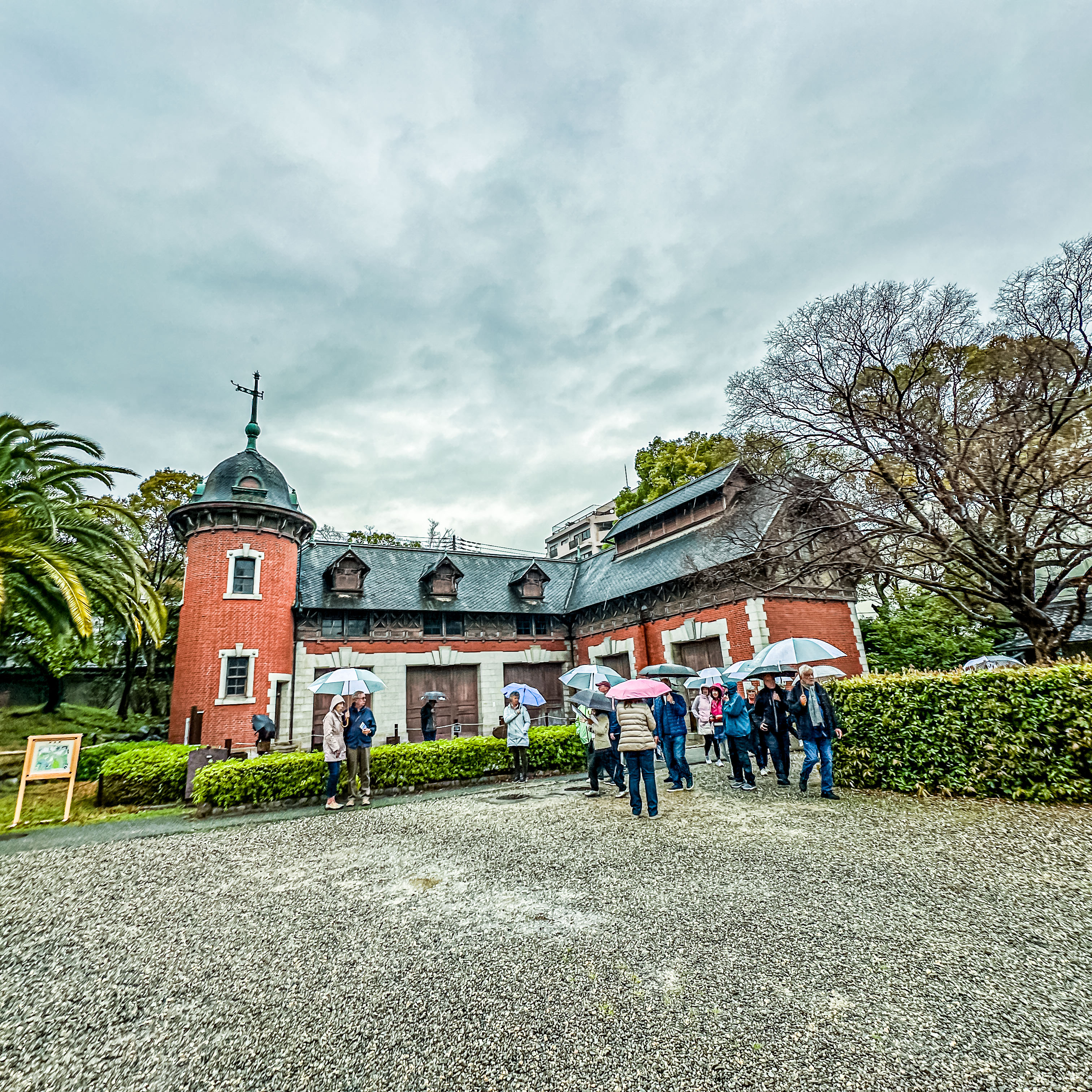
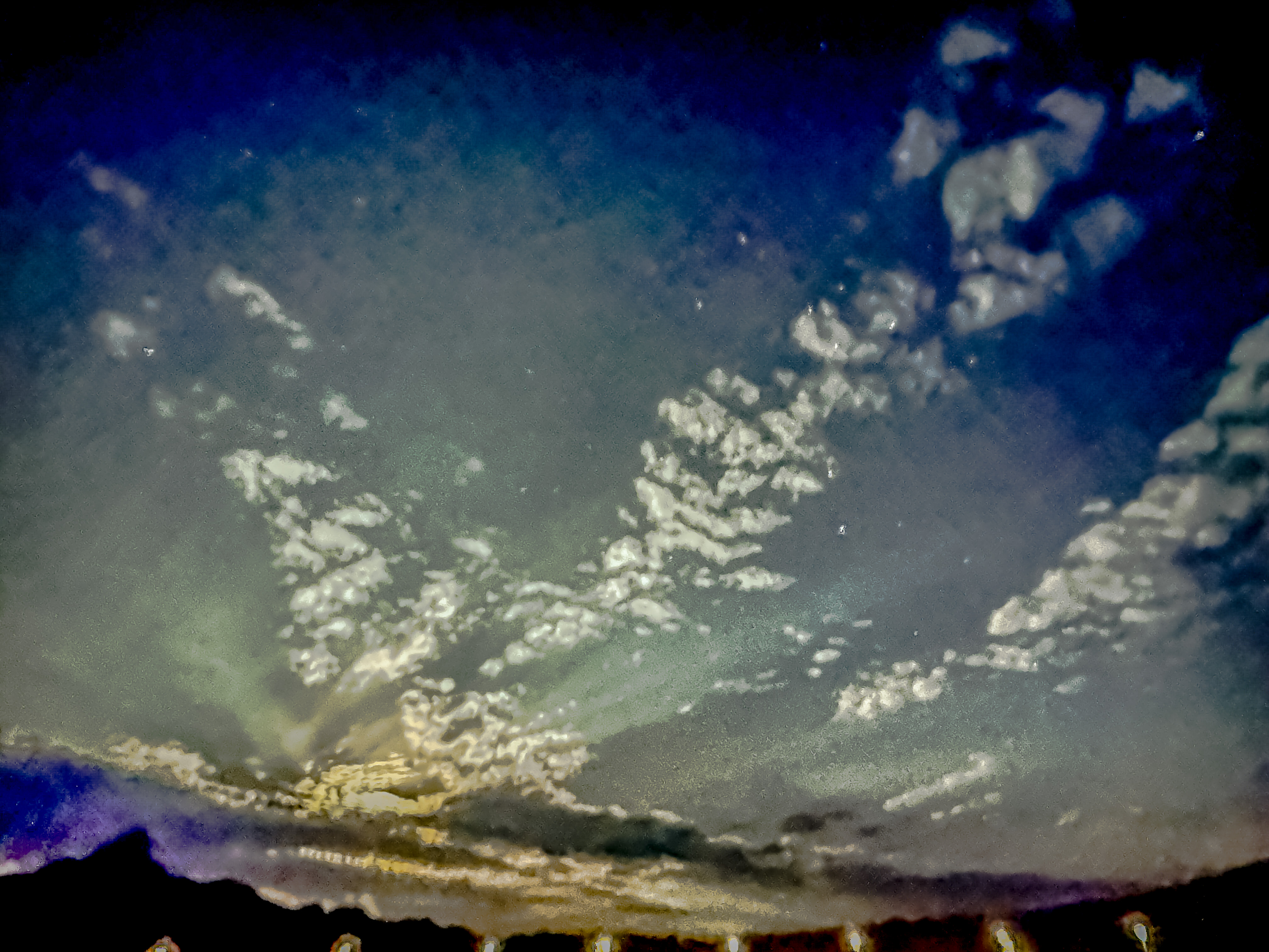
Sadly, our arrival in the mega port of Kobe the afternoon of April 3rd brought with it pouring rain instead of the sun we enjoyed yesterday. Kobe is the port for both Ōsaka and Kyoto. We will be staying docked here overnight to help us explore the cultural treasures which exist all over this area. For today’s explorations (given our afternoon arrival), we chose to stay in the Kobe area to see some of the sights here:the longest suspension bridge in the world (3,911 meters), and Sorakuen Gardens.
We left the ship, and drove over the Akashi Kaikyo Bridge over the biggest strait in Japan. The bridge started construction in 1988 and was completed in 1998; quite a feat considering the devastating earthquake which leveled Kobe in 1994. The pylons of the bridge measure 283 meters (928 feet), and its longest span is 1,991 meters (6,532 feet).
There’s a whole viewing area complete with shops and cafes, but it was raining steadily, and the tour operator allocated an hour there. Being done with the rain and limited views in about 15 minutes, the saving grace was that there was a Starbucks! I was able to successfully navigate Google Translate to order Jim and me our favorite coffees! Even better, they had a device by the door to encase your umbrella in plastic to keep the store dry while you drank your coffee! Brilliant! I’m sure it had beautiful views on a clear day, but we were more than ready to leave.
Sakura-themed donuts in Starbuck’s
Then we drove back into downtown Kobe to see the Sorakuen Gardens. Of Kobe’s many city parks, Sorakuen is the only traditional Japanese-style garden. Completed in the early 20th century, it was built by Taijiro Kodera, father of former Kobe City Mayor Kenkichi Kodera. Alongside the traditional layout, the wave of Westernization experienced in the Meiji Period can be detected in the sprawling lawn.
Sorakuen GardensLayout of the Gardens
Before coming under the ownership of Kobe City in March 1941, and being renamed “Sorakuen” the following November, it was commonly known as the “Kodera Mansion” or the “Sotetsu Garden.”
Hassam HouseKordera Stable
While the main residence and many other buildings burned down during World War II, the Western style Kodera Stable, surrounding wall, and gates are original. The Former Hassam House, Sorakuen Hall, and Kanshintei tea house were subsequently constructed after the traditional pleasure barge (Funa-yakata) was donated and relocated to the Sorakuen garden.
Camellia bush about to bloom
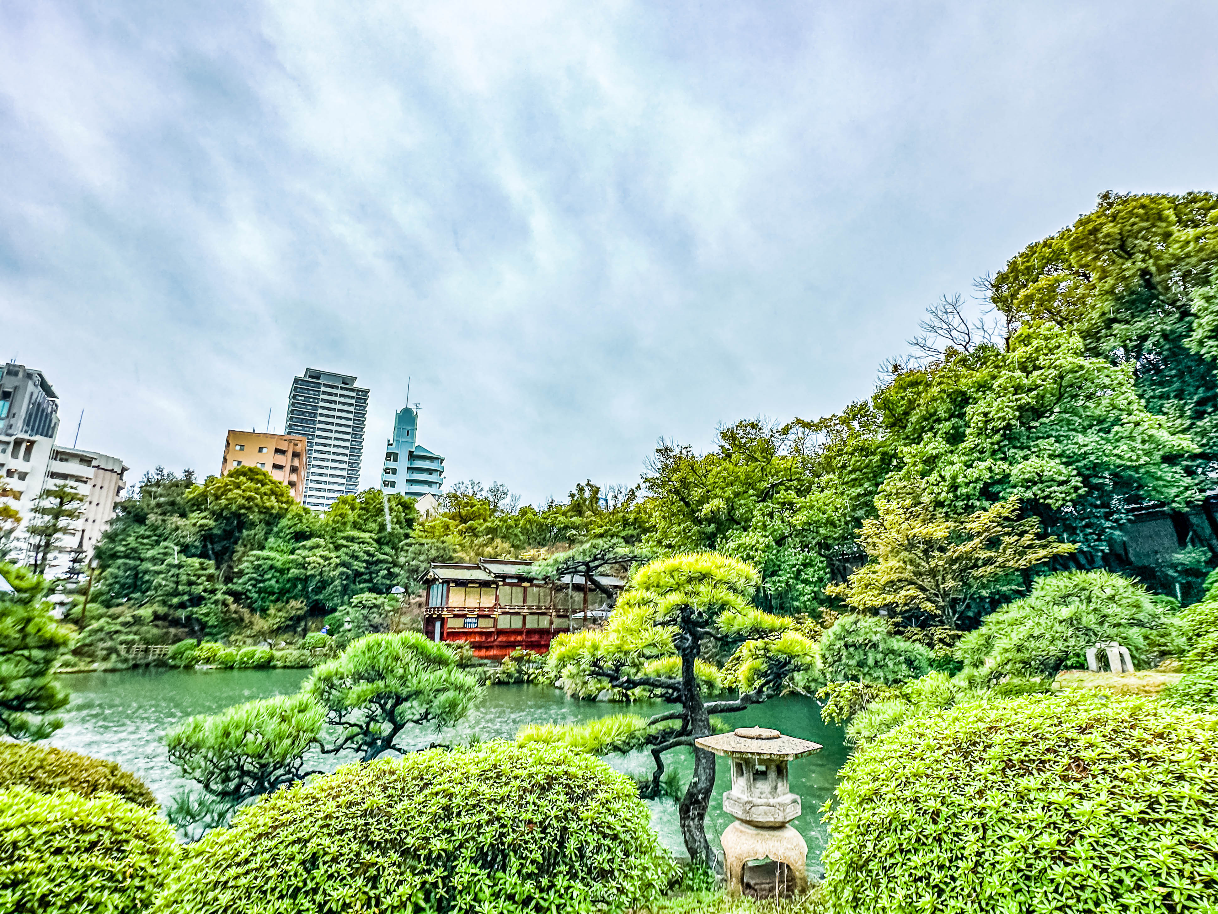
Although the gardens are fairly modern, they were lovely (although very wet). The magnificent camphor trees, cycad wood, and large lanterns give the garden a majestic aura. The sprawling grounds measure 19,566 square meters. The visual centerpiece of the gardens, though, is the building housing the river pleasure boat (funa-yakata) built early in the Edo period, and owned by the lord of Himeji around the end of the 17th century . It continued to be used on the river until the end of the Edo period (1603-1868). At the beginning of the Meiji period (1868-1912), it was moved from the Shikama port area to Takasago, at which time the cabin was detached from the boat so that it could be used as a tea house. In 1941, it was relocated to the residence of Yoshiro Ushio in Kobe City. He donated it to the city in 1978.
The Funa-yakata
All the wood surfaces both inside and outside the funa-yakata were painted with either transparent or thick black lacquer, the tie beams and rafter ends were fitted with metal decorations covered in gold leaf, and the sliding door and window frames were coated in black lacquer and the spaces between them covered in gold leaf, giving the structure a luxurious and delicate beauty.
Based on the family crests seen on the decorative metal fittings, it is thought that the barge was built sometime between 1682 and 1704, when the Honda clan was assigned to rule the Himeji domain.
During the Edo period, the feudal lords of western Japan built these pleasure boats, often in competition with one another, to travel to their compulsory residences in the distant Edo capital. Very few of these barges remain and this is the only remaining example of a pleasure boat for river use.
As we finished our walk, we found a some lovely viewpoints overlooking the ponds filled with koi fish, but even the booming cherry trees were not enough to make us linger.
Restaurant in Kobe harbor
Back on board, we were gifted with a special musical presentation by a local Kobe band of traditional Taikō drummers. It was very stirring (and loud), and we couldn’t believe the precision of the drummers. Their performance was very vigorous and enthusiastic, and we really enjoyed the performance!
Yesterday (Nov. 17, 2023), we flew out of Rome to Trieste, which is now the port of call for Venice (about 2 ½ hours away by bus). Our flight only took 50 minutes! We stayed in the beautiful hotel, Savoia Excelsior Palace, right on the waterfront in Trieste. We couldn’t have asked for better lodgings, as we looked right at the cruise terminal. We ate dinner in a restaurant called Al Bagatto. Most of their menu selections feature fish, and fishy fish at that (in the Venetian style). Needless to say, it was not my favorite restaurant of the trip!
This morning, Jim was like a kid on Christmas morning, and he popped awake at 5:30 to catch the sight of the brand-new Regent Grandeur sailing into port. I tried to go back to sleep, but Mr. Excitement was done sleeping by shortly after 7:00.
Grandeur coming into port at 5:30 a.m.All tied up at 7 a.m.First sunlight breaking over her!She’s so shiny!
The morning light looked beautiful on the ship, and we ate a good breakfast at the hotel, before being able to walk our luggage over to the ship. Naturally, we were too early to check in, but we had good company as about 15 fellow clients of our travel agency also showed up early to board. The wait was worth it as we finally got to see the ship!
First look at Compass Rose.Our cabinThe deckThe bathroom; incredibly spacious with lots of storage space!This is one of the main improvements; the deck behind the spa area. It is open to all passengers, but almost never in use. The old unheated infinity pool has been replaced with two hot tubs (one on each side next to the respective men’s and women’s spa areas, and a heated rear facing pool in the middle.There is tons of seating back here, with plentiful sun access, and hot and cold drinks available on order from the spa personnel.One of the whirlpoolsOutdoor relaxation area. Check out the comfy rocking chairs!View coming down the grand staircase into Compass RoseCompass Rose
We were also happy to see many of the world cruise travelers again as we boarded. It looks like it’s going to be a great cruise!
Leaving TriesteDeck 12 above the Pool Grill areaSail away party on the Pool Deck (Deck 11)Farewell, Trieste; Hello, Grandeur!
After one night back on the ship in Cape Town, we left again early the morning of May 6, 2023, to fly to Namibia. We flew all the way up to the capital of Namibia (Windhoek), and then changed to a small plane for the remainder of our journey back south to the Sossusvlei desert.
Airport in WindhoekTaking off out of WindhoekThe airstrip at Sossusvlei.
The area around Windhoek is more green and verdant than the areas in the south, which are largely full of craggy peaks overlaid with sand dunes. This overland journey will take us to the Sossusvlei Desert Lodge for two nights at a swanky resort run by the AndBeyond hospitality company, which will be the first time we would stay with them.
While there are some desert-adapted animal species to see, the real draw of this area is the gigantic red sand dunes. From the resort, we plan to drive out to the Dead Vlei (dead valley in Afrikaans) to see an area where the blowing sand choked off a river which used to flow to sea several hundred years ago, and what little vegetation there was in the valley all petrified. Reputedly, it is very haunting and stark. The resort also boasts its own high-powered telescope, and the area is certified as a “dark sky preserve” which promises some awesome star gazing.
Upon arrival at the resort, we were met at the private airstrip by one of the resort staff, who had set up a welcome station with sparkling wine and fruit kabobs. As we drove back to the lodge, we could see the small villas tucked into the foothills. We saw a Pale Chanting Goshawk in one of the few trees around. When we checked into our accommodations, they were some of the nicest we have ever seen in Africa!
Our first views of the lodgePale Chanting GoshawkThe view from our room.The other “cabins” spread out to preserve maximum views for each room.
After a quick time in the room freshening up, we headed out on a “game drive” and for sundowners. The starkness of this landscape is really eye-opening!
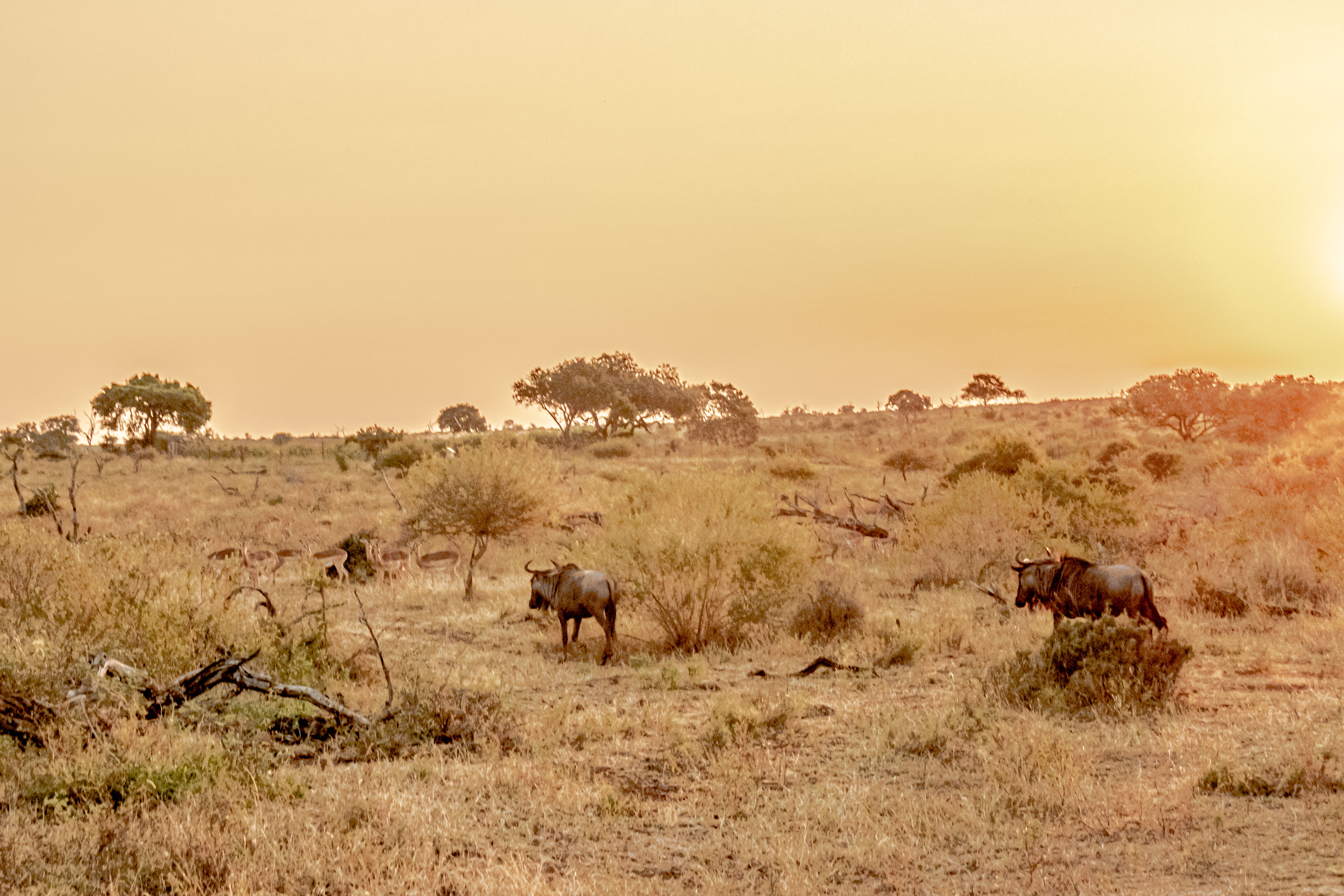
One of the few types of animals you see in this eco-system is the antelope. In particular, springbok and oryx are the two species most commonly seen. But they are very solitary, and it is rare to see more than one or two at time. After spotting the exemplars, we stopped for our sun-downers, and then drove a bit further to an open-air enclosure which had been set for a braai (barbecue) dinner under the stars.
SpringbokOryx and two springbok
Another captivating aspect to this area is that it is a certified “dark sky preserve”, which means the lack of light pollution from nearby populations makes for some great astronomy. During the time of our stay, the moon was full, which hindered our viewing somewhat, still made for a magical evening!
All too soon, our final day in Kruger dawned on May 5, 2023. As usual, we loaded into our safari vehicles about 6, and set off on our final game drive. One of the camp Bush Buck came to see us off.
The baboons were playing in the riverbed again, and the spotted hyena was also in almost the same place as yesterday.
The resident baboonsThe local hyena
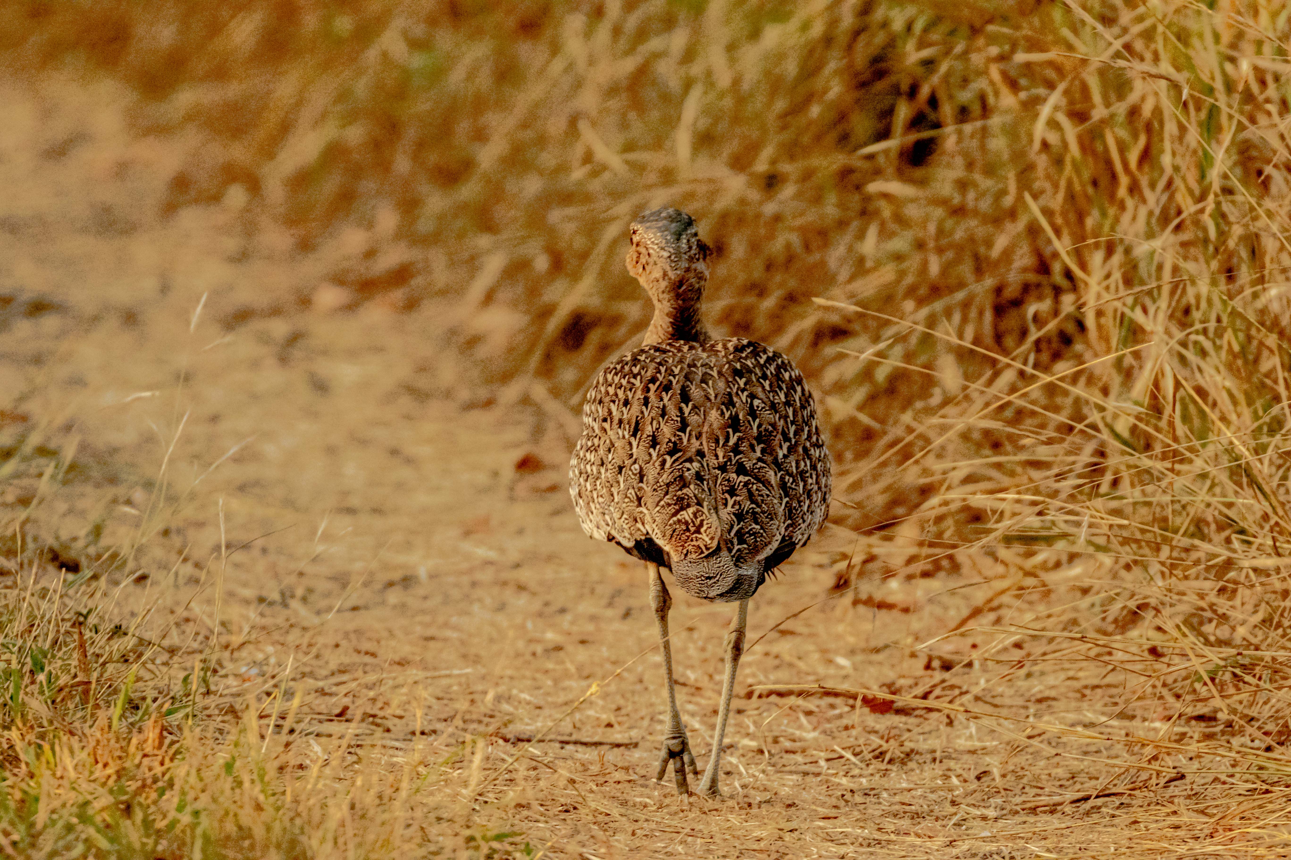
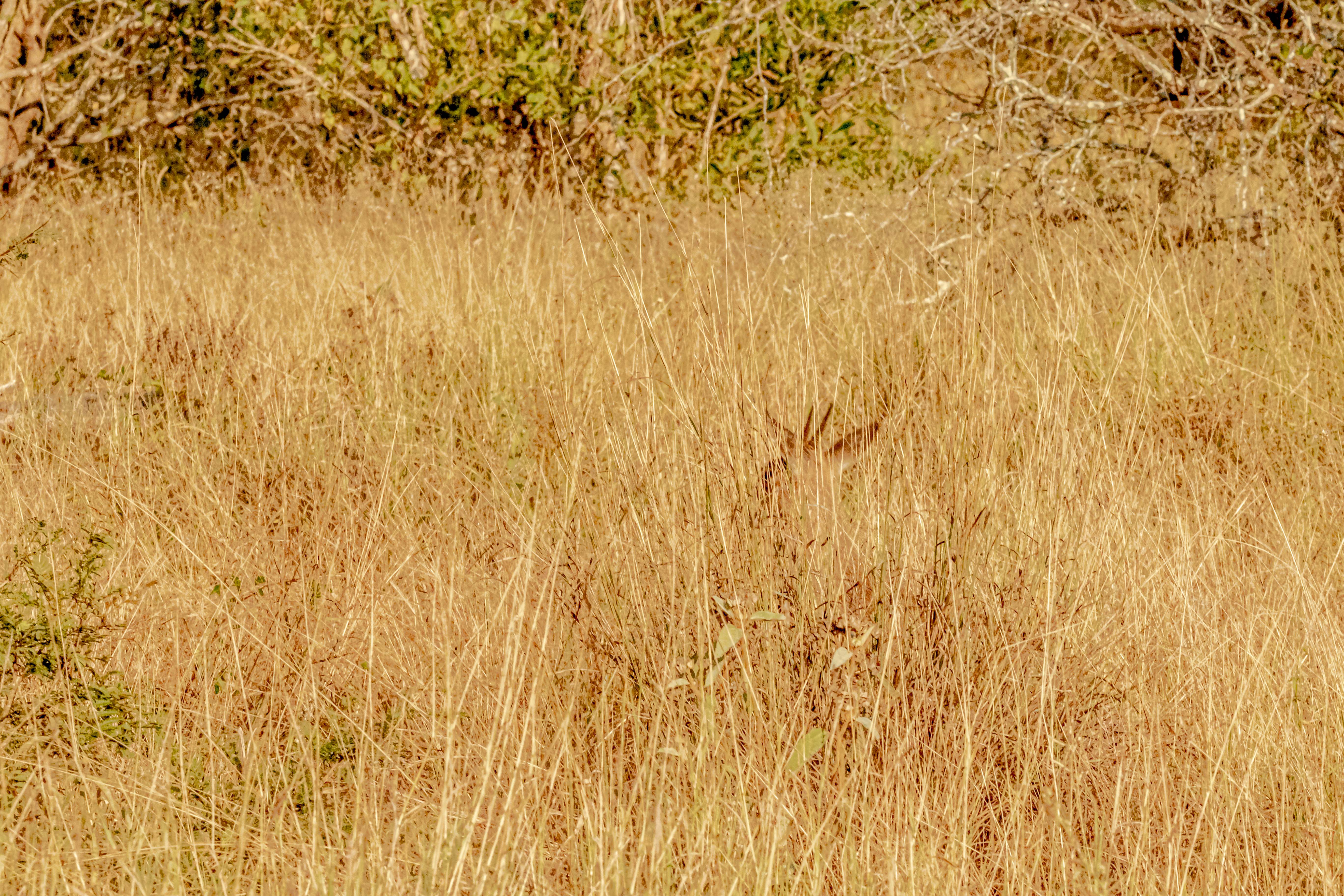
On our drive out, we saw an elephant , and then we had a great sighting of a Woodland Kingfisher. We saw a Red-crested Korhaan running down the road.
Water Buck!Woodland KingfisherRed-headed KorhaanImpala bucks fighting
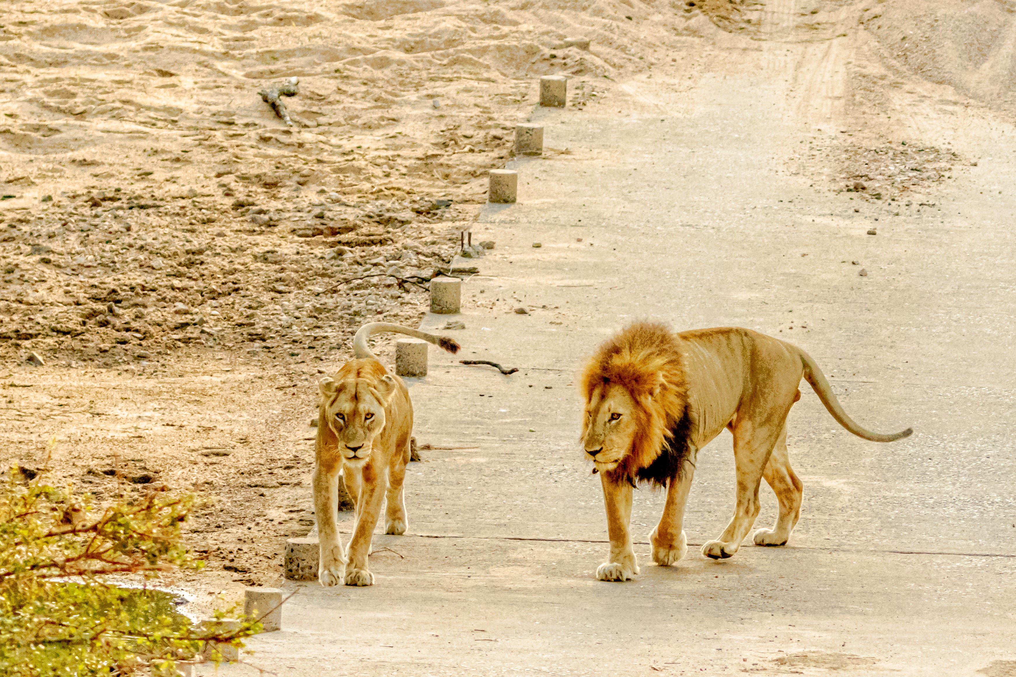
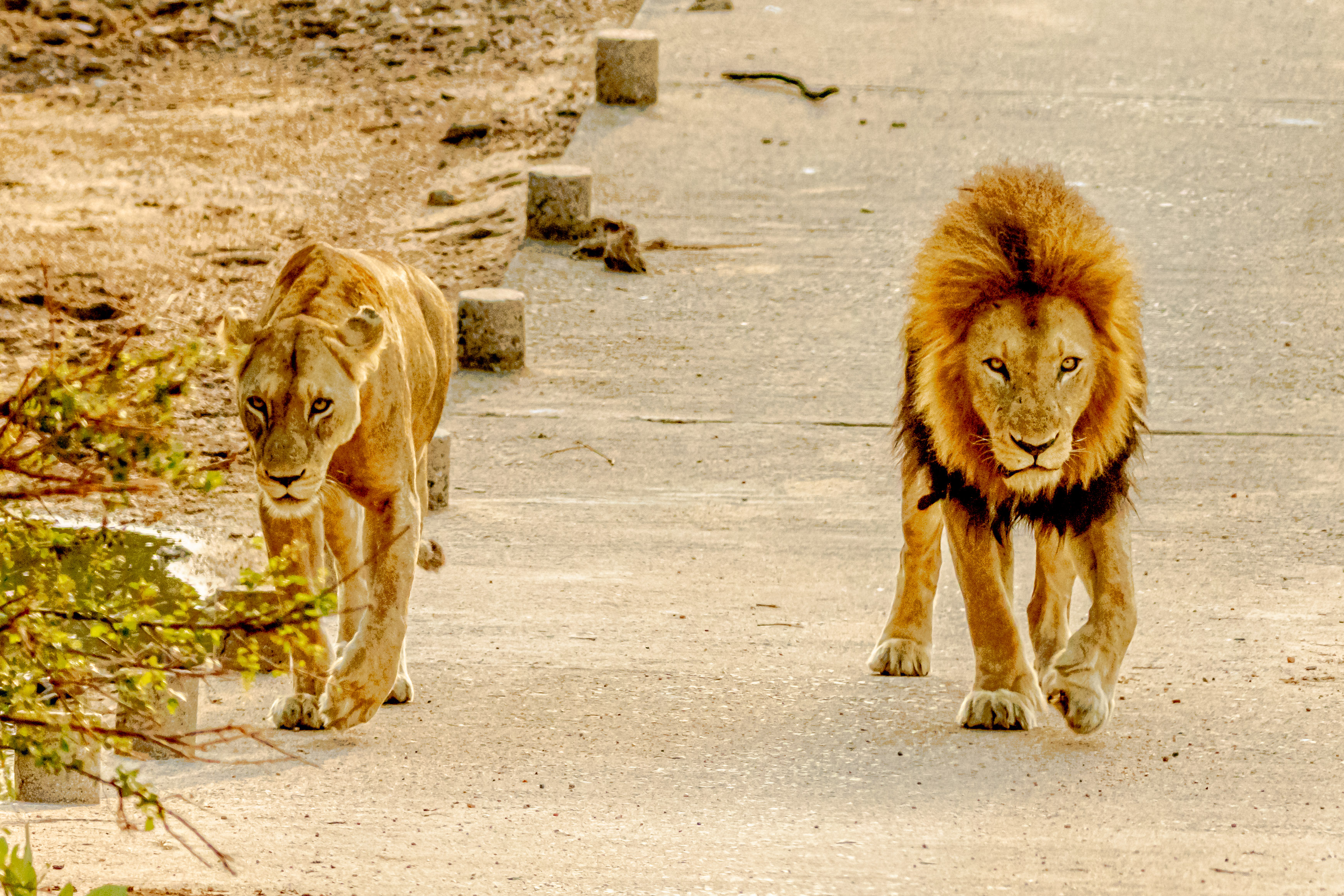
As we drove down into a gully, we hit the mother lode! One of the male lions and his lioness were napping on the bridge over the gully. All three of the safari vehicles gathered, which disturbed the napping pair. They got up, and stalked right by our vehicle. We were able to get across the gully, and watched them a little longer from the other side of the wash. It really was a special last viewing of this magnificent pair!
Pug marks from the lions
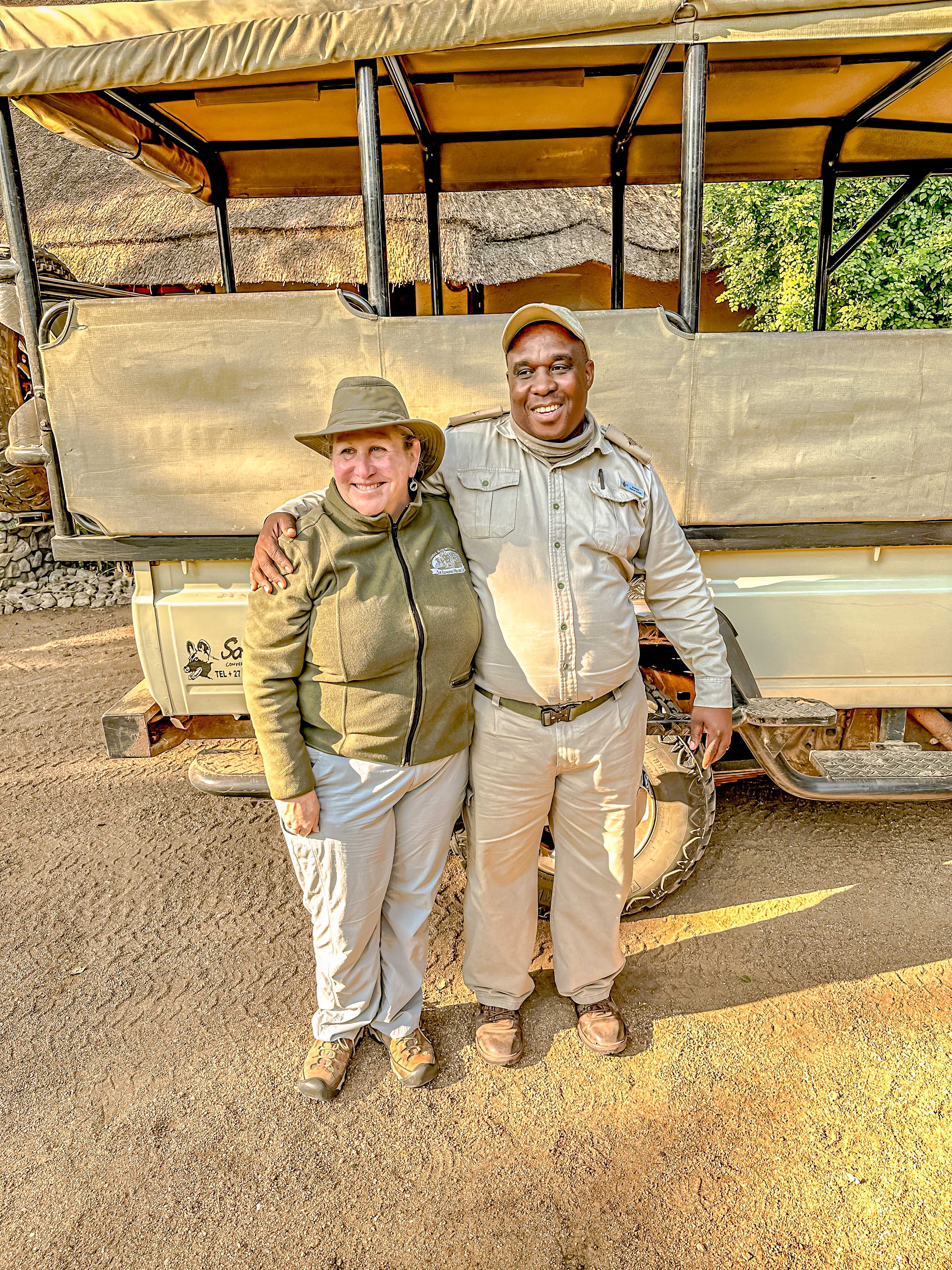
We headed back to the lodge, and passed a male Kudu and a Brown Snake Eagle on the way, along with a big Water Buck and a tiny Duiker. We said our fond farewells to our excellent safari guide, Andrew. All too soon, it was time to pack up to go back to the airport at Hoedspruit (on the edge of Kruger) for our flight back to Cape Town.
Brown Snake EagleWater BuckDuikerThe tree which marked the entrance (and exit) from the campSaying goodbye to Andrew
We had exactly one night back on the ship to do our laundry and drop the things we wouldn’t need, because tomorrow morning, we’re doing another overland journey; this time to the deserts of Namibia. Stay tuned!
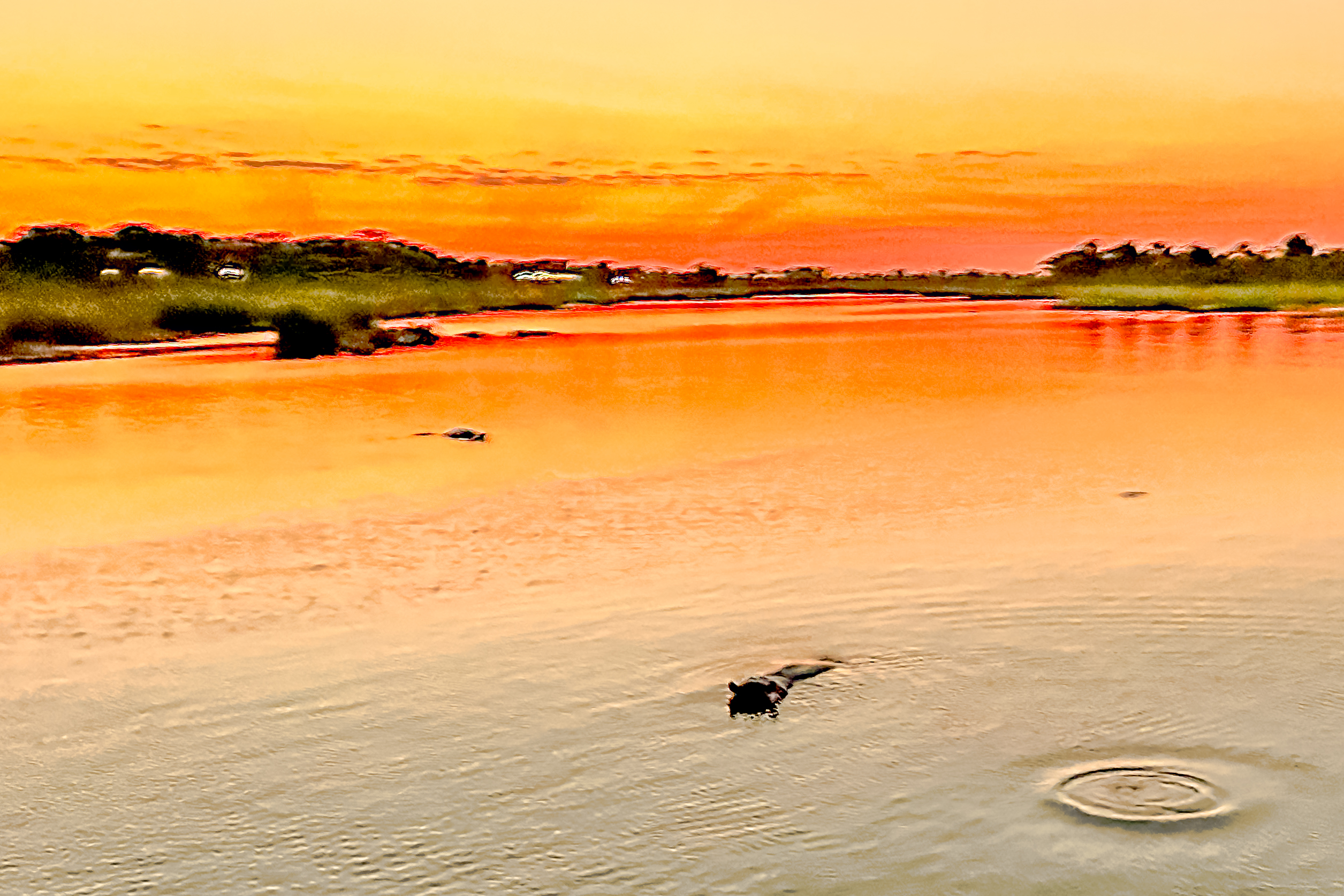
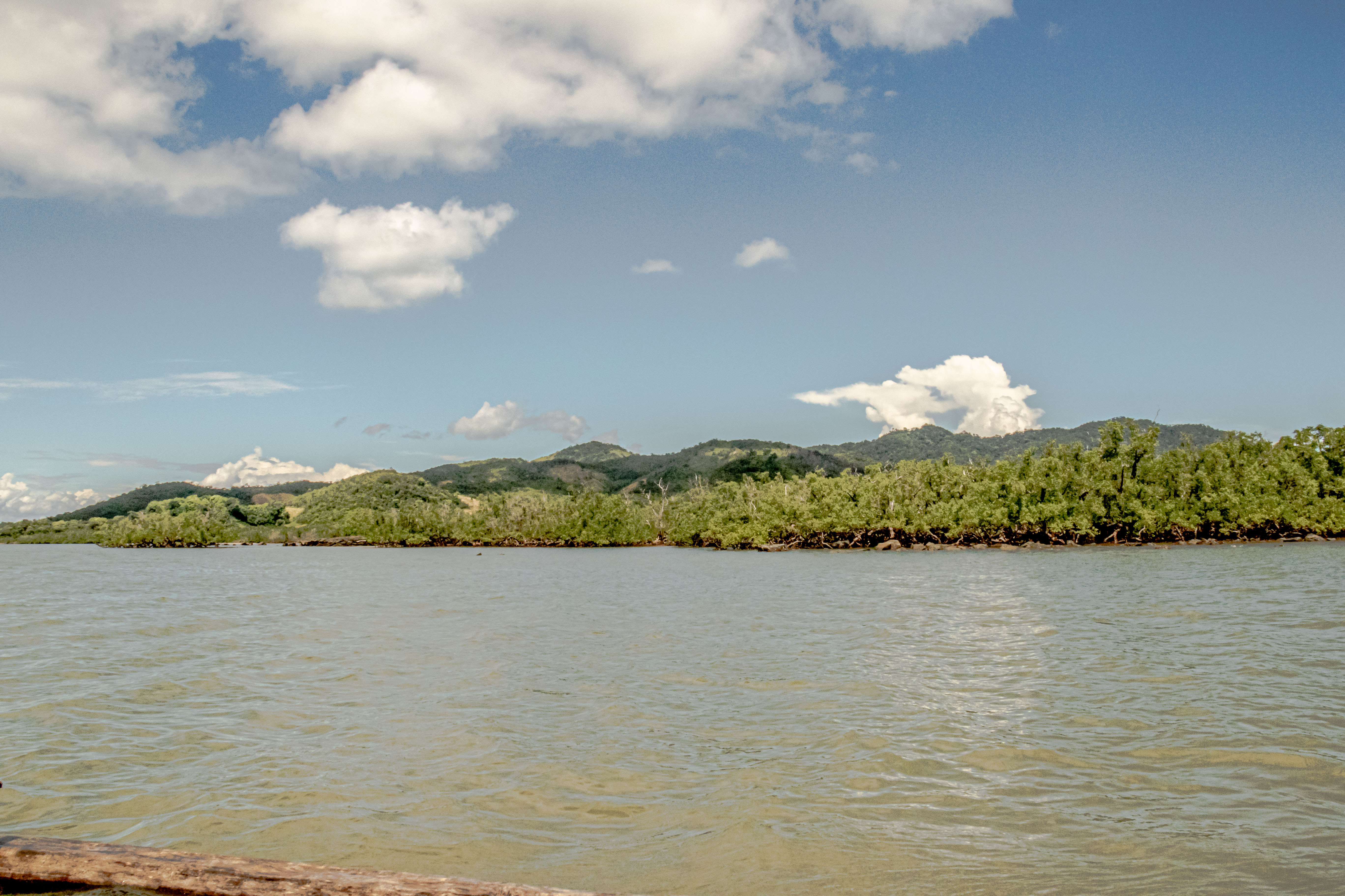
We sailed into Maputo, the capital of Mozambique, on May 1, 2023. We initially had great anticipation to see another African nation, and from the water, Maputo looked like a gleaming, modern city. However, what we experienced was a day of disfunction.
We left the ship to begin our overland journey to Kruger National Park. The border of Mozambique runs parallel to that of South Africa, and it took us about thirteen hours to travel the relatively short distance to our final destination in the Park.
High quality homes near the center of the capital
For starters, it was a national holiday in Mozambique, the International Day of the Worker. For a government which is a Communist-based democracy, you’d better believe everything in the capital was closed down for a day of marches. Fortunately, we got out of the capital relatively quickly before the marching started, but every mile further from the city center showed a deteriorating level of well-being for the populace.
After over 400 years as a Portuguese colony, in 1975, the people of Mozambique declared independence. The movement was predominantly led by Communists, and when they came to power, they nationalized all Portuguese holdings. Most investors left then, but our local guide said some are beginning to return. She was very well informed, and shared quite a lot of information about the country on our drive towards the border. As is usually the case with these trips, our fellow travelers had lots of questions about systems in the country of Mozambique. There is no universal healthcare system in the country, and many people in the villages still rely on traditional healers. Education is mandatory through Grade 12, but because of the lack of school facilities, school is taught in 4 shifts of two hours each. Not surprisingly, the literacy rate is only about 55% in the country. There are 28 official languages, and Portuguese and English are among the official languages. In 1977, Civil War broke out in the country, and lasted for 16 years, ending with a peace treaty and the introduction of UN peacekeepers in 1992.
Today, Mozambique sells electricity from huge hydroelectric power plant on a dam upstream to South Africa, Malawi, and Zimbabwe. It also exports aluminum, cotton, and minerals, cashews, and tobacco. However, the population of country is 32 million (with 5.5 million living in Maputo), and the GDP is only $48 billion, or about $1450 per person.
It only took us about an hour to drive to the border, but that is where the challenge began. There were cars lined up to cross the border for over a a kilometer before you even got to the border. Our local guide suggested it would be faster to walk to the border, so we piled out of our van and walked up to masses of people queued to make the crossing. Thank goodness for our Mozambiccan guide, who exerted some pressure and charm to get an immigration official to take our group as a whole and process us through. All in all, we got through the Mozambiccan side in about 45 minutes.
Then we had to drive a short ways to the South African entry point at Komatiport. Then the fun began. Our South African guide, Tanya, was not as fortunate finding a sympathetic immigration official to process our group, and we stood around in the hot sun for about an hour and a half before an immigration official showed up and took our group. As frustrating as this experience was, we heard that other overland groups from the ship waited up to five hours to get through the gauntlet.
In the teeming masses at the border
It was about a 45 minute drive to the Crocodile Bridge entry to Kruger National Park. There, two park rangers flexed their power, and were going to deny us entry on the grounds that it wouldn’t be safe for us to drive into the park without an escort. Fortunately, they were overruled, but they got their revenge by delaying our entry into the park for over an hour.
We entered the park just about sunset, and the driver put his pedal to the metal. However, it was still about another three hours to get to our safari camp, Imbali. There were some consolations as we got to see several animals along the way, but it was a grueling day, and we didn’t get to bed until about 11, with a 5 am wake up call. But our cabin was very comfortable and we slept like babies!
First wildebeest sighting! Yay!Hippos in the river at dusk
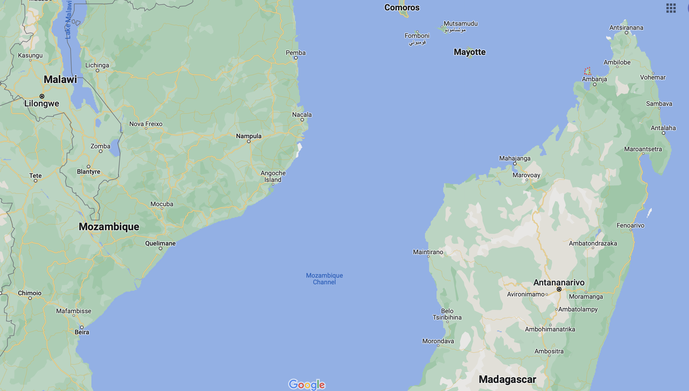
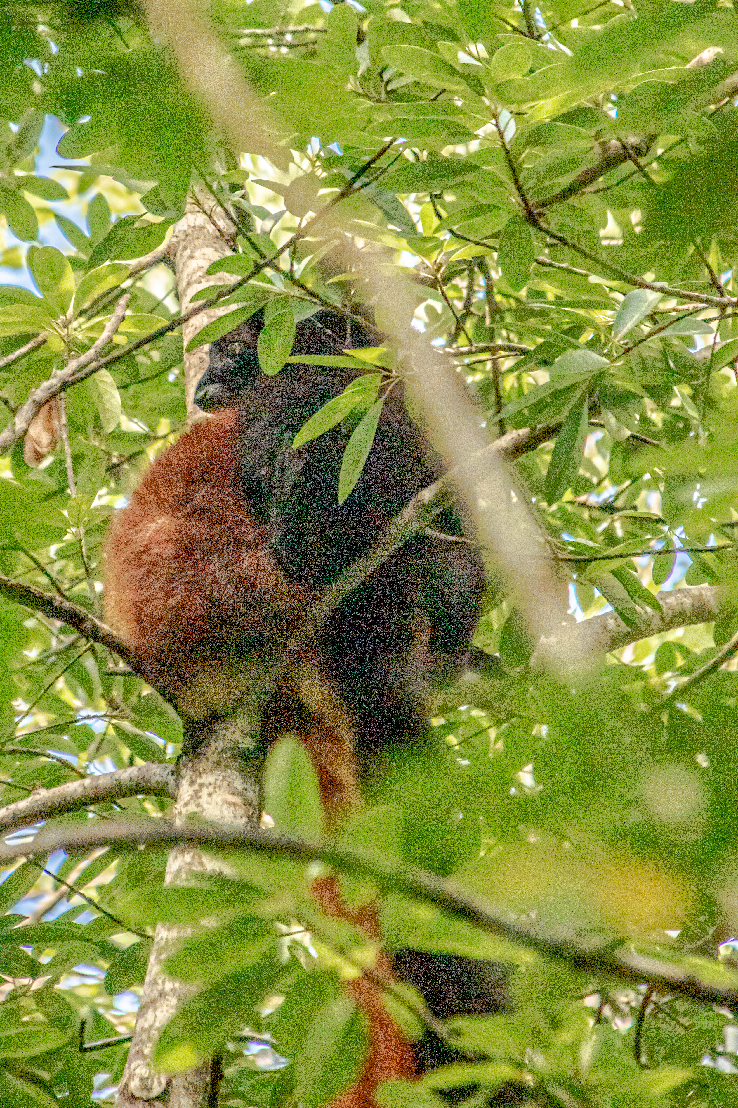
We have been particularly fortunate this leg of the trip to have had biologist/naturalist lecturer onboard, Bill Toone, who has spent extensive time in Madagascar. According to his presentations, 90% of the species in Madagascar are endemic, but 90% of their natural habit has been destroyed. Further, it is one of most impoverished countries in world. Even with those caveats, we are very eager to explore on our one day in this fascinating country.
The tiny red outline off the northwest coast of Madagascar is Nosy Be.You can see Hell-ville and Ambatozavary. The dark green area next to Ambatozavavy is the Lokobe Nature Reserve.
Although we were originally signed up to do one of the ship’s excursions, our friends onboard (the “James Gang”; a family of Jim, Sue and their 14 year old son, Buck) had signed up to explore the nearby Lokobe Nature Preserve with one of the guides from ToursByLocals, a company which provides local tours all over the world. Our guide for the day was Jean Claude, and he picked us up in the port on Nosy Be, which is called Hell-ville. This was our “plan” for the day:
•Drive directly to Ambatozavavy village and passing by Ylang ylang perfum plant. short visit Photos, •Ambatozavavy fishermen village – meet local people, walk inside for further information and photos then ride speedboat from there to Lokobe village • Drop off of the Boat and walking slowly into the reserve. The spotting walk inside of the reserve, will take about 2hrs • 12:00pm, Lunchtime, enjoy a traditional meal at a restaurant of Lokobe village.
However, we were late getting into port, and late meeting our guide, JC. According to JC, Nosy Be (pronounced Nosy Bay) is the most wealthy place in Madagascar, because most of the people are employed here, and there are no beggars. A huge percentage of the island is planted with ylang ylang trees, whose flowers are harvested and distilled for their essential oil to make perfume. On this island, about 25% of the population is Muslim, while 75% is Christian, but Muslims are much more of a minority on the main island of Madagascar. French is the official language, but English began to be widely used in 2002. A person must be able to speak English to guide. “Nosy” means island, and “Be” means big. However, the main island of Madagascar is much bigger, so go figure! It takes about 45 minutes by speedboat to get there.
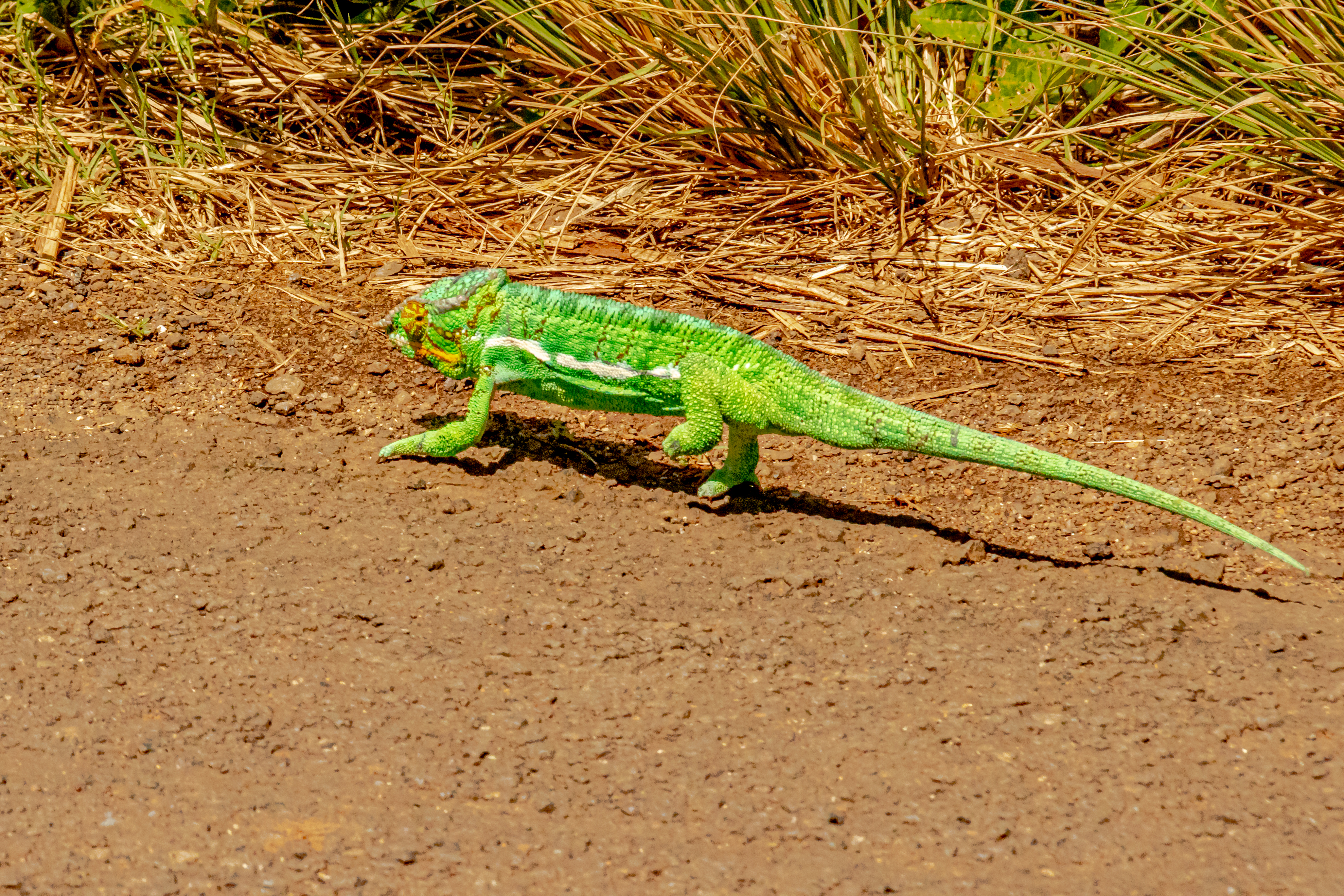
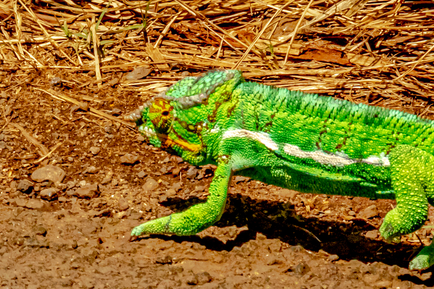
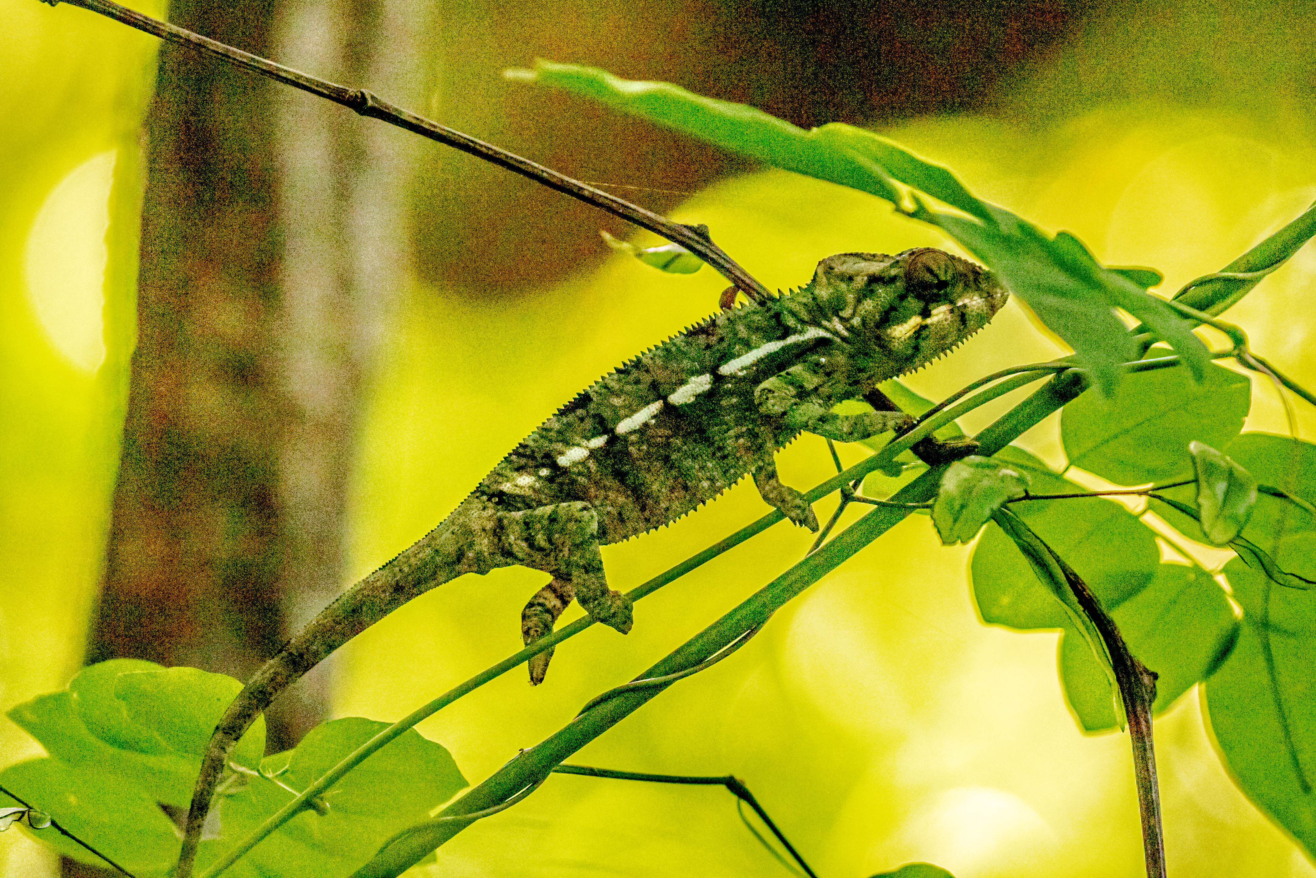
Our drive to the village of Ambatozavavy took about 45 minutes over progressively worse roads. Along the way, we passed countless ylang ylang plantations. Right in the middle of the road, we saw an amazing chameleon which was bright green with red zig zags around his eyes. We were able to walk right up to him (and his cousin) and get some great shots.
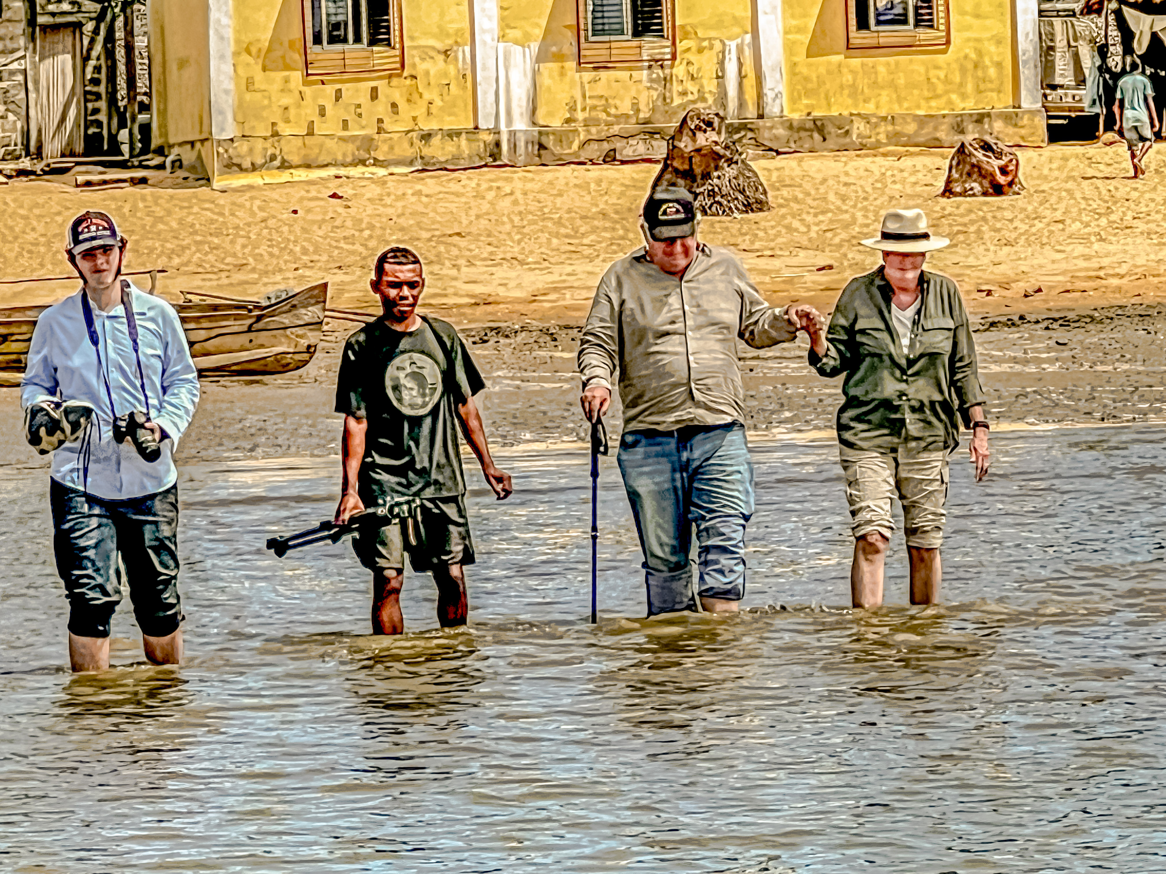
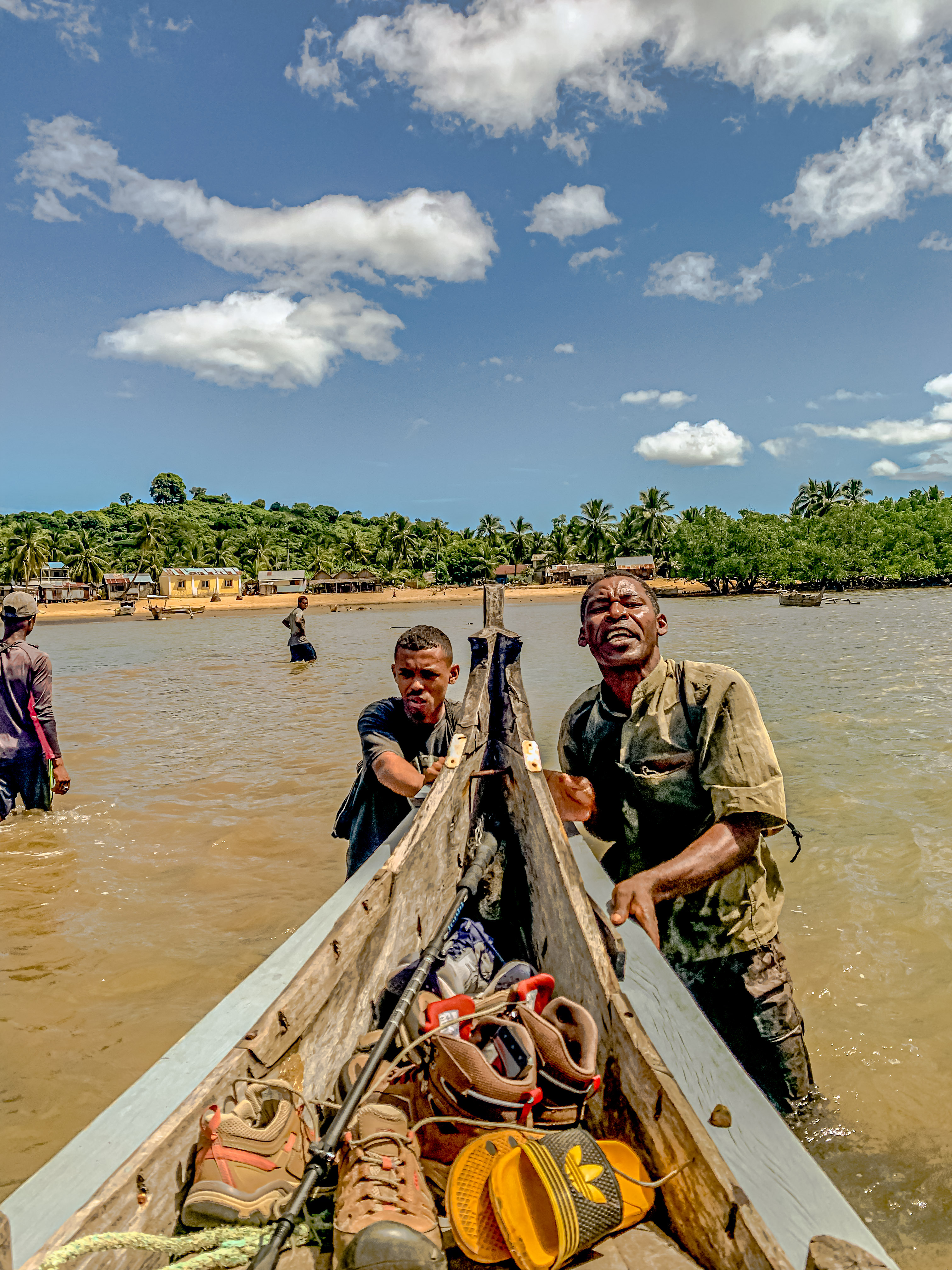
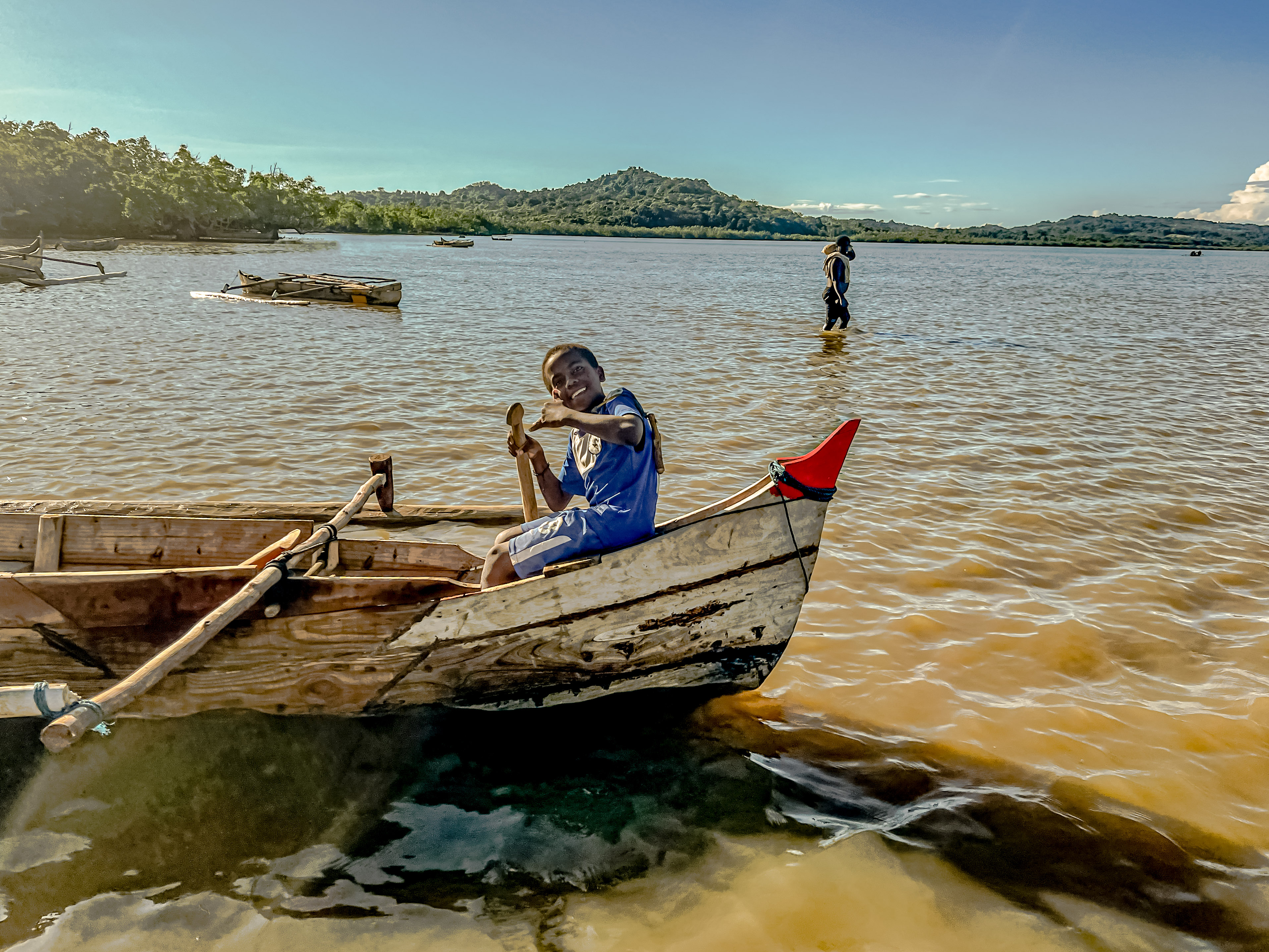
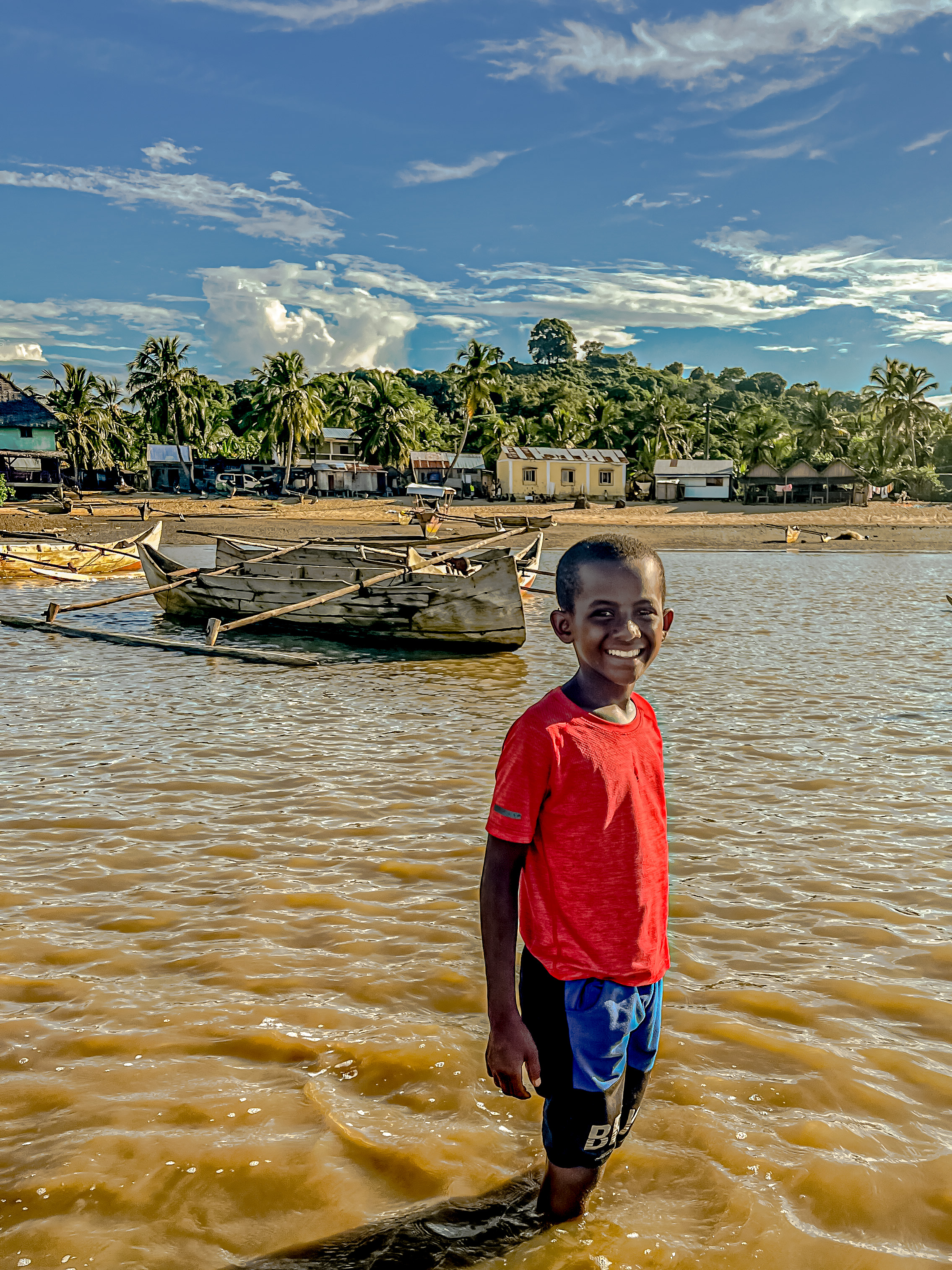
Finally, after we had been driving over gravel roads for about 10 kilometers, we arrived at the village. We saw lots of families had cattle, which are the Zebu cattle; the largest animal in Madagascar. Our first shock awaited us in the village, when we found out that our boat was in reality a narrow outrigger canoe with an outboard, and that we would have to wade out to it. Since we were all dressed in safari attire for our walk in the jungle reserve, we had to take off our shoes, and roll our pants up as best we could, before walking across the mud flats to the boat. Of course, we all got wet, and it was very difficult to climb into the boat, but we finally all made it. The trip by boat is necessary because there are no roads going into the nature reserve.
Elementary school
About 45 minutes later, we arrived at the village outside the reserve (Lokobe village?), and we again had to wade in to shore and then walk across the sand to get to the village. By this time, it was already after noon, so our “schedule” was badly blown. We decided to do the nature hike first.
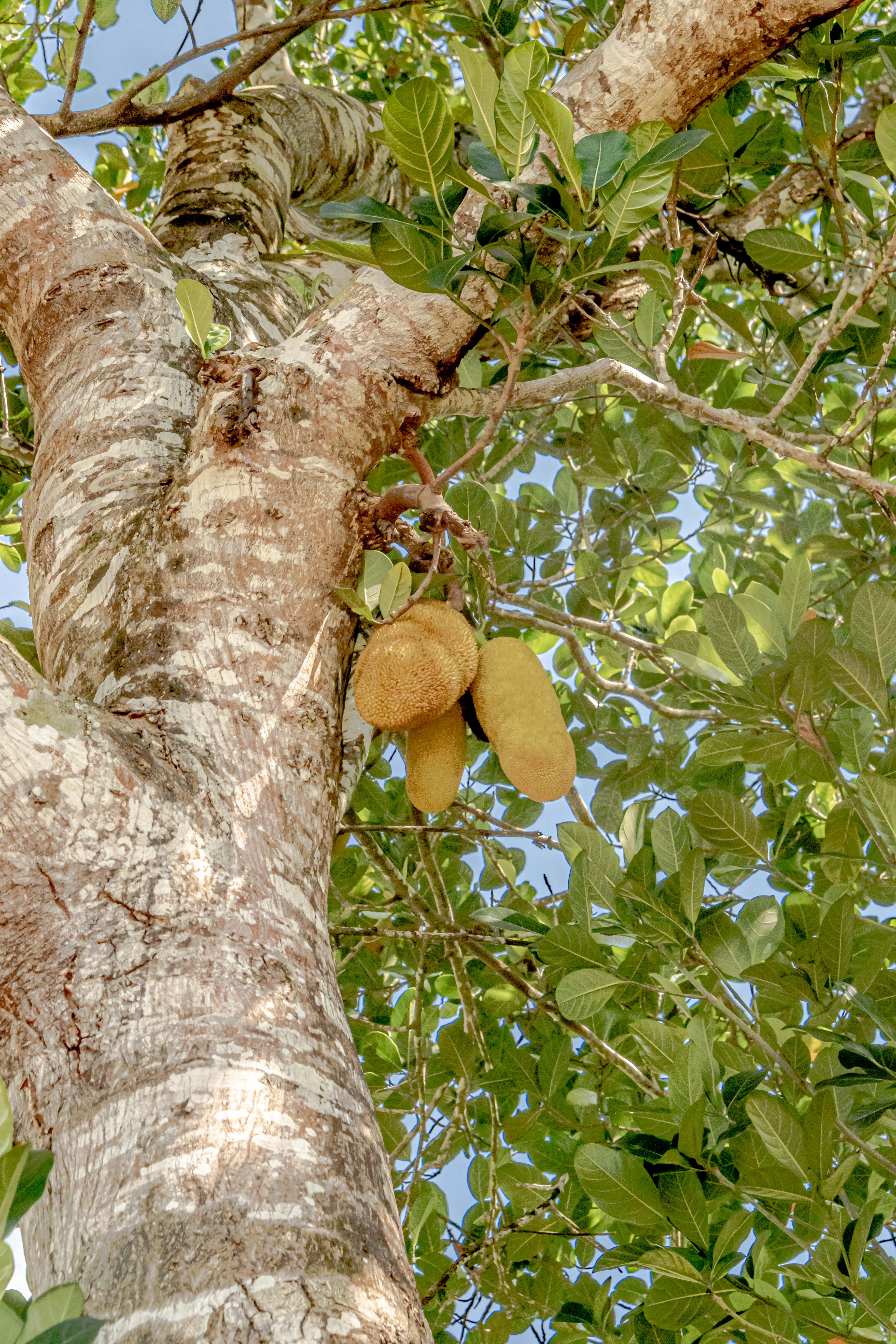
Jackfruit
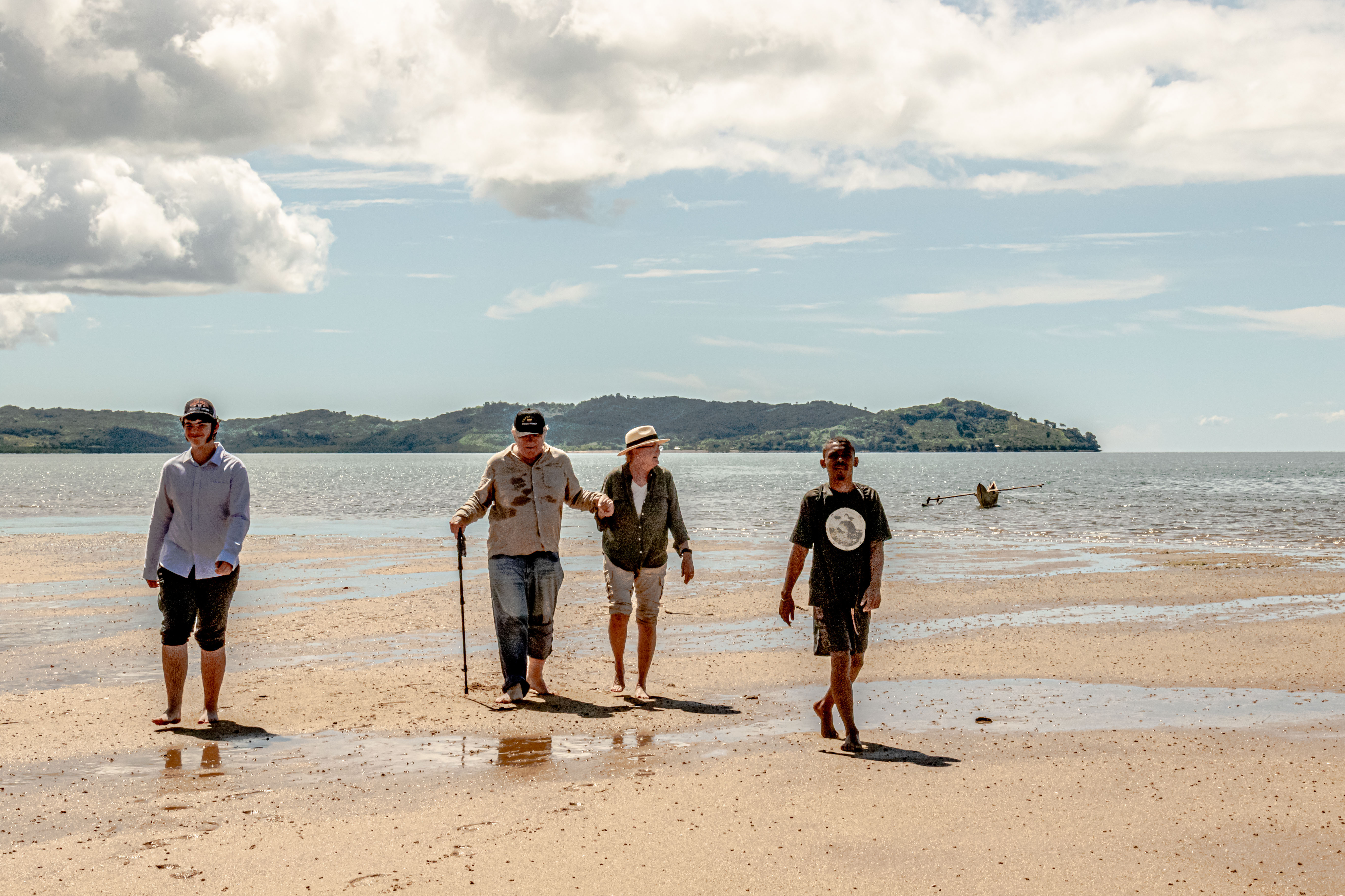
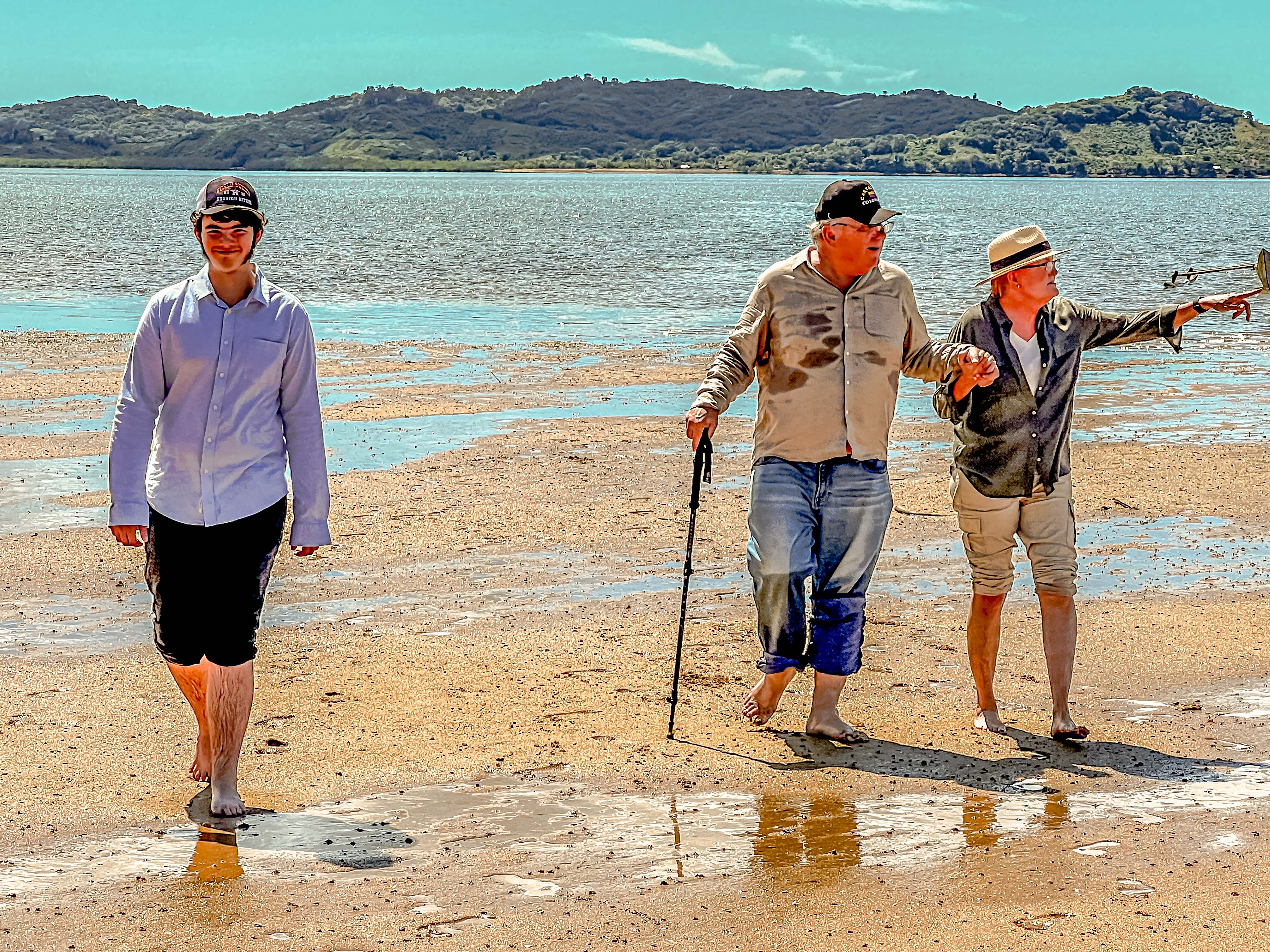
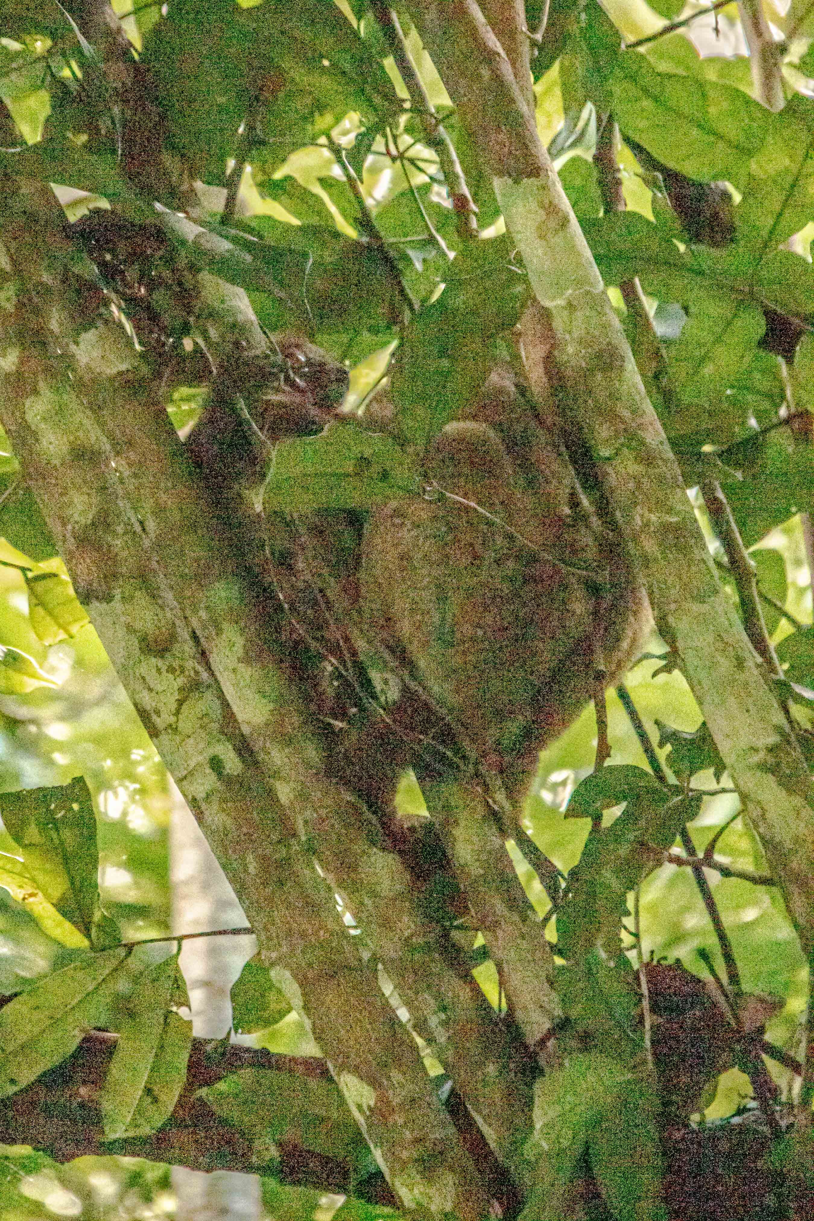
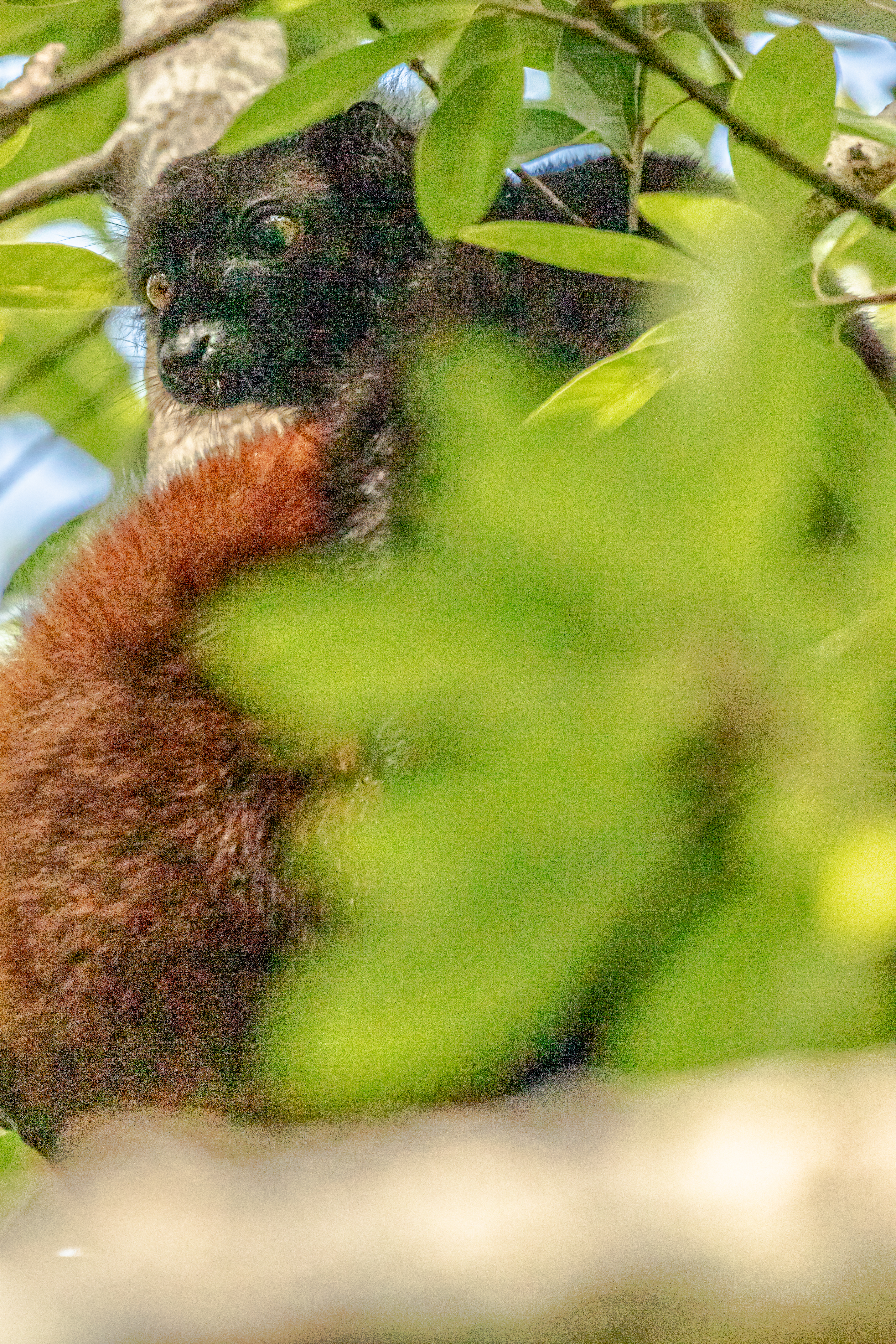
Having cleaned off our feet and gotten ready for the hike, we had our second rude shock, which was that he trails were not nearly as accessible to people who had mobility limitations like our friend, Jim. Nonetheless, our local guide was very good, and very soon, he spotted a pair of nocturnal lemurs for us.
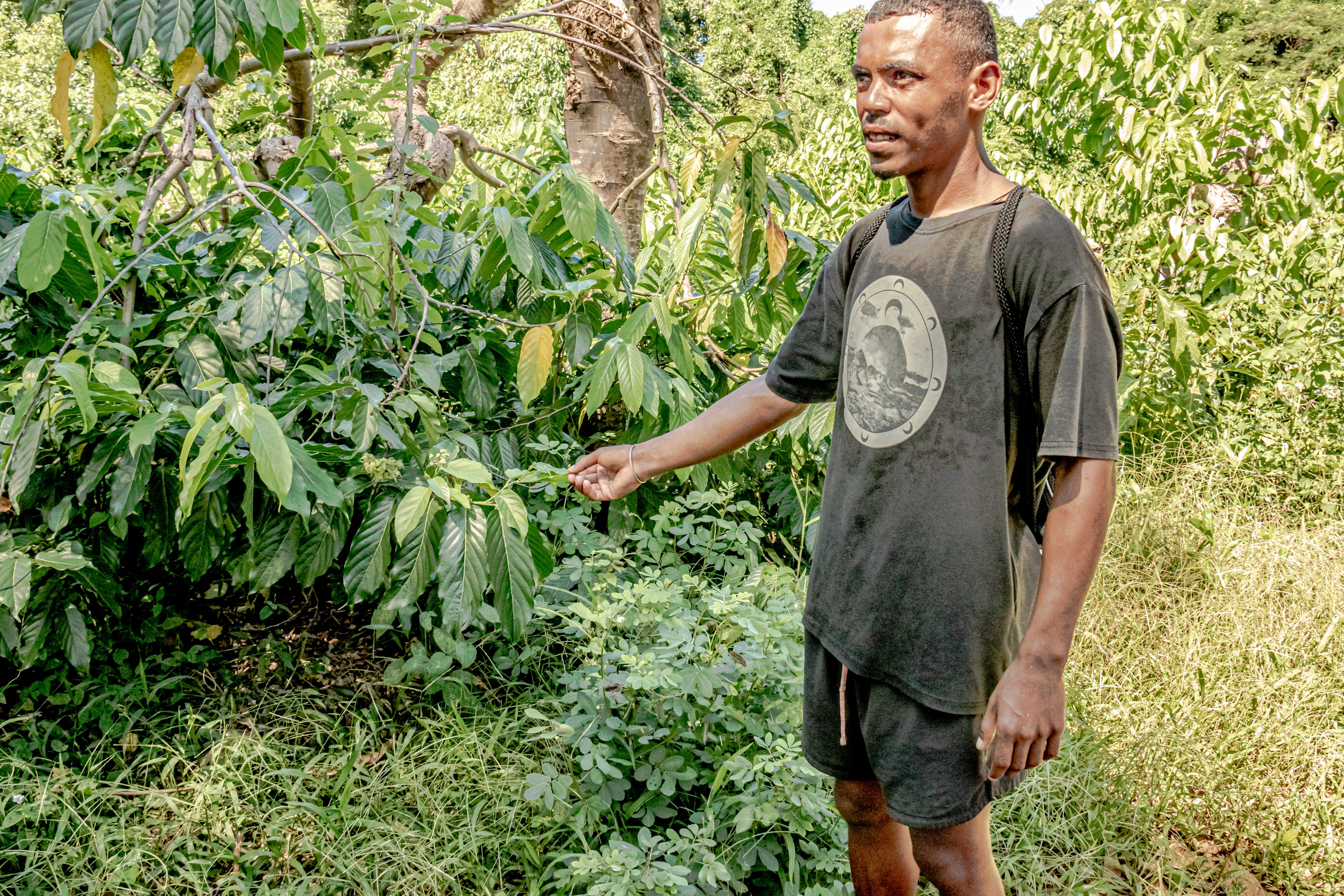
Our local guide showing us how easily the ylang ylang grows here.The blossoms which will be harvested in a few daysThis is pretty close to life size.Welcome to the jungle primeval.Vanilla growing wildTwo nocturnal lemurs bunched togetherThey sleep with their eyes open
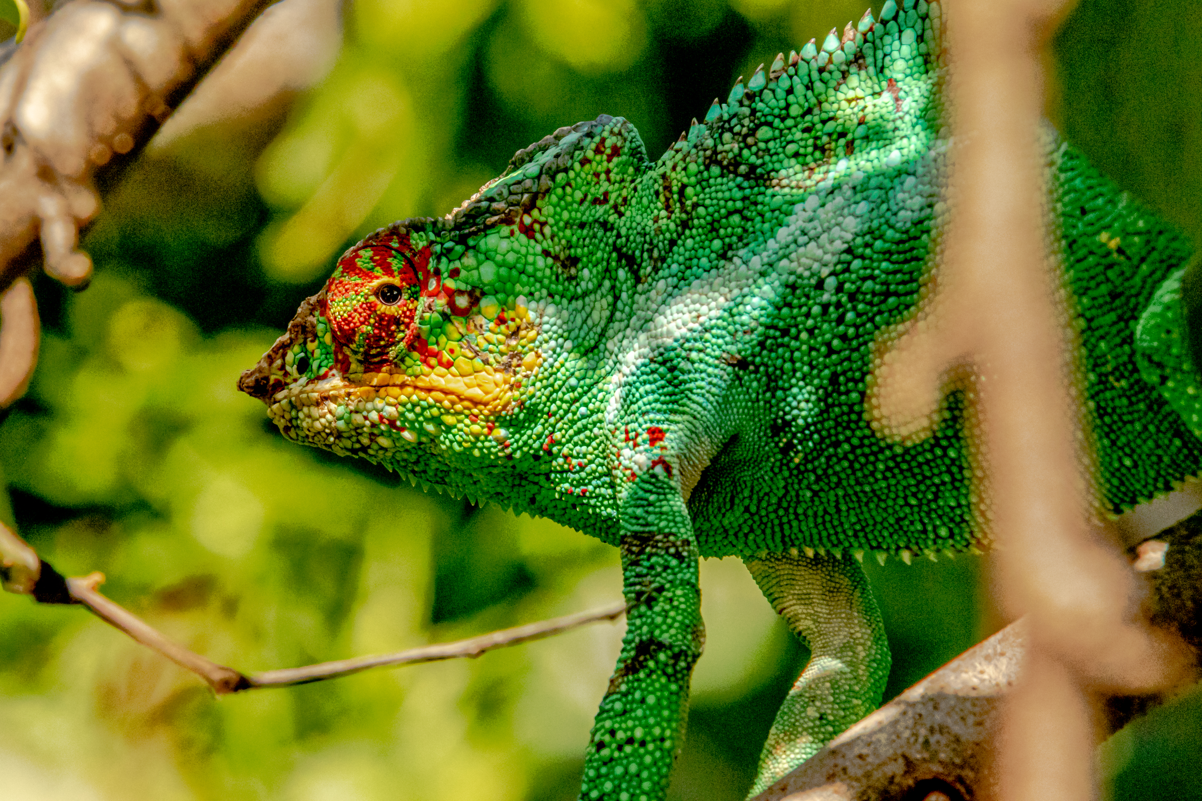
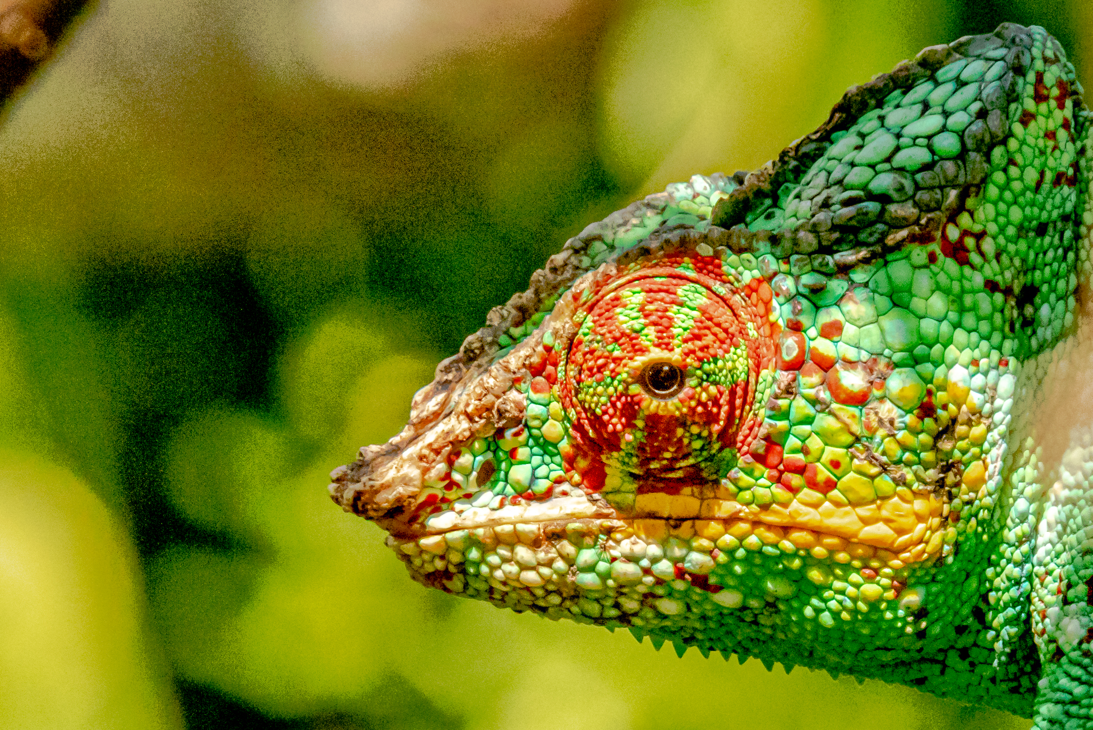
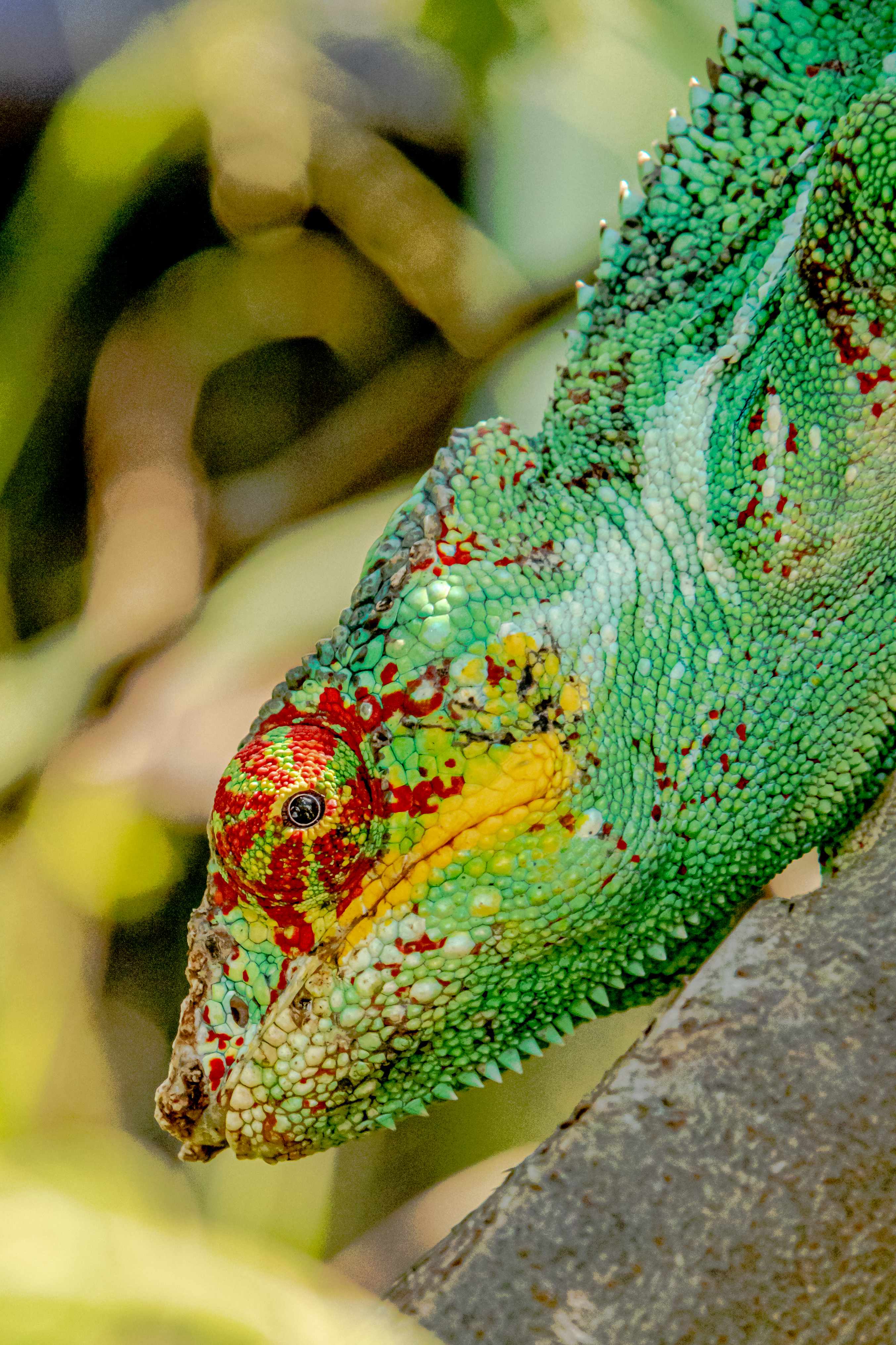
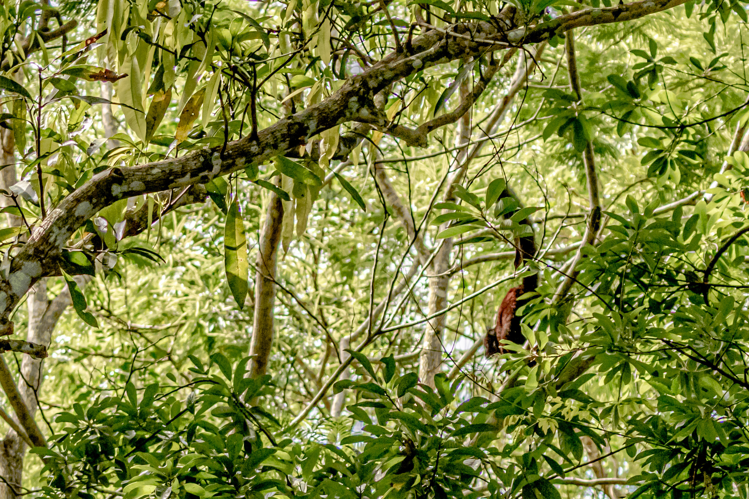
We walked on an he found us a different kind of lemurs to photograph. He also pointed out a very large sleeping boa constrictor coiled up in the roots of a tree right next to the path. We capped our explorations with a view of a different kind of chameleon, and by this time, we were all completely soaked with sweat and somewhat muddy. Most of the people in the village supplemented their income with handicrafts, and we braved the sales gauntlet on the way back into the village.
The second set of lemursAll together now … Awwww!Yikes! Boa constrictor.Another lemur jumping through the treesThis lizard is a master of disguise!A different type of chameleon
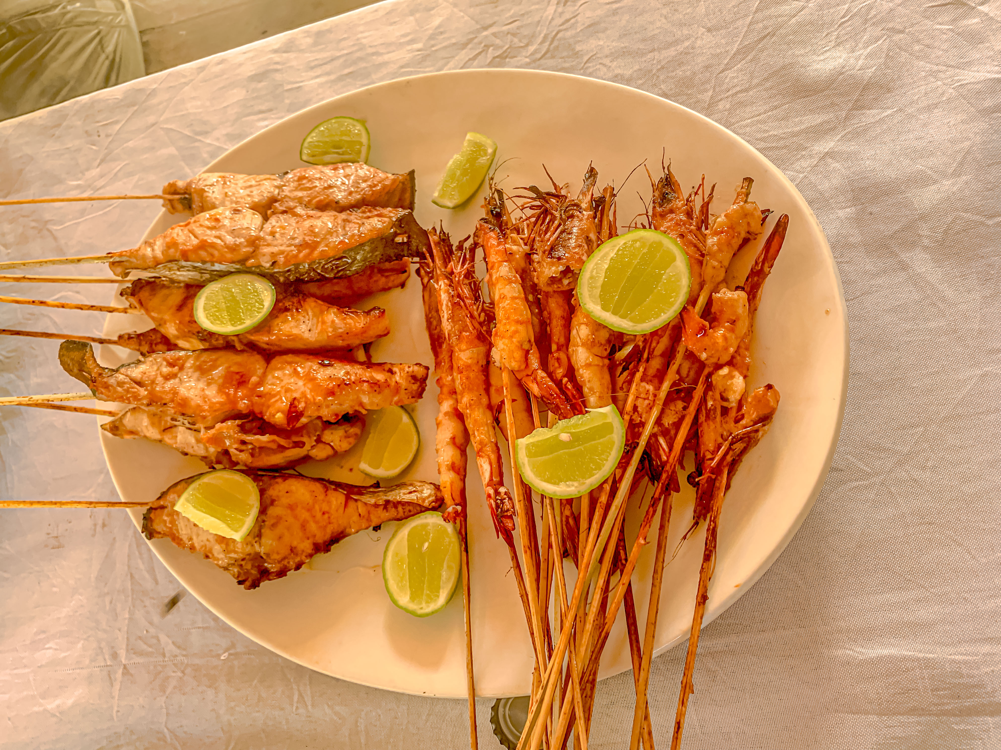
While not a restaurant by western standards, there was an open air eating area in the village set up with picnic tables, and most importantly, with cold beer! We had a very good lunch of grilled fish and shrimps served with an avocado salad and fresh fruit. According to JC, THB (Three Horses Beer) is the best local brand of beer, and we would have had to agree for as good as it tasted that afternoon!
We waded back out to the boat and motored back to Ambatozavavy. These young people all seemed to be practicing their boating skills. Then we returned to the pier, just a half hour before it was time to depart. It was a little hair raising for our tastes, but the day really fulfilled with this little taste of Madagascar’s wildlife!
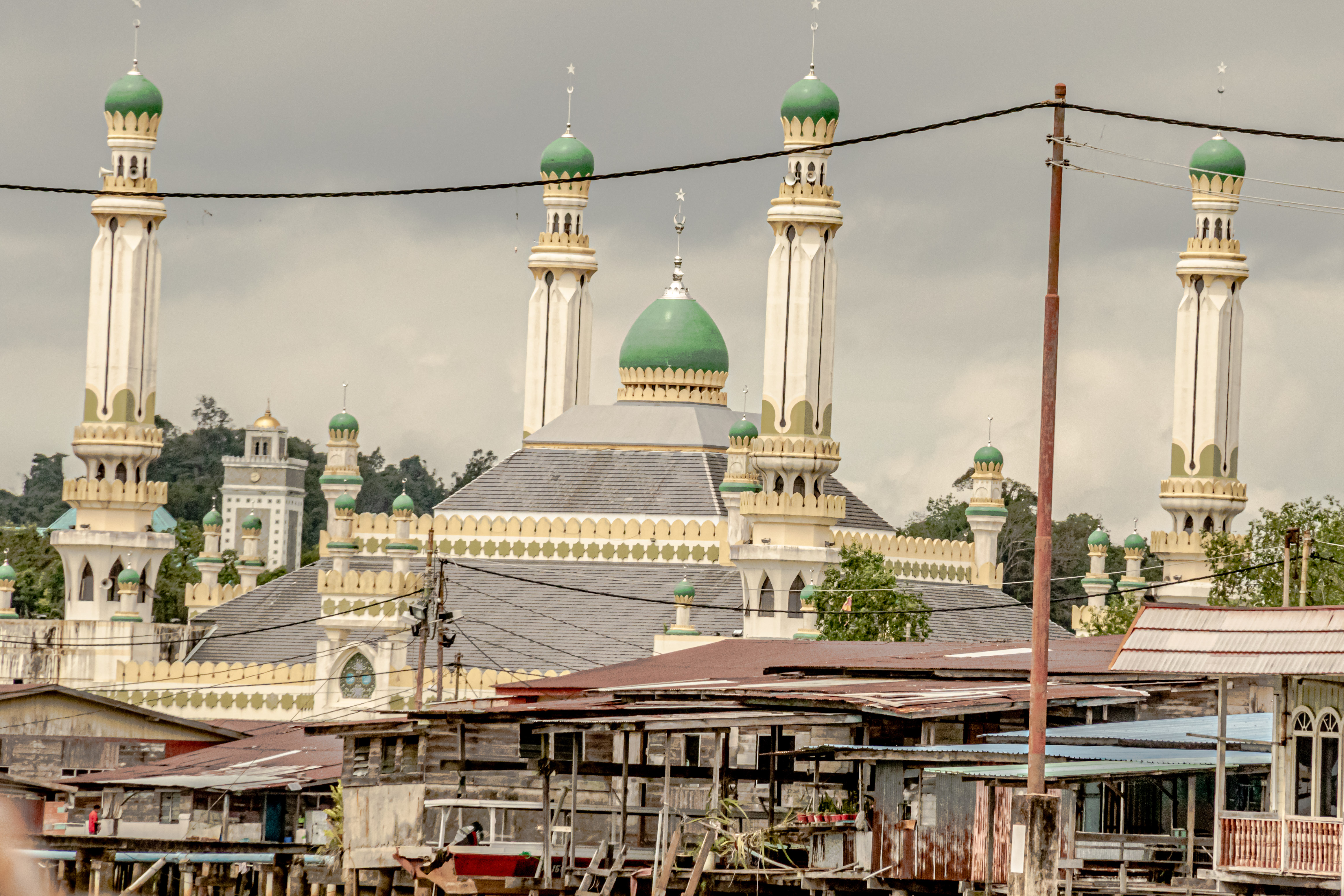
After two days at sea, we made port on the island of Borneo, and docked at the port of Muara in Brunei. Brunei is an absolute monarchy located on the north coast of Borneo between the Malaysian provinces of Sarawak on the west, and Sabah on the east. Its coast is on the South China Sea. The whole southwestern part of the island is a province of Indonesia.
The formal name of the kingdom is Brunei Darussalem, or Brunei, the Abode of Peace. It has a total population of about 460,000, and about 100,000 of those live in the capital city of Bandar Seri Begawan. The whole country is ruled by the sultan, who bears the title of Yang di-Pertuan. He wears the hats of Sultan, Prime Minister, Foreign Minister, and head of the Treasury. The current Sultan, Hassanah Bolkiah, has led the country since 1967, and the country of Brunei declared its independence from Great Britain in 1984. The country has dual law systems; English common law and sharia law. About 80% of the country are Muslim. Although the country had a past track record of religious tolerance, post-independence, the Sultan passed a new law prohibiting any new churches from being established, although the existing ones were allowed to continue in peace. The Sultan also passed laws prohibiting homosexual conduct and gay marriage. The kingdom is incredibly wealthy, since oil and natural gas were discovered here in 1929. The country has the second highest (after Singapore) human development index in the ASEAN (Ass’n. of South East Asian Nations), with a per capita GDP of about $75,000 per person.
Private homes. Almost no one except foreign workers live in apartments.All these cars belong to the family living in this house.Office buildings. There are no high-rises because there is no need for them, and the Sultan has decreed that no building shall exceed nine stories.Dome of the Jalan Masjid Omar Ali Saifudden (mosque)
The Sultanate dates back to the 14th century, when Brunei declared its independence from the Majahapit Empire in Indonesia, and became known as the sultanate of Brunei. The sultanate was founded by Awang Alak Betatar, who later became Sultan Mohammed Shah. Over time, it grew into an empire of its own (the Bruneian Empire), and ultimately controlled most of Borneo. The peak of the empire was under Sultan Bolkiah, who ruled from 1485-1528. The sultanate embraced Islam under the Bolkiah sultanate. The first contact with the western world came in the 16th century. Magellan apparently landed in 1521, and the first documentation about Brunei in western literature was in the writings of an Italian named Ludovico di Varthema.
The Dutch tried to settle on north coast of Borneo in 17th century, and failed. However, the British East Indies Company established a colony on the south coast of Borneo. During the 19th century, the Bruneian Empire had begun to decline. The north coast of Borneo became overrun with pirates, and the sultanate ceded the neighboring state of Sarawak to Englishman James Brooke, who established the Raj of Sarawak, and then ruled it as the White Rajah of Sarawak until his death in the late 1800s. In 1888, Brunei became a British protectorate, and was assigned a British resident as the colonial manager in 1906, and Brunei stayed a British protectorate until 1984. The Japanese invaded the island of Borneo in 1942, and stayed until 1945. In 1959, Brunei and UK decided on a written constitution. On Jan. 1, 1984, independence was declared.
Today, Brunei is one of 5 richest countries in world. Crude oil and natural gas account for 90% of the nation’s GDP. Interestingly, in the port area when we came in, there were acres of brand new shipping containers all bearing the name Brunei Fertilizer Company. They were all apparently awaiting export, and the country seems to have capitalized on the war between Ukraine and Russia to start a new industry. The nickname of Brunei is the “the Shellfare” state, because of the high level of benefits given to their citizens. Those benefits include free education and healthcare, no income taxes, access to social housing, and free home loans. The country also subsidizes gasoline costs so a liter of petrol costs about $.50.
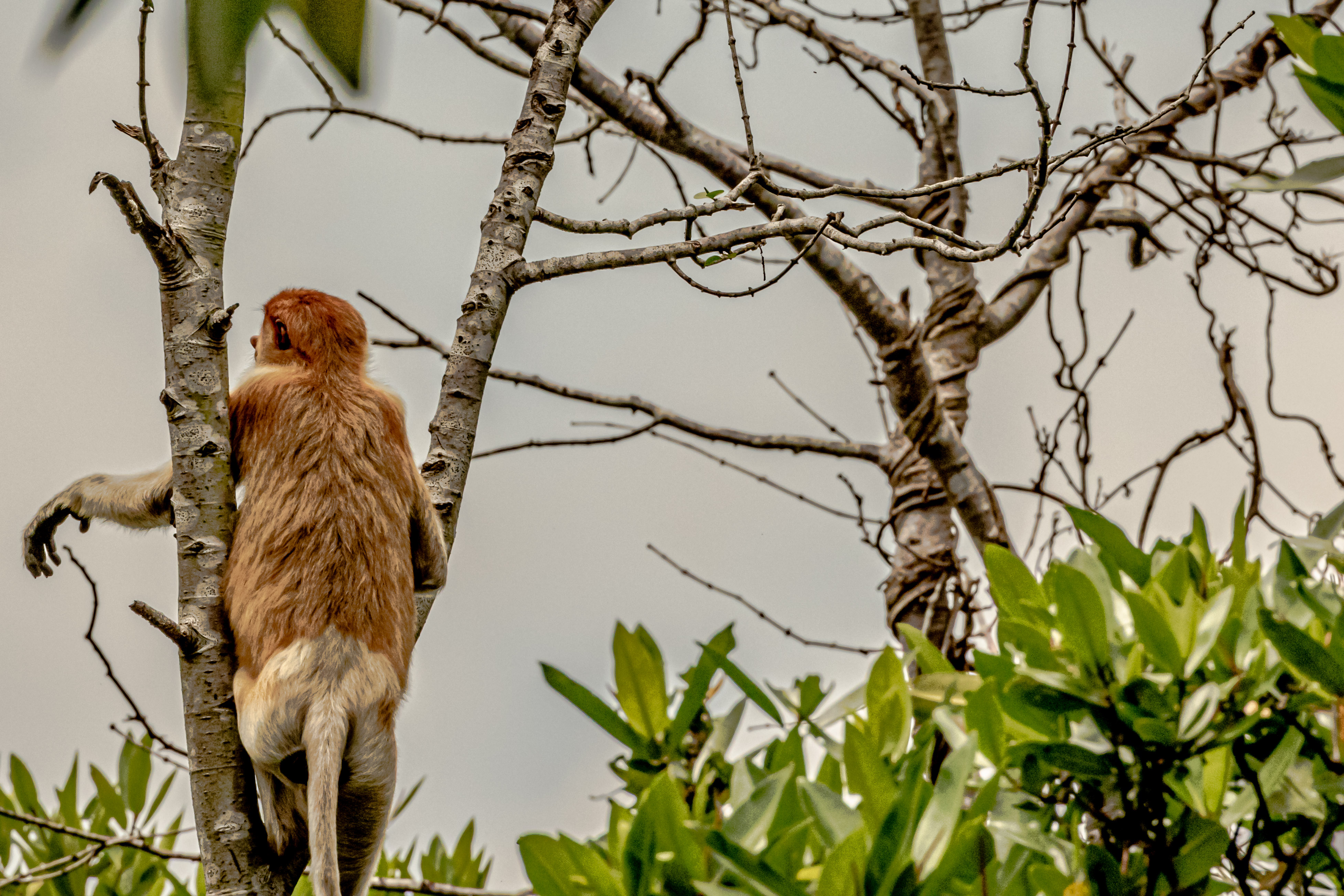
We have two main exploration goals for the day: to do a cruise up into the mangrove forest to see if we can spot the endemic proboscis monkeys, and to visit the water village and meet its inhabitants. We went first up the Brunei River to hunt for monkeys. The proboscis monkeys are notable for the huge noses on the male of the species. Males typically have 14-18 females in their “harems, and have genetically evolved to perpetually have a hard-on. Take that, Viagra! Therefore, most of the monkey sightings are of female monkeys lacking the impressive nasal appendages. We motored around up the river. Finally, we spotted the elusive monkeys. After spending some time trying catch photos of the monkeys, we moved on upriver. Our first spotting was not of monkeys, but of a crocodile lying on the bank. Then, however, we found a troop of monkeys swinging through the trees.
Part of Kampong Ayer Water VillageFamily enjoying an ice cream along the waterway.Mangrove forests along the Brunei River.First proboscis monkey sightingGreat egret (I think)Crocodile on the bank. Amazingly, the inhabitants of the water village just downriver swim in the river all the time.Definitely a male
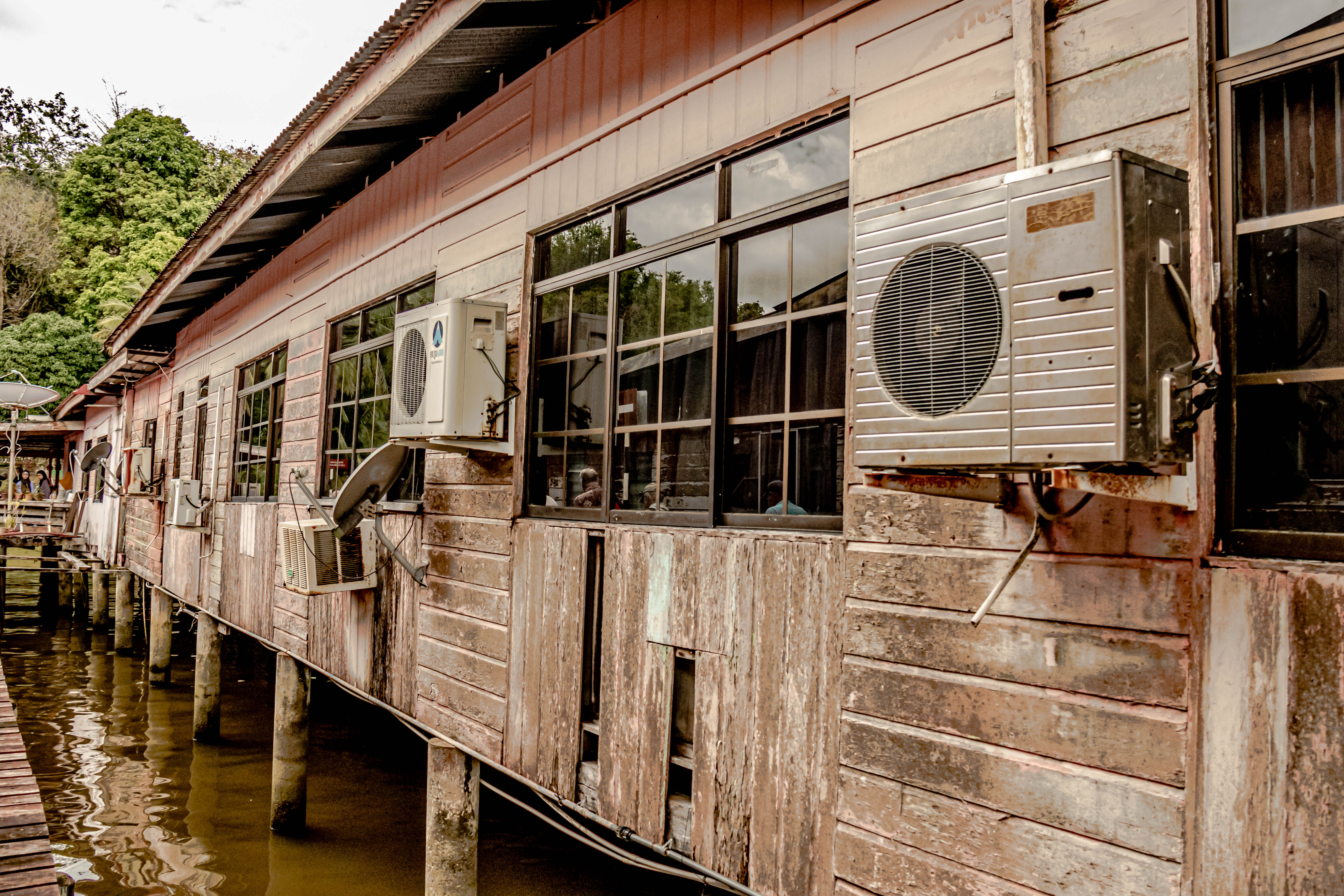
We then motored back downriver to visit the water village of Kampong Ayer, which is reputed to be the largest “water village” in southeast Asia, with over 39,000 people living in homes built on pilings over the water. A 1911 census showed that then, over half of Brunei’s population lived in the water village. Even the sultans formerly lived in this water village, albeit in much more luxurious dwellings than most of their subjects.
A huge attraction for us was the cultural exchange with the people living in the home we visited. None of the houses look very grand from the outside, but the interiors are lavishly furnished, and nearly everyone we met was all dressed up for our visit. We learned that 29 people live in the huge home we visited, which had several wings arranged around common living and cooking spaces. One of the highlights of the visit was that the women of the family had made numerous traditional Bruneian dishes for us to try, including both savory and sweet snacks. Jim and I like the curry puffs and the little packets (our hosts called them UFOs) of meat and rice with Malaysian spices. There was also a fried banana pastry, which was yummy.
The elementary school for the water village.One of the many little dock stations along the river.The neighborhood mosque for this area of the water village. There are several.Arriving att the water village of Kampong AyerI loved the expression of joy on this father’s face.This large home houses a very extended multi-generational family.These lovely young women greeted all of us, and had us sign their guest book.All the yummy treats prepared for the visitors.Inside the home.The curry puffs are on the left front, the “UFOs” in the center, and the banana tarts on the right.The communal kitchen for the families living in the house.
After our visit, we returned to the ship. However, I was looking for a charm, so I wanted to return to the commercial area in the capital. However, because nearly every family has multiple cars, there really are no taxis here. A technology start-up called Dart is experimenting with an “Uber-type” ride hailing app, so I decided to give it a try, along with three of our fellow passengers. However, instead of being able to hail it, from the port, you just hire the car and driver for two hours and he takes you where you want to go. In our case, we wanted to get a better look at the two monster huge mosques in the capital, and also to see a mall where I might find a charm.
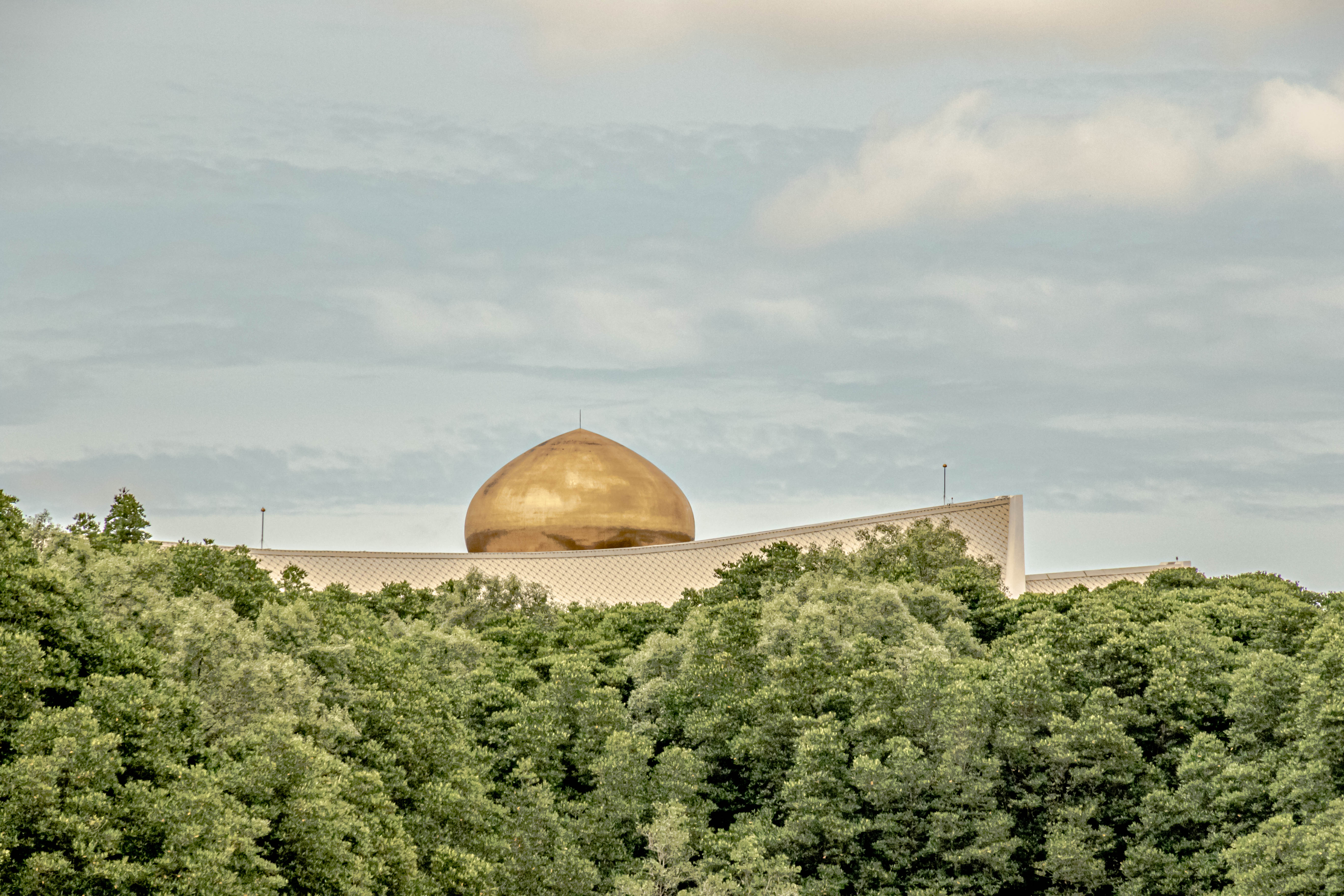
The first mosque we went to was built in honor of the former sultan (#28), in 1958, and is called the Jalan Masjid Omar Ali Saifudden. It is immense, and sits in the middle of the capital, very near the waterfront. It is easily seen from all over the downtown area, with its gold dome. It has a water feature around one side of it, with a stylized boat. It can accommodate 3,000 worshippers.
Jalan Masjid Omar Ali Saifudden
Then we visited to even bigger mosque built by the current Sultan, the Jame’Asr Hassanal Bolkiah, which is even grander. It is about three kilometers out of town in a very nice leafy suburb, but it would also be hard to miss, with its two golden domes, and six minarets topped with gold roofs. And yes, it is real gold leaf. This mosque was built in the 1990s to celebrate the current sultan’s silver jubilee. Most of the exterior is covered with mosaics. Just the stations to store your shoes when you enter are huge, and there are several of them all around the mosque. Clearly it was worth a stop to see these two monoliths.
Jame’Asr Hassanal BolkiahShoe storage.
The Sultan’s Palace, which I didn’t see is also unbelievably opulent. We could see glimpses of it from the river, but a friend gave me this picture. The Royal Palace cost $400 million, and covers 460 square acres, with 1700 bedrooms. The dining room seats 5,000, and has storage for the Sultan’s immense fleet of vehicles. He has 450 Ferraris, and a gold-plated Rolls Royce. There are also over 600 “ordinary” Rolls Royces in his garage.
Sultan’s Palace (or part of it).Another part of it as seen from the riverAnd another part of the Palace grounds.
The mall our driver took us to weirdly would not accept credit cards, so I had to confine my shopping to the purchase of some refrigerator magnets. There were tons of jewelry store in the mall, but they only stocked gold jewelry, so that was a nonstarter for my charm hunt. However, we all felt that the extra trip had been worth it and we returned to the port. Stay tuned, for tomorrow we dock in the Malaysian port of Kota Kinabalu.
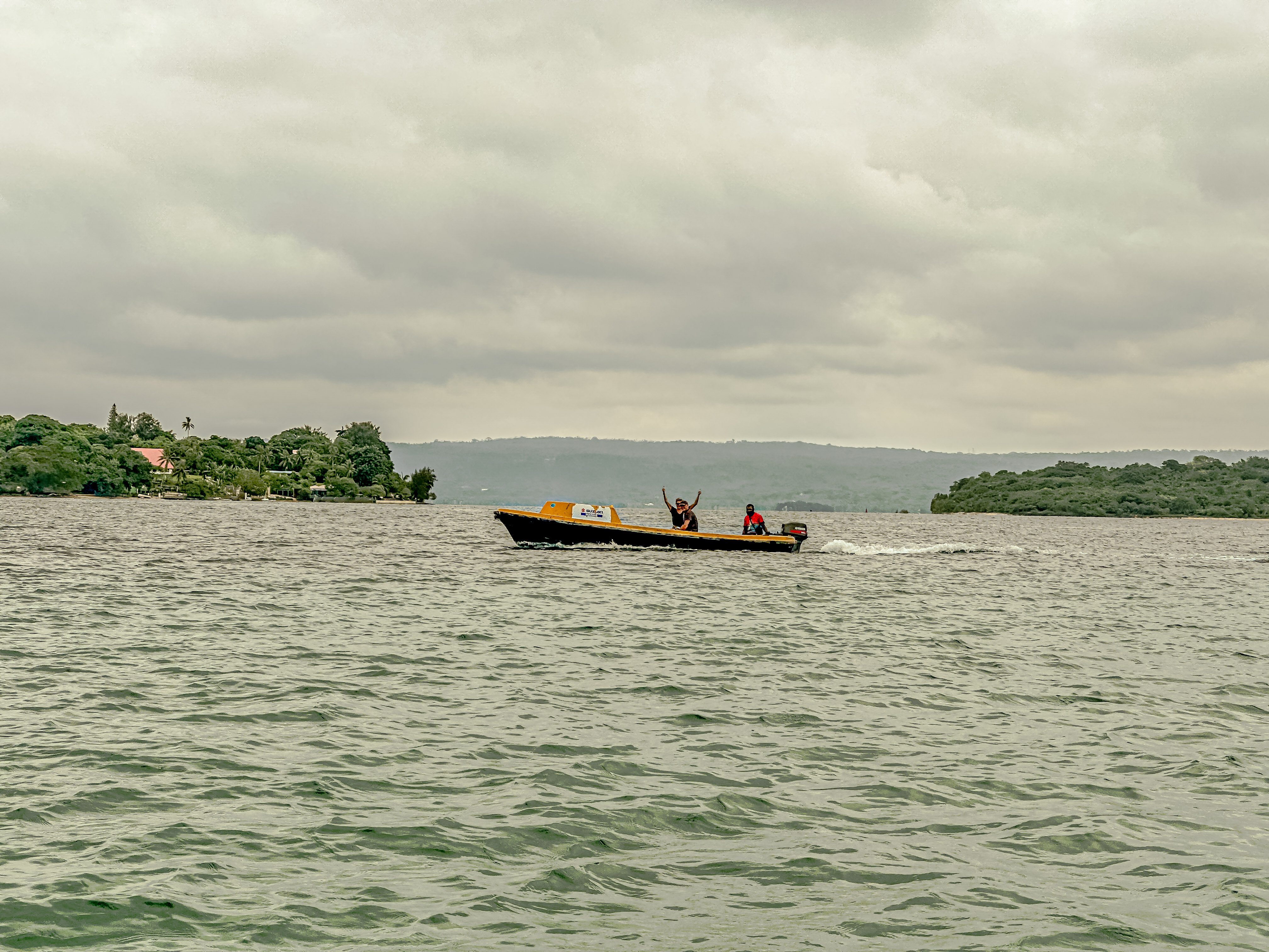
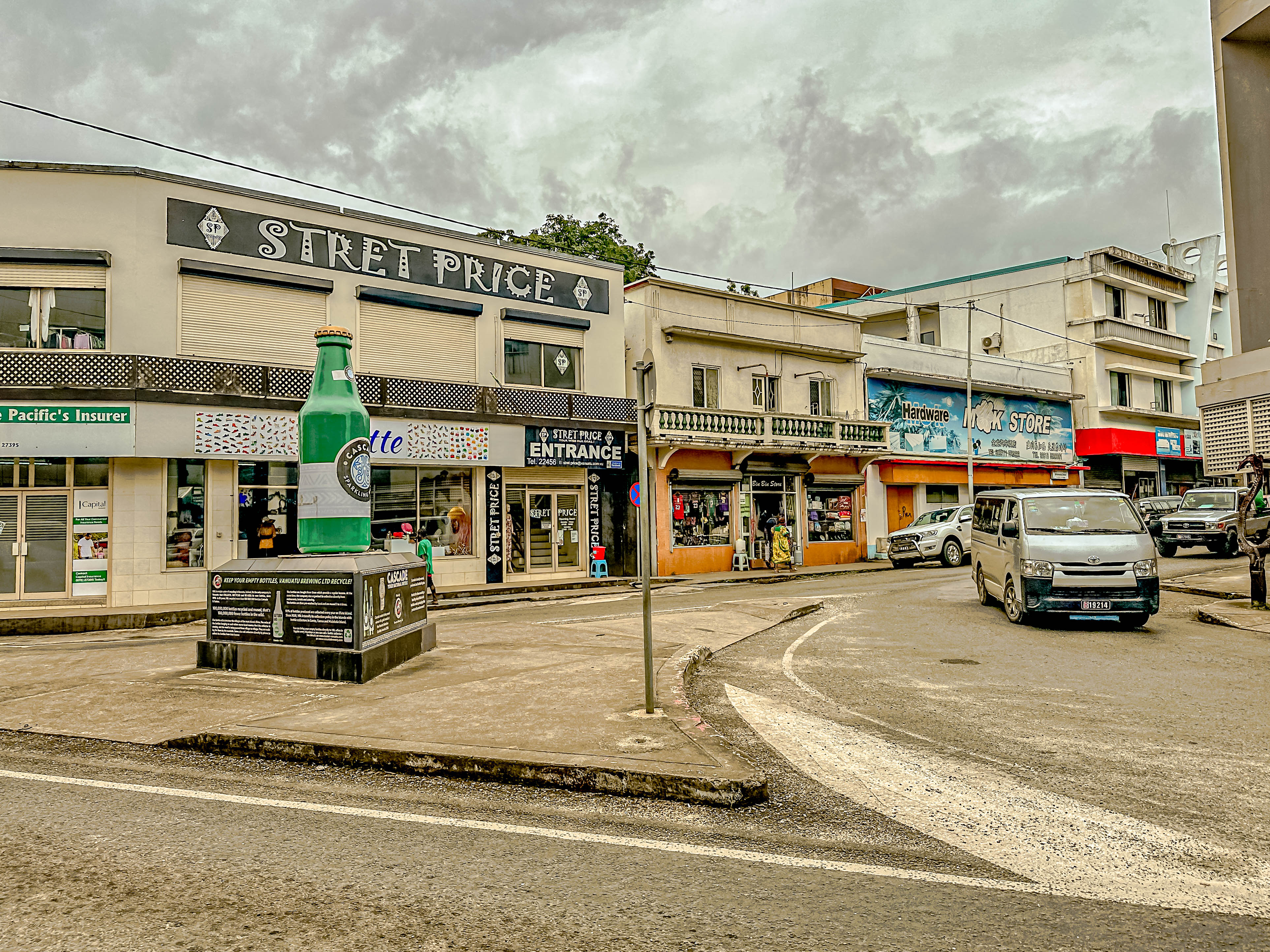
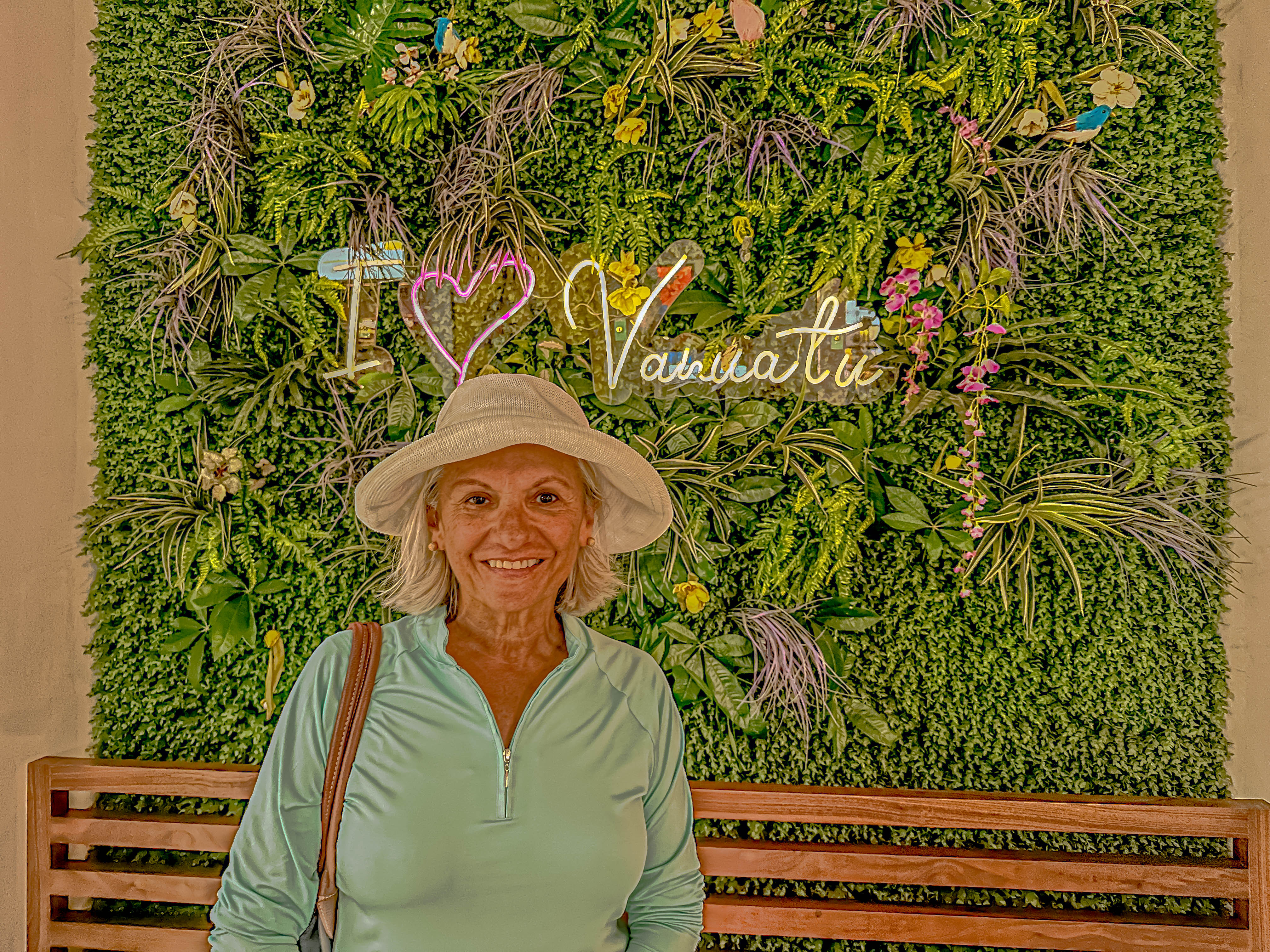
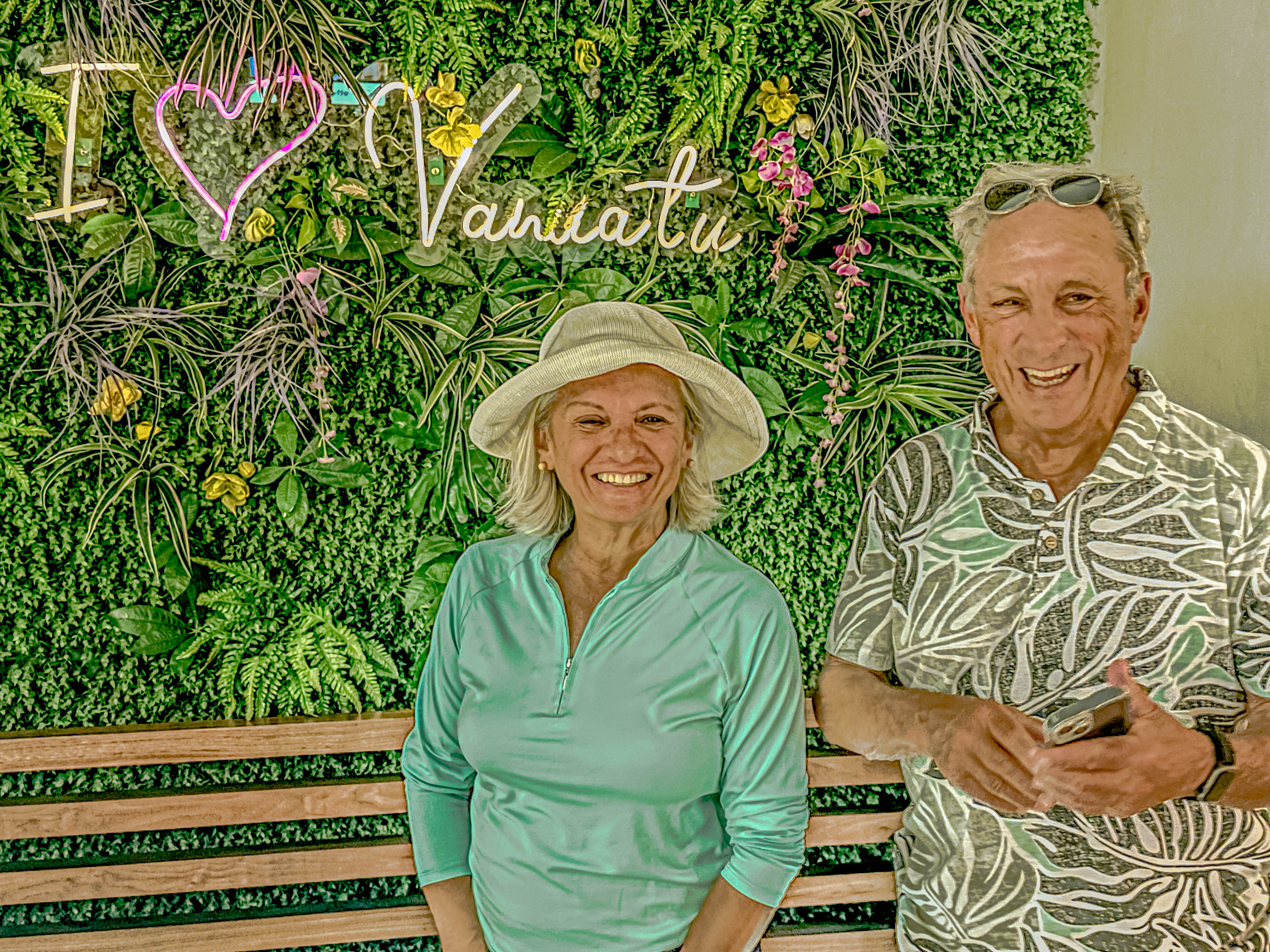
We pulled into port in Port Vila, on the island of Èfaté, Vanuatu, the morning of Feb. 15, 2023. After our dives yesterday, we opted not to take a tour, but decided to go check out the town instead. The port where we are moored is located some way from town, and there was no shuttle. We had two choices to get there, pile into a hot bus, or take a “water taxi” to town. Our friends Barry and Carol were with us, and it seemed like a no-brainer to take the water taxi. Carol had some concerns about the sea-worthiness of our vessel, but we piled in. Other than looking rough, the boat was actually fine, and Captain Mauru (?) took us on a lagoon tour on our way to town.
All the water taxi drivers come from this islandSomeone was happy to see us!Port Vila skyline-the building with the red roof is the Parliament building; the building with the curved brown roof is the sports stadium/event centerParliament House with the Vanuatu flag flyingThe event centerChef Mauro and his water taxi
Our group wandered through downtown Port Vila, which seemed like a bustling center of island activity for Vanuatu. As usual, Carol and I were in the hunt for charms, and we found a really lovely jewelry shop on the main street. I enjoyed talking with one of the shop ladies while Carol made her selection, but the workmanship at Vanuatu Bijouterie was lovely! Then we wandered back to the main craft market in town. Most of the crafts involve wood carving, but the Ni Vanuatu also harvest black pearls, and those were also on offer. While Carol and I were in the craft market, Barry and Jim tried out the local beer.
Downtown Port Vila. Don’t ask me why there is a monument to a beer.Carol in the duty-free centerThe Gringos in VanuatuPost with ceremonial carvings in the big central seaside parkOne of the merchants in the craft market wearing a traditional Vanuatese dressExample of traditional art depicting a successful warrior with all his power symbols around himAnother merchant in the craft marketThe best local beer according to Captain Mauru
Then Captain Mauru took us back to the ship around the lagoon in a different direction. There is an island called Iririki in the center of the lagoon, and thee seemed to be some nice hotels located on the island. Our explorations concluded, we enjoyed our sail away. But stay tuned, dear Readers, as our next stop is in Papua New Guinea.
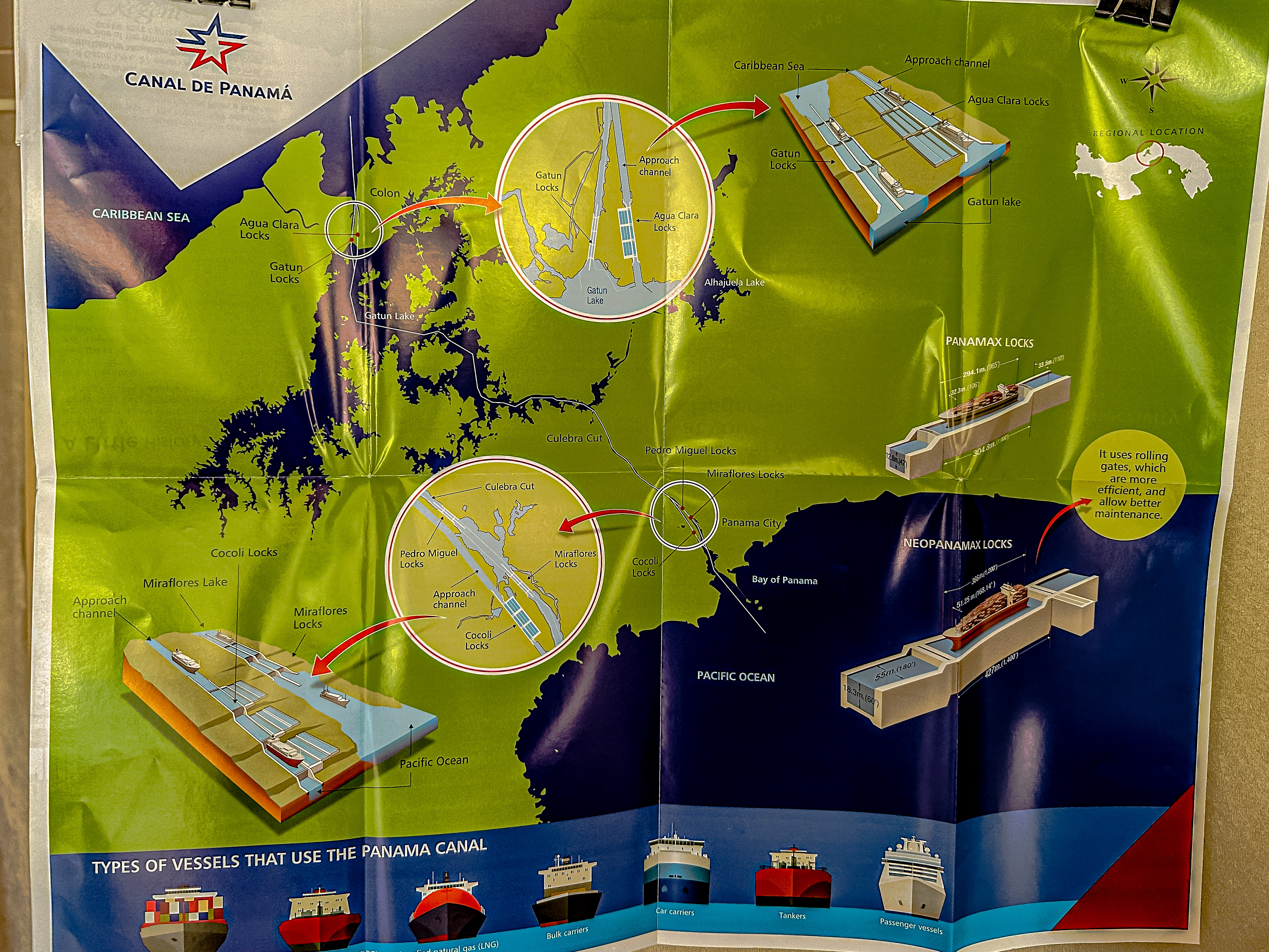
We made our call at the pilot station on the Caribbean side of the Panama Canal before dawn this morning, and brought our pilot aboard, along with a representative from the Canal Authority who will narrate our transit through the canal from north to south (that’s right; it’s not east to west, as you might think).
We approached the Gatún Locks from the Colon side of the Canal
No matter what I might tell you about the engineering marvel which is the Panama Canal, it will not be adequate to describe it to you. The transit must really be experienced to be understood! Originally completed in 1914, the canal came to be largely because of the political machinations of President Teddy Roosevelt, who helped the Panamanians declare their independence from Colombia in 1903. The contract for the United States to build the canal was signed the next day in 1903. The conditions for the construction were horrific, and thousands of men (mostly people of color) lost their lives building it. In particular, the canal had to be dug through over 200 feet of rock making up the Continental Divide to get the water levels to work. Over its first 100 years of existence, the Canal was used constantly, and became essential for world commerce, not to mention travel. However, when human ingenuity created container ships too wide and long to fit within the existing locks, and with waits to transit exceeding several hours on both sides, Panama decided to created a third set of locks to accommodate the increased traffic at a cost of approximately $6 billion. The new locks have only been open a few years and traffic through them has already paid for their construction. For a really good documentary about the building of the original canal, check out: “A Man, A Plan, A Canal, Panama” or you can read David McCullough’s great book about the subject. BTW, A Man, A Plan, A Canal, Panama is also the longest palindrome known.
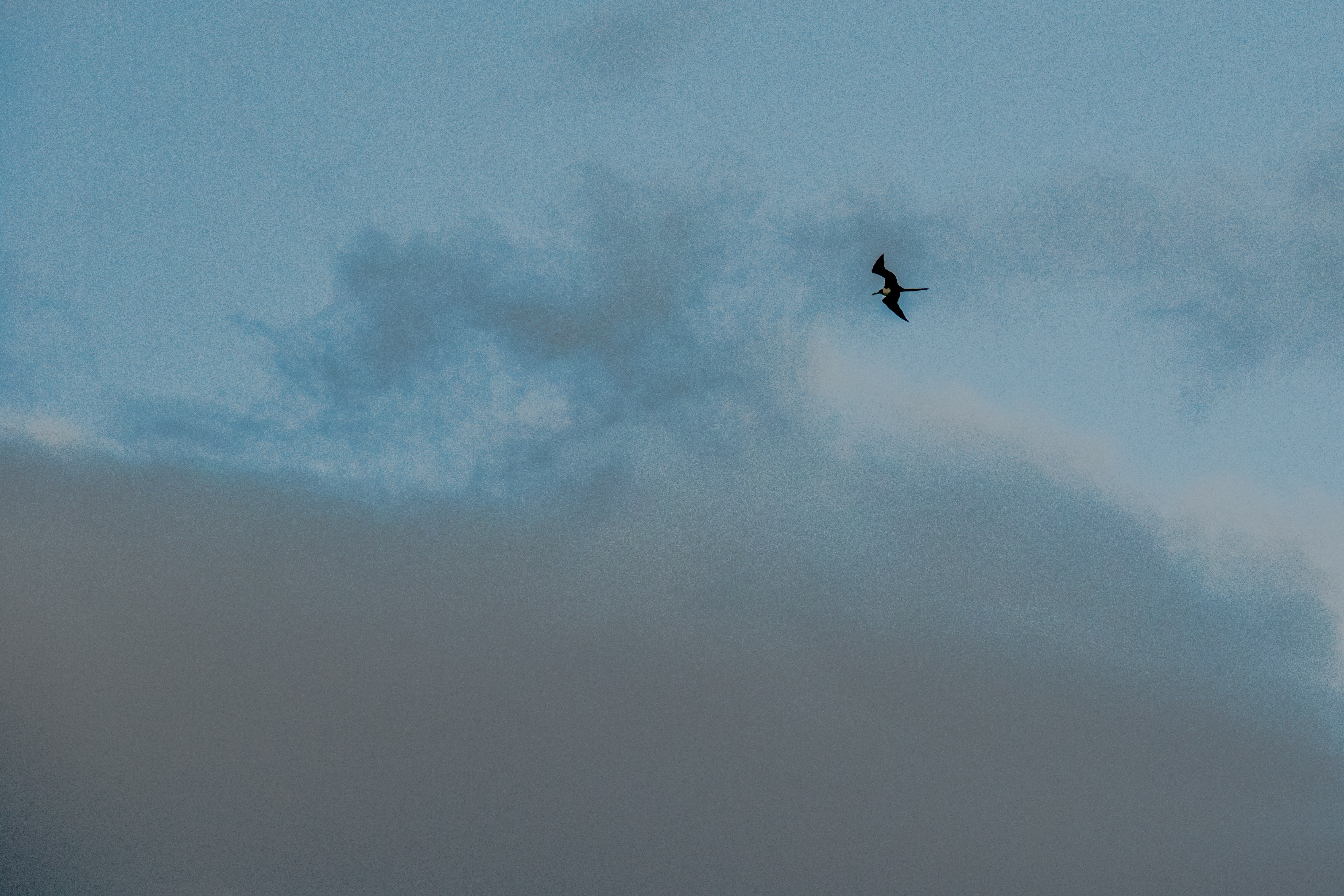
A Majestic Frigate Bird floating overhead.The Princess ship going through the Agua Clara Locks next to us.
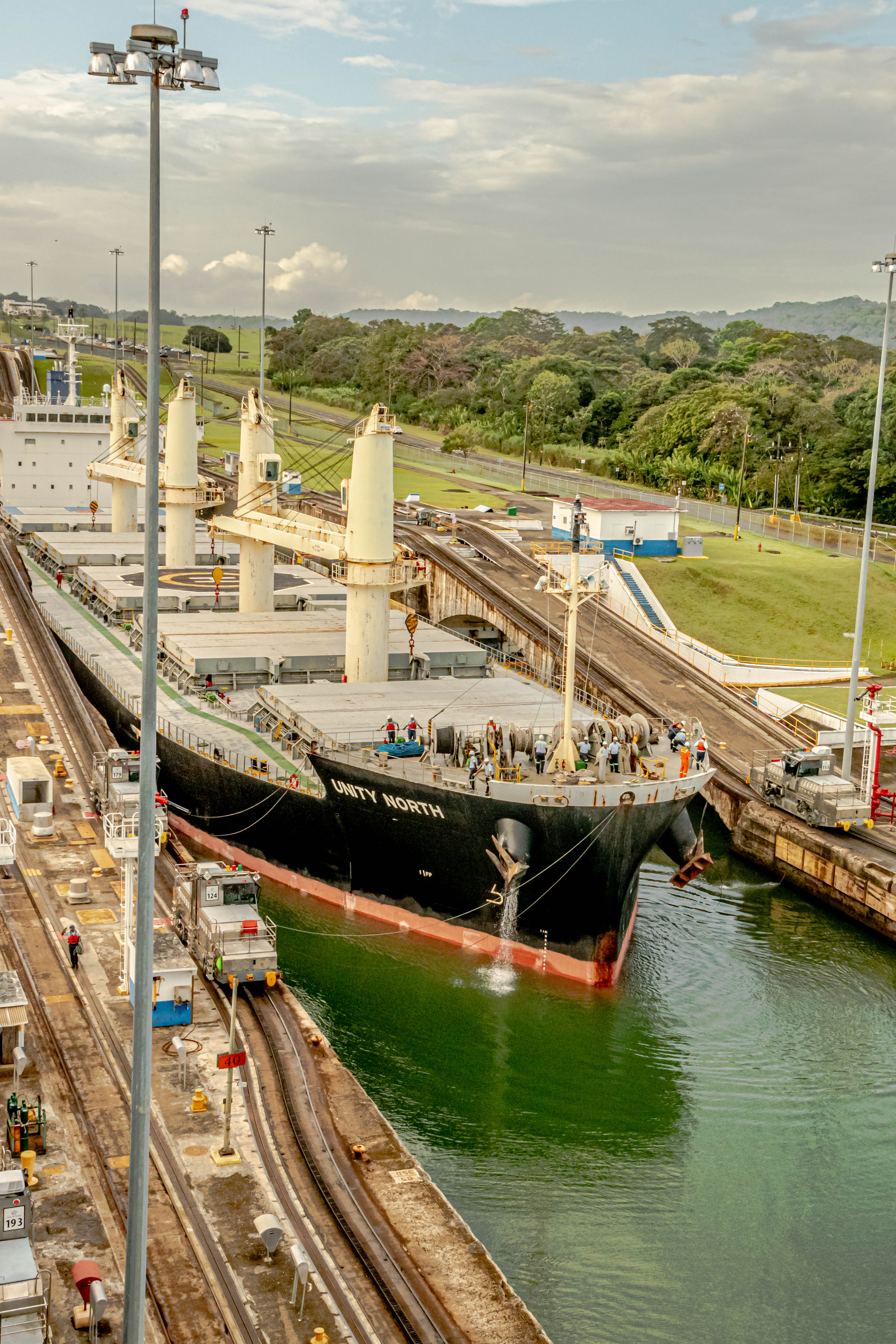
Jim and I have transited the canal a few times, and visited Panama even more (we love it here!), but the transit experience never fails to amaze. We were out early on the deck as we approached our first set of locks, but apparently not early enough to get a spot at the front-facing rails on the top deck. Nonetheless, we stayed outside until we had passed through the three locks which lead into Gatún Lake. We were fortunate to see a fellow cruise ship (the Caribbean Princess) passing the same way in the new third set of locks. Though she’s huge at over 3,000 passengers, she wasn’t large enough to have to use the bigger third channel, but there was so much extra traffic backed up, they probably needed to use that third channel just to keep traffic moving. From the aft deck of the ship, we were able to see the new bridge built high over the entrance to locks as part of the construction of the third channel. Previously, road traffic on the Caribbean side of the canal had to use a bridge right on top of the locks, and traffic could back up for hours waiting for the locks to close so traffic could pass over the top.
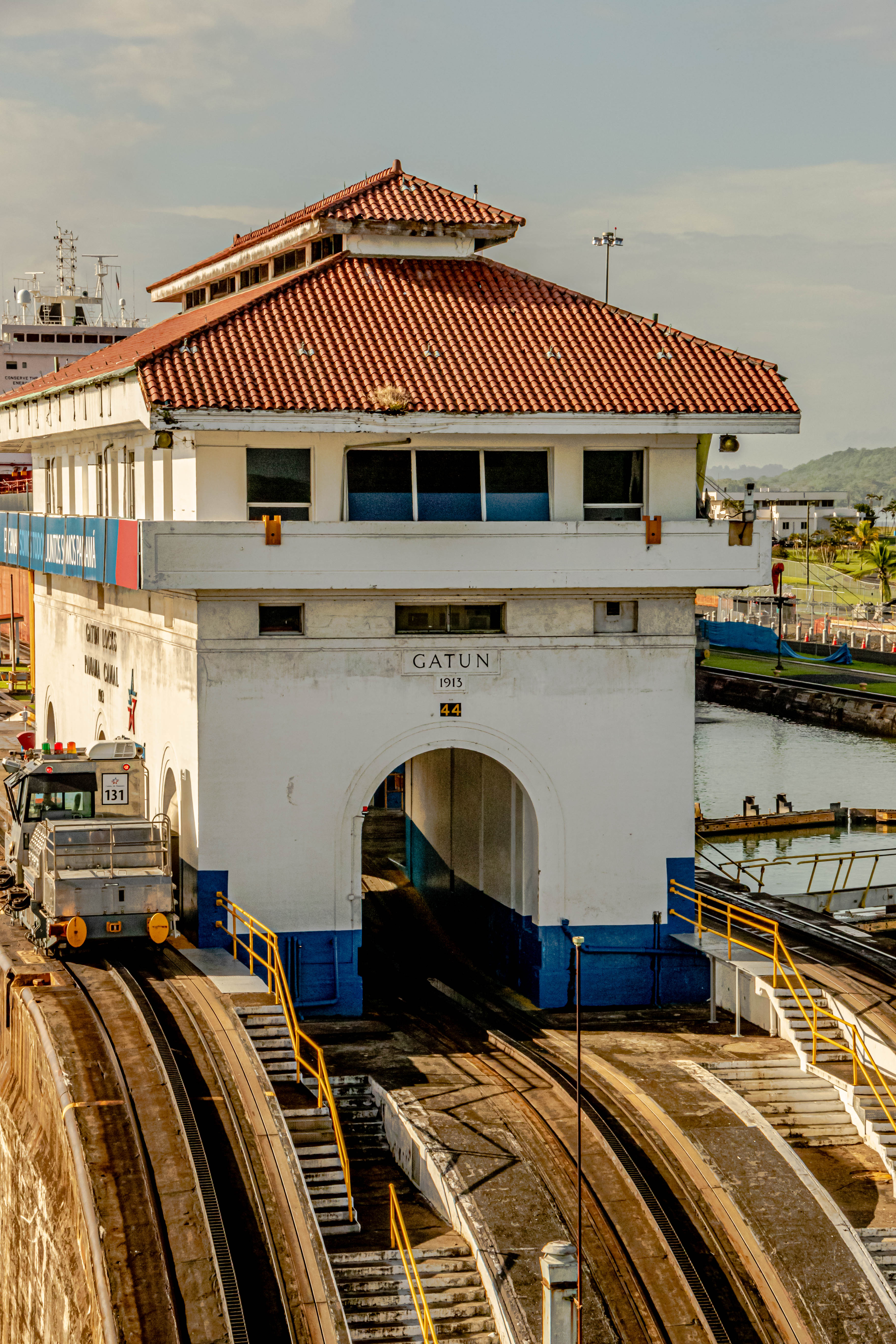
A tree full of pelicans beside the canal.Going through the Gatún Locks.The little engines that make it all possible by guiding the giant ships through the locks at an even spacing from the sides of the locks.Frigate Bird up closeThe engines go up these inclines as the ships rise in the locks.This ship just passed through the locks ahead of us.This one is in the lane beside us.The little engines that could.This is while we’re waiting for our lock to fill with water and float us up to the next level.The control house for the Gatún LocksPelicans flying by at eye levelLooking back towards the Caribbean at the bridge which didn’t exist before the third lane of the canal was built.
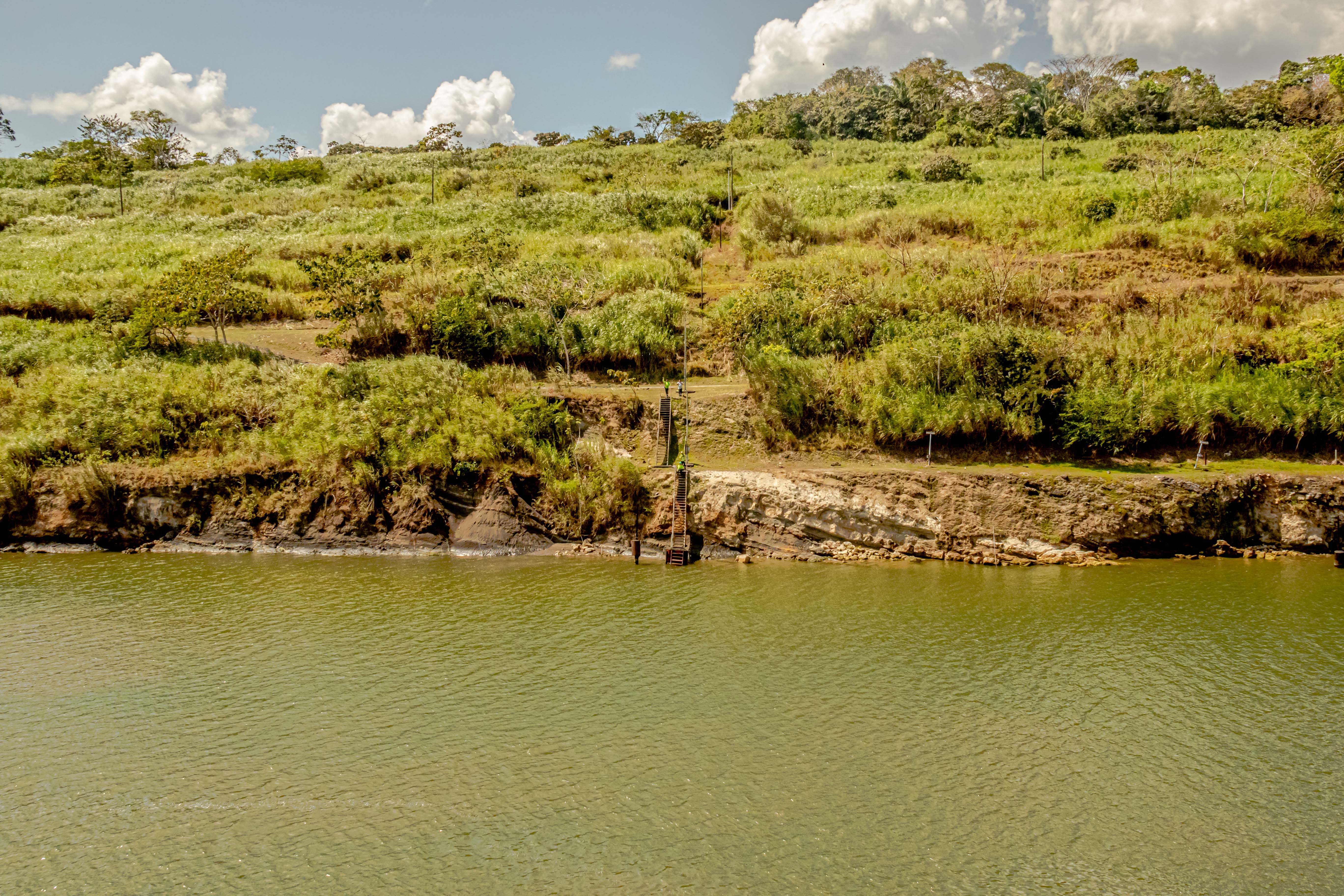
The sail across the vastness of Gatún Lake takes several hours, and I enjoyed just setting up my tripod to see what tropical birds and monkeys I might spy. It was a perfect day for the crossing; still but not too hot. We’ve been here before when the wind was blowing so hard, multiple tugboats had to fight just to get the ships lined up to enter the locks.
Some of the millions of little islands which are in Lake Gatún. Many of them have monkeys and birds, and an occasional crocodile, but there wasn’t much wildlife today.Some form of buzzard?Sightseeing boats looking for the same elusive wildlife.
At the southern end of Gatún Lake, you enter the area where the greatest excavation had to be done, and over 100 years later, you can still see the deep bench cuts the constructors had to make to cut a gap through the Continental Divide. This particular stretch of the canal was so nasty to excavate that it is called the Culebra (Snake) Cut. The mighty Chagres River empties into Gatún Lake through the Culebra Cut, and its waters power the operations of the Canal. Basically, the mountains which come together at the Continental Divide form a giant rain forest, which all empties into the Chagres River. Then you go under the Centennial Bridge to enter the single lock of Pedro Miguel. A short ways further, you enter the final set of locks, the Miraflores Locks. If you are driving alongside the canal, there is a fabulous museum right beside the Miraflores Locks, and there is a viewing station at the top of that building where restaurant for the visitors’ center is located, and you can watch the ships passing by at eye level. Even without transiting the canal, no trip to the Panama City area is complete without a visit to this museum!
In the Culebra Cut.A container ship coming through the Culebra Cut behind us.In the Pedro Miguel LockTis big boy whizzed past us in the third lane and is already almost under the Bridge of the Americas.
We passed through the Pedro Miguel Lock, and then sailed the short distance to the Miraflores Locks. One of the cool things you can do is watch your ship pass through the lock on the camera they have mounted on the lock building. Here is a screen shot of us passing through. We had no sooner passed through the last lock when a torrential downpour hit us. Talk about perfect timing!
Picture from the Canal-Cam.Jim as we go through the Miraflores LocksEnd of the Miraflores LocksHere came the rain!
We’re sailing out into the Pacific Ocean with our next port of call in two days in Manta, Ecuador. However, you won’t hear from us for a few more days because the Gringos are doing an off-ship adventure in the Galápagos Islands. When we get back to the ship, and can download our pictures, we’ll post again. Until then, you can enjoy this photo of the Spontaneous Duo (Kasia and Boogie) playing last night in the Horizon Lounge. They’ll be onboard with us for the entire trip.
Headed out under the Bridge of the Americas into the Pacific Ocean .Kasia & Boogie
We journeyed by ferry to the Outer Hebrides islands of Lewis and Harris the morning of August 30, 2022. We were blessed with another glorious sunny day, which is quite out of the norm here. The ferry from Skye takes about an hour and twenty minutes, and we pulled into the south, in port of Tarbert, on the island of Harris. Lewis is the northern island, but for all intents and purposes, they are connected.
Over the sea to Lewis and HarrisThe entrance to TarbertSouth HarrisThe Tarbert Light
The combined population of the islands is about 21,000 people, with the biggest employer being the Council office, followed by port authorities and beer distillers. Most people are crofters, and most of the land is now owned by the community. The combined islands are also called the “Long Island”, or the “North Island”.
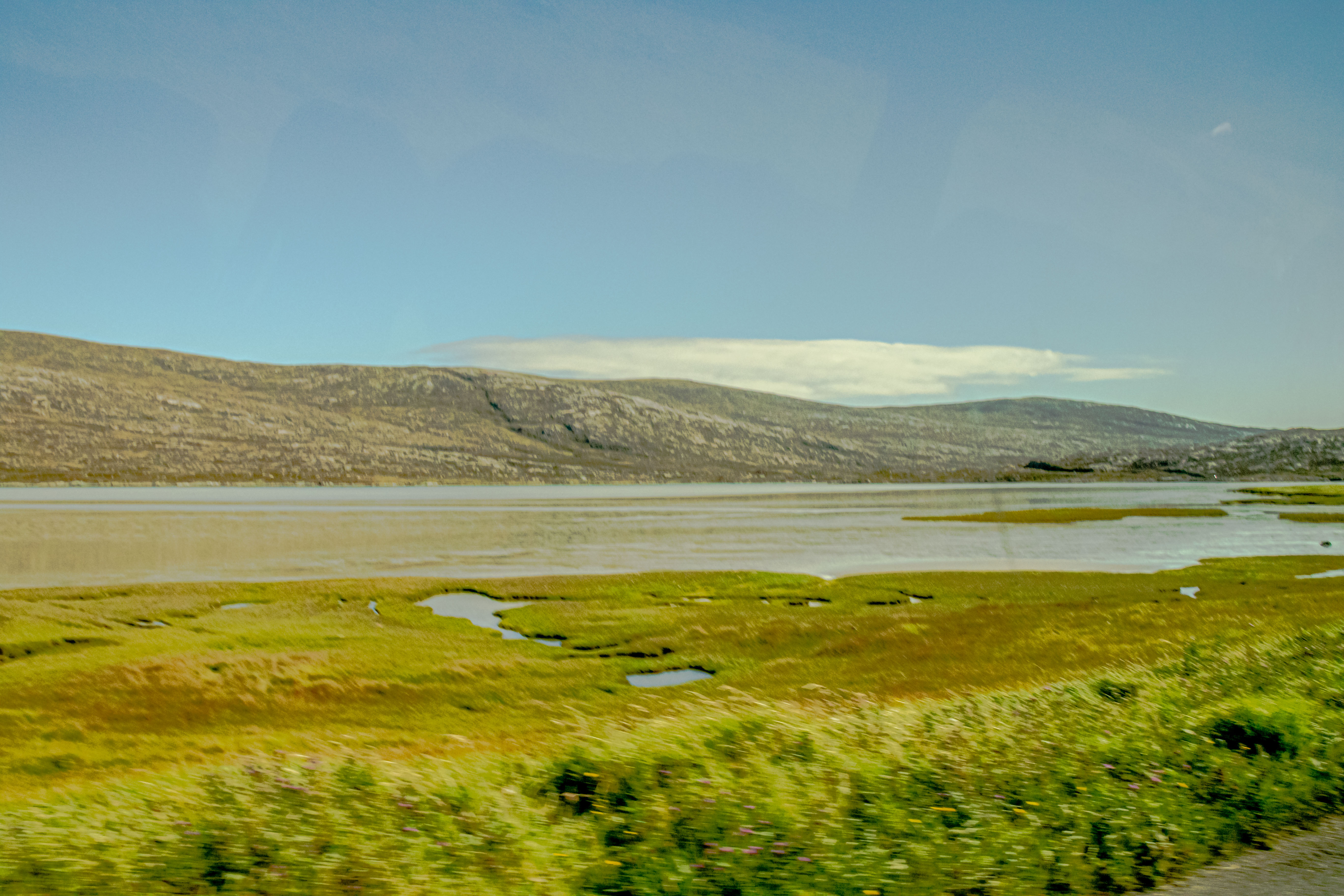
Pretty soon after driving onto the island, you could observe some obvious differences in topography from Skye. For one thing, there seemed to be many more rivers and lochs, and the hills looked more rolling and gentle than those on Skye. All those bogs have led to an increased availability of peat, and we could see evidence that some people were still cutting it to heat their homes.
Rolling hills of the Outer Hebrides
For our first intended stop, we were going to gaze out at Luskentyre beach, but a lorry accident closed the road. Instead, we went down the coast a bit to stop at the beach at MacLeod’s Stone. As you’re viewing these pictures, I hope your impressions are of what looks like an island in the Caribbean or some other tropical locale, because that’s what it looked like to us (minus the cows, of course)!
Luskentyre beachThe wetlands Horgabost CampgroundNisabost BeachScottish beachgoersOur merry band of explorersJim can’t believe the water is as cold as we’ve been told.Jim apparently thinks the cell service is better by cows.MacLeod’s Rock
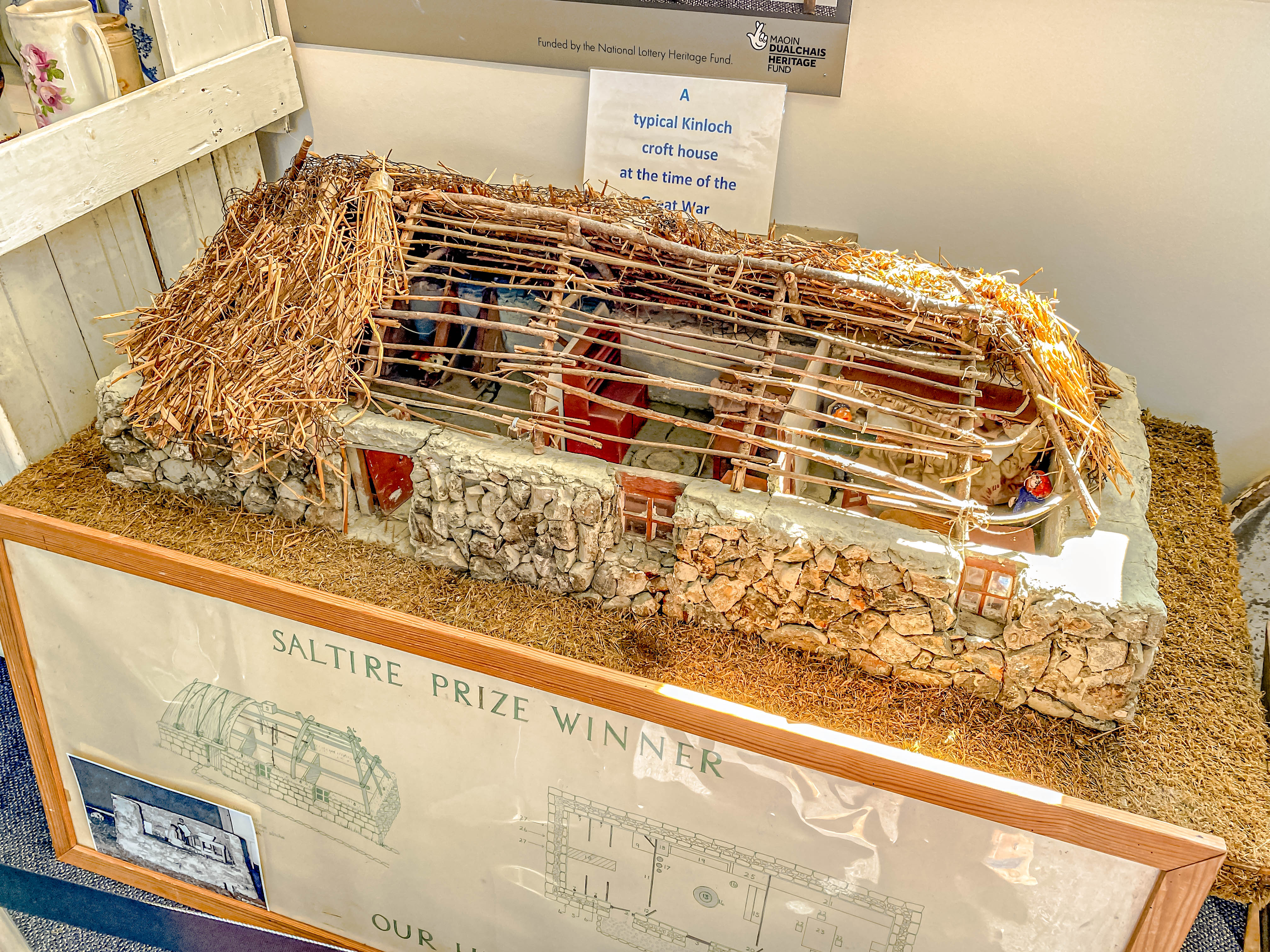
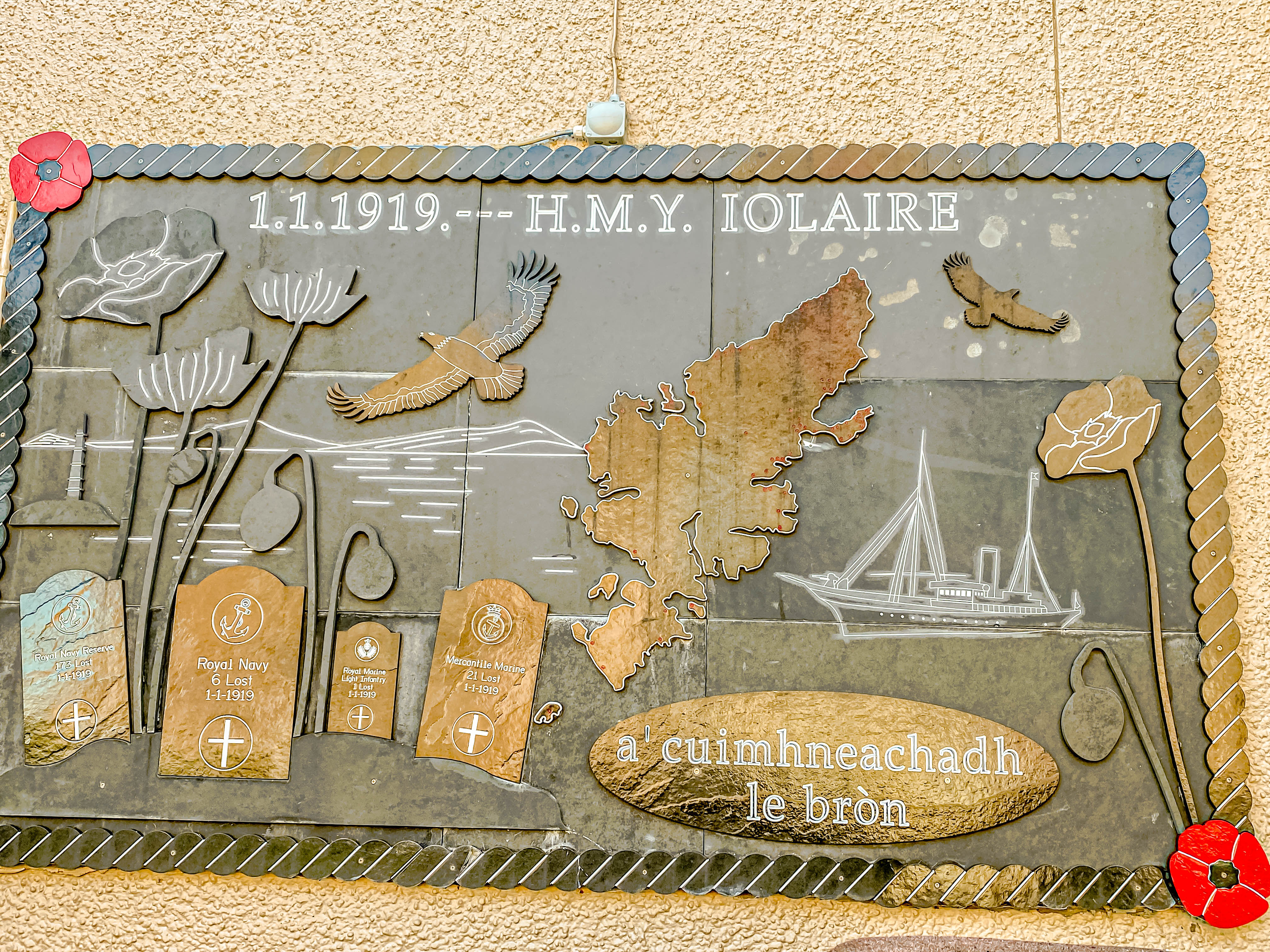
We stopped by the Kinloch Historical Society, which runs a small museum, tea room, and a craft shop. We had some lunch and visited the museum, where we learned about the “black houses” crofters lived in during the 18th and 19th centuries, and the loss of the marine transport vessel, the Iolaire, right outside the harbor of Stornoway, killing over 200 local lads returning from World War I.
Kinloch Historical SocietyModel of a “black house”
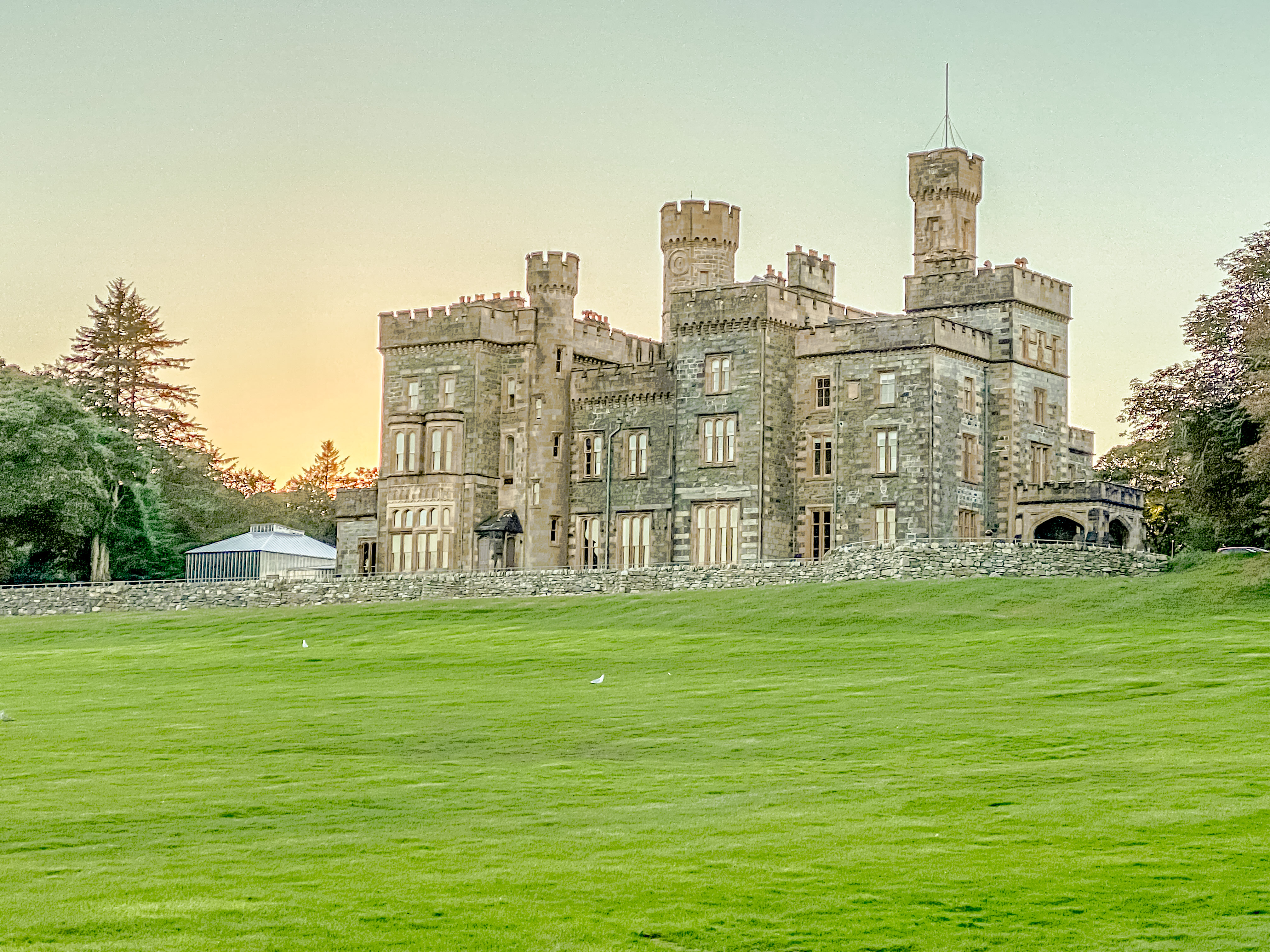
Then we completed our journey in the town of Stornoway, where our accommodations for the next three nights is the lovely Victorian Castle called Lews Castle overlooking the harbor of Stornoway. The story behind its construction is not a pretty one. It was built between the years 1844-51 as the country home for Sir James Matheson, who had grown rich in the opium trade. The Sir Matheson had all the crofters living on the choice property with waterfront views turned off during the Clearances so he could build his dream house. However, in 1918, the castle was bought by Lord Leverhulme, who gave the castle and its property to the people of Stornoway parish. Today, the museum on the ground floor and the self-catering apartments on the second floor are run for the benefit of the town council. The grounds are frequently used for fairs and festivals, and seemed to attract quite a few sun-worshippers on this glorious day.
Lews CastleViews of Stornoway HarborStornoway town
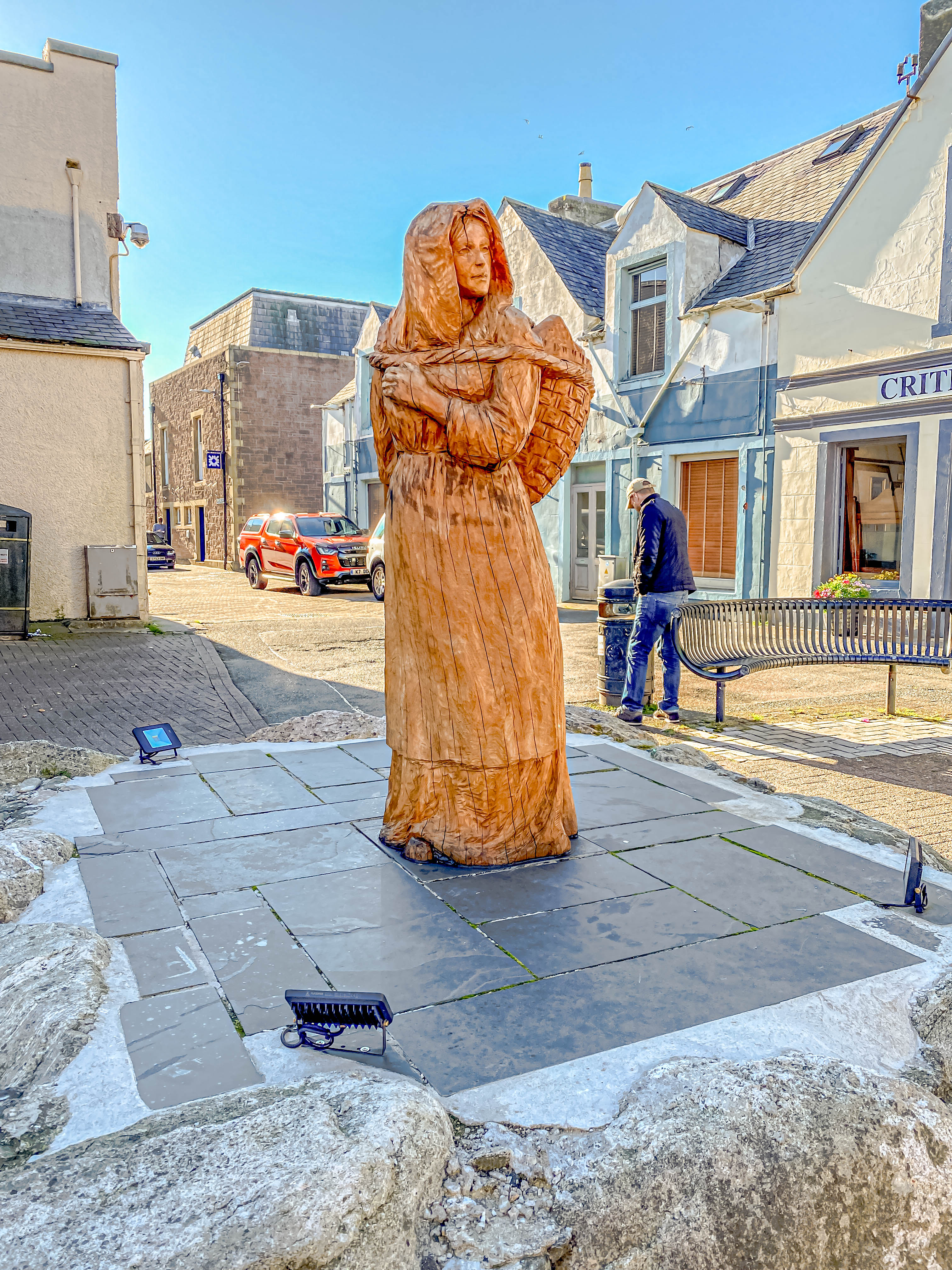
After we refreshed ourselves, our guide, Damian, gave us an orientation walk of the town. Perhaps the most notable is the haunting outline of a ship’s hull along the port esplanade commemorating the loss of the Iolaire. There are lots of good restaurants and bars, mostly serving up fresh seafood. We had dinner that night at a really nice local restaurant called the Boat Shed, and then walked home through the dusk.
Wooden carving of a fish wife selling the fish her husband caught.Memoriaal in town to the sailors of the IolaireRepresentation of the IolaireAlong the esplanade in StornowayThe harbor at duskHome to our castle abode
Stay tuned, dear Readers, because tomorrow will be another epic day on Lewis and Harris!