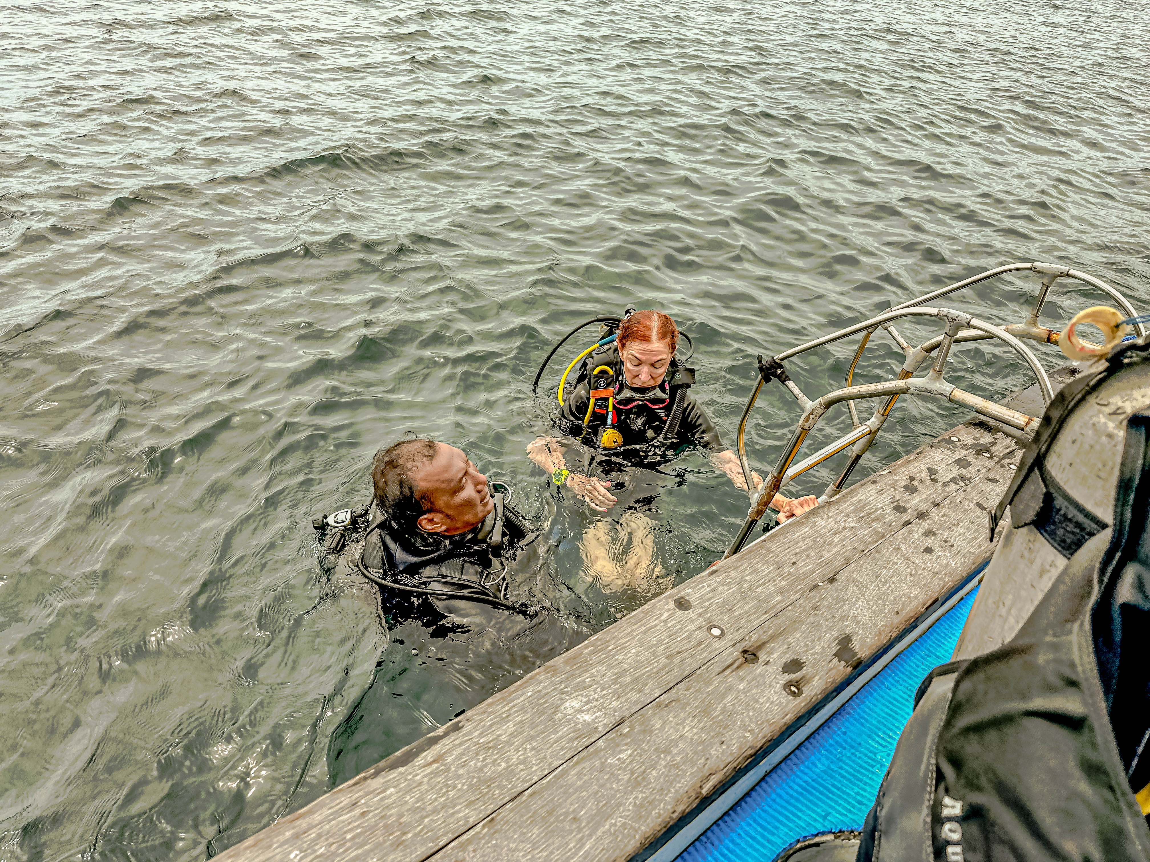
For our second day in Bali, we decided we wanted we wanted to go scuba diving to explore some of Indonesia’s famous undersea life. As you can see from this map, Indonesia is right in the middle of what is known as the Coral Triangle, and because of that, has some of the greatest diving in the world. Ever since Jim and I booked this trip, we decided to try to dive as many places in the Coral Triangle as we could. S we booked two dives with Bali Scuba Masters, and six of us from the ship went off the explore together. From the port of Benoa where we are still moored, the two most popular dive spots within range are off the island of Nusa Penida on the southern side of Bali.
The trip out to the first dive site took about an hour and a half through incredibly rough seas. The southeastern most tip of Nusa Penida is a dive site called Manta Point, because … there are frequently mantas there. However, the seas were so rough, it was not safe to dive, so we moved to site number 2 on the northwestern end of Nusa Penida, a dive spot called SD Point. After another half an hour of rough riding, we were able to pull into the lee of the island and dive.
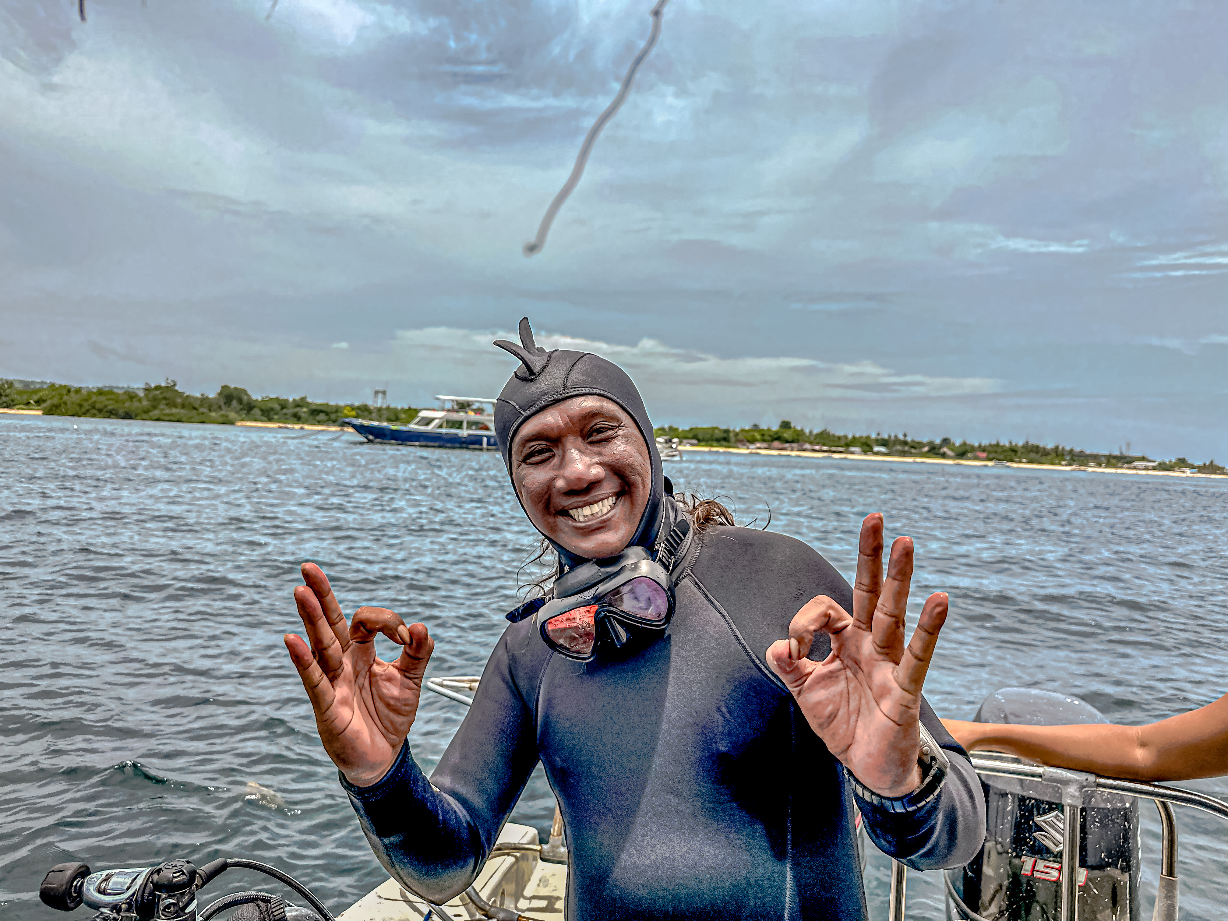
The deckhand making an offering as we left the harbor.Gritting our way through the ride to the dive site.Mount Agung on the main island of Bali. It is still an active volcano.Rock arch off the coast of Nusa Penida.At Manta Point, making the decision to scrap the dive here.Our dive masters. I think you can see how rough the waters were.
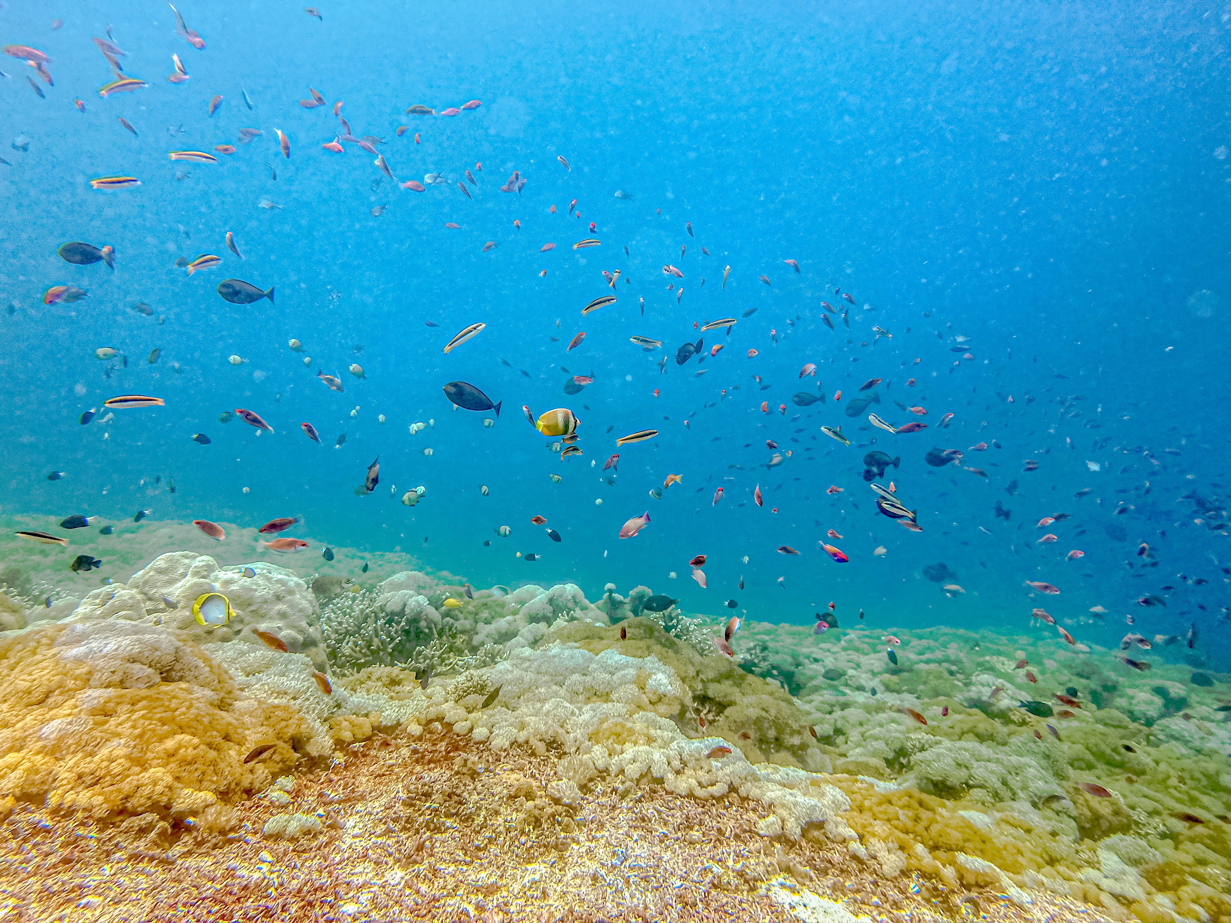
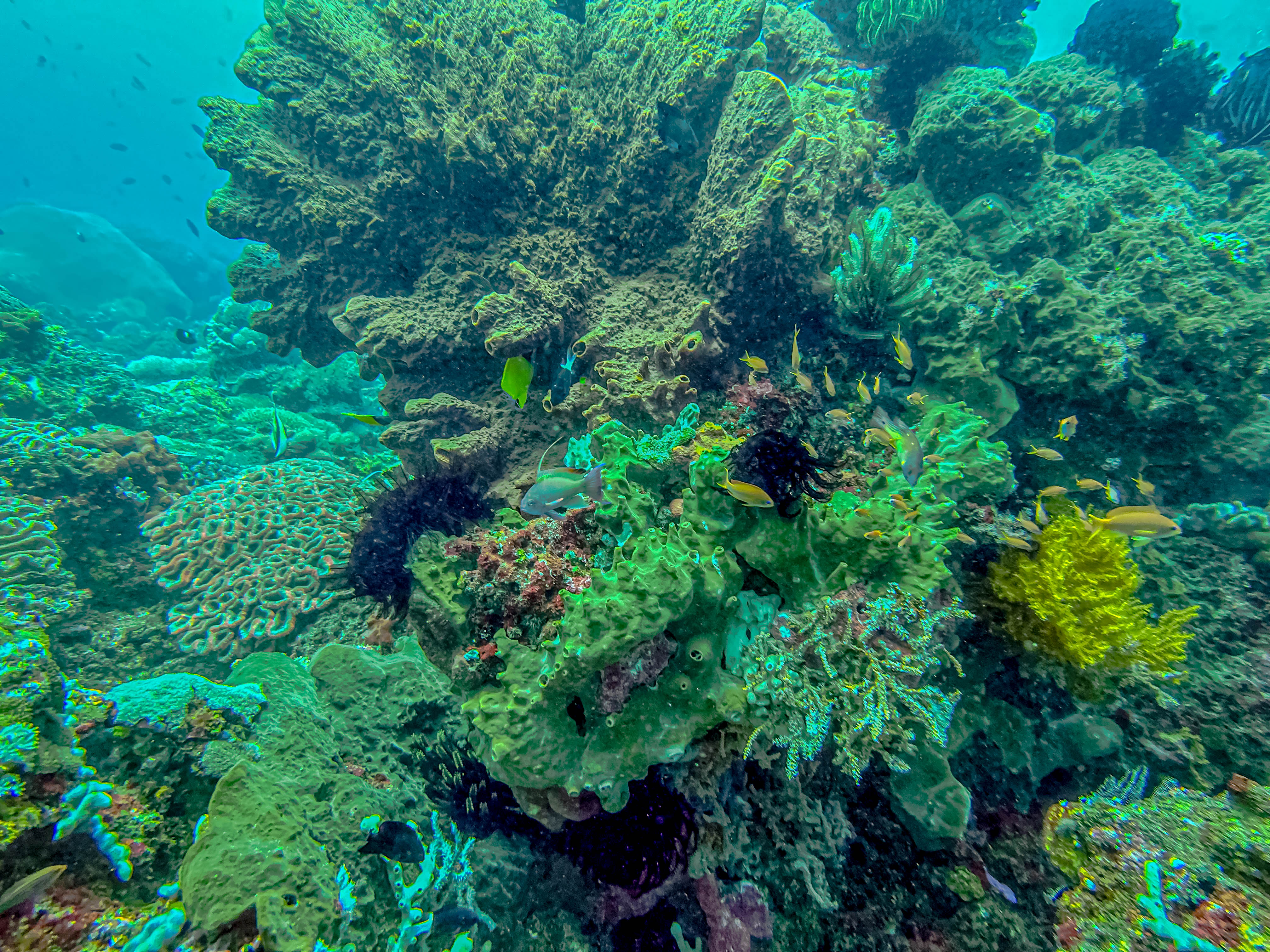
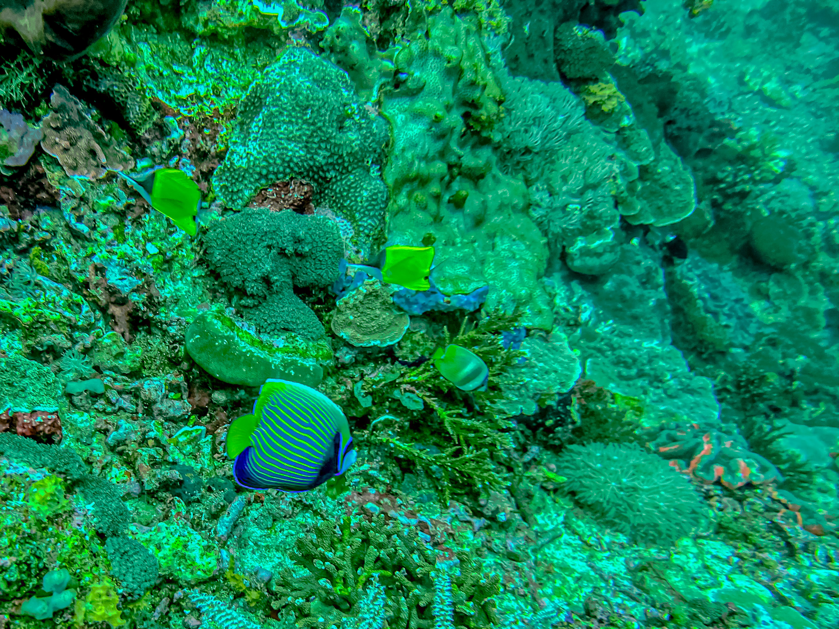
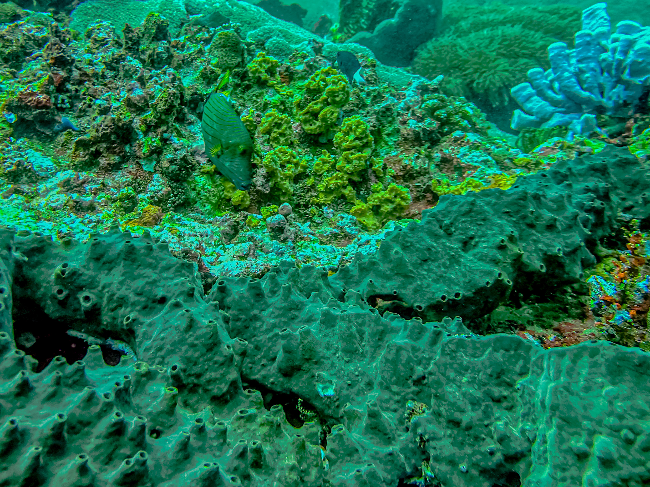
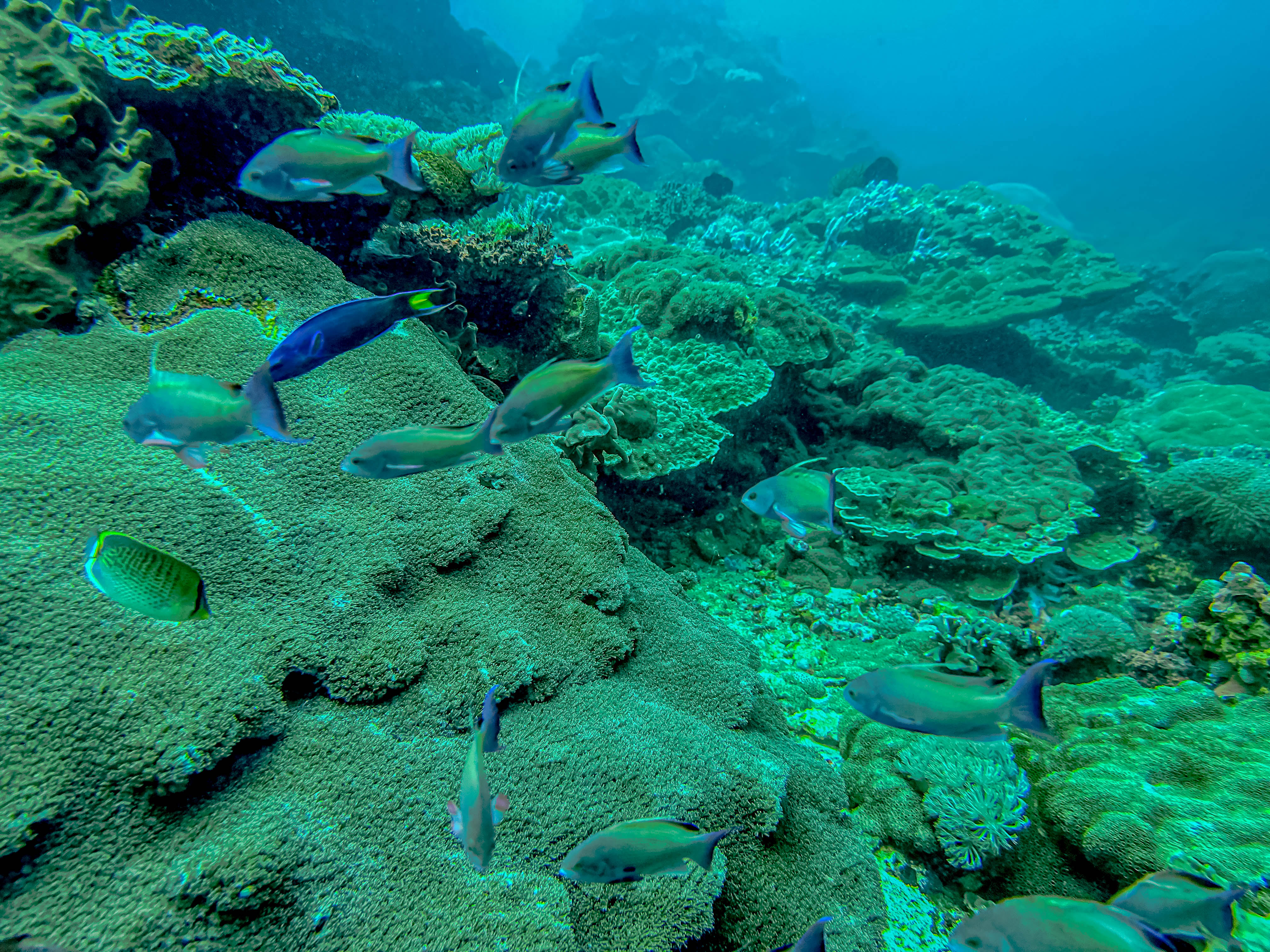
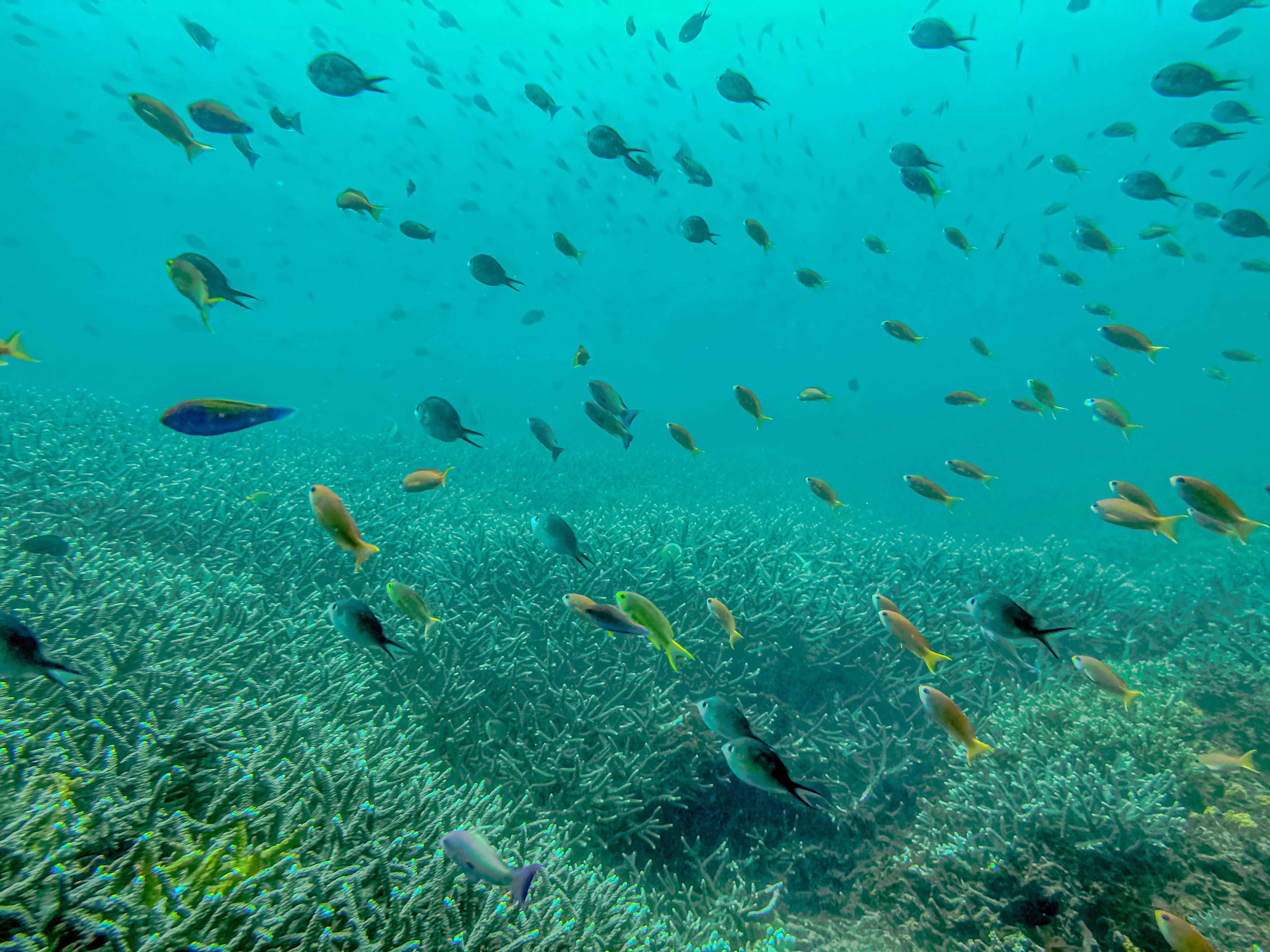
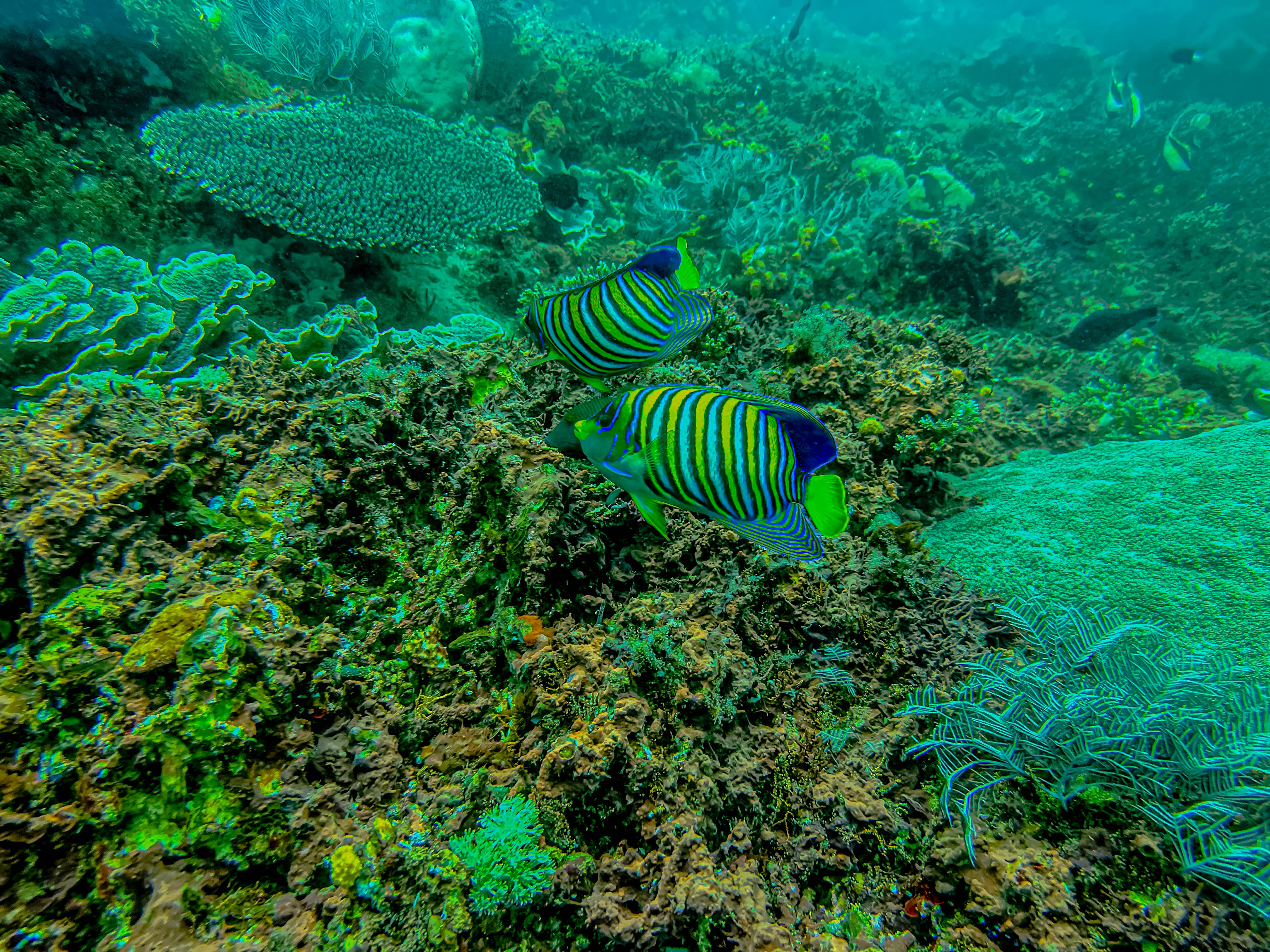
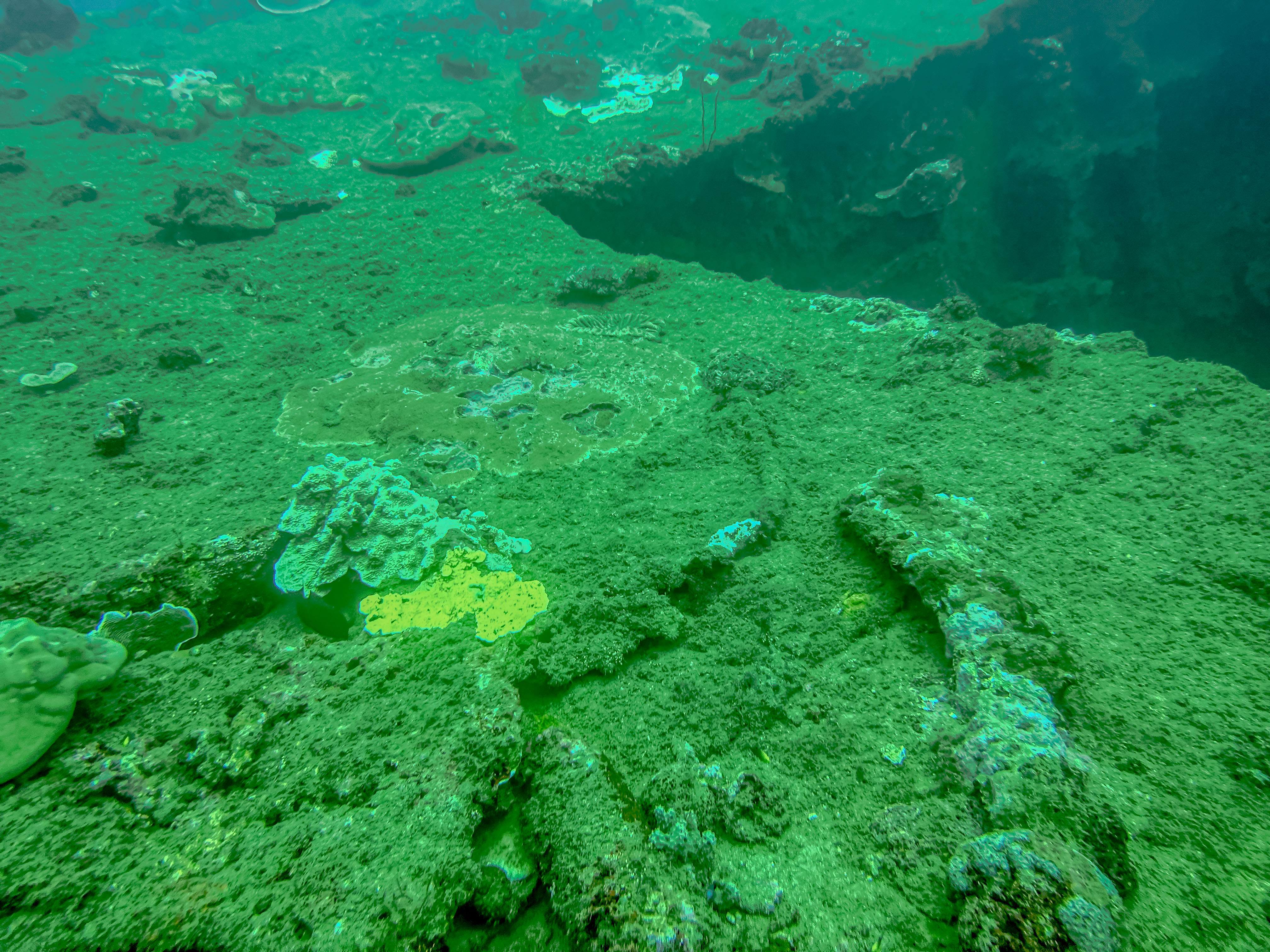
Sadly, because the water was so turbulent, the visibility on the dive was a fraction of what it would normally be (about 25 feet instead of close to 100), but we still managed to see numerous types of fish which were new to us. Fellow diver Greg Jones provided all the underwater shots for this post as he is still our “dive photographer in residence”. Thanks, Greg! We saw numerous types of angelfish, including both the emperor and regal angelfish. And we also saw many different types of butterflyfish. Some of the angelfish were HUGE! WE also saw a moray eel and a green sea turtle. The corals were fantastic, with some really intriguing shapes.
There were just clouds of fish!Anthias, wrasses, damsel fish, and others.Susan in her elementBlack angelfish.Moorish Idol and a Pyramid angelfish Yellow-saddled butterflyfishVarious anthiasFinding our first turtle of the dayThe variety and colors of the corals were amazing!Two butterflyfish and a cleaner wrasseMore anthias, and a forceps fish in the back.Yellow-tailed blue damselsEmperor Angelfish in the front.Check out these crazy corals! This is a new kind of angelfish for me in the front, and also a new kind of butterflyfish in the back.Another unknown (to me) butterflyfishPurple soft coralThis blue tipped coral was almost neon colored.I don’t know what this species of starfish is called, but we’re all calling them the “Gumby” starfish.TrumpetfishLined TriggerfishBlue-spine golden damsel?Black anemone fish (also called clown fish)Very large Anthias, and the blue and yellow fish are bicolor angelfish.Another green turtleOur dive master, Made
After our surface interval, during which the dive operator provided really nice box lunches for us, we motored a short ways to our second dive spot off an adjacent small island called Lembongan Island (Nusa Lembongan). The dive spot is known as Mangrove Point. The water was even more turbid here, but again, we saw some great fish and another green turtle. We also saw a lionfish. And Greg and Susan saw a stone fish! In extremely challenging visibility conditions, Greg got some great photos!
A lemon drop angelfish? and some kind of triggerfishButterflyfishRegal AngelfishA boxfishAnother “Gumby”!Tang/SurgeonfishThese were some of the huge angelfish., but I don’t know this species.Cute boxfishOrange Anemonefish (we found Nemo!).Black-saddled Toby fish (type of boxfish).The poisonous Stonefish (a master of disguise).NudibranchGiant clamPennant Bannerfish (in center)We’re calling this one the Pillsbury Doughboy starfish.Pennant Bannerfish in front, Batfish in back.Tang and parrotfish in foreground,.I don’t know what this striped and spotted fish is, but it’s beautiful!Another beautiful nudibranch. This creature is no more than an inch long.Happy divers returning to the surface from an excellent day of diving!
Then it was time to head back to the ship. The ride back was not quite as hair-raising as the outbound trip, but still very rough. Jim and I decided when we got back not to dive tomorrow, so we will have other adventures to share with you instead. Stay tuned!
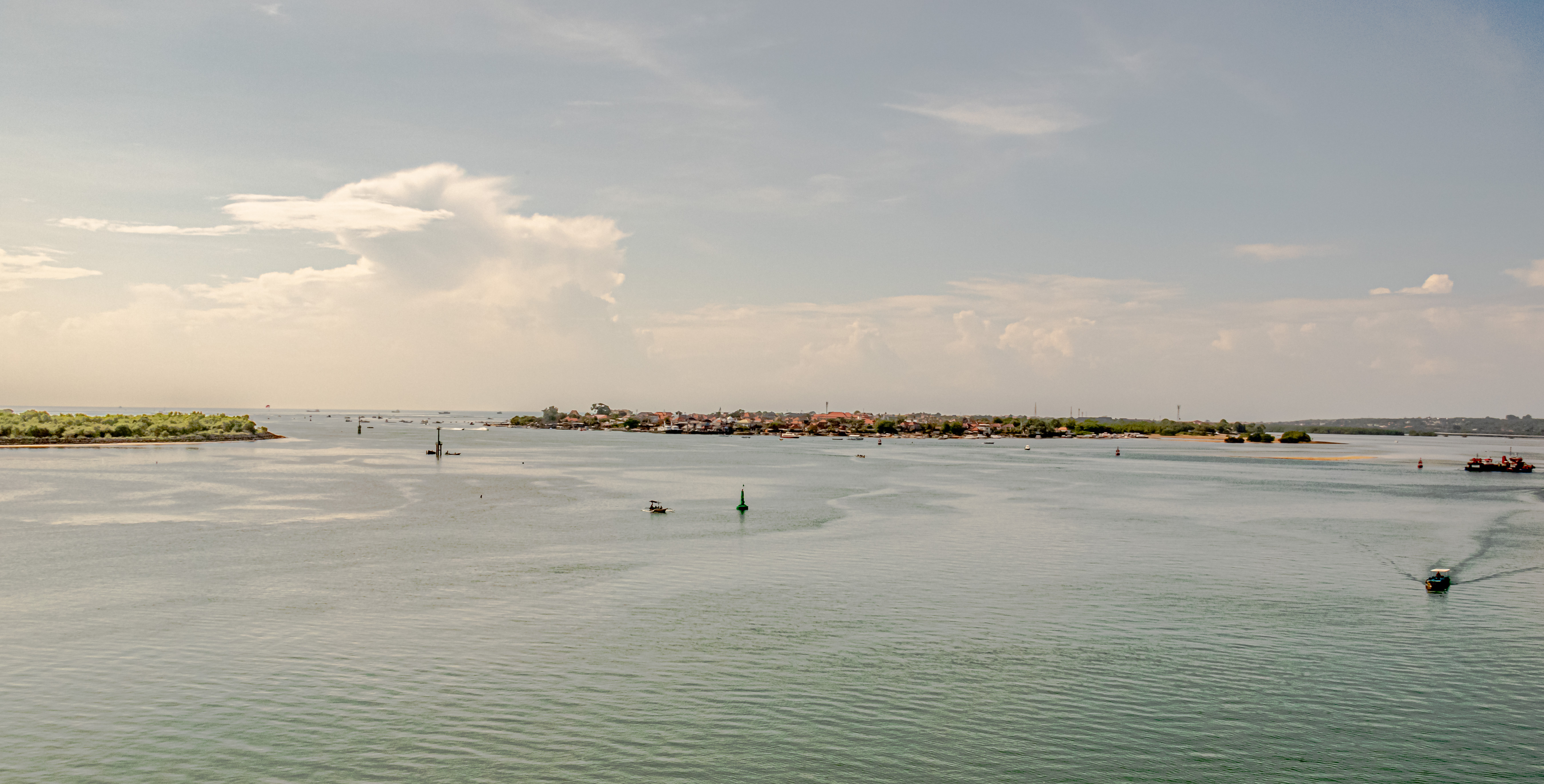
After two days of really rough seas, on February 27, 2023, Jim and I docked in the port of Benoa on the island of Bali in Indonesia. In fact, we were awakened by the exotic sound of Balinese drums and bells, as we were welcomed into port.
Benoa Harbor
There are over 17,000 islands in Indonesia, and the biggest of those are: Java, Bali, Sulawesi, Sumatra, Borneo, western New Guinea, and Lombok. In fact, Indonesia is the largest archipelagic country in the world, and the 14th largest country by area at 19 million km² (735,000 mi.²). The population of Indonesia is over 275 million people, which makes it the world’s fourth most populous country. It is the largest Muslim country by population in the world, with over 80% of their total populace being practicing Muslims. The island of Java is the country’s largest island, and also its most densely inhabited (about 160 million people live there). The capital of Indonesia is Jakarta, on the island of Java, but the Indonesian government is in the process of moving the capital to the Indonesian part of the island of Borneo because climate change threatens Jakarta.
However, for the next three days, we will be located on the island of Bali, which is anomalous in Indonesia, because 87% of their population are Balinese Hindus. Denpasar is the capital of Bali, and we are parked in the harbor of Benoa, right next to Denpasar, which is unbelievably densely populated.
The history of Indonesia is incredibly rich. Archeologists have found fossilized remains of homo erectus (“Java Man”) dating back between 500,000 and 2 million years ago. The earliest remains of homo sapiens in Indonesia date back about 43,000 years ago. As discussed in earlier posts, it is believed that Austronesian peoples, which form the basis of the modern population, migrated to the islands from Taiwan about 2,000 B.C. The agricultural conditions here are nearly perfect, and the people perfected the art of wet rice farming as early as the 8th century BCE, both of which allowed villages, towns and small kingdoms to flourish by the first century CE. Indonesia’s prime location along major shipping lanes fostered inter-island and international trade with India and China back several centuries BCE.
By the seventh century CE, the Srivijaya kingdom flourished due to its trade, and was influenced by both Buddhism and Hinduism. Its sailors sailed to and traded with the peoples of Madagascar and East Africa. Between the 7th and 10th centuries CE, the dynastic kingdoms of Srivijaya (Buddhist) and Mataram (Hindu) thrived and then declined, but left behind great monuments like Borobodur (world’s largest Buddhist temple) and Prambanan (largest Hindu temple in Indonesia). By the 13th century CE, the Srivijaya empire ceased to exist, which is when the Hindu-Buddhist Majapahit kingdom (also called the Wilwatikta empire) was founded, and expanded to rule over much of present day Indonesia, including what is present day Brunei.
Islamism started in Indonesia in the 13th century CE on the island of Sumatra. Other parts of the archipelago (except Bali) adopted Islamism, and it was the dominant religion in Java and Sumatra by the end of the 16thcentury CE, albeit overlaying existing cultural and religious influences, so that today, Indonesians practice a type of Islamism heavily influenced by Hindu cultural icons.
The first Europeans arrived in the area in 1512, when Portuguese traders sought to monopolize the sources of nutmeg, cloves, and cubeb pepper in the Malacca islands (Spice Islands). However, in 1602, the Dutch established the Dutch East India Company (“VOC”), which became the dominant European trading power in the area throughout the next two centuries. But it wasn’t easy; the Dutch were perennially having to fight the native Indonesians to maintain control over their trading outposts. After the VOC went bankrupt in 1800, the Dutch government took over control of the islands, which lasted until the Japanese invaded in 1942. When the islands were finally liberated in 1945, the Netherlands attempted to reassert control over the vehement objection of the Indonesians. Finally, with the U.S. threatening to withhold Marshall Plan reconstruction funds from the Netherlands, the Dutch acceded to Indonesia’s independence.
After a few years as an independent democratic republic (the United States of Indonesia), a failed coup in 1965 led to a violent repression, and strongman dictator Suharto assumed power in 1968, staying in power until he was brought down by popular uprisings in 1998. Today, the Republic of Indonesia is a presidential republic with an elected legislature over a people with hundreds of distinct ethnic groups and over 700 spoken languages. But their motto is “Bhinneka Tunggal Ika” (“Unity in Diversity”), which aptly describes the cultural and religious diversity, whose people’s right to co-exist is constitutionally guaranteed.
The history of Bali is similar, but not entirely the same as the rest of Indonesia. It is located very close (only 2.4 kilometers) from the eastern coast of Java, to which it was joined geographically several times over the millennia. However, Bali had its own culture and its own royalty. The first written records in Bali were clay tablets written with Buddhist inscriptions and dating to the 8th century CE. This period is tied to the arrival and expansion of Buddhism and Hinduism. One of the earliest mentions of Balinese royalty refers to King Sri Kesari, inscribed in both Balinese and Sanskrit in 914 CE. Apparently, there were several dynastic intermarriages between the Balinese and Javanese royalty over the centuries. Java invaded Bali in 1284, and Javanese rule over Bali became complete in 1384 under the Majapahit Empire when they defeated the Balinese king Bedalu in 1343. The Majapahit Empire ruled over Bali until the fall of that empire in the 13th century CE with the rise of Islamism. Many Javanese aristocrats fled to Bali, and continued in power there. Bali again asserted its independence in the 15th or 16th century CE. The relatives of the Majapahits continued to rule Bali until1908, when the Dutch eliminated the dynasty. But the upshot was that the continuing influence of the Majapahit Empire was responsible for Bali retaining its Hindu beliefs, which prioritize the worship of the Hindu god, Shiva (pronounced as “Siwa” in Indonesia).
For our explorations today, we drove along the main north-south highway in Bali. We had three main objectives in mind: a visit to a traditional Balinese home; a drive into the northern hillside provinces of Bali to see the terraced rice paddies; and a visit to the lakeside temple of Ulan Danu.
Our guide told us that today, there are about 1,500 traditional villages in Bali, but each traditional village has three temples, and villagers pay to support the temples, so there are over 4,500 formal Hindu temples in Bali. But this does not count the private temples maintained by almost every family in their own family compound. The temples are each separately dedicated to the Hindu trinity of gods: Brahma, Vishnu, and Shiva (respectively, the Creator, Protector, and Destroyer gods). So all houses also have their own family temples. Most are oriented toward the highest point on the island, Mount Agung.
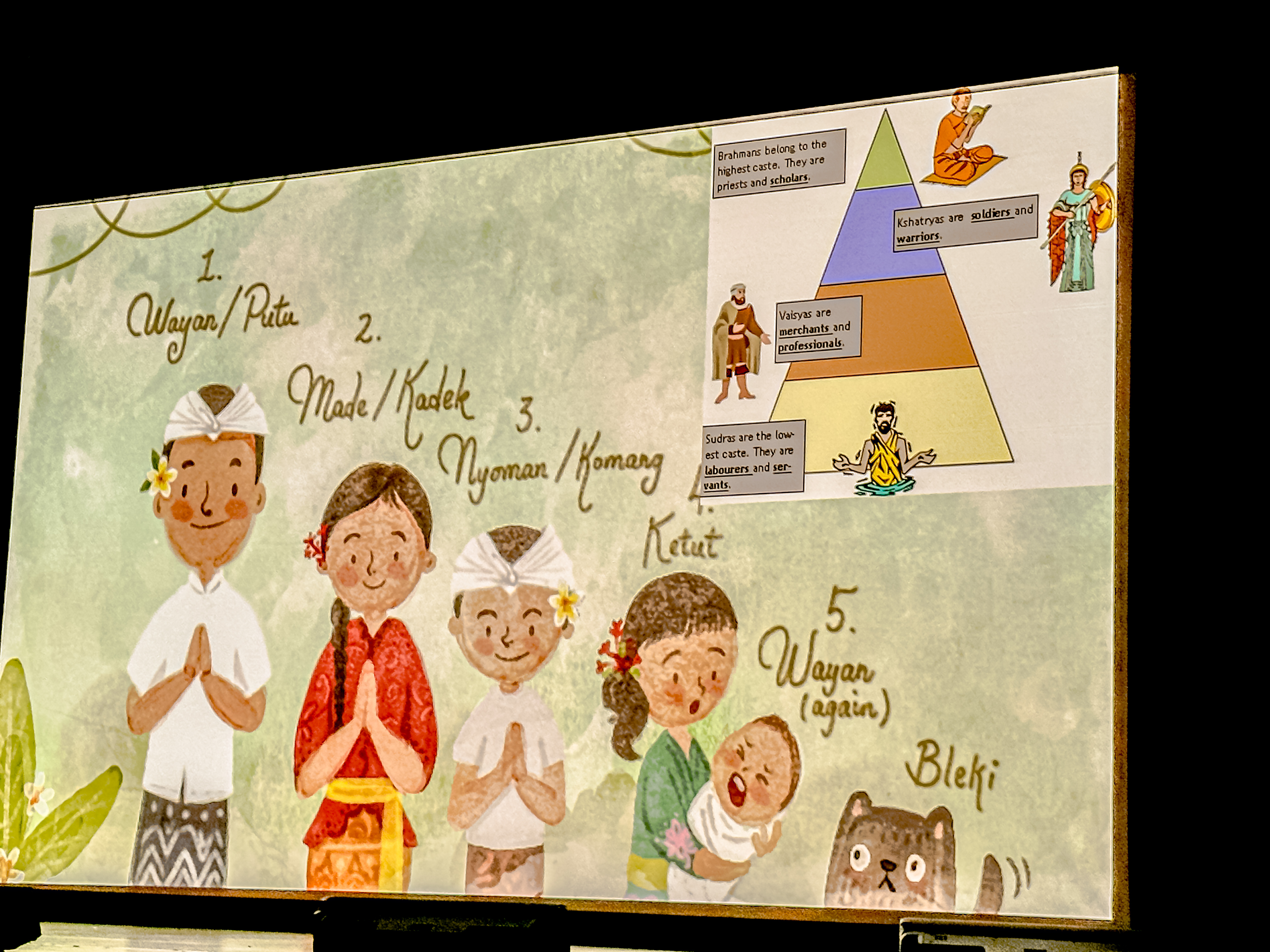
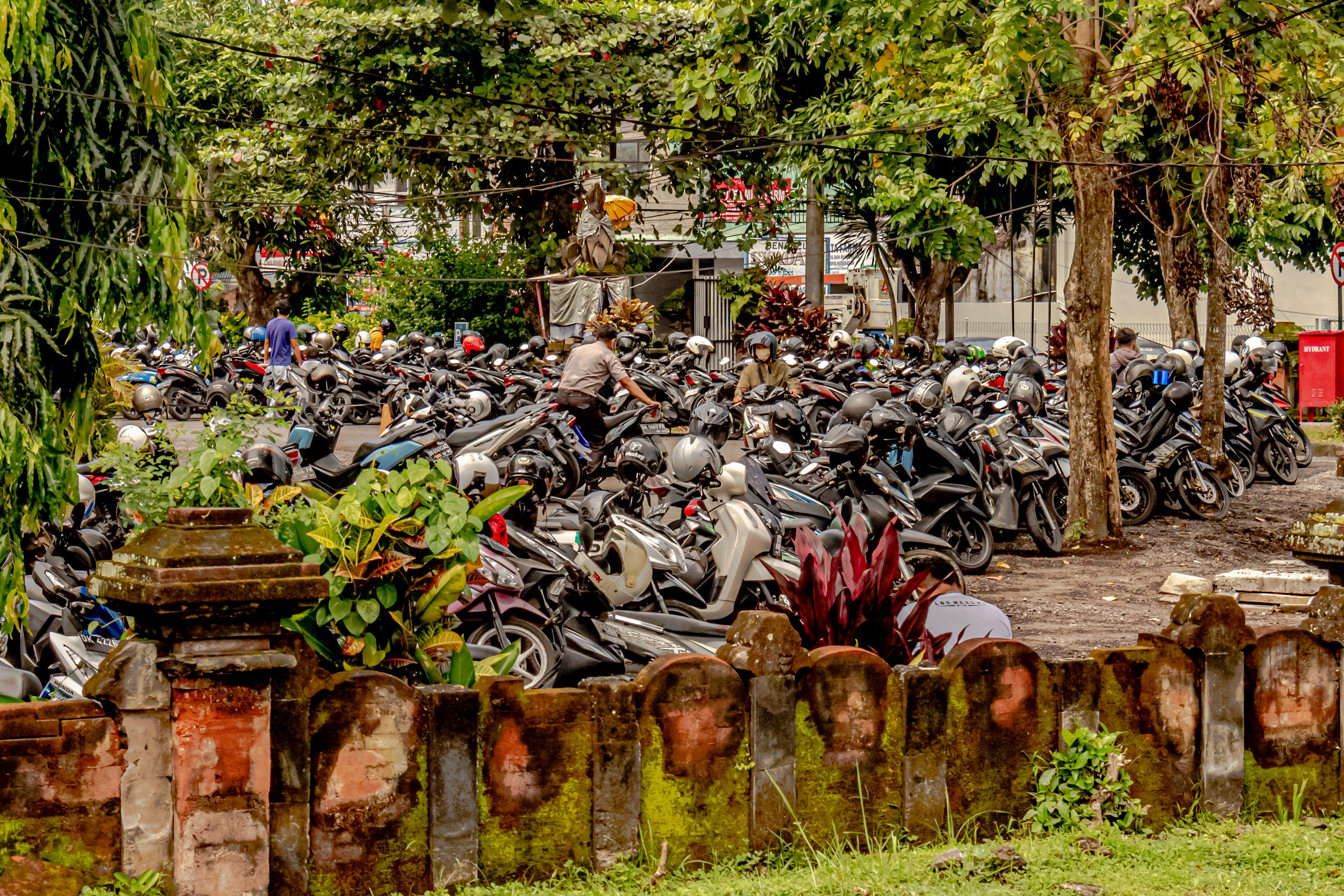
Naming conventions in Indonesian families. Children are named by their order in the family.Scooters are the main mode of transportation, and lane markers on the roads are mere suggestions !
Education is compulsory for all children for 12 years: they spend 6 years in primary school; 3 years in secondary; and 3 years in senior secondary school. Most kids do 1-2 years kindergarten or preschool. Primary school starts at age 6-7. Education is free for everyone (paid by the government), and includes college if the student’s scores are good (paid through scholarships).
Primary schoolSchool boys-all the children were uniforms to school here.Family templesMore family temples
We had quite a bit of bus time for our excursion, and our local guide, Sudarta, gave us lots of information about Indonesian society. For starters, the standard Indonesian greeting (and reply) is: “Om swasti astu”. The family we are visiting lives in the village of BongKasa, and we have left the city behind. This is clearly an agricultural area.
Rice nearly ripe
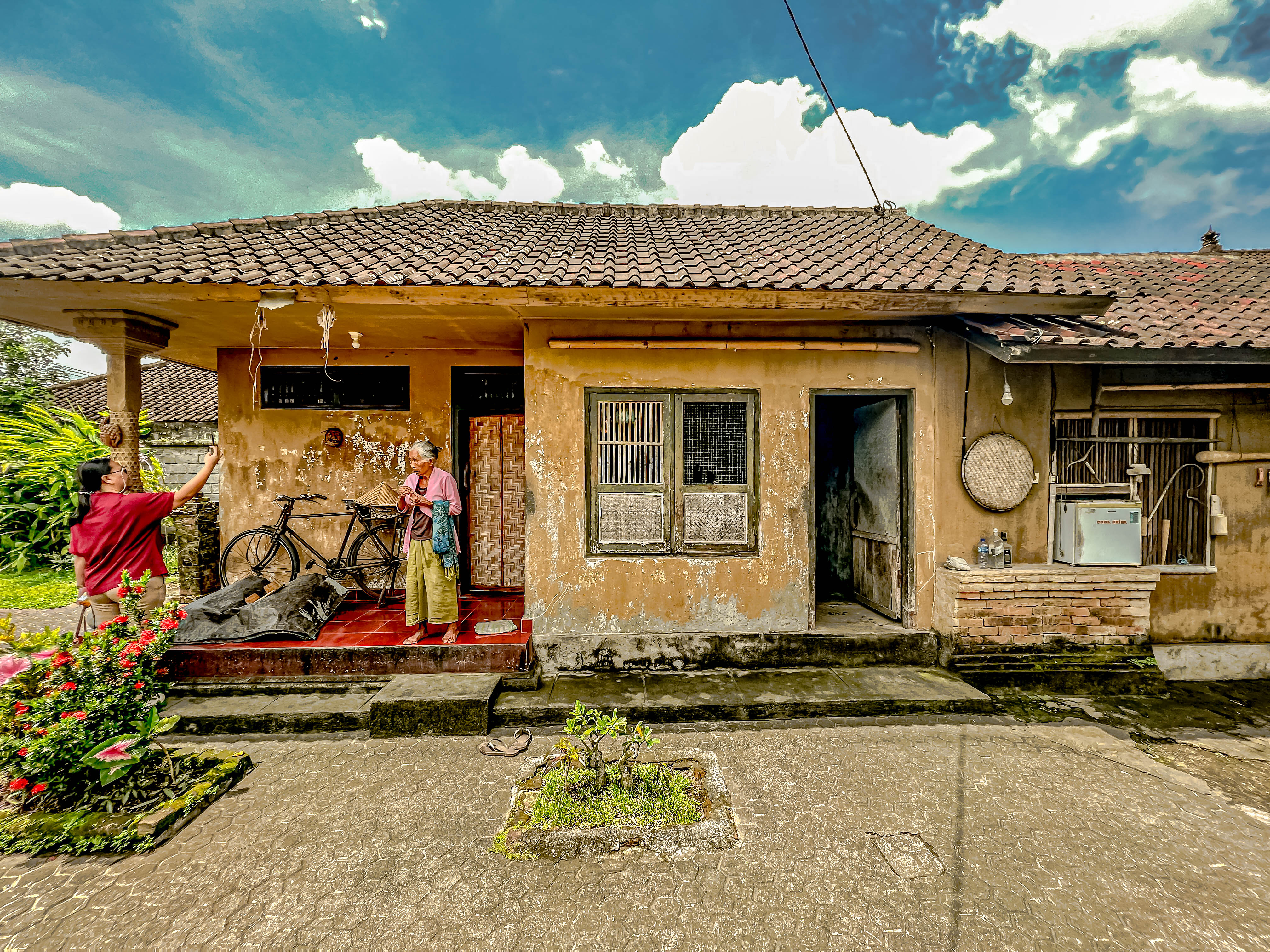
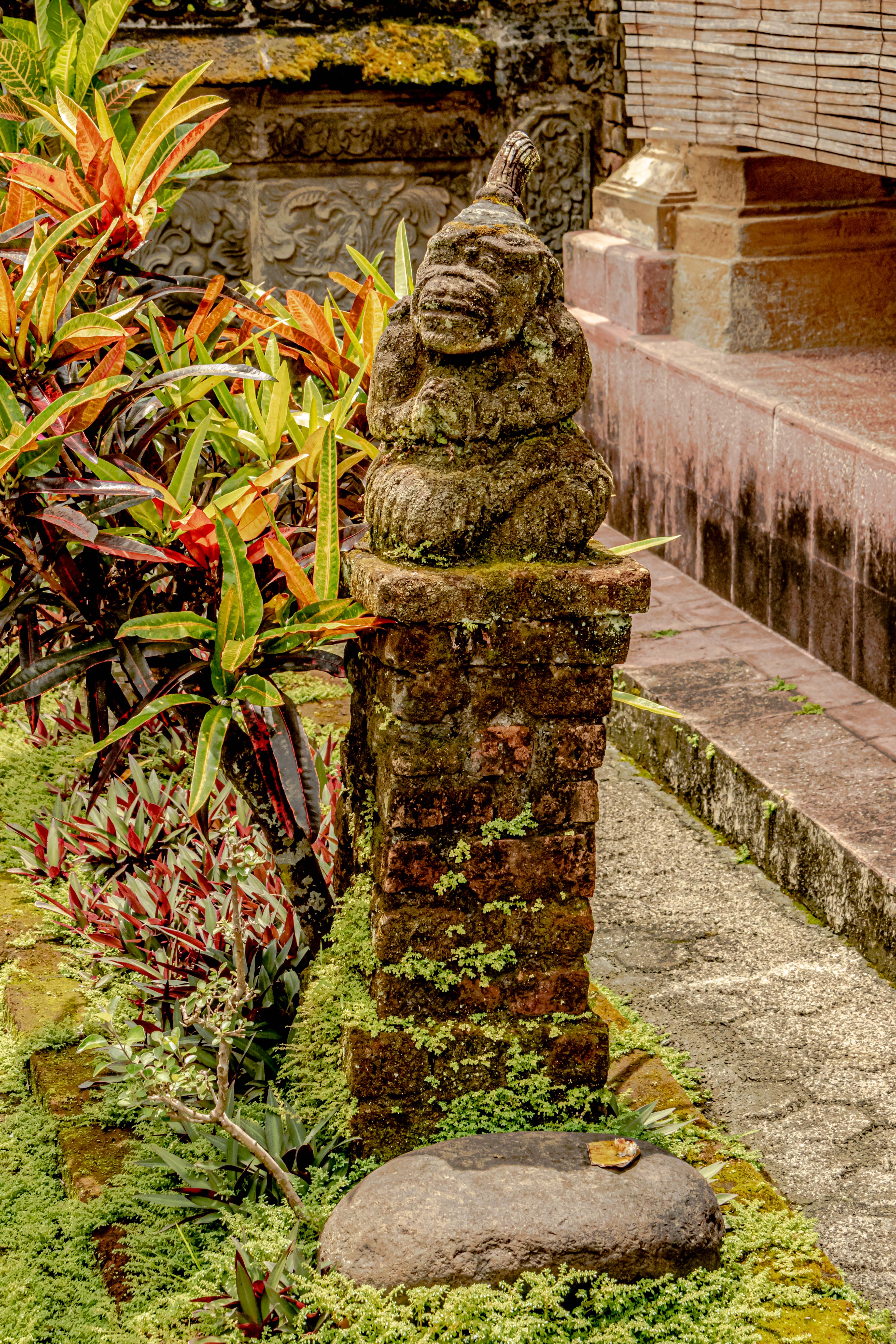
Traditionally, extended families live in family compounds, usually surrounded by a masonry wall. The compound will consist of several outbuildings, including the three temples (minimum). There might also be statues to lesser gods. Usually, there will be a kitchen garden, and a separate enclosed area for farm animals, like chickens, geese, and occasionally pigs. There is also usually at least one sacred area. At the family compound we visited, it was a three-generation family, and the grandparents slept in the sacred area, while the parents and children slept in a more modern house. There was a separate outbuilding for traditional cooking over a wood fire, which appeared to be in frequent use. We did not see in the modern house. Each family does an offering daily for their family temple, but the offering is usually very modest, consisting of a few grains of rice and a a few shreds of meat. Sudarta told us that most of the meals are plant-based, and they might only eat protein once a day, and in small amounts. There was also a “rice house” where the rice harvest was stored above ground. The lots for the family compounds were modest (maybe 3-4,000 square feet in total) and almost none of the space was not covered/used for a household purpose. I don’t know where the kids play, but it doesn’t look like they do so in their yards.
The gate into the walled family compoundThe inner gate into the sacred temple area.Family templesThe grandmother of this family.The sacred area which doubles as the grandparents’ bedroomThe kitchen garden.The traditional kitchen.Sumatra explaining about the offerings
Everyone makes a larger offering at the village temple for every traditional holiday (which fall approximately every 210 days) according to the Balinese calendar (about every 6 months). However, in the Balinese calendar, every month has about 35 days. Ceremonies are performed at major life events: birth, birthday, starting adulthood (at age 17), which is called the “tooth filing ceremony “ (it is intended to minimize negative emotions/drives: desire, anger, confusion, greed, drunkenness, envy); and also for marriage, to celebrate the new year, and death. Everyone in Indonesia is cremated, but the body might be preserved first for six months to five years. The cremation ceremony costs minimum 2 million rupiahs ($20=$190,000 rupiahs), which might cause the delay in the ceremony until the family saves the money.
Example of a daily offeringGrandma and GrandpaThe rice storage houseOrchids just seem to sprout from every available tree.
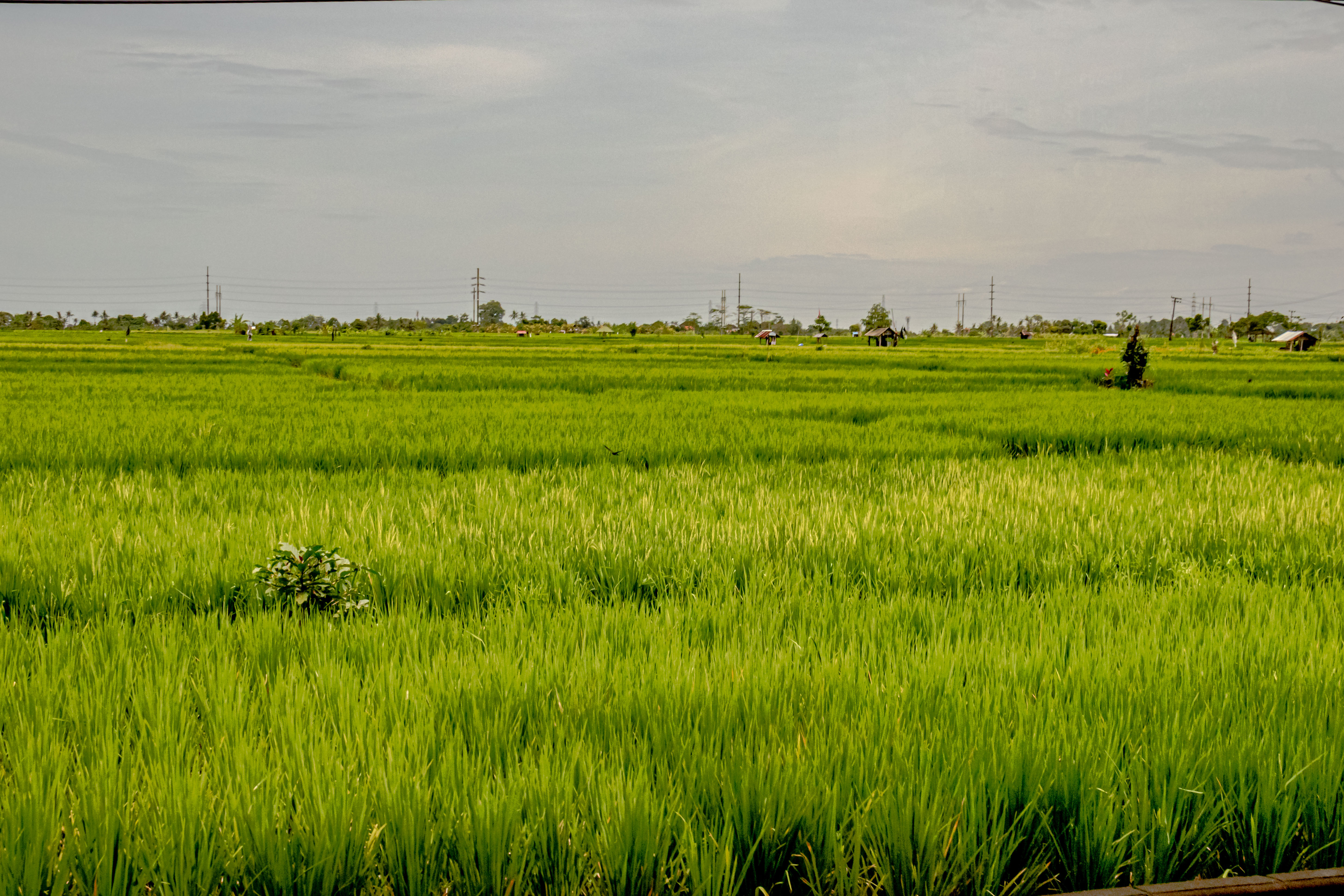
We completed our visit to the family compound and drove deeper into the countryside, towards our next stop at Lake Beratan. One of the most famous hillside villages near where are traveling is Ubud, made famous in the movie, “Eat, Pray, Love”. We are traveling steadily upward into the mountains, and it is clear the central part of this island gets a lot of rain. We passed numerous fruit and vegetable stands, and the rice paddies are terraced up into the hills. The clouds also were coming down on the mountains, and it looked like rain. In Bali, they have three white rice harvests per year. The growing season is about 4 months. The red, black, and glutinous varieties of rice only yield two harvests per year. $1 US gets you about 1 kilo of white rice. The black rice used mostly for coloring in baking.
Terraced rice paddies
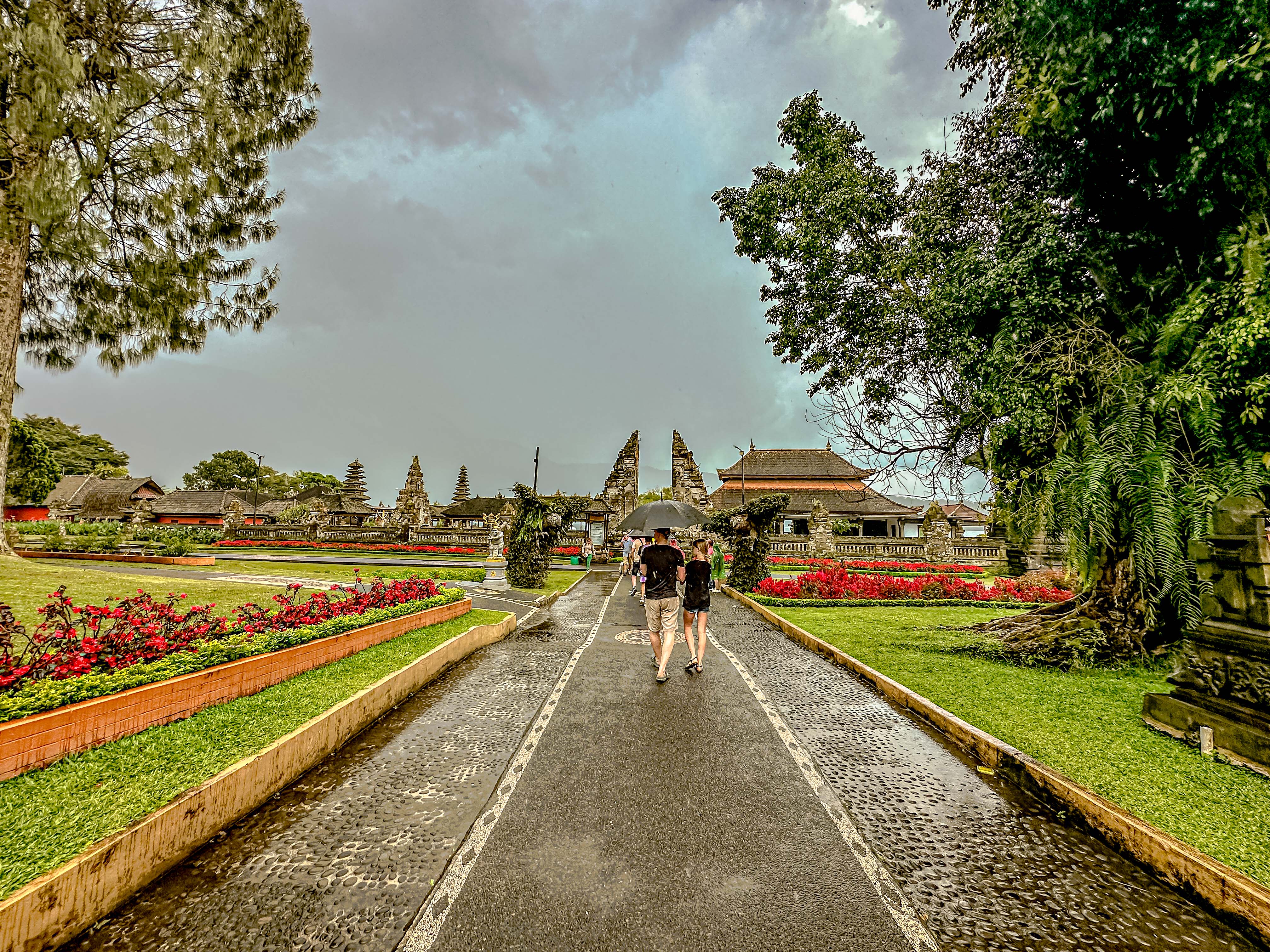
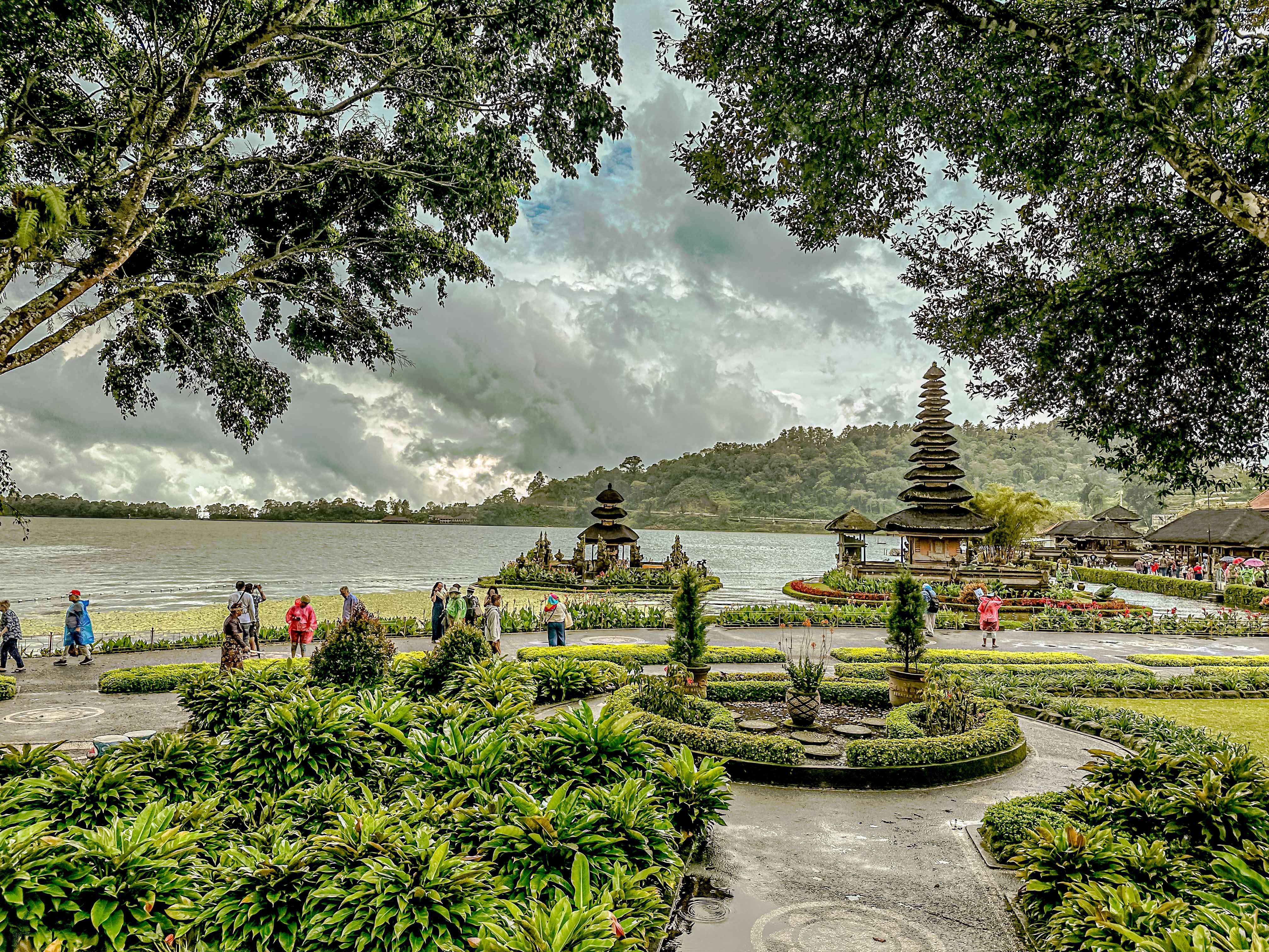
Our next stop was at the Temple of Ulun Danu, on Lake Beratan. Of course, the rain which had been threatening, had settled in. This is such a usual occurrence that every tour bus seems to be equipped with a large supply of disposable raincoats. The only problem is that they were designed for Balinese people, so we Americans had some trouble squeezing into them. I Giusti Putu, was the king who built temple of Ulan Dani, in 1633, and it is dedicated to the river, lake and waters gods, Dewi Danu. Today, the operators of the temple park have added many pavilions to capitalize on the beautiful lake views. The rain started and stopped, but we made the best of our visit.
On the way back to the port in Benoa, we made a stop for tea and cakes in at a lovely hotel/restaurant complex called the Secret Garden in a small town called Bedugal-Bali. The cakes were mostly very sweet, and there was an interesting thing which was a sweet made of caramelized palm sugar wrapped in a spiraled cone of palm frond. Again, it was really too sweet for my tastes. We had fun wandering the grounds in between the bouts of rain, and then headed back to the port. All along the way, we saw signs for a local delicacy; Babi Guling, which is a meal made of roast suckling pig. Right then, I decided that we were going to have to try some while we were in Bali!
As soon as we returned to the ship, we had to hurry and change for the gala event Regent had planned for its world cruise passengers at a nearby Aman resort. The only problem was that it was pouring down rain, and the event was to be held outdoors. Clothing choices made (basically, everything I wore could stand to get wet, including my sandals), we went to the busses to join the festivities.
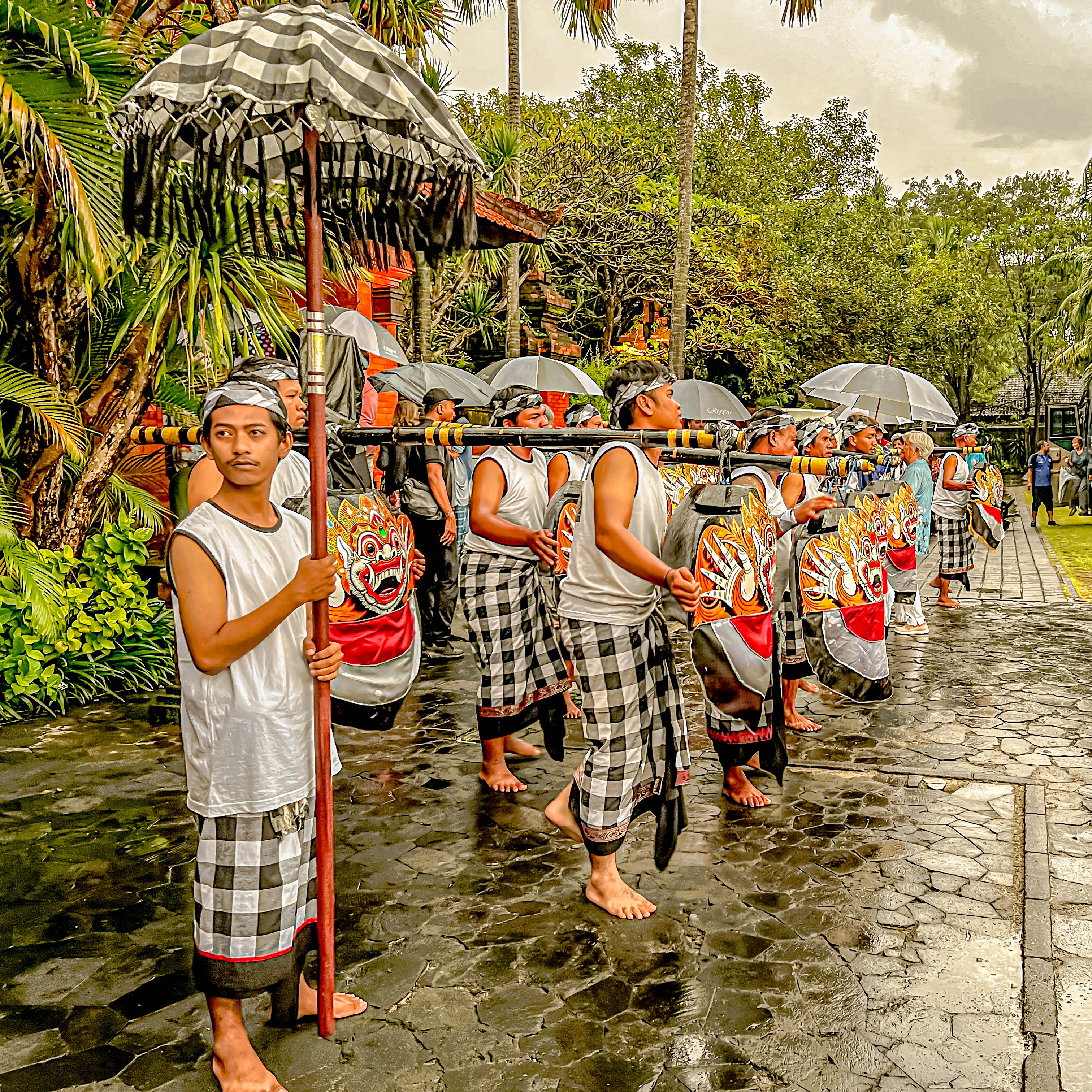
Sure enough, it was still raining when we arrived, but the resort put on a lavish spectacle for us nonetheless! We were greeted by male Balines dancers called the “cow boys”, and dressed like those boys who traditionally herd the water buffalos. Then we passed through the gates onto the grounds of the hotel, which were lavishly decorated, and greeted by women dressed in traditional Balinese costumes. The rains had largely stopped by the time we had had our cocktails, but the tables outdoors wete all soaking wet. The hotel employees leapt into action and replaced all the chair cushions and table cloths for the 500 guests.
After a fantastic meal with multiple stations of authentic Indonesian specialties, we were treated to a panorama of Balinese music and dance. The quality of the show was excellent, and huge Jumbotrons throughout the grounds ensured every one had as close to a front row seat as was possible. This special evening concluded with a fireworks extravaganza. All in all, a very special event indeed!
After an aborted visit to the Australian town of Cooktown because high waves and wind made the tender service unsafe, we steamed to Darwin. We sailed through some of the most challenging seas we have yet seen, as the bridge team picked our way among stretches of reef around the North End of Australia. I’m thinking the Captain was happier to be able to make this navigation in full sunlight so we could see to avoid the obstacles!
We arrived in Darwin on a very rainy morning on Feb. 24, 2023. To start the day off, I thought you might like more fun facts from Prof. Peabody about Darwin:
While Charles Darwin himself never set foot in the city, it was christened in honor of the famous naturalist. The moniker was bestowed by his former shipmate Lieutenant John Stokes, the first European to observe Port Darwin in 1839.
Darwin city was officially founded in 1869. The population rapidly expanded after gold was discovered at Pine Creek in 1871.
The didgeridoo, famed instrument of the indigenous Australians, originally came from Arnhem Land, just east of Darwin.
Between 1860 and 1907 tens of thousands of one hump camels were imported into Australia to help people pioneer the harsh, dry conditions. Today, around 200,000 wild camels roam the Northern Territory.
Jim and I had planned to explore the Territorial Wildlife Park today, but the likelihood of trying to spot wet and miserable animals while tromping around in the pouring rain changed our minds. The Northern Territories really only have two seasons, the wet season and the dry season. I’ve heard more than one Aussie refer to it as the wet season, and hell! The wet season lasts from October until April, so we are right in the midst of it now!
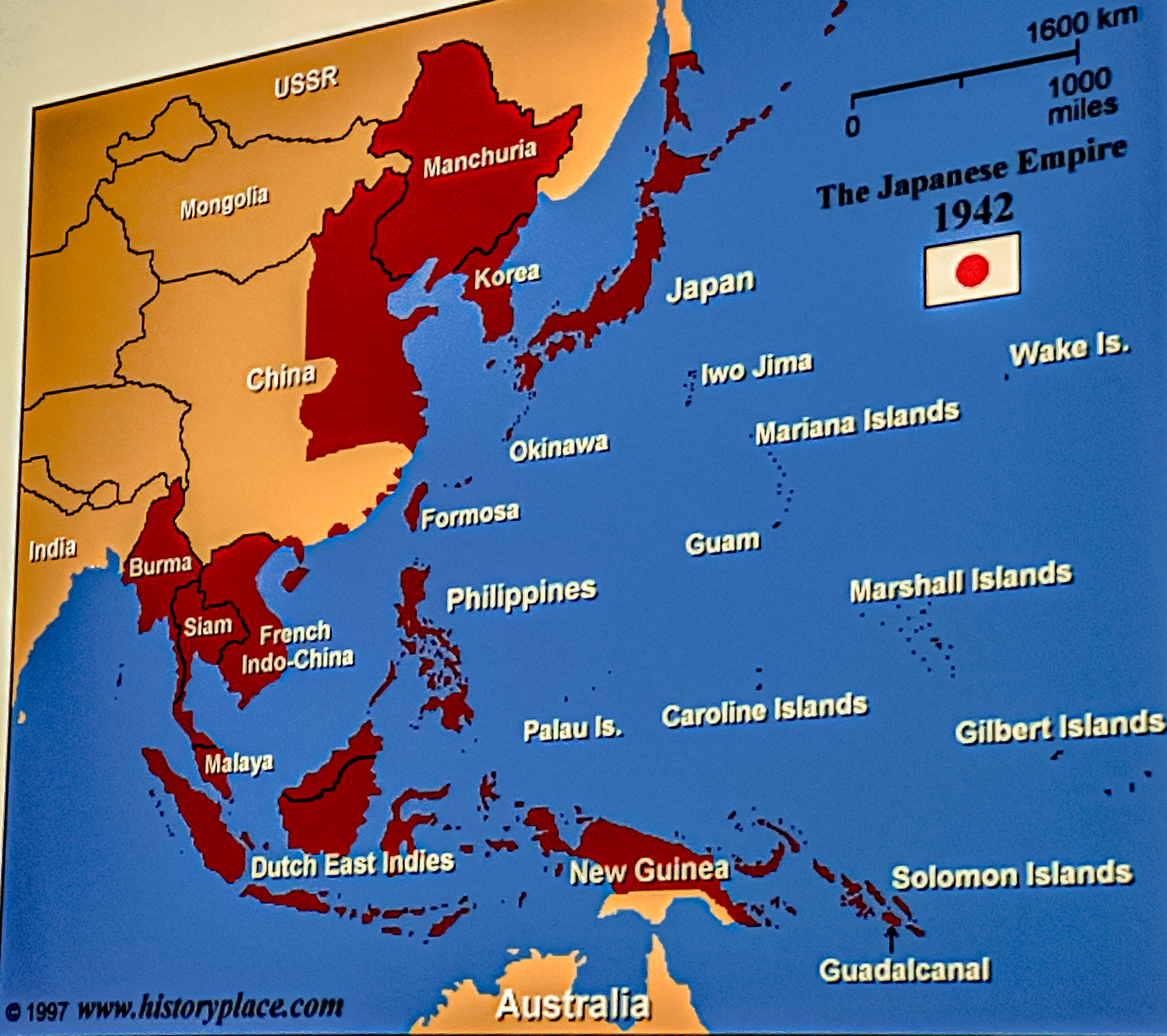
Instead, we were fortunate to get on a tour of several museums exploring Darwin’s military history. Few Americans realize that Darwin had its own Pearl Harbor just a couple of months after ours. The Australians had entered World War II in 1939, after the Germans invaded Poland, and England entered the war. While most of America was focused on what was happening in Europe, in 1941, the Japanese Imperial Navy began its expansionist campaign through the South China Sea, Indian Ocean and Pacific Ocean.
The Australians had long relied on what was referred to as the Singapore Strategy, i.e., with the British Navy having a strong presence in and around Singapore, Australia and the rest of the British Empire’s colonial holdings in the area would be protected. However, as British and other European colonial island holdings fell, the Australians became increasingly worried about their security. Following the attack on Pearl Harbor in Hawaii on Dec. 7, 1941, things “got real” for the Australians. Here is a timeline of the major Japanese territorial advances in the area: https://www.historyplace.com/unitedstates/pacificwar/timeline.html Towns like Darwin and others in the Northern Territory were ordered to evacuate their women and children beginning in December, 1941, to the south of Australia. Most women and civilians went, but many stayed, including women whose husbands or family were involved in the war effort in Darwin. The U.S. staged ships and war planes in Darwin Harbor as a base to try to deter the Japanese onslaught.
On Feb 19, 1942, four days after fall of Singapore, Australia suffered their own “Pearl Harbor”. Sadly, like the Americans, there were early warnings which were dismissed by the military. In the case of Darwin, a resident on Bathhurst Island to the NW of Darwin called the civil defense forces to report large numbers of aircraft flying overhead. Warnings of approaching Japanese aircraft were ignored, being deemed to be “friendly“ (the Australian military assumed it was about 10 U.S. aircraft which had left that morning to supply air support to Java). They were wrong.
The town of Darwin, and especially its harbor were attacked by 242 Japanese bombers. The attack came in two waves, about an hour and a half apart. The attacks sunk 8 destroyers and killed 243. Another 350 servicemen were injured. The 10 US Kittyhawk bombers turned back from Java to assist in the battle, and all but 2 were downed. America had several vessels in the harbor at the time of the attack, including the USS Peary, which had been badly damaged in an earlier battle. It suffered several direct hits and sunk in Darwin harbor, killing 88 servicemen. The U.S. also lost several other vessels in the attack that day.
250,000 Americans were later stationed in Darwin during the war. To give you an idea of how massive that was, the Northern Territory today has a total population of 250,000. Most of them live in Darwin. Many Australians felt abandoned by England, and are still very grateful to the Americans today for protecting them from the Japanese.
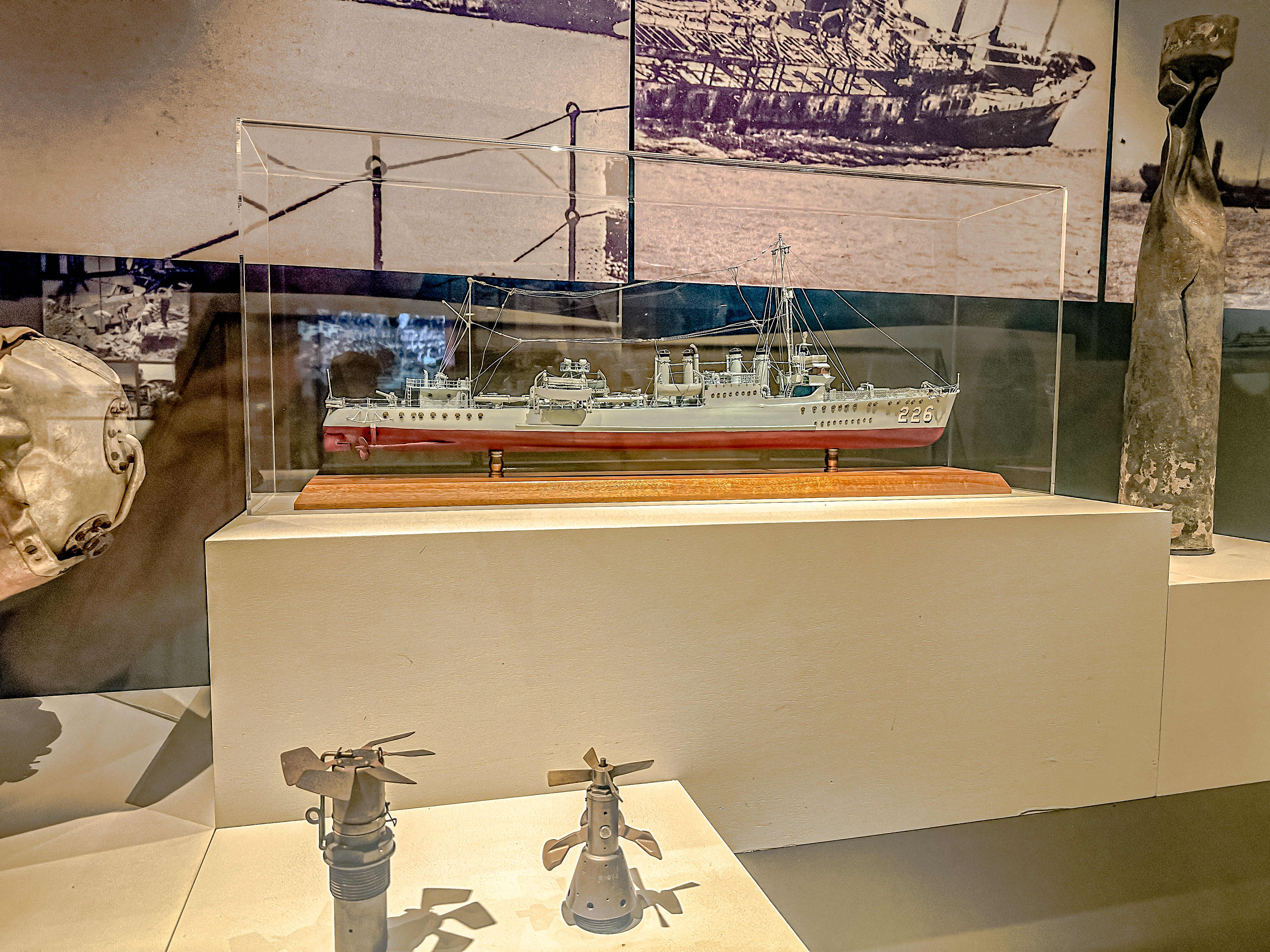
While we killed some time waiting for the Darwin Aviation Museum to open, we made a visit to a mechanical museum entirely sourced and operated by volunteers, many of whom have personally rebuilt some of the machinery on display. It is located in the suburb of Parap, which was one of the first suburbs developed in Darwin.
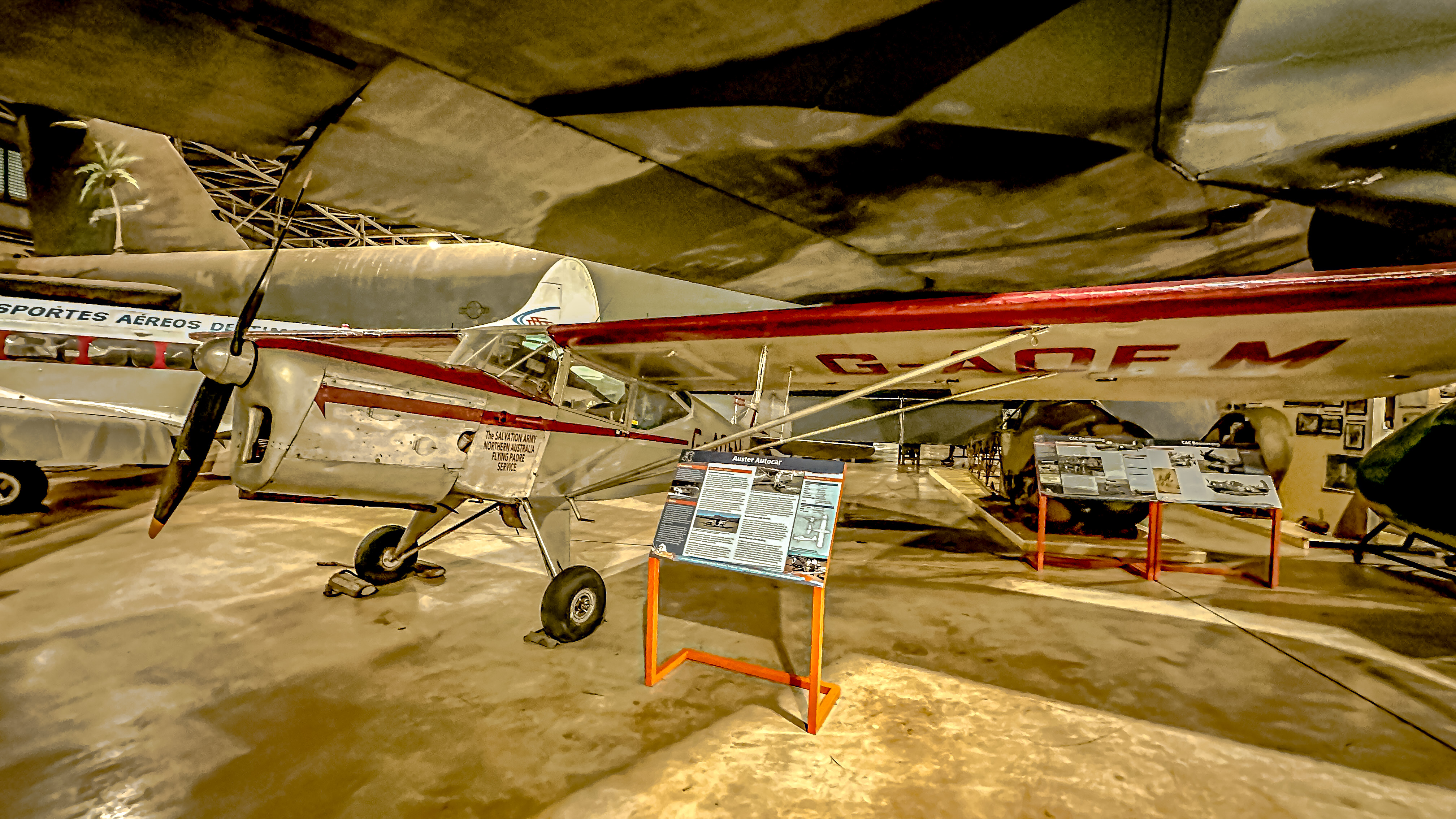
Then we moved on to the Aviation Museum, which has an extraordinary number and variety of aircraft on display. The primary focus of the museum is the 1919 flight from Europe to Australia which set a new speed record. But most of the museum is devoted to Australia’s role in World War II, and in subsequent conflicts.
The Aviation Museum
One of the most visually striking exhibits, though, is the B-52 Bomber on display. It is the only B-52 bomber in the southern hemisphere, and she was retired here in thanks to the Australians for their military support in all the wars in which America has been involved since WWII. What made our visit even more special is that one of our fellow passengers, Rick, actually piloted this exact plane throughout the Vietnam War, and he was on hand to tell about those experiences. There was also a great exhibit about Australia’s flying medical service the Royal Flying Doctors, who were a true lifeline for those living in remote parts of the Northern Territory and Western Australia, who lacked any access to medical care in the remote Outback.
B-52 bomber, renamed Darwin’s Pride
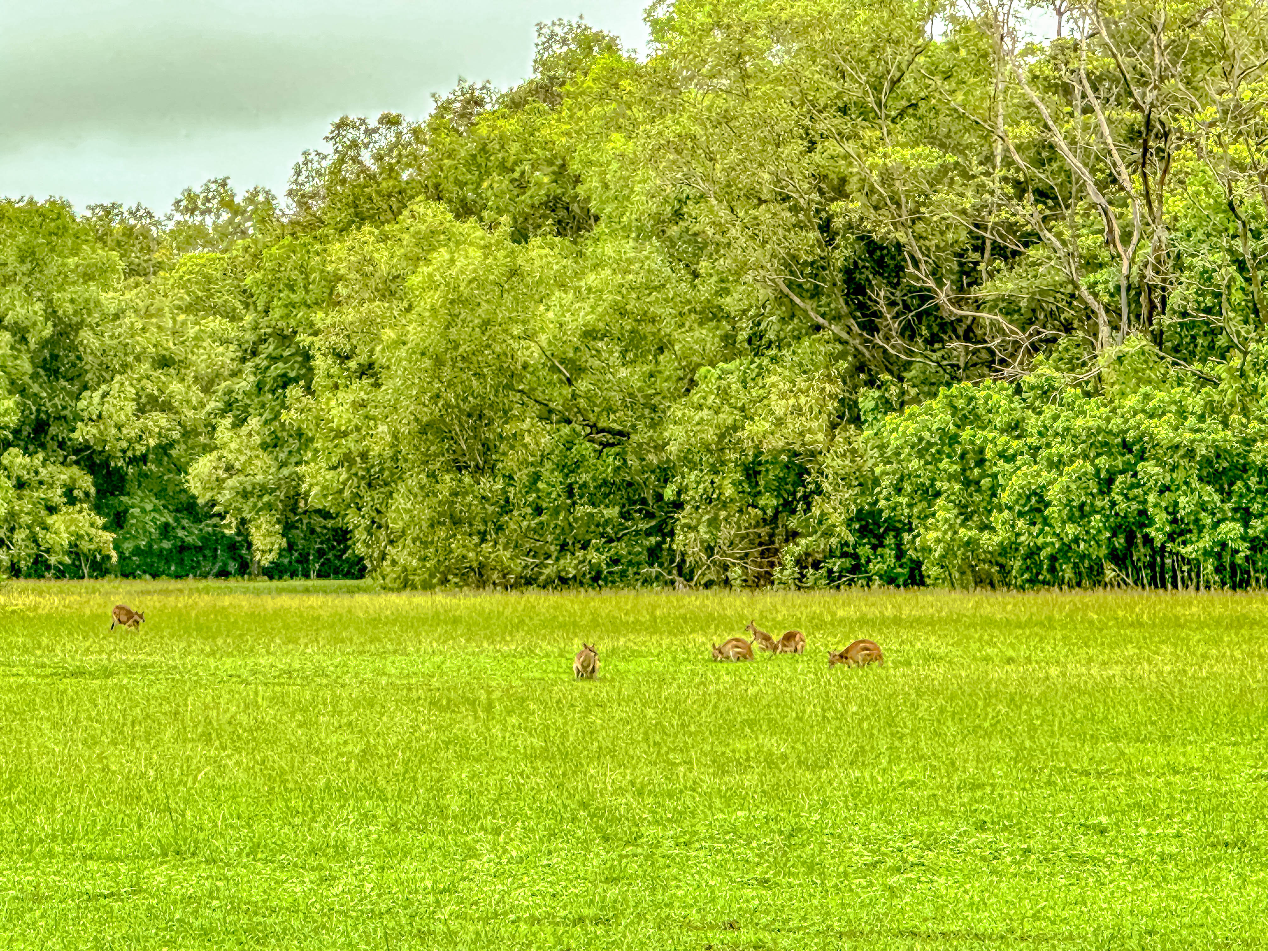
After we left the Aviation Museum, there was a lessening of the rain, and we also made a brief stop to see the wallabies and Magpie Geese in the field outside.
The next museum we visited focused on a more granular level on Darwin’s role in World War II. There was more detailed information about the Feb. 19, 1942 attack, and the building of the great north-south corridor called The Track (the Great Stewart Highway) from Alice Springs to Darwin to supply the troops and ships. There were also taped interviews with those who lived through the Feb. 19th attack, and information about the evacuation of the Northern Territory.
The Defense of Darwin ExperienceBomb fragments from the attackModel of the USS Peary-it suffered the greatest losses of any vessel in the Darwin attackThe building of the Track
Then our guide took us to another spot which played a big part in Darwin’s military history. We parked next to a park near Elliott Point, where the USS Peary was sunk right off the shore. There is a nice memorial there with one of the deck guns which kept firing until the Peary sunk beneath the water. There is also a memorial to an American aviator, Robert J. Buel, who gave his life to shoot down two Japanese bombers which were trying to sink a convoy of supply ships coming into Darwin harbor just four days before the Japanese attack.
Tribute to Lt. Robert BuelDeck gun from the USS Peary. She sunk right off the sore here.
Our tour officially over, we had the driver drop us in the center of the old town area, and we browsed around a little, still trying to locate a replacement battery for my dive camera. Boy, the people are friendly here. We didn’t find the battery, but we picked up two bottles of Shiraz from one of our favorite Australian vineyards to share with friends onboard. We got back onboard just as it started pouring down rain again. We settled in, as we will have two days at sea before we arrive in Bali, Indonesia. The Gringos are very excited!
Looking across Chinaman’s Creek in the harbor of Cairns
Jim and I docked in Cairns, Australia, on Feb. 20, 2023. We have visited this lovely tropical city twice before, but on those trips, all our activities were dive-related, as Cairns is the jumping off place to access the Great Barrier Reef. This trip did not allow us the time to do a dive trip (except to the lame pontoon accessed by a boat ride from the shore, and besides, we had done it. Instead, we opted to explore Cairns’ other great natural wonder, the Daintree Rain Forest.
The Barron River-beware of “crocs”!Sugar cane.
It was a relatively short drive out of town to the beginning of the Skyrail system, which is a long set of gondolas which float over a huge portion of the Daintree rain forest above the canopy level, with several stations interspersed, so you can get out and actually walk among the trees (and some wildlife) of the rain forest. We went from the Smithfield Terminal to Red Peak to Barron Falls to the Kuranda Terminal. Once again, the weather gods favored us, because although it is the rainy season here, the rain held off for the entire time we were in the rain forest.
Our route on the Skyrail gondola system over the rainforest.You can pay extra to have one of these private canopy carsAs we were going to our first station, we saw a huge brilliant blue butterfly, but I never caught a decent shot.
At the first stop, we walked along elevated wooden walkways, where we saw a giant Queensland Kauri Tree, believed to have been alive during Shakespeare’s time. In fact, the Daintree Rain Forest is the oldest rain forest in the world, and it has been dated back 180 million years!
The giant Queensland Kauri treeThe equally giant spider hanging in its web over the pathway
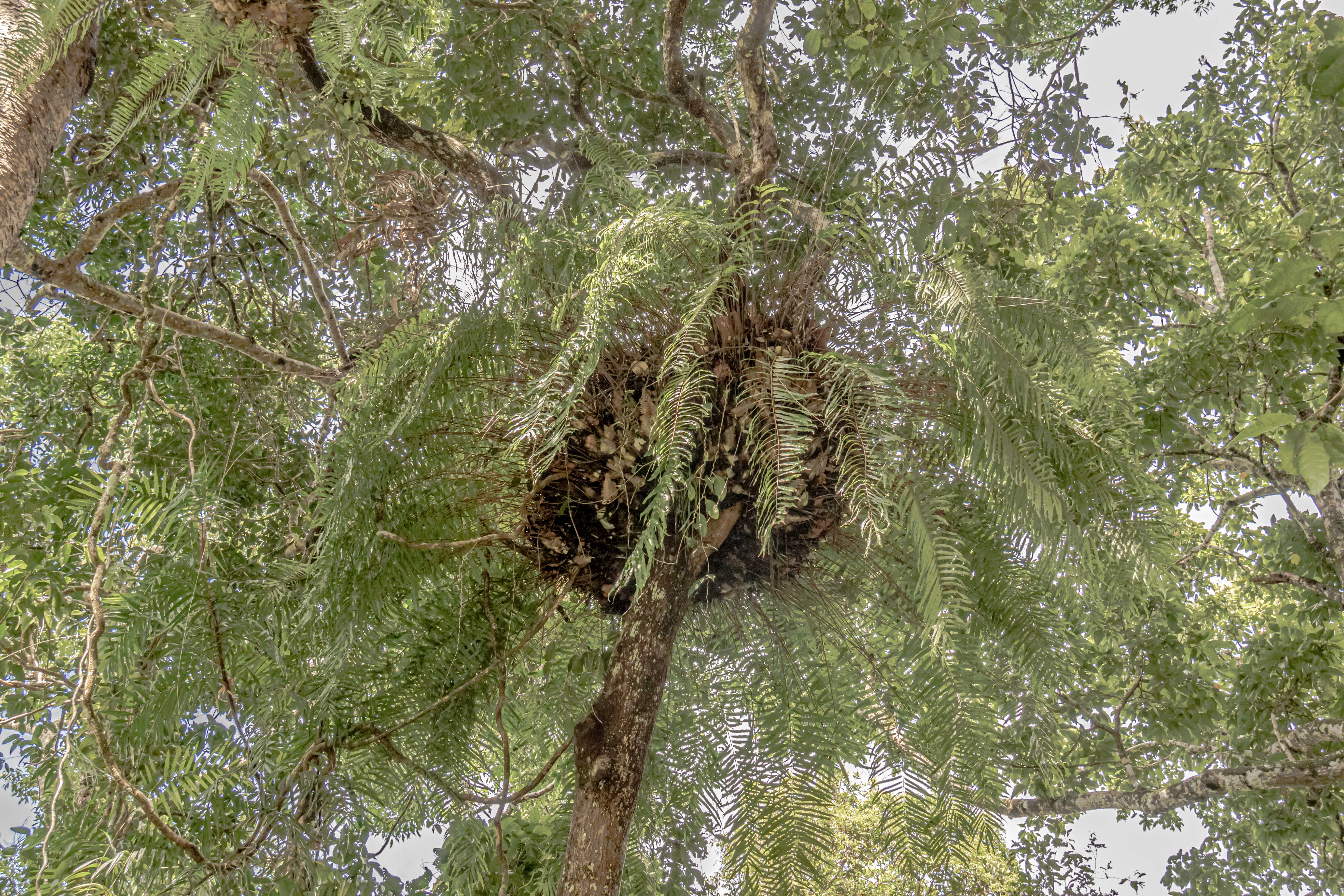
From the first stop, we could also see examples of huge basket ferns, which live near the tree tops, and provide a sheltered environment for all types of animal life. Unfortunately, the forest predators also know this, and occasionally invade the baskets in search of food.
Basket ferns
Of all of them, the apex predator in the forest is the scrub python, which can grow to over 8 meters (25 feet!) in length. It can eat a kangaroo. Here in the rain forest, most animals have evolved to live well above the forest floor, and Kangaroos are no exception. There are tree kangaroos here. Did you know that kangaroos evolved from possums?! Most of them came down from the trees and moved out in the grasslands away from the forest, but not the tree kangaroo.
First glimpse of the Barron River below.
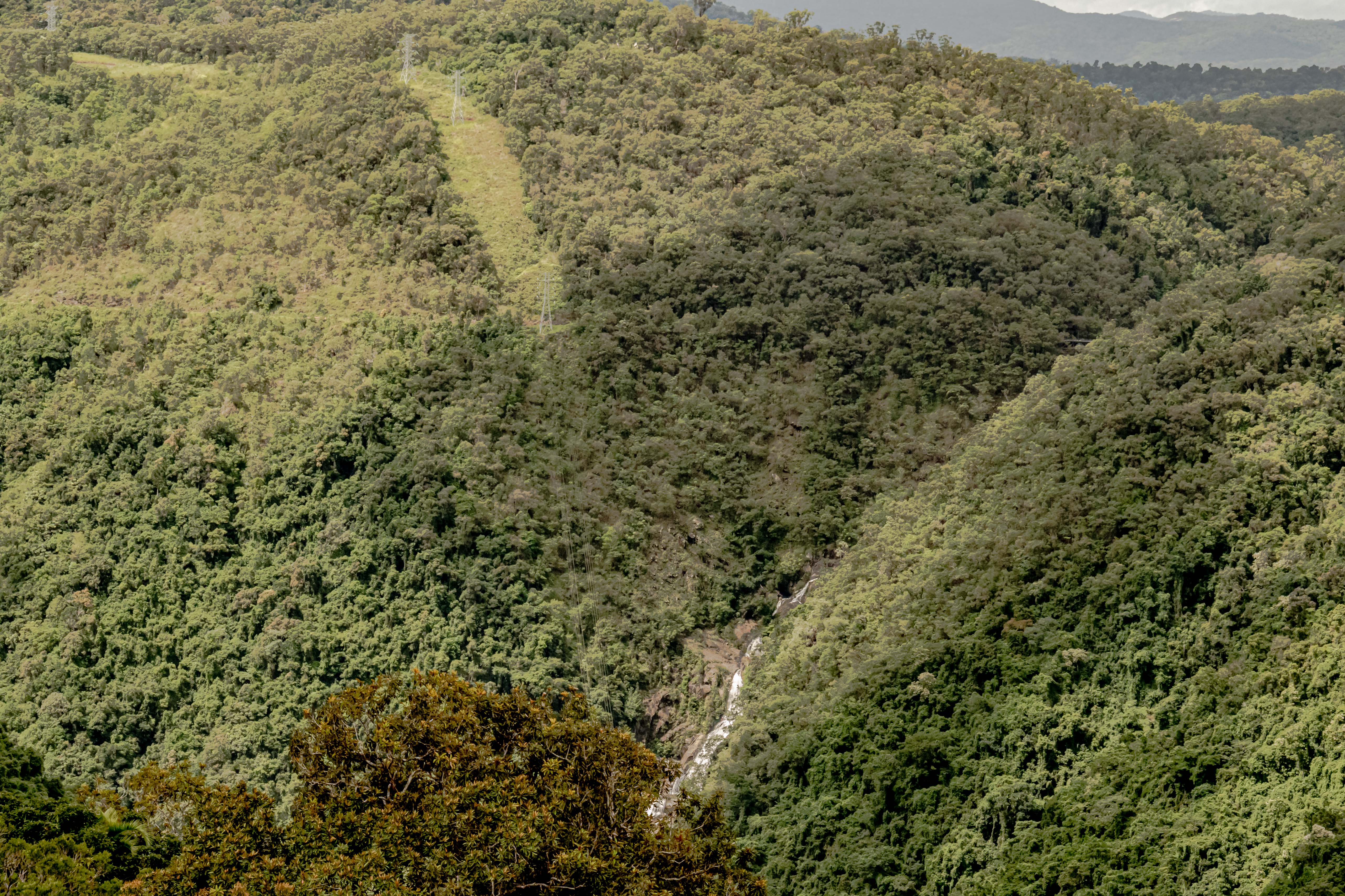
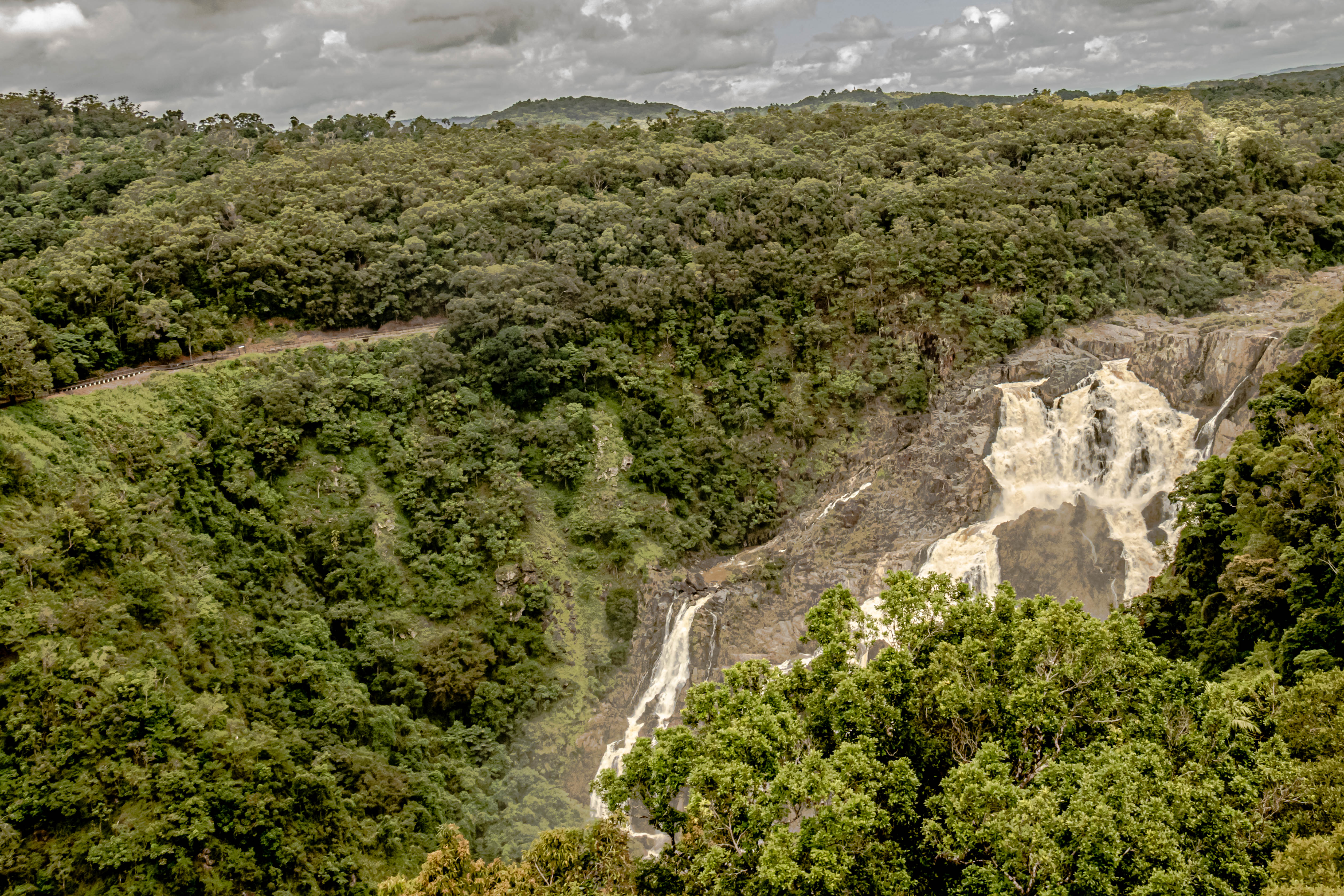
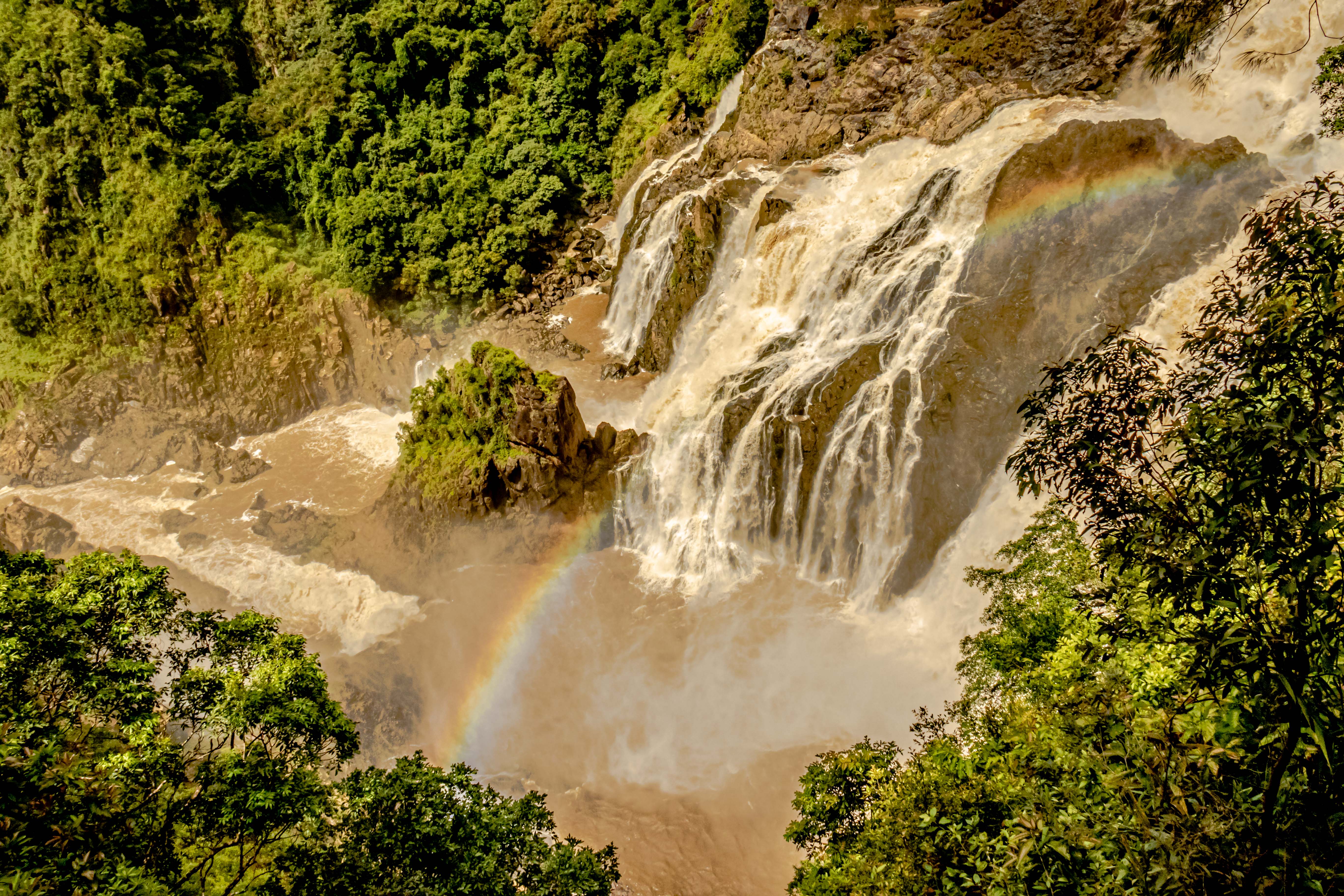
As we approached our second stop, we began to be able to see the Barron River and the waterfalls formed by it. The power of the waterfalls was great at this time of the year, given all the recent rains. We also lucked out with some rainbows being formed by the spray coming off the cataracts.
The power plant-our guide told us that the Barron River has fresh water crocodiles above the power plant, and salt-water crocs below.Barron River Falls
After viewing the waterfalls, we took the cable car to the last stop, and exited out of the park into the adjacent Kuranda Village. The village is a collective run by the local tribe of Traditional Owners (the preferred term for Aboriginal peoples in Australia). There are about 1500 residents of Kuranda Village, but most of them actually live in the rainforest. Jim tried a local brew, while I did a little shopping, and then we hopped on our bus for the return trip to the port just ahead of the afternoon rains.
View over Cairns as the rains come in.
However, our tour guide had a couple of extra stops in mind for us. First, she squeezed in a brief tour through the Cairns Botanical Gardens. The tropical plants, in particular, were amazing, and I particularly liked the ginger plants and the heliconia.
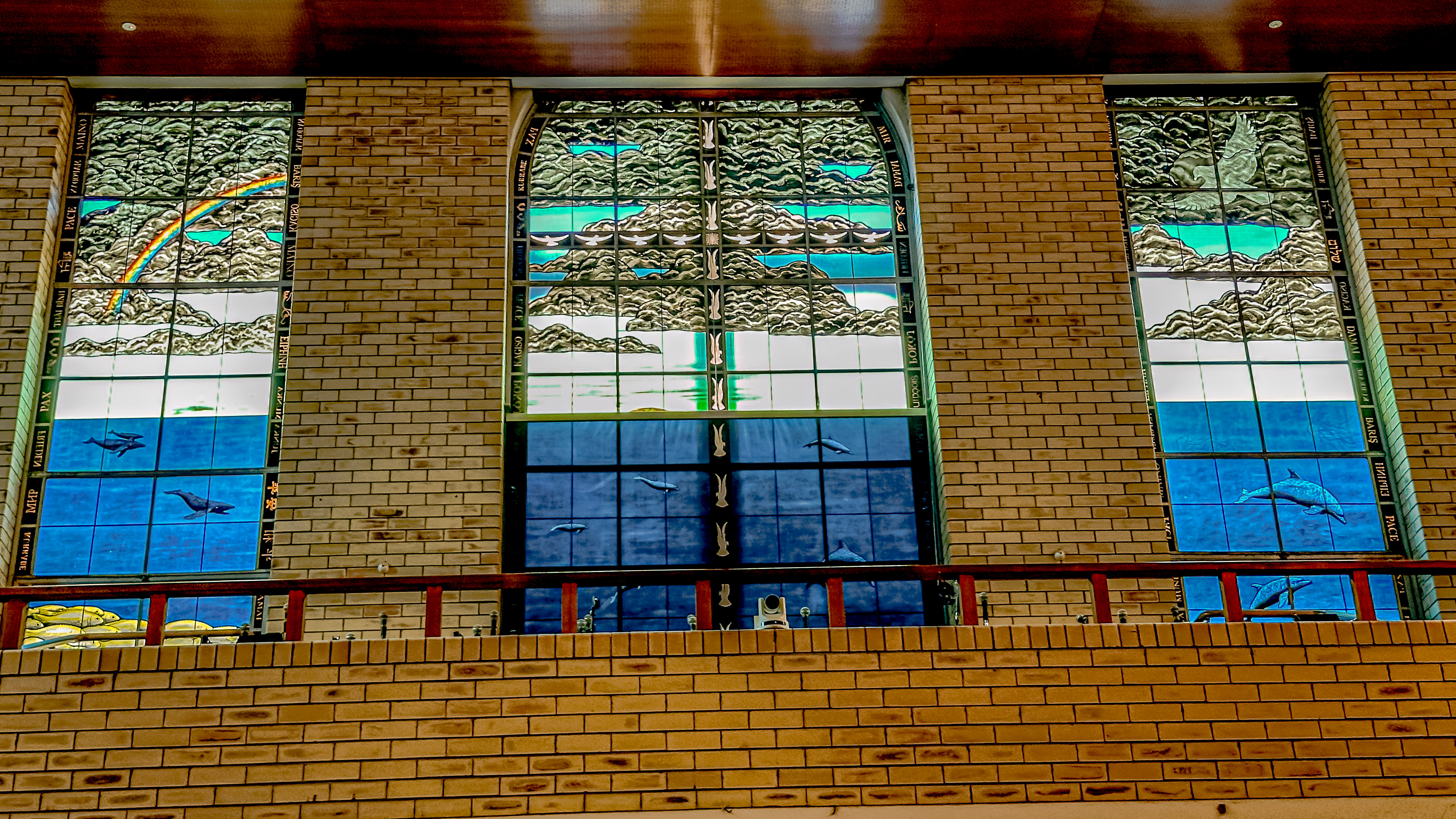
Finally, we made a brief stop at the College and Church of St. Monica’s, where all of the stained glass windows were designed and made by native artists. Of particularly haunting beauty were the two 14 foot glass panels on either side of the entrance door to the church, depicting the Battle of the Coral Sea.We returned and sailed away for our next port of call in Australia, Cooktown.
Locals meeting the ship wearing traditional costumes
How do I begin to describe the island nation which is Papua New Guinea?! For one thing, their nation is part of the larger island of New Guinea, which lies just to the north of Australia, and is the second-largest island in the world (after Greenland). In many ways, it is a land which time forgot, but which is also striving to take its place in the community of nations.
The western part of the island of New Guinea is today part of Indonesia. Guadalcanal is marked on the island on the right in the Solomon chain.
The peoples of Papua New Guinea first began arriving there between 45,000 and 50,000 years ago. They were part of the dispersion of peoples from what is today Africa, but was then part of the super-continent we call Pangea. They are now believed to have reached Australia between 60,000-70,000 years ago. However, the sea levels rose about 10,000 years ago, isolating New Guinea. Its terrain is so diverse that it features numerous microclimates which range from the coastal areas up to peaks reaching over 14,000 feet, where it snows each winter.
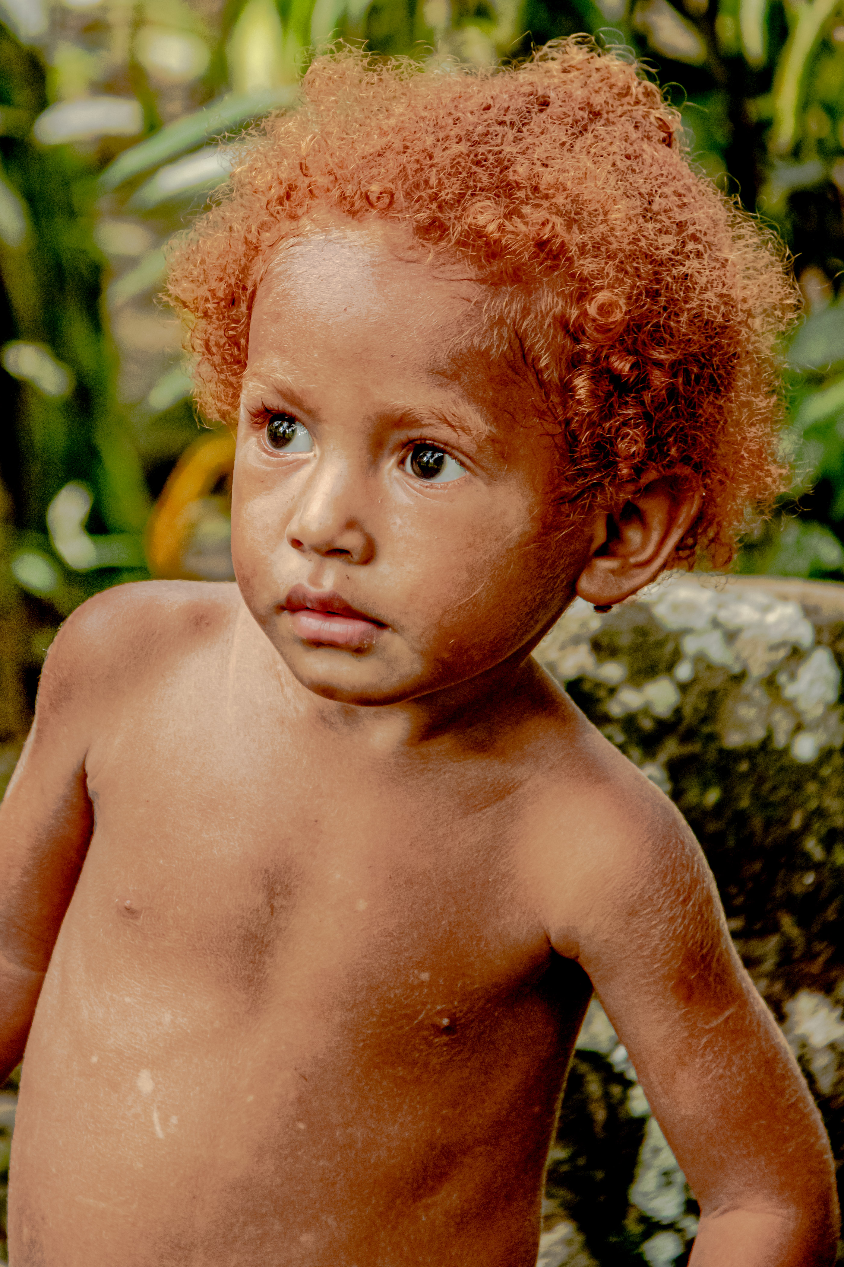
There are over 500 islands in the archipelago of Papua New Guinea, but only 160 are inhabited. Western explorers did not “discover” the islands until 1526, when Spanish/Portuguese explorer Menezes named their land Papua, which was Malay for “frizzled hair”. Of course, eastern explorers had made contact with the island as early as 5,000 years ago. Spanish explorer Ortiz de Retez named the island New Guinea, because he thought the natives resembled the inhabitants of the African Guinea coast. At the time of this first contact with Westerners, the inhabitants of New Guinea were, archeologically-speaking, living in the Stone Age; not having progressed to using metal implements.
The next contacts with Western explorers came in the 18th century, when both Captain Cook and Captain Bligh made contact. The British set up a trading post on the island and briefly settled troops on the island. Because the island was close to its territorial outposts in Indonesia, the Dutch also set up an outpost on the western end of the island. However, Britain lost interest, and their settlements were largely abandoned. In the 19th century, the Germans had a plan to establish outposts throughout the South Pacific, and in 1884, Germany annexed settlements in northern New Guinea. The British interest in the island was revived, and in 1874, the British sent Captain John Moresby to survey the coastline of the entire island. Shortly thereafter, The British Empire sent out Sir Henry Wickham to collect plant samples. He sent back rubber seeds, which were cultivated by the Royal Botanical Society at Kew Gardens, and which succeeded in crushing the Brazilian monopoly on the rubber trade.
At the dawn of World War I, the island of New Guinea was divided into ownership by three imperial powers: the Netherlands, England, and Germany. Following World War I, colonial ownership of the island was split between the Netherlands and the British, with the British ceding control over the former German portion to the Australians.
Photo courtesy of Terry Bishop.
However, as you probably recall from our post on Vanuatu, in 1936, the Japanese began their imperial conquest movement into the South Pacific. By early 1942, the Japanese had taken many of their strategic targets in the South Pacific, including the Philippines, the Solomon islands, and much of New Guinea, including the Dutch portion, the outlying islands, the Australian-administered Territory of New Guinea, and the Australian Territory of New Guinea.
Photo courtesy of Terry Bishop.
In short, only the southeastern coastal areas were free of the Japanese, whose ultimate goal was to capture the capital port city of Moresby, and establish airfields and supply ports from which they could attack Australia. The campaign for New Guinea had one of the highest casualty counts in the South Pacific campaign, with over 200,000 Japanese, Australian, New Zealand, and American forces killed. The Australian portion of the campaign was called the Kokoda Track campaign, and it was a brutal attack fought from the south over the mountains and dense jungle in New Guinea. The American forces based in Vanuatu overseen by General MacArthur helped turn the course of the war after the Battle of the Coral Sea. One of the most pivotal battles in this campaign was the Battle of Milne Bay right here in Alotau where we are moored.
Papua New Guinea became independent from England in 1975, although it is still a member of the British Commonwealth of Nations. It is a constitutional monarchy whose head of state today is King Charles III of England. There is a Governor General of the nation, as well as a Prime Minister. PNG is one of the most linguistically diverse countries in the world, with over 839 recognized languages. However, there are three official languages: Tok Pisin (which is a kind of pidgin English), English, and Hiri Motu. Virtually everyone speaks English, and we were surprised by how fluent in English the children we met were. PNG’s ties with Australia remain extremely strong. Today, the people of PNG are somewhat suspicious of the expansionist tendencies of the Chinese, and are fighting to maintain their independence by joining numerous international coalitions.
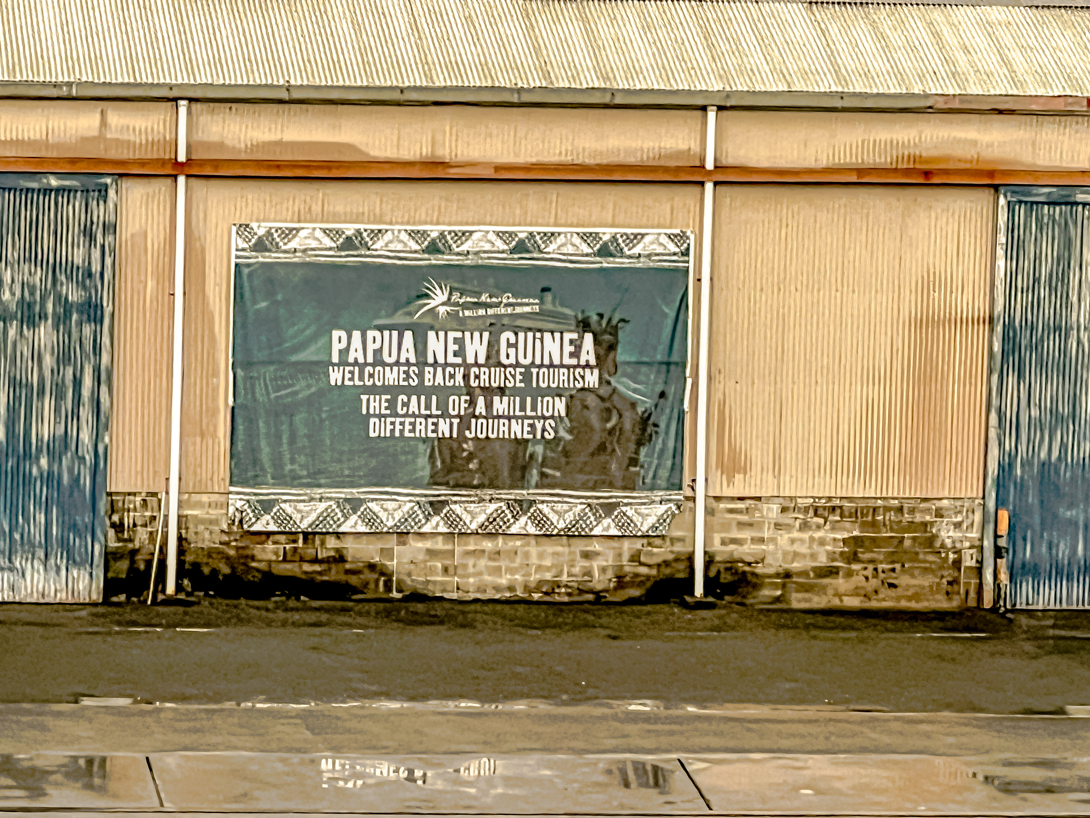
The PNG islanders were really happy to see cruise ship passengers again.
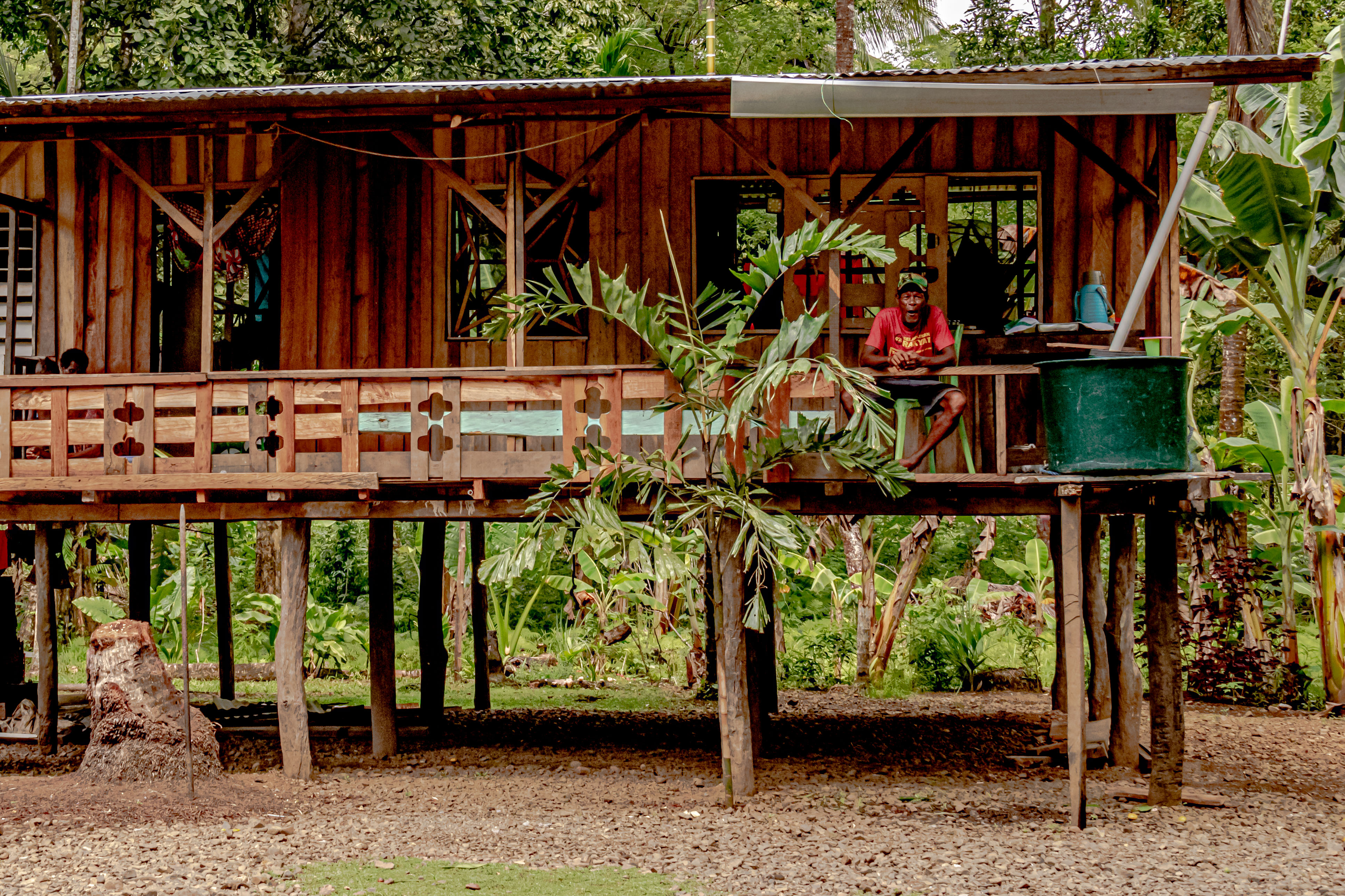
Our explorations today will take us to two different villages so we can learn about their traditional lifestyles and culture. Unlike many countries in the modern world, the majority of the inhabitants of Papua New Guinea still live in rural areas. Beyond that, over 40% still live a subsistence farming lifestyle, with no use of cash whatsoever. Most villages do not have running water or electricity today. As part of their traditions, the people strongly identified with the warrior lifestyle, and neighboring tribes warred frequently with each other. Cannibalism was practiced at least until the end of World War II, and although it is said it has been completely eradicated, there are still some tribal communities so remote in the jungled hill country that it is impossible to know.
Likewise, the actual population of the country is subject to a great deal of speculation, with the official count at nearly 9,000,000, but some estimate upwards of 17,000,000 people live there.
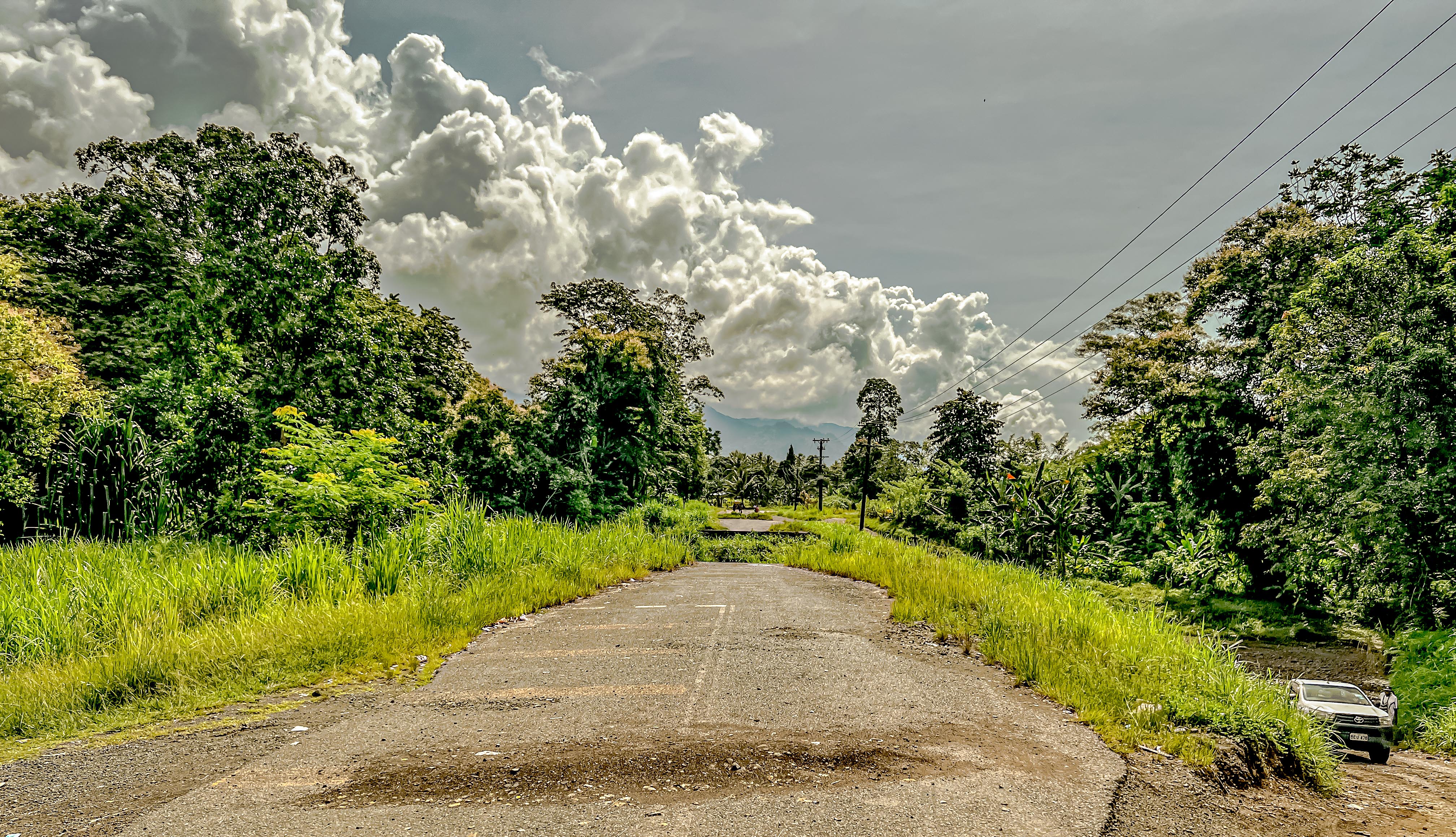
Shortly after we left the town of Alotau on the main (and only) road to the south end of the island, we came to a bridge, which had been destroyed.The village of Taludadani
We really enjoyed our visits to the two communities, and especially our talks with the children in each. We were only the second cruise ship which had visited since the pandemic, and the villagers were incredibly grateful for our visits. In these types of situations, it is easy to speculate that the visits are all a staged show, but we didn’t see any evidence that daily life was any different than as it was prepared for us.
The first village was called Taludadani, and after fording a river where the only bridge was knocked out by an over-laden truck (apparently quite some time ago, we had to go offroad and drive up another stream to get to the village. They had prepared several activities to show us. We first saw some of the women of the village preparing a traditional meal, which mostly consisted of fruit and vegetables.
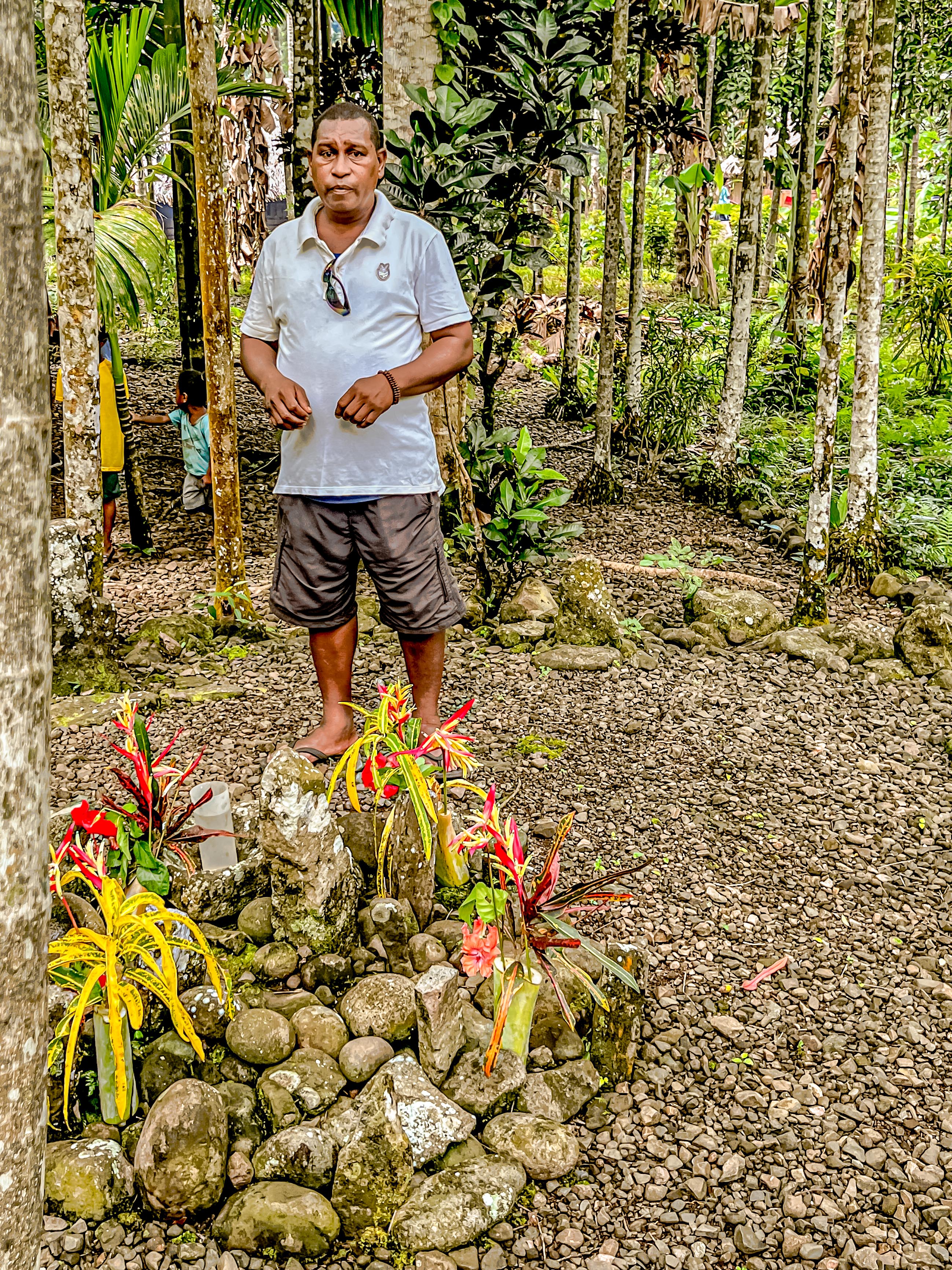
The creek we had to ford to get to the villageTypical PNG homeThe guide telling sabot the sacred circle where the chefs would gatherAll of the pathways in the village were decorated with flowersThe chief’s sacred circleLittle girl sitting in one of the chief’s chairs in the circle
Although we saw a couple of pigs running around, and fishing is a way of life all along the coast, there does not seem to be a great deal of protein in the PNG diet. Portuguese traders introduced the yam in the 18th century, and it has rapidly become the predominant foodstuff of the islands, almost completely replacing taro.
Typical foodstuffsI loved how joyous this woman wasa teenager who was not so joyous
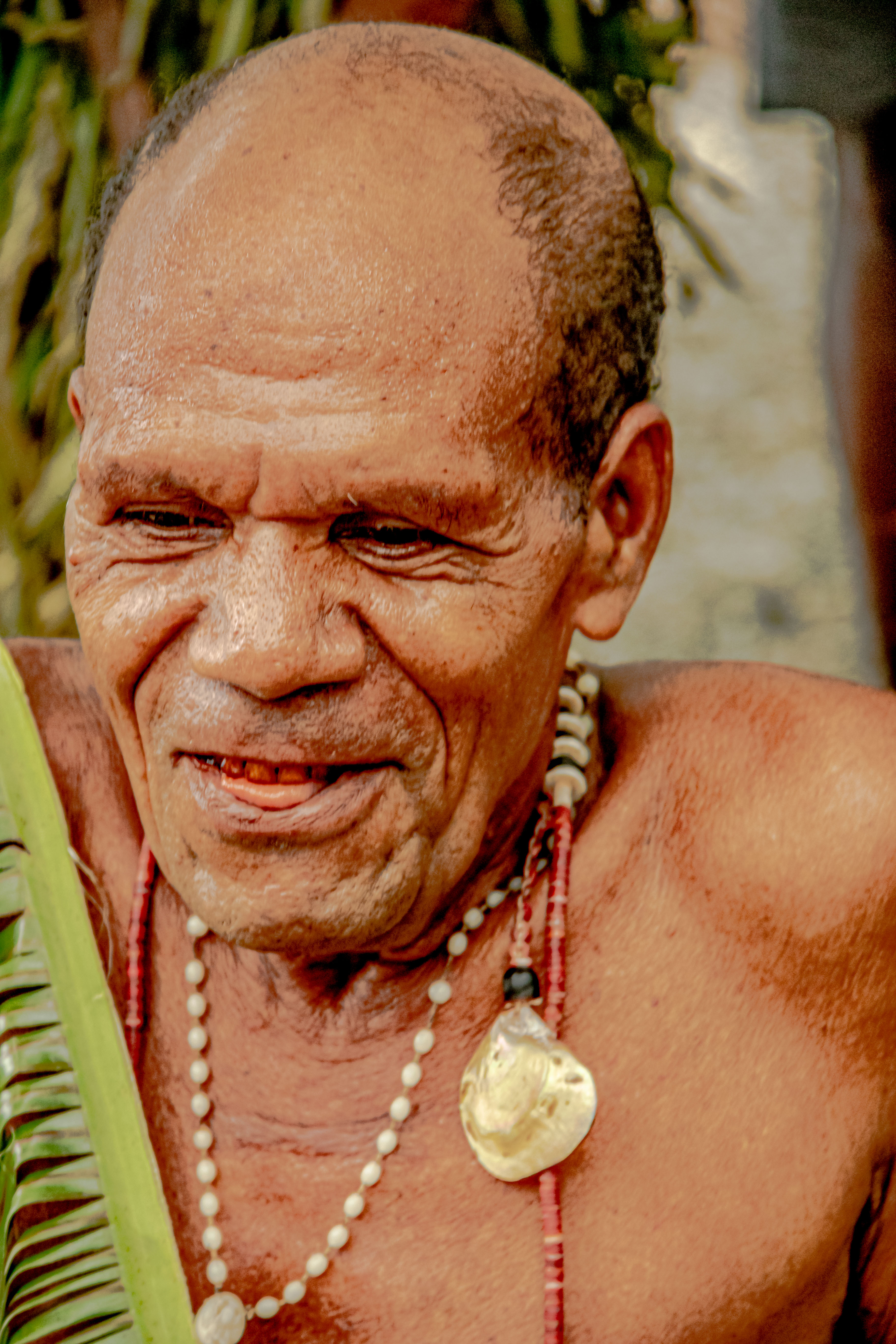
Then one of the young boys showed us how to climb a palm tree to harvest the betel nuts. Most islanders chew the betel nut, which is mixed with coral lime, which turns it red and gives it a mild narcotic effect. The village headman said that when they are tired, instead of drinking coffee, they chew the betel nut. Most of the adults we met had the tell-tale red teeth of habitual betel nut consumer.
Little boy demonstrating his tree-climbing skillsBetel-nut seedsHarvesting the between nutsIn order chew the betel nut, you have to remove the outer husk.
This village recognizes the potential benefits in tourism, and is the process of building simple huts to serve as hostel-type accommodations for the backpackers and photographers who are now coming more frequently to the islands. There was a young girl and boy dressed in traditional attire (she was 12 and he was 14). We were told that they were of the age when islanders had traditionally gotten married.
One of the guest houses the village has built for touristsTraditional had-carved canoe made from a single log of rosewood.The young couple in traditional dressMark: this is for you; “That” dog, PNG version
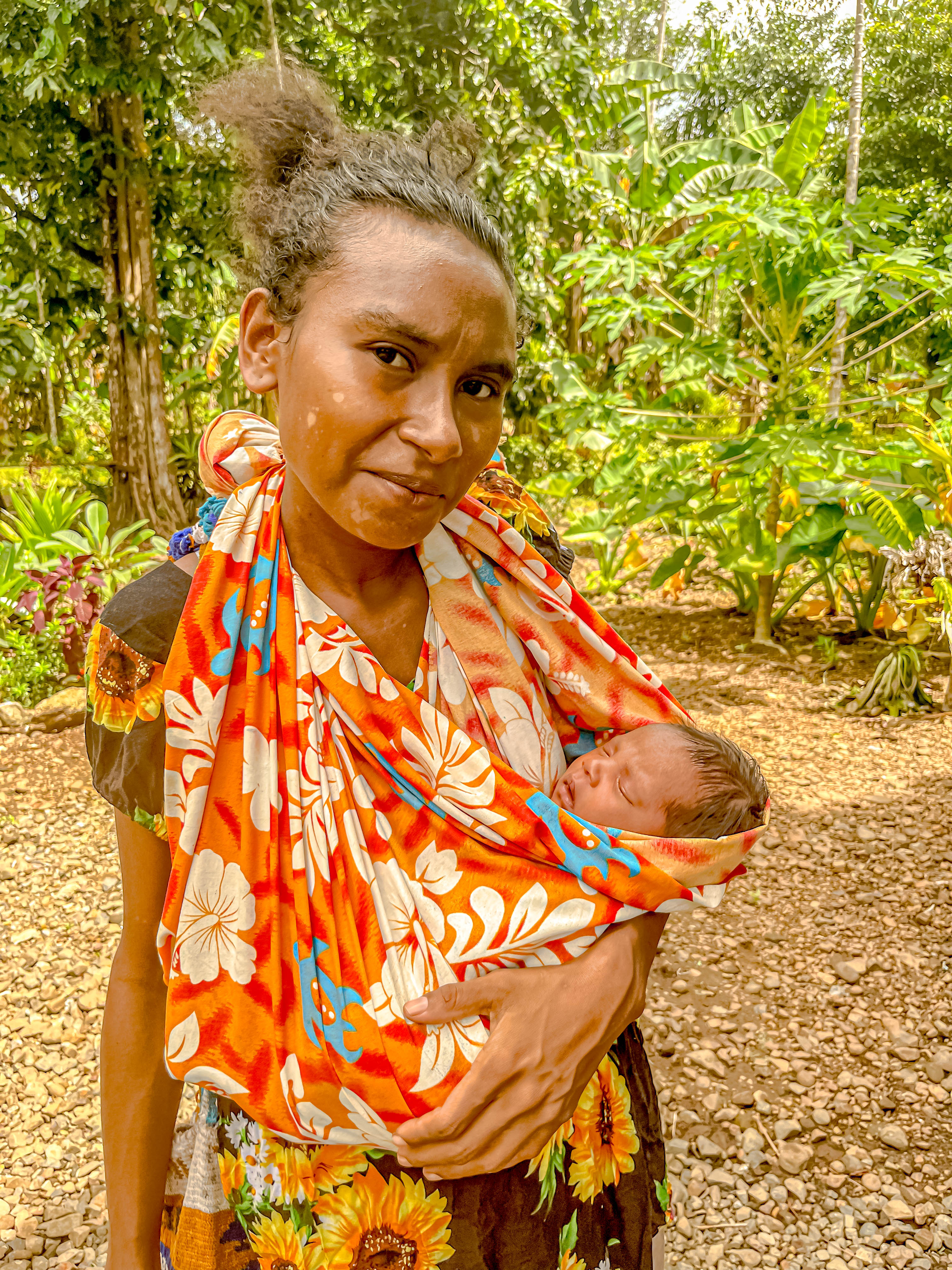
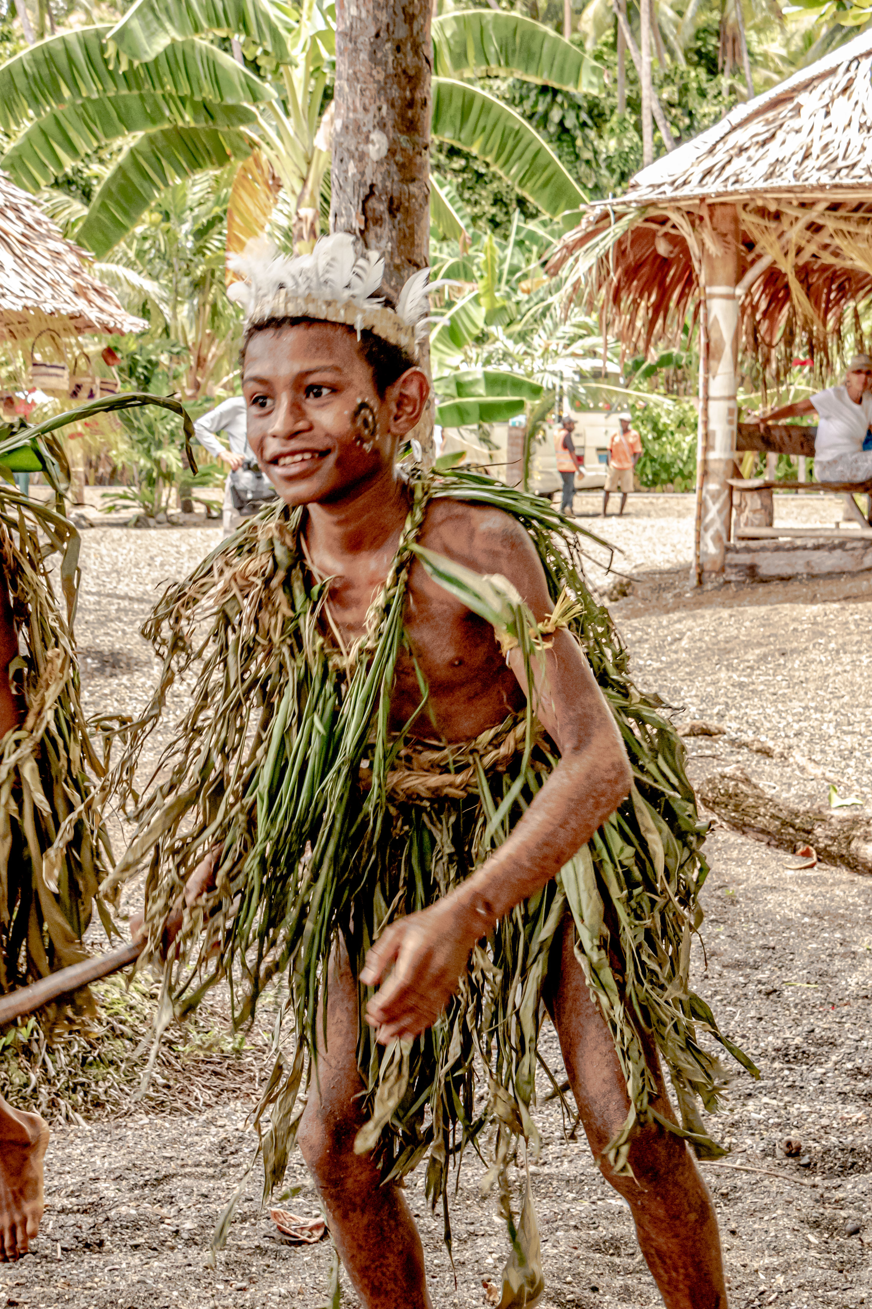
The second village we visited was located on the sea shore, and we were greeted by the young people of the village dressed in their village’s version of traditional dress, while they sang and danced for us. These kids were aged about age 8 to late teens, and not a one of them (or the villagers either) had a cell phone in sight.
Our welcome to the village of Gaba Point
The women of the village had prepared a beautiful spread of fresh fruit for us, and some were cooking some vegetables with cocnut milk over an open fire. They also had fresh coconuts, which they opened so we could drink the juice. Everyone learned something from the pandemic, as we were each given a plastic-wrapped straw to use. The young boys demonstrated their paddling skills by taking their canoes out in the bay. One of the village men then showed us how to start a fire without any matches. Most of their implements are still hand-carved from wood. Then the young people danced some more for us, and the boys made a great show of trying to scare us with their spears. Jim accommodated by acting surprised each time they jumped at him.
The boys and their canoesThe man who showed us how to make fire. He was pleased with his success.The boys trying to scare us with their spearsThe beach at Gaba Point
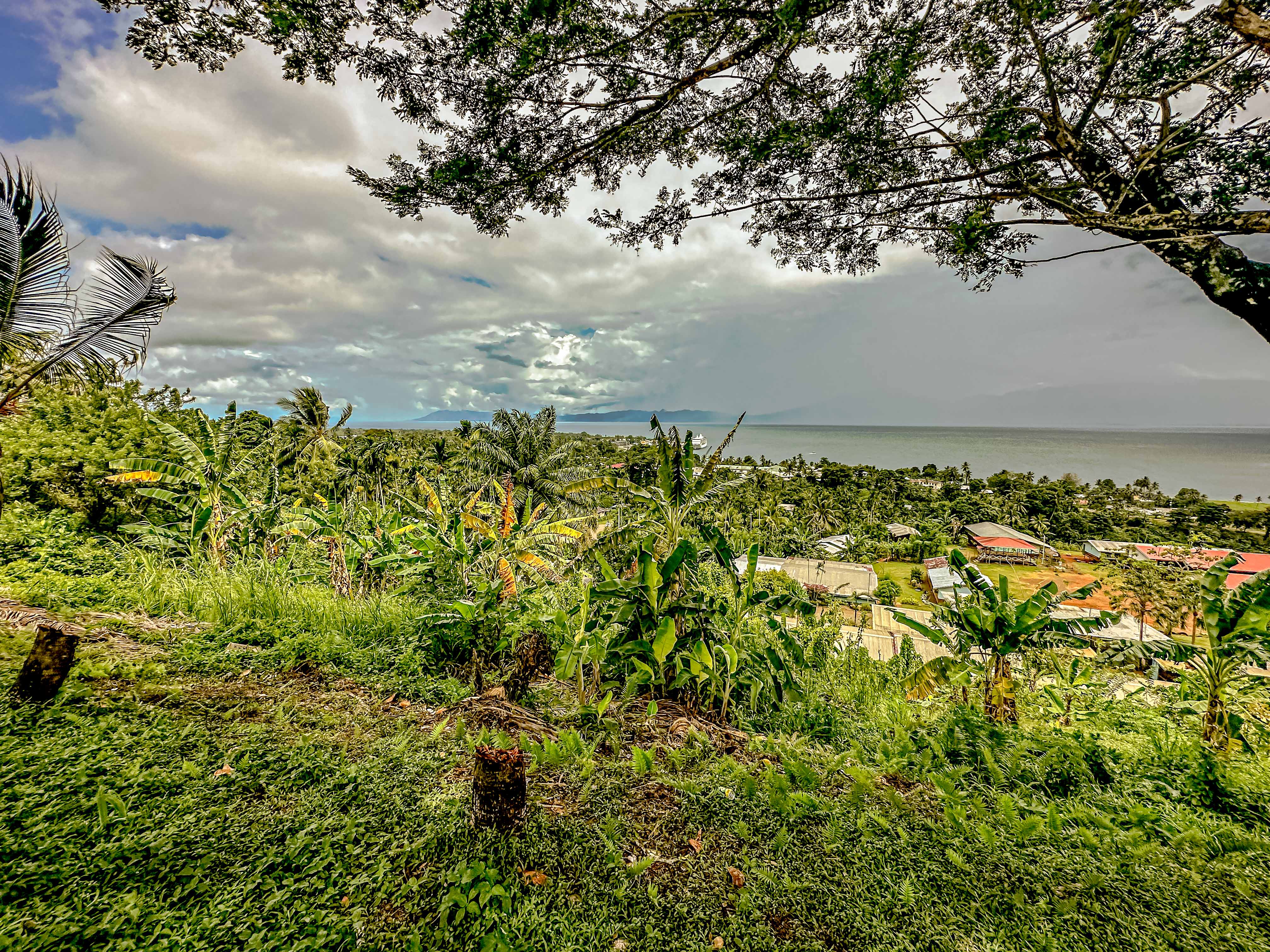
We returned to town, and visited the war memorial to those lost in the Battle of Milne Bay in World War II. The downtown of Alotau wasn’t very large, but it’s natural harbor makes it an ideal ferry port for all the ferries leaving and arriving constantly from the outlying islands. We also got to see the craft market, where the residents displayed their lovely wood carvings.
The harbor in AlotauPeople coming to town to catch the ferries moored at the rightMilne Point war memorialCarving of the phoenix bird, which is endemic to the island
Finally, we drove a little way above the town so we could enjoy the panoramic views. An enterprising woman had set up a display of some traditional clothing and feather headpieces, and we contributed to her outdoor museum.
The open air museum
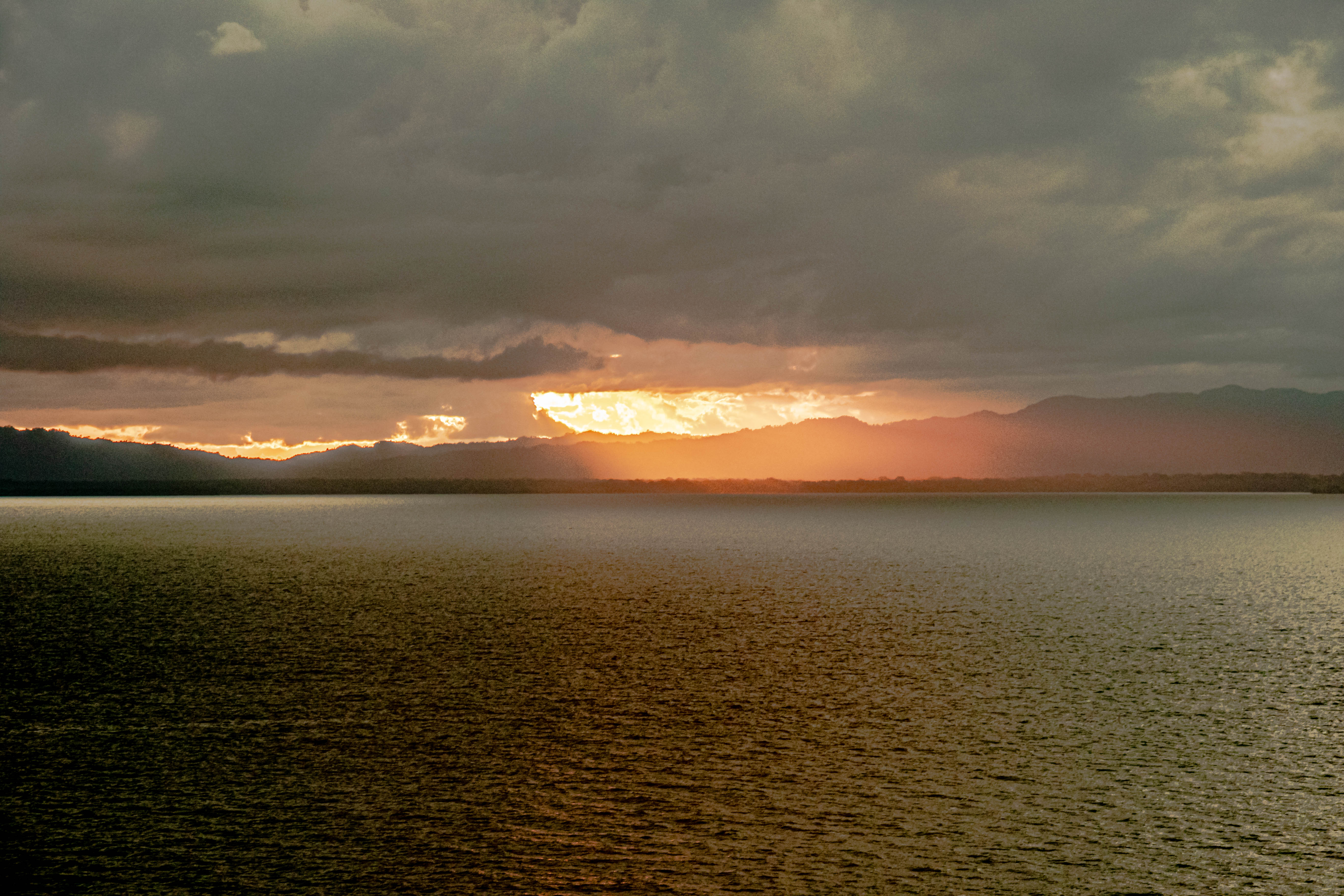
Undoubtedly, there’s a lot more to this country than we were able to absorb in our short time here. But we left feeling that PNG really is a remarkable place!
Local performers sending us on our waySailing away from Papua New Guinea
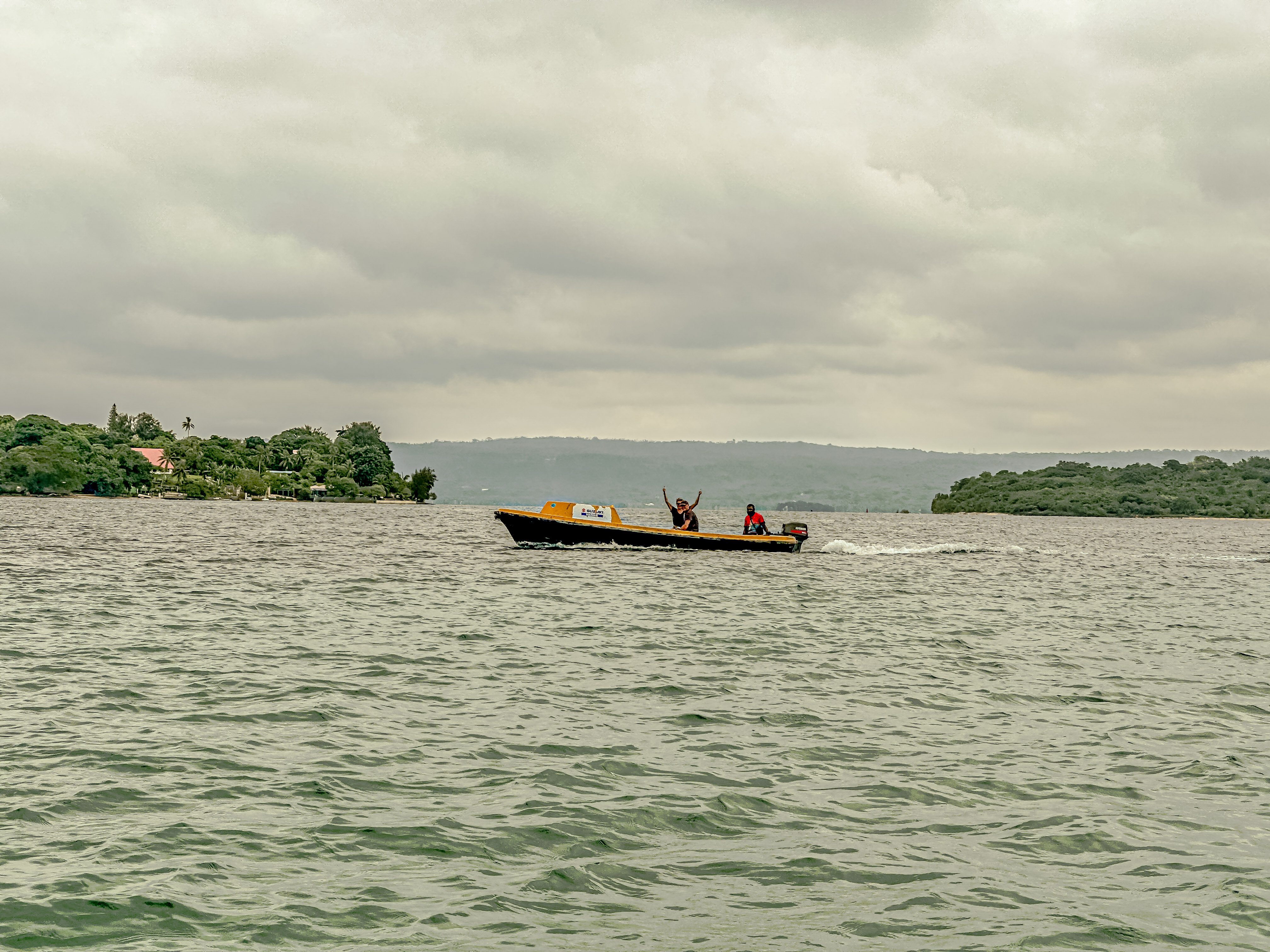
We pulled into port in Port Vila, on the island of Èfaté, Vanuatu, the morning of Feb. 15, 2023. After our dives yesterday, we opted not to take a tour, but decided to go check out the town instead. The port where we are moored is located some way from town, and there was no shuttle. We had two choices to get there, pile into a hot bus, or take a “water taxi” to town. Our friends Barry and Carol were with us, and it seemed like a no-brainer to take the water taxi. Carol had some concerns about the sea-worthiness of our vessel, but we piled in. Other than looking rough, the boat was actually fine, and Captain Mauru (?) took us on a lagoon tour on our way to town.
All the water taxi drivers come from this islandSomeone was happy to see us!Port Vila skyline-the building with the red roof is the Parliament building; the building with the curved brown roof is the sports stadium/event centerParliament House with the Vanuatu flag flyingThe event centerChef Mauro and his water taxi
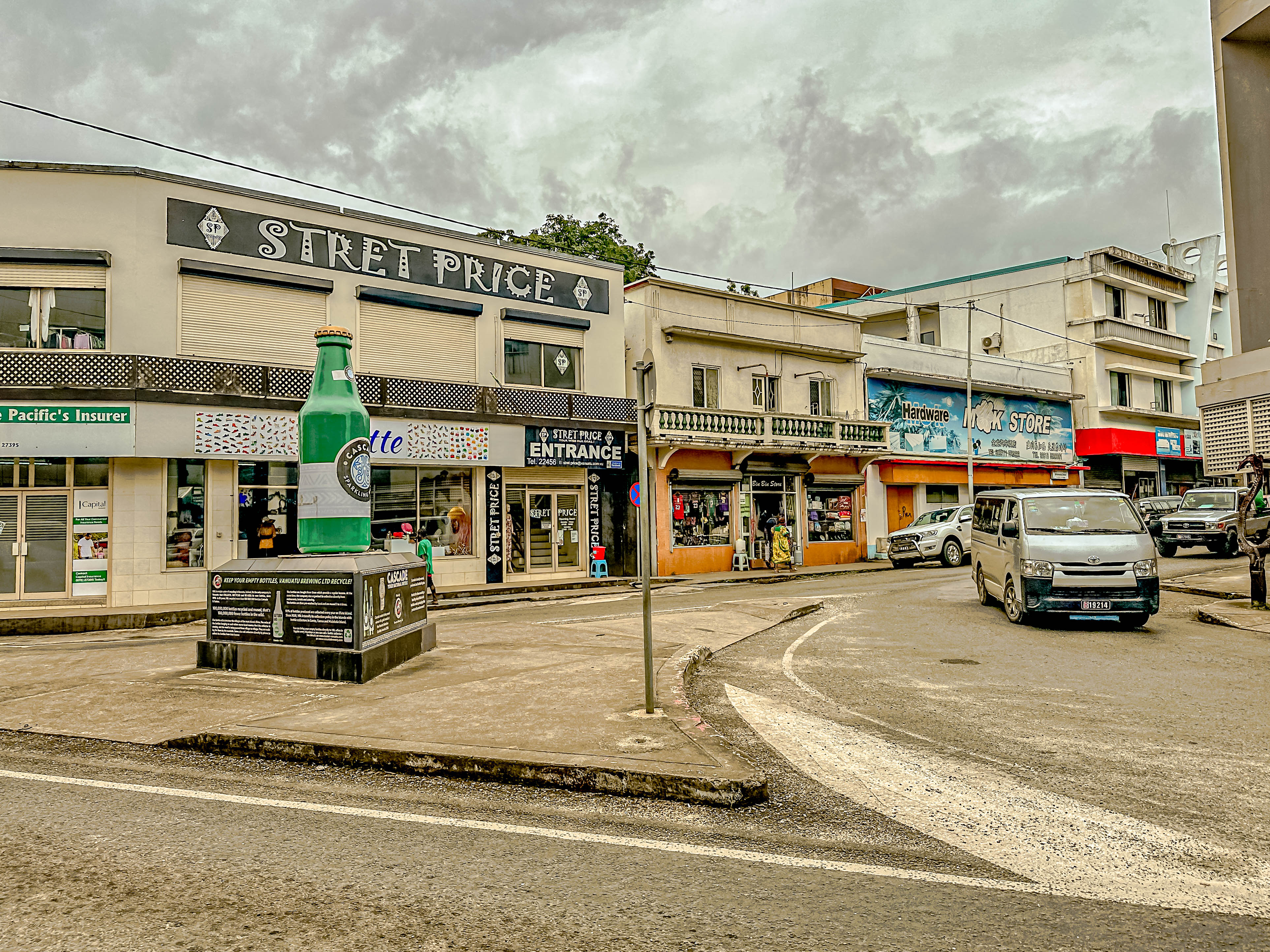
Our group wandered through downtown Port Vila, which seemed like a bustling center of island activity for Vanuatu. As usual, Carol and I were in the hunt for charms, and we found a really lovely jewelry shop on the main street. I enjoyed talking with one of the shop ladies while Carol made her selection, but the workmanship at Vanuatu Bijouterie was lovely! Then we wandered back to the main craft market in town. Most of the crafts involve wood carving, but the Ni Vanuatu also harvest black pearls, and those were also on offer. While Carol and I were in the craft market, Barry and Jim tried out the local beer.
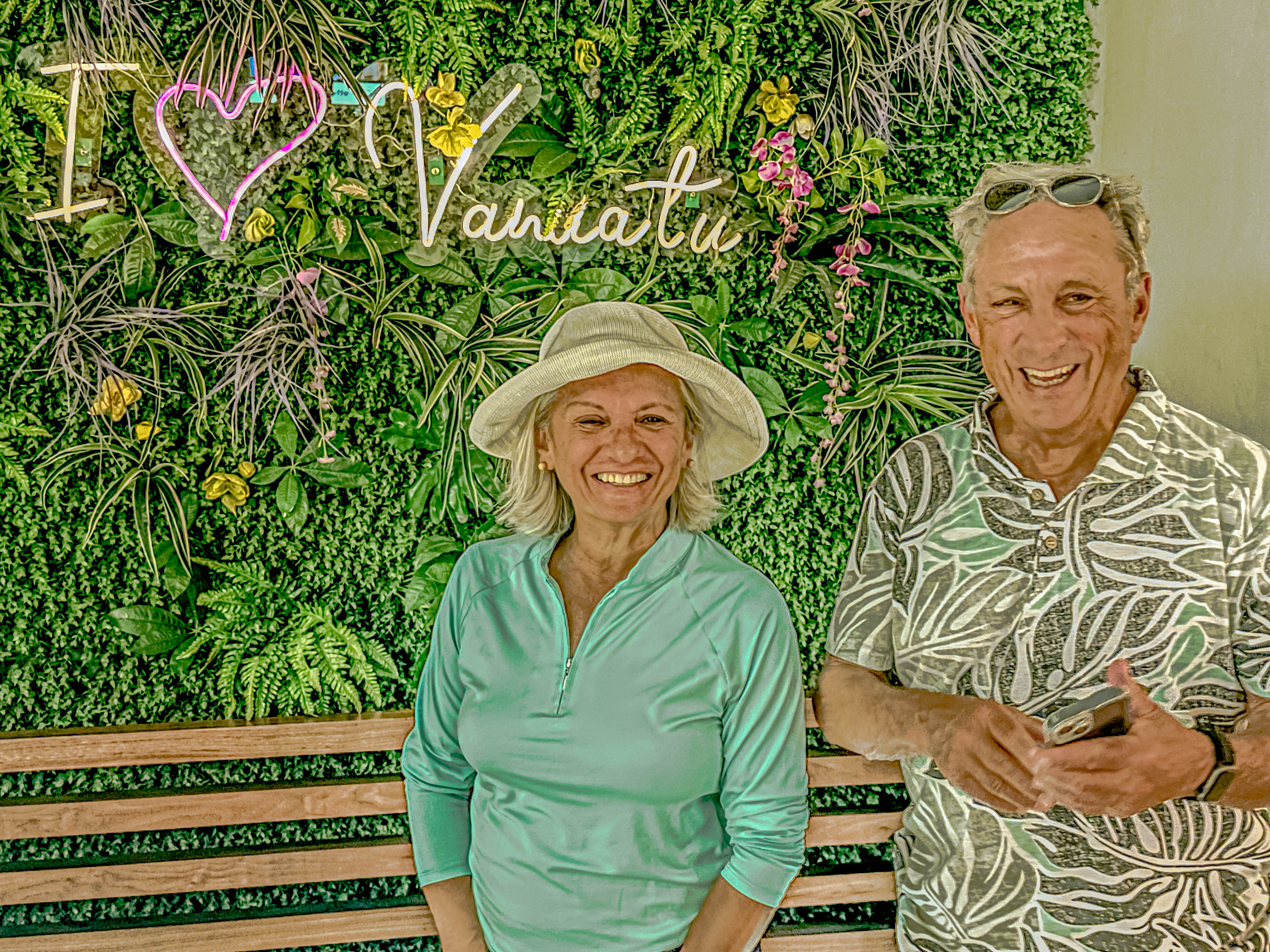
Downtown Port Vila. Don’t ask me why there is a monument to a beer.Carol in the duty-free centerThe Gringos in VanuatuPost with ceremonial carvings in the big central seaside parkOne of the merchants in the craft market wearing a traditional Vanuatese dressExample of traditional art depicting a successful warrior with all his power symbols around himAnother merchant in the craft marketThe best local beer according to Captain Mauru
Then Captain Mauru took us back to the ship around the lagoon in a different direction. There is an island called Iririki in the center of the lagoon, and thee seemed to be some nice hotels located on the island. Our explorations concluded, we enjoyed our sail away. But stay tuned, dear Readers, as our next stop is in Papua New Guinea.
Happy Valentine’s Day and welcome to Luganville, Vanuatu! A couple of days ago, we learned that we would not be docking at our first planned stop in Vanuatu, at a location known as Champagne Beach, on the island of Espiritú Santo, because the mooring had been badly damaged by a passing cyclone. Instead, we were headed for Luganville, further south on the same island which was the former center of the U.S. and Anzac forces in opposition to the Japanese expansion plans in the South Pacific.
Sailing into LuganvilleViews down island from our mooring
Vanuatu is yet another fascinating island archipelago in the South Pacific. If you remember from our post about Polynesian expansion through the Pacific, Vanuatu was originally settled by the Lapita peoples who dispersed out of what is now Taiwan. The islands in this archipelago are believed to have been populated by the Lapita between 1000 and 700 B.C.
The islands had their first contact with European peoples in 1606, when they were discovered by Portuguese explorer, Pedro Fernades de Queirós (sailing for Spain), and it was he who named the main island Espiritú Santo. Europeans did not return until 1768 when French explorer, Louis Antoine de Bouganville, did a drive by of the islands, naming them the Great Cyclades. The only island he landed on in the archipelago was Ambae, and then left. Captain James Cook landed and explored the islands extensively in 1774, and he named them the New Hebrides, which was the name which stuck until the islands declared independence in 1980. Captain William Bligh sailed through the islands in 1789 on his return to England following the mutiny on the Bounty, and later returned and explored some of the outer islands further, naming them the Banks islands.
Sadly, as was the case in most of Polynesia, in the 1860s, British landlords in colonial holdings raided the island in a practice called “blackbirding” to essentially steal slaves for their plantations. British Christian missionaries also arrived in 1839. However, given its remote location, although both France and England claimed colonial rights in Vanuatu, their attitude toward this colonial outpost was largely one of benign neglect. In 1906, the French and English decided that they would jointly rule their colonial outpost.
Nothing much changed until the buildup to World War II, when in 1936, the Japanese began their campaign of territorial expansion in the South Pacific. The fall of the French government to the Nazis in 1940 allowed the British to assume total control over the islands, and the Australian military stationed about 2,000 troops there. After the bombing of Pearl Harbor in Dec. 1941, the U.S. joined the war, and became concerned about the unchecked spread of Japanese forces throughout the Pacific. Unfortunately, in the early years of the war, the tide was all in Japan’s favor, and they kept gaining island possessions throughout the South Pacific. By 1942, Japanese forces occupied the complete northern half of Papua New Guinea, and all of the Solomon Islands, which left New Hebrides on the frontline of the Allies’ efforts to repel the Japanese. Starting in May, 1942, the Americans made a massive deployment on Vanuatu, eventually stationing 50,000 American troops here, and building a huge amount of infrastructure on the islands to support their war efforts in the South Pacific.
However, after the success of the British and Anzac forces in retaking Papua New Guinea, and the recapture of the Solomon Islands in 1943 following the Battle of Guadalcanal, the military outposts, airports, roads, ports and bridges in Vanuatu became less important to the war effort, and a gradual troop drawdown began. The Americans withdrew entirely from the islands in 1945. They tried to sell the leftover military and construction equipment, and the detritus of their occupation, to the British or the French, but with both countries broke and cash-strapped after the war, they weren’t able to pay even 10 cents on the dollar. In what can only be described as a completely mad and selfish idea, rather than leaving the materiel for the native Ni Vanuatu, the sunk the entire lot off the site of their former pier on Espiritú Santo right outside of Luganville. The locals have ever after called it “Million Dollar Point”.
The far point of land on the left is “Million Dollar Point”Flag of Vanuatu on the Police Station in town
Fast forward to our visit today. After we found out about our change of port, two of our newest friends aboard, Greg and Susan found out that you could book diving excursions over both Million Dollar Point, and also on the wreck of the S.S. President Coolidge, which was a troop ship sunk by the Japanese right outside Luganville. So the four of us signed up to dive both locations (in two separate dives) with a dive operator named Pacific Dive. Their staff picked us up at the cruise terminal, and drove us the short way to their dive operation.
Depiction of how the Coolidge lies on the ocean floor.The S.S. President CoolidgeDeck plan for the Coolidge
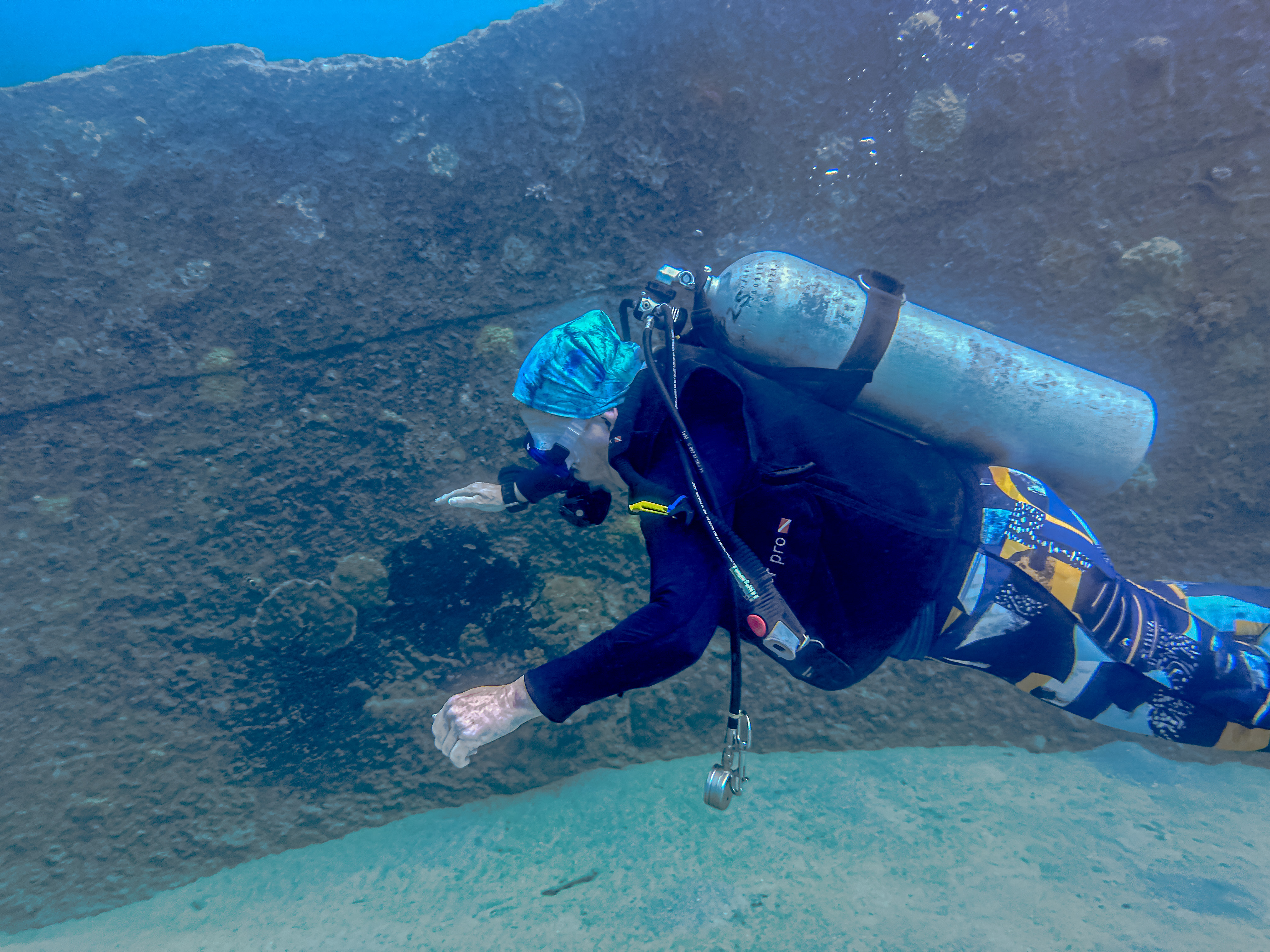
As none of us are certified for wreck diving, and because the Coolidge is a complicated technical dive which requires decompression diving, which we are also not certified to perform, our dive was limited to exploring the upper deck of the ship. Our maximum depth was 90 feet, so we didn’t need to do decompression stops, but we did perform a safety stop for about five minutes at 15 feet. However, there were still plenty of things to explore, and we were all excited for the opportunity. Since I have still not been able to secure replacement parts for my underwater camera, Greg became the visiting Gringo photographer for both dives. All the underwater pictures are his.We went to the dive shop, and got all kitted out in our dive equipment. One of the nice things about both of these dives is that they are easy shore entry dives, where you just wade out into the protected bay to begin your descent along a rope line. For the first dive, we just waded offshore from the dive shop because the Coolidge is sunk right offshore. Our dive master, Dave, told us that normally the visibility was excellent here, with usual range of vison about 100 feet. Sadly, it has been raining a lot here recently, and the runoff from the mountains has caused the visibility to greatly diminish (about 30 feet) This meant that as we descended and approached the bow of the Coolidge, we could not see it until we were almost on top of it.
The dive shop.Our transport to the dive shop and to Million Dollar Point.Looking north to Luganville, where the Mariner is moored.The S.S. Coolidge lies sunk right out here.
The story of the Coolidge is a somewhat sad one. She was built as a luxury liner, and completed in 1931. She was operated as a liner until 1941, after which she was converted into a troop carrier for the Americans’ South Pacific campaign. She was headed to New Hebrides (Vanuatu) with troops in October, 1942, when word came out that Japanese submarines were patrolling the area right off Espiritú Santo. The Captain decided to try to make a run into Luganville, but the entrance to the harbor was mined, and he hit one, then two mines on his way into port. Despite the tragic hits, the Captain was able to get all the men safely to shore, except a seaman killed in the first mine blast, and an assistant captain, who drowned trying to get all the patients in the hospital wing safely on deck. While that man was successful, the ship sank suddenly, and the assistant captain was lost. The Captain had tried to run the ship up on the fringing reef in the harbor, but it slid off the reef, and the deepest part sits in 60 meters (over 180 feet) of water today.
Exploring the upper bow deck.A smoke stackA plaque on the ship.An octopus hiding under some of the coral encrustations that have grown on the deckUnexploded canisters of ammunition. What could possibly go wrong?!Susan with a rifle lying on the deckAnd GregOne of the cargo holds80 years of coral growth
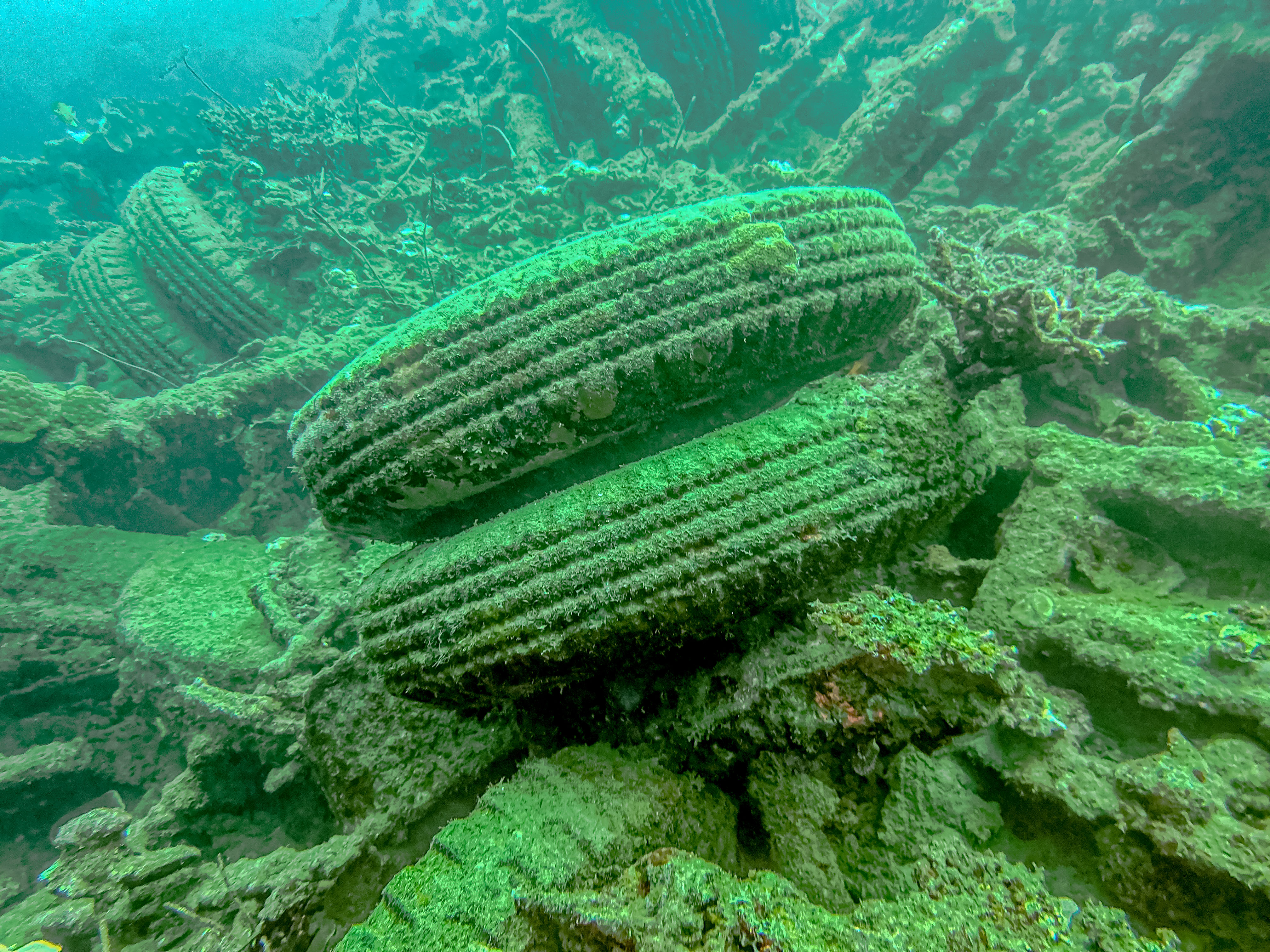
We had a great time exploring what we could on the Coolidge, but the time seemed to just fly by. All too soon, it was time to come up. We spent about two hours at the surface shooting the breeze with Dave, and eating fresh fruit they provide us. Then we geared up again, and Dave drove us about 15 minutes further down the island to Million Dollar Point. Once again, this proved to be a fairly easy beach entry, but right away, you started seeing pieces of discarded military and construction equipment. The sheer volume of all this wasted materiel was heartbreaking, particularly when the native islanders live such hardscrabble lives.
The hold of the salvage ship sunk after it sunk all the other materiel.The tires have fared the best.But some incredible corals have grown in 80 years!A soup ladle which still shows the insignia of U.S.N.A soup potCups and saucersAmazing starfishVaya con Jim all trimmed outJust amazing!
We all thoroughly enjoyed our dives, but it was Valentine’s Day, and time to return to the ship. Once again, the staff aboard helped me make it a special day for my sweetheart. We drank a great bottle of French champagne with dinner, and then when we returned to our cabin, the pastry chefs had made a chocolate ganache tort for my special Valentine. All in all, a stupendous day!
So, some of you have been wondering what shipboard life is like for us, particularly since this cruise has had so many sea days.
Well, I’m happy to tell you that there is no shortage of activities to keep us busy. Not only have we had some excellent guest lecturers, including a guest photographic expert, who has been giving some super workshops, but the ship’s staff really goes the extra mile to make sure we miss no opportunities to celebrate whatever cultural holidays we pass while onboard. A mutiny onboard was narrowly averted yesterday, when IT experts from Regent’s home office were finally able to re-establish Internet connectivity, so the Super Bowl could be broadcast.
Case in point: we had a crazily extravagant celebration for the Super Bowl, which occurred on one of our sea days; Monday Feb. 13, 2023, where we are located.
The staff decorated the ship’s auditorium by dividing it in half, and decorating each side for the opposing teams (KC Chiefs and Philadelphia Eagles). The Captain threw out the game ball, and probably about half of the ship’s passengers piled into the theater for the game.
The kitchen staff went all out to provide “game food”, including popcorn, wings, dogs, burgers, chips and guacamole, and desserts galore! Jim was ensconced for the game, but I went in to check it out (and steal some chips and guac).
Meanwhile, on the rest of the ship, you could have fired a cannon and hit no one, but it was a great lazy day!
Our ship arrived in the port of Suva, Fiji, on the morning of February 12, 2023. Instead of taking a tour today, Jim and I decided to walk around this colonial city which is the capital of Fiji. The customary greeting for hello/goodbye (or just any exclamation in Fijian) is “Bula”. If someone is very excited, they say, “Bula, Bula!”. Everyone we met on our walk was quick to tell us “Bula!”, and we responded in kind. I can’t tell you how outgoing and friendly the Fijian people are!
We were moored in Walk Bay; Jim and I walked along the coastal route until the first bridge, then turned inland and followed the yellow road ( Victorian Parade) to the bottom of the map.Views from the coastal promenadeSpider lilies; these were growing everywhere!
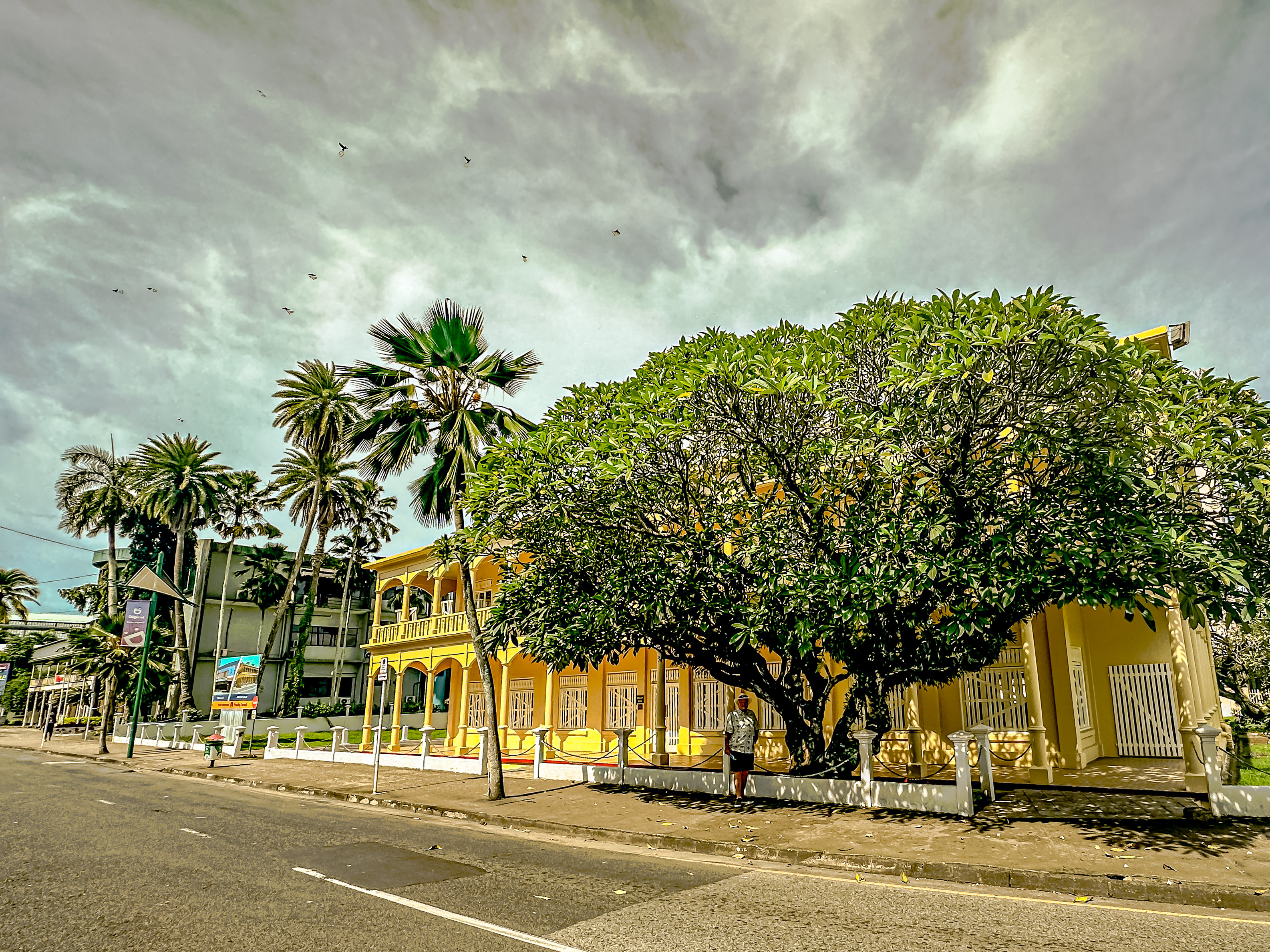
Fiji was formerly a British colony, and finally gained its independence as an “Independent Realm” with the British Commonwelth in 1970. In 1987, they became a truly independent Republic. One of our onboard lecturers had told us about some of the colonial architecture in Suva, which has been restored in the old downtown city center. As you can see from the map, from our moorage in the port, you can take a short walk along the coastal walkway amidst tropical trees and flowers. Then you take a short jog inland, and walk along the main street in town, Victorian Parade. There you find the restored colonial buildings, many of which have been converted into government buildings. Interspersed amongst it are some lovely, modern buildings as well.
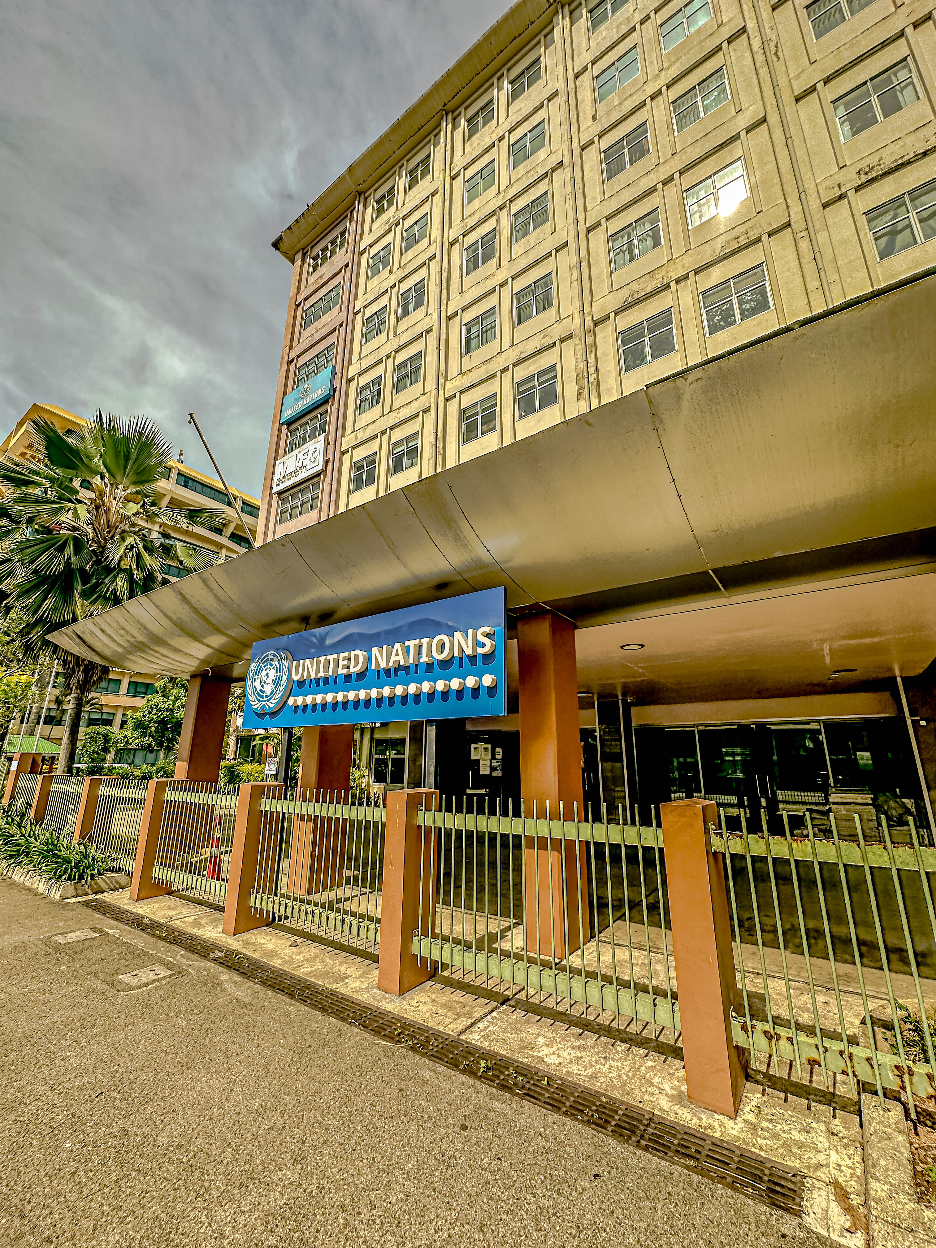
Colonial architecture. This was Mercury House.The Carnegie LibraryWe thought this bank was particularly attractive.In the thick of it, the United Nations
Another glorious set of colonial-era buildings is what is now the justice complex, but which was formally the parliamentary center of Suva.
The Justice Center (former parliamentary center).
One of the shining examples of restoration is the Grand Pacific Hotel, which had been allowed to completely fall into ruin in the postcolonial period. But some wealthy investors have restored it to all of its colonial glory, and it is now part of the IHG hotel chain. When Captain Kingsford Smith made the first Transpacific flight in 1928, he stayed at the Grand Pacific Hotel. Jim and I had only been walking for about 45 minutes at this time, and in the hot tropical sun, we were melting, so we chose to go into the Grand Pacific Hotel, and have a cold drink and enjoy some of their air conditioning.
Grand Pacific HotelThe restored interior.
At least semi-restored, Jim and I set off to try and find an open store. It was Sunday on the day of our visit, and most Fijians are very observant religiously, so most of the shops are closed. However, one of the best stores in Suva (which also has an outpost in Lautoka), is called Jack’s of Fiji. It is a fabulous store, which not only has regular clothing, and everything you might need for beach going, but also carries a wonderful selection of clothing made in Fijian prints, which are very bold and colorful. Jim and I each picked up a shirt, and then we went to another store, called Tapoo City, which is a mall within a single department store. It was a very interesting set-up, in that the store is owned by Indians, and there’s a whole department of traditional Indian attire. I found one of my favorite Indian designers there, and bought a couple of shirts to update my wardrobe. But the real purpose for our visit was to see if we could find a charm to add to my charm bracelet. The selection wasn’t great, but I was able to find an anchor which I figured could represent Fiji‘s nautical history.
Fiji’s leading export
Chores accomplished, we headed back to the ship. Jim and I enjoyed watching our sail away from this beautiful island nation.
Our sail away from SuvaThe fringing coral reef which protects the port.Goodbye, Fiji!
We’ve been aboard our floating home for about five weeks now, and quite the little community is forming. We are really enjoying getting to know our fellow cruisers by name, and learning more about them. One fun thing a fellow cruiser did in preparation for this trip was that in 2022, a year before our cruise started, she posted something every day on the site www.cruisecritic.com with fun facts about the port we would visit on that same day in 2023. Her user name is ProfPeabody. Our friend, Carol, and I loved these posts because they really got us excited about the trip, as well as informing us about the ports we would be visiting. Fast forward a year, and at a cocktail party onboard for all the clients of our travel agency, and we finally got to meet ProfPeabody (Cynthia), and could thank her for all the fun facts. So now I’m going to use some of her facts from time to time in the blog.
On February 11, 2023, we pulled into the port of Lautoka, Fiji after another two sea days, during which we crossed the international dateline. Unfortunately for those aboard whose birthdays were February 9th, we crossed the international date line about 2:00 am on the 9th, so the rest of February 9th completely ceased to exist.
We had a really lovely sail into the main island of Fiji, Viti Levu. One very interesting fact about Fiji is that there is a huge population of southeast Asian Indians. During the British colonial period, British landlords tried to make the island possession a more profitable enterprise by growing sugarcane and producing sugar. However, the native Fijians found the work to grow and harvest the cane far too arduous, so the British imported indentured Indians to do the manual labor, and most of them stayed in Fiji. In 1803, a huge sugar mill was built in the city of Lautoka, and Lautoka has been known as “Sugar City” ever since. There are over 300 islands in the Fijian archipelago, but only about 100 of them have any population at all.
Here’s what ProfPeabody had to say about Fiji:
Fiji’s main commercial export is water, which is bottled from a natural aquifer and sold globally.
Fiji boasts nearly 800 species of plants found nowhere else in the world. The most famous of these is the tagimoucia flower, which only grows on a single mountain ridge on the northern island Taveuni.
Cannibalism was a significant part of Fijian culture until the introduction of Christianity. The Fiji Museum indicates that according to archaeological evidence, the practice is at least 2,500 years old. Ratu Udre Udre, a Fijian war chief, was the most active cannibal in recorded history. He is reported to have eaten between 872 and 999 people during his lifetime.
Nearly five centuries ago on Beqa Island, the Sawau tribe introduced the fire walking ceremony which would later come to be one of the most popular activities within Fiji.
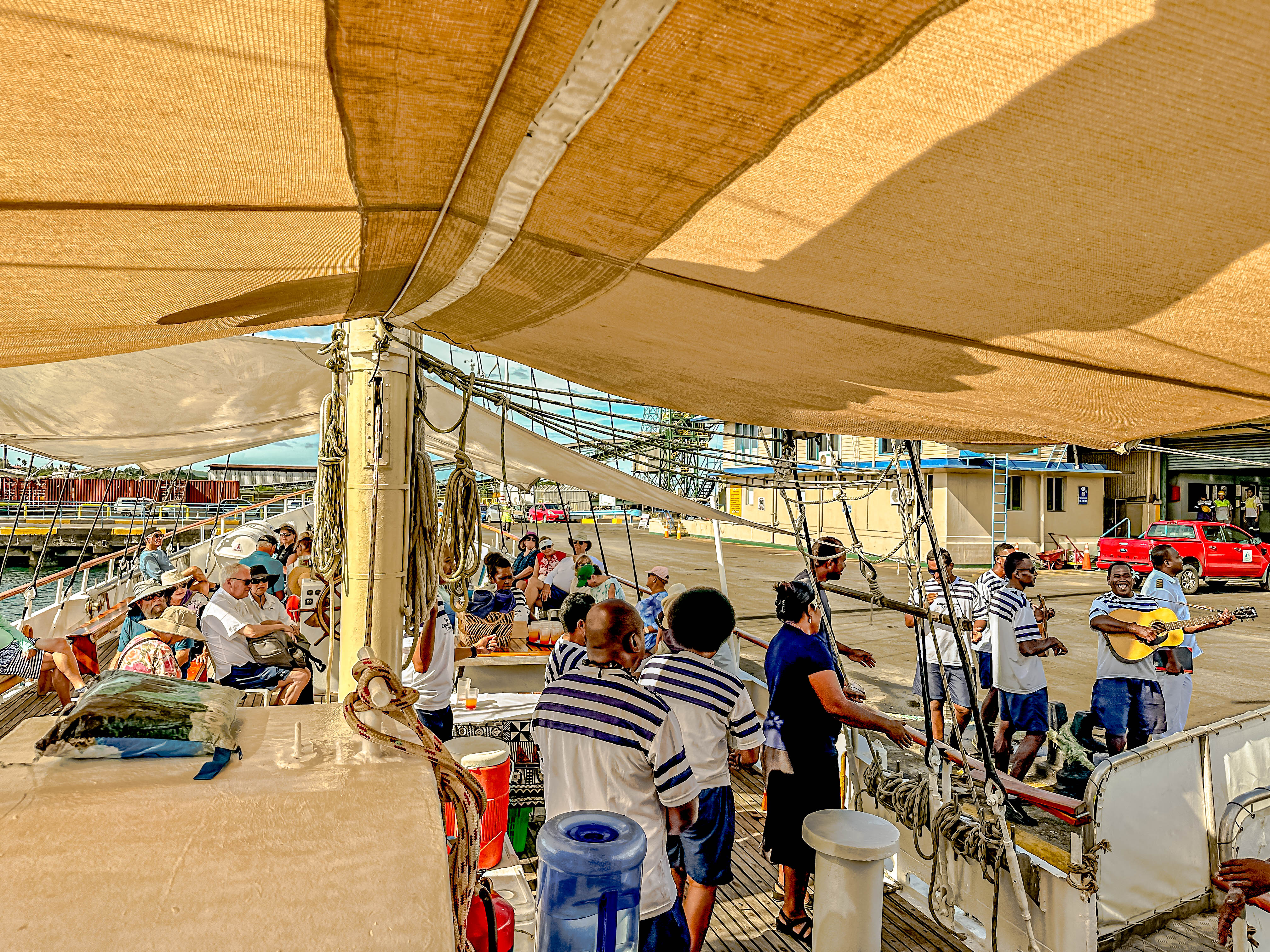
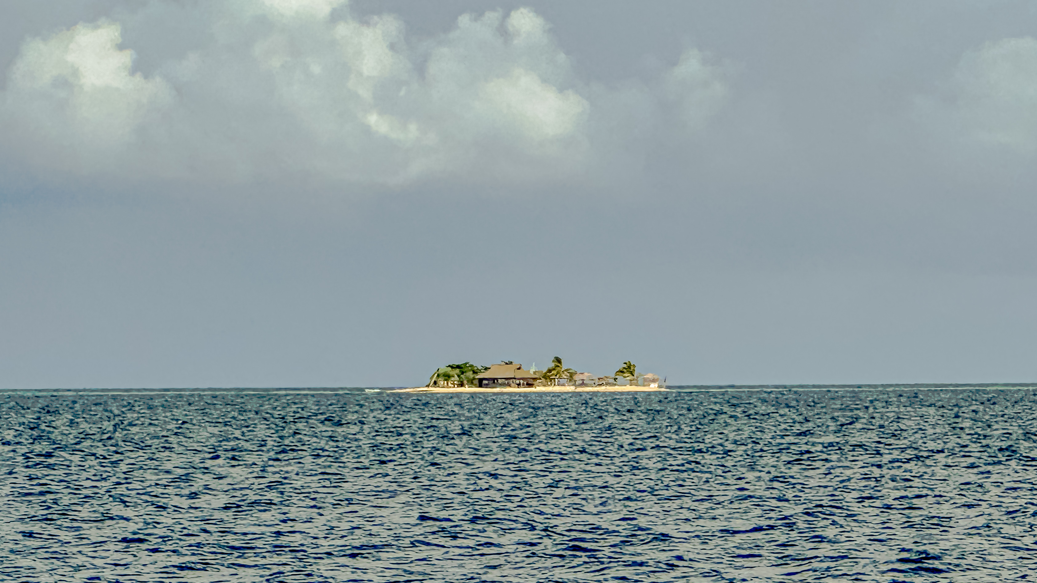
Our scheduled activity for the day was to take a sailboat out to one of the nearby outlying islands, where we could snorkel, take a glass bottom boat ride, lounge on the beach, and have lunch. We boarded the sailboat right next to where our ship was docked and set sail. The crew serenaded us with Fijian songs, and were incredibly warm and welcoming. On the sail, they had a kava ceremony, which used to be part of how Fijians chiefs were chosen. Today, we operated solely on a volunteer basis. This entire area is blessed with an incredibly rich and diverse marine life, and we look forward to coming back here for an extended dive trip someday. For today, however, we just enjoyed some snorkeling and beach time, and kicking back.
Crew serenadeKava CeremonyFirst guineapig, oops! “Volunteer”!Jim James takes one for the team!Fijian FlagOur little desert island, Tivua.The snorkeling wasn’t fantastic, but we did see some anemone (clown) fish, aka, Nemo.