From Belfast to the Boyne Valley

June 8, 2017:

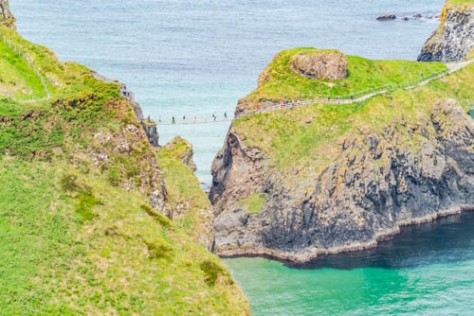
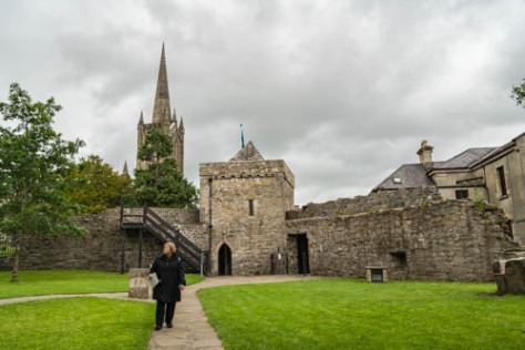
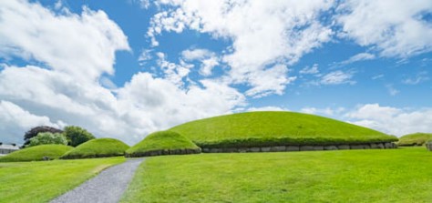
This morning we beat feet to the south, with an ultimate destination of the K Club in Kildare, just south of Dublin.  However, our first stop for the day in just outside of Drogheda, to see the Unesco World Heritage Site of Newgrange–the location of a trio of immense Neolithic passage tombs. This historical site is known as Brú na Bóinne in the local Gaelic, and is located back in the Irish Republic along the Boyne River in County Meath. It is comprised of three different historical ruins, which are called Knowth, Dowth, and Newgrange.

Newgrange-1

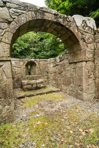
Newgrange is the oldest site and was constructed about in about 3200 B.C. (5200 years ago). The Knowth and Dowth sites are a little newer, but all of them were constructed before the Great Pyramid in Egypt, and before Stonehenge in England.  The passage tombs are large domed circular structures with an earthen roof built over internal stones lined up to create a passage to an internal chamber in which the cremated remains of ancestors could be laid until sunlight from the winter solstice crept down the 21 yard passage and lighted stone bowls in which the cremated remains were kept. In this way, the Neolithic people believed the souls of the dead were transported to the afterlife. Around the outside of each tomb is a collar of “kerb stones”, which are decorated with patterned carvings. Even now, over 5,000 years later, the sun still reaches the inner chamber at dawn on the winter solstice, and over 30,000 people sign up for a lottery each year which determines the lucky few able to witness this phenomenon in person. It being Ireland, though, and her highly fickle weather; even if you win the lottery, you might not see the sun that day!

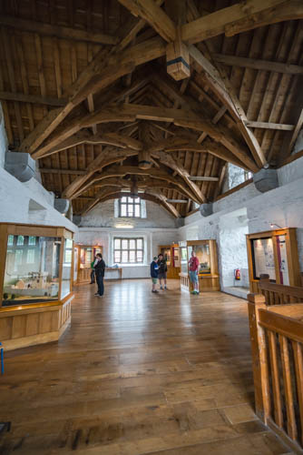
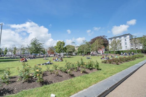
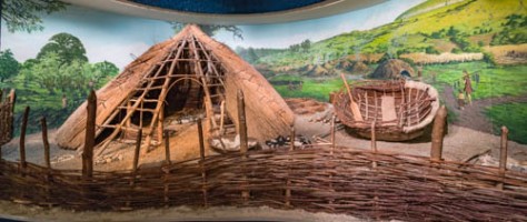
All of the sites are accessed from the Visitors’ Center via small busses, but you have to buy a ticket to each site. Since access is controlled, you are given a timed ticket to access each site. Sadly, the tickets for Newgrange were sold out until 1:00 this afternoon (it was only about 10:00 when we arrived), so we elected to go to the Knowth site instead. But first, we learned more about these Neolithic people in the Visitors’ Center, which has exhibits based on their food, dress, and village structures, as well as two replica inner chambers: the one at Newgrange, and the entrance to Knowth.

Newgrange-2
Relief map of the Newgrange site
Newgrange-6
Re-creation of Neolithic villagers’ lives

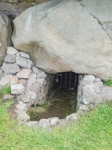
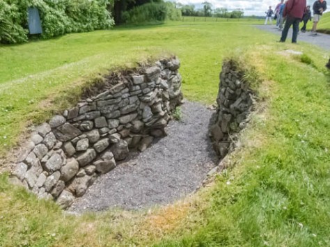
As we went out to the Knowth site, we were fortunate to meet up with a docent who was just beginning a lecture about the Knowth site. As I mentioned earlier, it was built later than Newgrange, having been constructed between about 2500-2000 B.C., so it is still older than The Great Pyramid at Giza.  However, unlike the Newgrange site, this passage tomb was constructed with an east and west entrance which allowed the sun to enter on the equinoxes in spring and summer. Sadly, because the Knowth site was later used for settlement through the Middle Ages, and the later inhabitants constructed a hill fort and subterranean structures which may have been used as passages or for storage, the two passages no longer align for sunlight to enter on the equinoxes.

Newgrange-10
The topography of the Boyne River Valley
Newgrange-24
The Boyne River as it flows by the Visitors’ Center
Newgrange-29
The Knowth Passage Tomb and smaller surrounding tombs

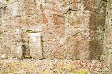
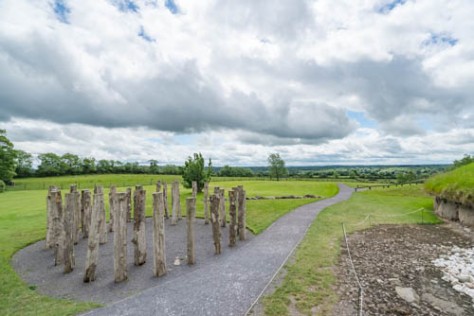
The Knowth passage tomb site is the largest of the three tombs, and is surrounded by 17 satellite tombs.  It also has the largest collection of kerb stones encircling it, although some are missing and others damaged.  However, outside the eastern entrance is a timber circle (think Stonehenge in wood), which is believed to have been constructed in the late Neolithic or early Iron Age (starting bout 2200-2000 B.C.), and the central tomb was believed to have already been in disuse by that time.  As mentioned above, the site was abandoned and repurposed for human habitation beginning in the late Iron Age/early Christian period.

Newgrange-11Newgrange-13

Newgrange-15

Newgrange-16
The timber circle
Newgrange-43
Smaller satellite tomb, probably repurposed as a dwelling

Newgrange-45

Newgrange-48
Excavated smaller tomb

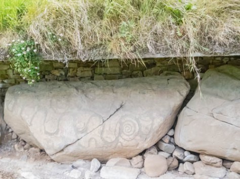
The kerb stones have really simple, but pretty carvings on them, and are more varied than those at Newgrange. Interestingly, one of the most common patterns is that of a spiral, which we have seen in other cultures (notably the Incan and Mayan), as well as some other cultures where it depicts the Earth Mother, and fertility or the circle of Life. One other interesting fact about these stones is that they were originally installed with the carving facing inward, in a style known as “hidden art”. Upon closer inspection, we could also see numerous “sand martins” (we call them bank sparrows in America), who had built nests in the grass edge right above the kerb stones.

Newgrange-31Newgrange-37

Newgrange-41
Sand martins built nests all along the domed top of the tomb knoll which was given a concrete lintel to stabilize it after excavation and reconstruction starting in the 1960s

Newgrange-51

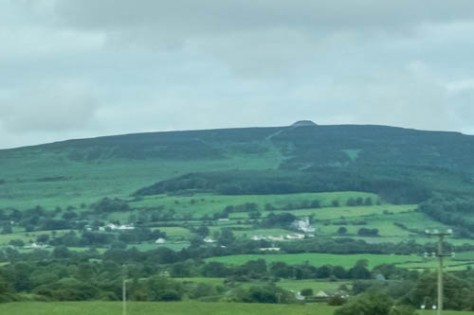
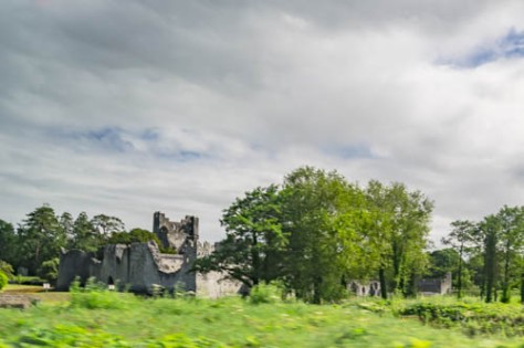
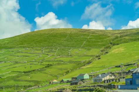
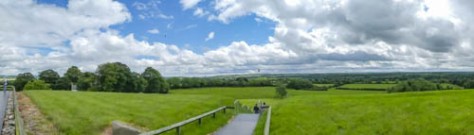
We also climbed to the top of the tomb, from which you could see all over the Boyne Valley. You could also see the Newgrange site in the distance, as well as the ruins of Mellifont Abbey, which was established by the Cistercians. Weren’t they just the busy little religious order?!!!!

Newgrange-53
The top of the Knowth tomb

Newgrange-57

Newgrange-63
View out over the Boyne Valley toward the Newgrange site
Newgrange-61
Long distance view of Newgrange 

We then decided to beat feet directly to the K Club in Kildare, as our lodgings have been upgraded, so we will be staying in the mansion known as Straffan House, located on the property.  Sadly, we will also be bidding farewell to Dermott, but after nearly two weeks with all of us, I imagine he’ll be glad to sleep in his own bed and reacquaint himself with his wife!

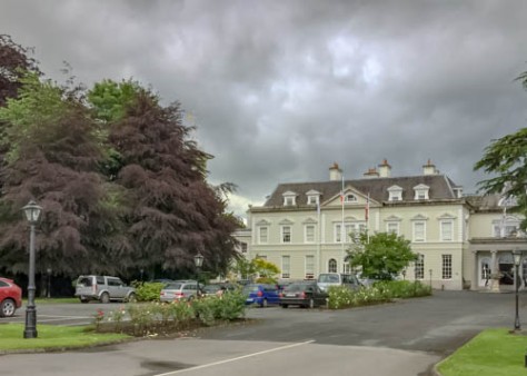
We were treated like royalty upon arrival and driven to the remote property where Straffan House is located. The house is the private resident of Sir Smurfit, and was designed to look like the original Straffan House, which became the Kildare Hotel, now known as the K Club. The Smurfits were among the original founders of the K Club, and now own it outright. The new Straffan House is now available for lease to large groups at an astronomical cost, but I guess when it wasn’t rented (or being used by the Smurfit family), it serves as a kind of overflow accommodations.This is what greeted us as we arrived.

The K Club-25

The K Club-22

The K Club-19

The K Club-26The K Club-14The K Club-17The K Club-18

I had stayed at the K Club about 10 years ago on a business trip to meet with my company’s London and Irish insurance brokers, and I had treasured my memories of this grand old place.  As you can see, Straffan House is a complete luxury showcase, complete with its own butler (named Patrick), movie theatre, gym, spa and pool, and golf carts provided for getting around the property.  However, this is when reality set in.

The K Club-1The K Club-3The K Club-5The K Club-7The K Club-8

The K Club-13
Views over the 10th hole of the Smurfit course at the K Club

I will preface these comments by saying that I am about to whine about what are clearly “FIRST WORLD PROBLEMS”, and I recognize that (and gave some thought to not mentioning any of this, but decided to leave you readers with an accurate account of our good stroke of fortune turned bad).   After Patrick showed us to our rooms,  we noticed that the rooms themselves, although nice, were certainly nothing to write home about, and ours was about as modest as my nephew’s room back home. More importantly, some of the rooms had no ensuite bathroom, and none of the bedrooms had air-conditioning. The whole house was about as hot as a sauna when we arrived, and although the pool room and gym downstairs apparently had air conditioning;  since it was not working, those amenities were unusable. We had been told that whatever we wished in terms of food or drink could be provided at the house by merely letting Patrick know. The problem was that management had not authorized Patrick to do this and had not provisioned the house. Since the main hotel property is about 7-9 minutes away by car (and about 10 minutes directly across one of the golf courses by golf cart), that left us having to drive the carts to get anything we wanted or waiting forever for someone to come from the main hotel to drive us.

Since Jim and I wanted a cocktail after we settled in to celebrate the last night of the trip, we took 1 of the carts over to the main hotel. While that we cool (and we even saw a bunny playing on the greens), when we were ready to back to house to join our group for dinner, we got trapped at the main hotel by a huge thunderstorm deluge, and then had to wait some time to get back to Straffan House, and the vans had to make two trips to ferry us all to dinner.

untitled-81untitled-82

untitled-85
The Clubhouse at the K Club (we ate dinner here)
untitled-87
The grounds of the main hotel
untitled-89
The main hotel

untitled-90

The crowning blow came the next morning, though. After arising early (after having sweated my way through the night because of no air conditioning and humidity outside) so we could eat breakfast  and then leave for the airport, the chef who was supposed to show up and bring provisions and cook breakfast never arrived. Calls by Patrick to the main hotel didn’t produce any results, so Patrick found us a couple of tubs of yogurt and some fruit (probably his), and we had to leave. The conclusion was inescapable: we would have been better off staying in the main hotel.

While this was a less than stellar end to a great trip, Jim and I will still look back on our trip to Ireland as a wonderful exposure to a great company, and especially, its warm and welcoming people.  Stay tuned, as our next adventure (starting in August) all take us through the Canadian Maritime provinces and on to, Greenland, Iceland, Norway and Sweden. Thanks for reading along!


Walking in the Giants’ Steps

June 7, 2017:

Another big day in our itinerary is finally here: we are bound for the Giant’s Causeway to see this incredible geological formation that left giant hexagonal basalt columns sticking up like broken teeth or stepping stones on the edge of the ocean! It’s also time for us to get our geek on; specifically, geeking out about Game of Thrones. All along our drive today, we’ll be seeing several of the sites featured in the series, which Jim and I really enjoy. It turns out Steve is a big fan, too.

We drove out of Belfast this morning to the east to drive along the coast, for another very picturesque drive called the Nine Glens of Antrim drive.  We will spend the whole day in County Antrim, but you are very clearly still in Northern Ireland, as it seems that each successive town takes turns proclaiming their allegiance to either the Republican or Loyalist forces. You can easily tell this by the prominent use of either Irish national flags or the British tricolor. So much for getting out of the corrosive partisan atmosphere of Belfast!

Nonetheless, the drive was as lovely as advertised! Our first stop was in the town of Carrickfergus, with a fort dedicated to the English invasion of William III of Orange. Plainly, this is a Loyalist town, complete with a mock redcoat statue on the ramparts of the fort.

Carrickfergus-2
Carrickfergus Harbour
Carrickfergus-3
The fort
Carrickfergus-6
Statue of William III

Carrickfergus-8

Carrickfergus-9
The Redcoat on the Ramparts
Carrickfergus-14
Hi, Lauretta!
Carrickfergus-16
Clearly, a Loyalist town

Next, we stopped in the quaint seaside town of Glencloy, which has been used to film scenes in Game of Thrones, both as the seaside port in Braavos where Arya Stark goes to learn from the Faceless Man, and the cliffside behind the town, which was featured when the Whitewalkers attack the Wilding encampment, a  If all of that means nothing to you, just know that Glencloy is the prototypical Irish seaside town and enjoy it for that!

Causeway Drive-32
Coming in to Glencloy; the wall the Whitewalkers overran above the Wildings village
Causeway Drive-35
Entrance to Glencloy Harbour

Causeway Drive-37Causeway Drive-38Causeway Drive-41Causeway Drive-44

Causeway Drive-54
Where Arya comes ashore

Causeway Drive-57


Beyond that, we drove through village after quaint village, with sheep and lambs grazing happily in the fields. One town in particular, Ballycastle, looked like it might be a pleasant place to stay at the seashore, but we would probably pick the westside of the Irish Republic before we would come back here.

Causeway Drive-1Causeway Drive-12

Causeway Drive-110Causeway Drive-148Causeway Drive-155

Shortly thereafter, we pulled into a carpark on the coast on the cliffs high above the sea. From here, you can see the Carrick-a-Rede rope bridge, which connects the mainland to a tiny island that lies just feet off the coast. From here, you can also see the much larger Raflin island, and just 11 miles away, the outline of the coast of Scotland.  While I would have liked to climb across the bridge, several in our group don’t deal well with heights, and we still needed to get to the Giant’s Causeway.

Causeway-249

Causeway Drive-115Causeway Drive-117

Causeway Drive-119
The only house served by the rope bridge?

Causeway Drive-121

Causeway-253

Causeway Drive-123

Causeway Drive-125
The island of Raflin and the coast of Scotland behind it

Causeway Drive-135

Finally, we came into the town nearest the Causeway and had lunch at a very cozy pub, called, appropriately, The Nook.  Somewhat uncharacteristically for Northern Ireland, all of the young women working in the pub were very friendly.

Causeway Drive-159

Following lunch, we hopped on the shuttle bus which takes you into the Giant’s Causeway area, and at last, we were free to explore!  First I hiked out along the seashore just past the main tourist part of the sight, which was TEEMING with visitors.  Then I walked up the trail behind the site to see the organ pipe-shaped rock formations, and then up to the top of the cliffs overlooking the site so I could get some perspective shots. Finally, I scampered down to the main site to see all I could before we left.  Sadly, I felt like I did not get nearly enough time here, and I would like to return someday, perhaps when there are fewer tourists.

Causeway Drive-176Causeway Drive-177Causeway Drive-178Causeway Drive-182Causeway Drive-185Causeway Drive-187

Causeway Drive-190Causeway Drive-191Causeway Drive-193Causeway Drive-197Causeway Drive-198Causeway Drive-199Causeway Drive-200Causeway Drive-202Causeway Drive-205-2Causeway Drive-205Causeway Drive-207

Causeway Drive-209Causeway Drive-210Causeway Drive-211Causeway Drive-212

Causeway-261Causeway Drive-219

Then it was back in the bus to continue our tour of Game of Thrones sites.  As we drove south from the north coast of Northern Ireland, we headed for the location of the  “Dark Hedges”; more properly known as Kingsroad in the series. This location is a country road lined with twisted, gnarly beech trees, and was used a few times, including in the scene where Arya Stark dresses up like a boy to escape from King’s Landing, but is captured instead, and dragged off to the Brothers without Banners hideout (which was filmed in another part of Northern Ireland — Pollnagollum Cave, in County Fermanagh).  The actual road is Bregagh Road, outside of Stranocum, in the Ballymoney district in County Antrim.  Obviously, this is not a well-kept secret, as tour busses jockeyed for position, and it was a challenge to get a photo without other tourists in it. Some people went to elaborate lengths to strike poses from the GOT scenes.

Dark Hedges from Game of Thrones-1Dark Hedges from Game of Thrones-4Dark Hedges from Game of Thrones-5Dark Hedges from Game of Thrones-7Dark Hedges from Game of Thrones-9

Finally, it was back to Belfast.  We enjoyed a super good meal at the restaurant James  Street South. Tomorrow dawns with the last day of our tour, so we all hurried back to pack and go to bed.


Buzzing Up to Belfast

June 6, 2017:

Wow! Today was a really action-packed day!  We left Lough Eske  (in County Donegal) early this morning so we could get Paula and Steve to Derry, where they were set to met with the parents of friends back in Virginia. In doing so, we left the Republic of Ireland and entered Northern Ireland, which is part of the United Kingdom.

Dermott drove us expeditiously to Derry, also known as Londonderry (but never by anyone from the Irish Republic). It lies on the seaside, where the River Foyle opens to the north onto the ocean.  There has been a town here since 546 when St. Columba founded a monastery here. Derry is a completely walled city, which became one of the first “Plantations” after the British took power back following the Nine Years War.

Derry-1

Derry-4
The “Peace Bridge” by Calatrava

Derry-6Derry-8

Derry-10
Looking across the River Foyle

Derry was the center of several violent incidents during the “Troubles” which resulted in armed clashes between Republican and Loyalist forces in Ireland from the late 1960s until The Good Friday Peace Agreement was signed in 1998.  The Troubles arose out of a civil rights movement by the republican (largely Catholic) residents of Northern Ireland against discrimination in jobs, housing and suspensions of civil liberties against Catholics by the unionist, (largely Protestant) local councils and police forces. The city of Derry was the site of the Bloody Sunday massacre when British soldiers shot 13 unarmed demonstrators dead, and the Northern Irish Parliament was suspended, and direct rule from London was imposed.

Dermott dropped us off at the Guildhall Building, which is situated right on Lough Foyle. The building itself is lovely, Neo-Gothic in style (it was built in 1890), with stained glass windows telling tales of Ireland’s history. Additionally, there is a really good comprehensive museum archive, which documents the British Plantation system, as practiced in Ireland, and the seeds of Irish discontent which led to the Troubles, and ultimately, to limited Home Rule for Northern Ireland.

Derry-13
View of the Guildhall from the Peace Bridge

Derry-16

Derry-18
Stained glass windows in the Guildhall

Derry-21

The Guildhall is located right on Lough Foyle, and right across from it is a Calatrava-designed bridge called the Peace Bridge.  We all hopped down from the bus and started to walk across the bridge, but the wind was blowing so hard (and cold), that we decided to get a latte instead.  After visiting the Guildhall, and learning more about the Plantation system (so we could get a better idea of the factors leading to the strongly opposing political views in Northern Ireland), we collected Paula and Steve, and moved on to see more of Derry.

Then we drove around to see more of the  city.  You immediately sense the turbulent emotions underlying the divergent political positions as you drive through the streets of Derry, which are divided into strictly Republican/Nationalist and Unionist/Loyalist neighborhoods. First stop, the Bogside neighborhood, which is staunchly Republican, and in the late 1960s, barricaded its streets from outsiders, creating an area known as “Free Derry”. There are extensive murals on the walls of some of the homes depicting political themes, mostly in favor of greater civil rights, and commemorating the struggles of Irish nationalists during the Troubles.


untitled-44
Memorial to those killed while protesting during the Bloody Sunday Massacre

untitled-46untitled-50untitled-51untitled-52untitled-54untitled-55untitled-56

From Bogside, we drove up to a point where we could access the walls of the city, and see the city from the walkways there. There are still cannons remaining on the ramparts, ostensibly placed to protect British forces of yesteryear from attacks by the sea. However, as I look at them, it’s easy to see that they are also pointed at the largely Republican neighborhoods in the city, and the feel is vaguely menacing instead of merely historical.

Derry-25
Entrance to the barracks atop the walled city
Derry-27
Cannons pointing at Bogside

Derry-28Derry-30Derry-31Derry-32Derry-38Derry-41

Then we all piled back in the bus to drive on to Belfast. First stop: the Titanic Museum! The Museum is located right in the docklands area of Belfast, and the building housing it looks like it has a giant ship’s bow on all four sides.

Belfast-6

Belfast-14

We all had signed up for this very interactive tour, and enjoyed learning more about Belfast at the turn of the 20th century, when it was the second richest city in Europe.  In addition to all the exhibits which detailed the building of the the Titanic, and its final fateful trip, there was a reproduction gantry which reached up about 4 stories, just like the two which had been built about 100 yards from the museum to build the Titanic.  You could take a motorized ride through sections of the reproduction ship, and really get a sense of what a massive undertaking it was.  There were also re-enacted rooms which gave you a very good idea of what the traveling conditions were from the those of the first class passengers all the way down to the steerage passengers.  There was also a very cool overlay on the window looking over the former shipyard which gave you an idea of the scope of the ship as it was being constructed. Finally, there was a great exhibit detailing the discovery and documentation of the Titanic wreck, with some great footage from the submersible ROV which recorded the conditions of the wreck as it lay on the ocean floor.

We then picked up a local guide, Bibi, who would be our leader to some of the more recent historical spots in modern Belfast.  We went first to the Northern Irish House of Parliament (Stormont). It was built between 1928 and 1932 as a result of the Treaty between the Irish and the English which settled the Irish War of Independence, and resulted in the partition of Ireland into the Irish Free State and the British-controlled Northern Ireland. As noted above, this Parliament was suspended after the Bloody Sunday Massacre in 1972, and the Northern Ireland Assembly not re-established until Good Friday Peace Treaty of 1998.  A huge purpose of that peace treaty was to restore limited self-rule to Northern Ireland.

Stormont sits in a very pretty parkway way off in the eastern part of Belfast. There is also a prominent statue of Edward Cason, a Dublin barrister, who was the leader of the Northern Ireland campaign against Home Rule under the banner of the Unionist Party. He is largely credited with being the force behind the partition of Ireland in the Irish-Anglo Peace Treaty of 1921.

Belfast-54
Stormont
Belfast-51
Stormont grounds
Belfast-52
Statue of Edward Carson

Our next stop was at the Queen’s College of Belfast. Candidly, in comparison to Trinity College, this seemed to lack a little, with the exception of  the fact that after negotiating the Good Friday Peace Treaty, Former U.S. Senator George Mitchell was appointed Chancellor of Queen’s College of Belfast; a post which he held from 1999 until 2009. How cool!

Belfast-83
Queen’s College Belfast

Belfast-85Belfast-91Belfast-92

Belfast-98
Symbol of the City of Belfast

We then drove to western Belfast, which was the epicenter of The Troubles. Many civil rights marches occurred here, among other areas in Northern Ireland, and it became a flashpoint for violence during the Troubles. In response to rising violence from both sides, the British Army erected huge walls between neighborhoods (some as tall as 25 feet high) which effectively partitioned western Belfast into Unionist and Republican enclaves, called “Peace Walls” or Peace Lines. Not only were (and are) the walls physically imposing, but the British erected armed checkpoints at the major intersections, and prohibited vehicular access (and some pedestrians) after dark every day.  Ironically, there are more peace walls today than there were before the 1998 peace treaty, but a sad fact is that a majority of the Belfast residents still think these walls are necessary for protection.

Belfast-105Belfast-64

Candidly, you could write a doctoral thesis (and many have) on the topic of The Troubles.  However, because I will undoubtedly blow the nuances about this issue, you can read more about it in the very good article in Wikipedia here: https://en.wikipedia.org/wiki/The_Troubles.

We made three major stops in western Belfast: We stopped in the Republican Falls Road area of West Belfast, and drove through the nearby Unionist neighborhood of Shankill Road, and made stops to look at the murals on the peace walls in several neighborhoods, as well as the infamous heavily fortified checkpoint station known as “Checkpoint Charlie”. On one of the main peace walls, tourists are actually encouraged to write graffiti messages of peace, and many famous people have done so, from President Bill Clinton to the Dalai Lama.

Belfast-123
Posters in a Loyalist Neighborhood


Belfast-120Belfast-110

Belfast-114
Republican Murals in Falls Road

Belfast-115

Belfast-125
One of the gates between neighborhoods closed each weekend night

Belfast-132

Belfast-136
The Peace Walls where messages of peace are left

Belfast-137Belfast-138Belfast-140

Belfast-142
Bill Clinton’s Message

Belfast-145untitled-63

Belfast-148
“Checkpoint Charlie”

After this mentally grueling afternoon, we made our way to the Europa Hotel in central Belfast right next to the Opera House, and then made our way to dinner at a nearby restaurant, Ginger Bistro (recommended by Dermott), we had an excellent meal and went to bed.


SaveSave

Slipping off to Sligo

June 5, 2017:

Sadly, we packed up this morning and left our lush accommodations at Ashford Castle to head even further to the northwest (after eating another epic Ashford breakfast).  Once again, rain greeted our departure, but as we have learned, the weather in Ireland is “mixed”, meaning it can be just about anything at just about anytime, so we are content to let things play out.

This is a momentous day, as it is Dermott’s birthday, and Shellie has drawn him a beautiful card from all of us!

untitled-40

We had planned to go to the Museum of Folk Life as our first stop, but we had failed to take into account that today is a “Bank Holiday” in Ireland, meaning mostly all museums are closed. Oh, well, it was off to Sligo Town in County Sligo. On the way, we passed the tomb of Maeve (Medbh), the warrior Queen of the Connaught, at Knocknarea. She was an Iron Age queen, who was supposed buried standing up in her full battle regalia. The tomb is an immense stone cairn (or dolmen) situated on top of a hill where it dominates the surrounding country side.

Sligo-1
Queen Maeve’s Tomb

Sligo is best known (outside of Ireland, at least) as the birthplace of the poet W. B. Yeats. Several of his poems recall life in Sligo, and he penned several odes to the surrounding lakes and hills.  We stopped for a coffee, and were relieved to find that even if the museums were closed this bank holiday, the liquor stores were not, so we were able to slip off and buy Dermott a bottle of his favorite tipple, Jameson’s Green Spot whiskey. Jim and I walked around the town a bit, and managed not to find to find the Sligo Abbey which dates back to the 13th Century.  But we did gaze on the River Garavogue, which divides the town and is quite scenic. There is also a whimsical bronze statue of Yeats in the town center.

Sligo-6
Sligo, on the river Garavogue

Sligo-7Sligo-16Sligo-17

Sligo-18
W. B. Yeats
untitled-38
Another notable poet, Chuck Cascio, poses with Yeats

We drove on a short way to the town of Drumcliffe, which was once the site of a monastery established by St. Colmcille, dating back to about 500 A.D. The only parts remaining of it are a really well-preserved stone High Cross (probably erected about the 11th Century) and a round tower house built between 900 and 1200 A.D.). But the real purpose for our visit was to see the tomb of W.B. Yeats, which is inscribed with part of an epitaph he wrote for himself. Dermott demonstrated his oratory skills by reciting the whole poem, and we figured this was a fitting time to deliver his birthday present.  Yeats’ final resting place is very scenic, and has a direct view to the rocky outcrop known as Ben Bulben, which was a frequent topic of Yeats’ poems. His grave lies in the graveyard of St. Columba’s Catholic church, and we took the opportunity to take a peek inside to see what an Irish country church looks like.

Drumcliffe-4Drumcliffe-8

Drumcliffe-6
Walking towards St. Columba
Drumcliffe-16
Ben Bulben
Drumcliffe-13
Dermott’s oratory

Dermott's birthday gift

Drumcliffe-17
Entrance to St. Columba

Drumcliffe-20

Then we had to beat feet to get further to the northwest, to Donegal, where Chuck, Mark & Jeff had another date with the gods of golf.  When we arrived, it was POURING down rain at the Donegal Golf Club (hence no pictures).  I think all of us who weren’t playing golf secretly blessed our good fortune in not having to venture out in the muck. On the way out of the club, I spied this quaint road sign (one of many in Ireland), and wondered why anyone would want to save squirrels??!

Donegal-1

Dermott drove us on to Donegal Town for some sightseeing.  The rest of us viewed the town, with its quaint parish church, and Donegal Castle, the ancestral home of the O’Donnell family, dating back to the time when the O’Donnells were the royal family who ruled one of Ireland’s kingdoms; in this case, the Kingdom of Tyrconnellp (Tir Chonaill) from about 1200 until 1601.  The O’Donnells took their name from Dómhniall, who was  descended from Niall of the Nine Hostages (d. 901), one of the High Kings of Ireland. Notably, the Castle was last home to the legendary Red Hugh O’Donnell, who led the rebellion against the English starting in 1595. Although O’Donnell and the rest of the earls of Ireland were initially successful in their battles against the British (the Nine Years’ War), they finally lost the war, and fled Ireland in 1602 (the so-called Flight of the Earls). After that, ownership of Donegal Castle was granted to an Englishman, Captain Basil Brooke.  He and his family were responsible for adding onto the Castle, building first Barbican turrets, and then a Manor House starting in 1623.  The Castle also features an underground storeroom with barreled ceilings dating back to the 9th Century.

Donegal-3
Entering Donegal on the River Eske
Donegal-10
parish church
Donegal-14
Outside Donegal Castle
Donegal-15
Donegal Castle

Donegal-20Donegal-22Donegal-25

Donegal-30
The Garderobe; a “modern” convenience
Donegal-32
The Banquet Hall
Donegal-33
Model of Donegal Castle from the 1600s
Donegal-44
Underground storeroom
Donegal-50
View of the Castle from the River Eske

After walking about the Castle, we indulged ourselves with a little shopping in the town’s main downtown area, known as the Diamond. Jim lasted about 10 minutes, and then went off to find a typical Irish pub, where he was kindly schooled in the intricacies of Irish football by the regulars there. I checked out the the woven offerings, since this is the home of the famous Harris tweed.

Donegal-53
The Diamond in central Donegal
Donegal-52
Loom set up to weave Harris Tweed
Donegal-55
Wall hanging made out of patches of Harris Tweed
Donegal-54
Fun tweeds for sale

Then we drove a short distance to tonight’s hotel, the Solis Lough Eske, about 10 miles out in the Donegal countryside.  It was still a chilly day, so we were grateful for all the fires blazing in the hotel’s common areas.  After we settled in, Jim and I, Shellie & Paula retired to the lounge to try a few more Irish whiskies (and to blog).  Dinner in the hotel tonight, and then tomorrow, on to Northern Ireland.

Living the Castle Life

June 4, 2017:

Today we opted to spend all day just enjoying the amenities at Ashford Castle.  Accordingly, we slept in late (to sleep off the effects of our feast at the George V restaurant last night) before we tackled the legendary breakfast spread at Ashford Castle. OMG!  If you can dream it, you can have it; from hand carved fresh baked ham leg to smoked salmon, all the way to Irish whiskey to add to your oatmeal, and the best scones we have eaten on this trip!

On the way back to our room, we got to see the Castle dogs, two gorgeous Irish wolfhounds who were visiting the lobby after their daily walk through the grounds.  Gosh, these dogs are huge!

After breakfast, we walked around the Castle grounds a bit, and then headed off for our first activity of the day; a “Hawk Walk” at Ireland’s School of Falconry, located on the grounds of Ashford Castle.

We met our falconer, Joe, at the school, and he introduced us to two of the Harris Hawks we would be flying today. Their names are Geimhreadh (which sounds something like Giffer) and Airic (Eiric?).  In any event, the birds are gorgeous, but a little smaller than I had imagined.

Killarney-521
Our falconer, Joe

Killarney-525Killarney-526

There are a total of about 38 birds at the Falconry school, but they are carefully paired because, just like in junior high, some won’t fly with other, and some attack others, and still others have problems with raging hormones.  While most of the hawks are Harris hawks, there was also a peregrine falcon, an owl, and a set of 4 baby hawks.

Joe told us about the basic signals for how to control the hawks, gave big leather gauntlets to Jeff & Chuck as the first ones to fly the hawks, and we set off into the parkland. First off the bat, we gave the hawks a little “test flight” to make sure they would return to Chuck & Jeff. Mission accomplished. Then they let them fly a little further afield. The hawks fly so fast, you can barely track them with your eyes, much less the camera!

Killarney-579Killarney-582

When the hawks return to you, they get a little treat of raw hamburger, and Heaven help you if you don’t have the treat ready for them every time they return!  Jim quickly mastered the art of flying the hawks, and looked like a real natural. So much so that he started talking about getting a pet hawk to take care of our squirrel problem!

Hawk Walk-1Hawk Walk-3Hawk Walk-6

Hawk Walk-35Hawk Walk-36Hawk Walk-37Hawk Walk-38Hawk Walk-39

Hawk Walk-66

Finally, it was my turn, and words can’t describe how absolutely cool this was!  The hawks are such fierce little predators, and yet, when one is on your hand, you feel like a team.

We all took turns flying the hawks in the open, and then it was time for something a little more difficult: flying them in the surrounding forest!  Because the forest is so much more crowded, it is hard to follow them visually, and I think they had some problems, too!  One ran into Faye, and somehow, Jim ended up with two of them on his arm at once.

Hawk Walk-193Hawk Walk-197Hawk Walk-199

Hawk Walk-205Hawk Walk-208

Sadly, the hour went all too fast, and then we had to return to the school.  We got to go into hawk enclosure with Joe as he put Geimhreadh away.  Geimhreadh celebrated by immediately taking a bath in his water bowl.  All of the hawks are really beautiful, and it was nice to be able to photograph them more closely.  We also got to see the Peregrine Falcon, and the four new hawk chicks.  Even though our trip is far from over, I think this experience will likely rank as one of the best of this trip!

Hawk Walk-242

Hawk Walk-243
Peregrine Falcon
Hawk Walk-253
Baby Hawks

Hawk Walk-261

For a day of “rest”, we have quite a few things on our agenda today.  After walking back to the main castle, we walked through the Ashford grounds, on our way to the nearby town of Cong.  In addition to all the sites used in the Quiet man movie (including a statue of John Wayne and Maureen O’Hara replicating a scene from the movie), there are the ruins of a royal abbey,  with grave stones dating back to 1200, and at the edge of the river, the ruins of a “monk’s fishing house”.  This weekend, there is also a regional food fair in town, so we spent a few minutes checking in on that.

Galway-36

Ashford Castle-24

Cong-22
The Monks’ Fishing House
Cong-29
Ruins of the Royal Abbey

Cong-51Cong-52

Cong-25
Walking the streets of Cong

Cong-26

Cong-30
Statue of John Wayne and Maureen O’Hara
Cong-35
Cong Food Festival
Cong-37
The judging of the cabbages
Cong-55
Fishing on the Cong Canal
Cong-58
A family of swans

Cong-61

Shortly, however, it was time to walk back to Ashford Castle to catch a boat ride out onto Lough Corrib, with a visit to Inchagoill Island, which for a time, was the home to exiled St. Patrick (when he was just a priest).  There is a fabulous old church called St. Patrick’s church (“Teampull Phadraig”) built about the 6th or 7th century, as well as the remains of a later church (The Temple of the Saints) on the island.  Between the two churches is an ancient graveyard, with a stone pillar called the Lugnaedon Stone, which says it marks the burial place of St. Patrick’s nephew.  There are also the remains of some simple stone houses where the last of the island’s residents’ lived.  Overall, the island is very peaceful, and it was nice just to walk among the ruins.

Cong-66
View of Ashford Castle from the Cong Canal
Cong-68
Shelly, Mark, Steve, Paula & Dermott sending us off on our “three hour tour”

Cong-70

Cong-77
Ashford Castle from Lough Corrib
Lough Corrib Cruise-45
Landing at Inchagoill IslandEnter a caption

Lough Corrib Cruise-48

Lough Corrib Cruise-49
Wild orchids?

Lough Corrib Cruise-55

Lough Corrib Cruise-65
St. Patrick’s Temple

Lough Corrib Cruise-71Lough Corrib Cruise-72Lough Corrib Cruise-74Lough Corrib Cruise-75Lough Corrib Cruise-77

Lough Corrib Cruise-80Lough Corrib Cruise-81Lough Corrib Cruise-84

Lough Corrib Cruise-90
Jim in front of the Temple of the Saints

Lough Corrib Cruise-95Lough Corrib Cruise-96

Lough Corrib Cruise-97
the Lugnaedon Stone
Lough Corrib Cruise-104
Islanders’ homesteads

Lough Corrib Cruise-106

On the way back, we were serenaded by Irish music, courtesy of the talented accordion player, Martin Noone, who was an extra in The Quiet Man.  People even got up and danced! Of course, it helped that there was a bar on board.

We finished up our incredible day with a great dinner at another restaurant on the Ashford Castle property, called Cullen’s at the Cottage. This was much more casual than our dinner last night, but the cottage is very cozy, and we all really enjoyed our dinner.

Tomorrow, it’s off to the further north, to the city of Donegal.

A Glorious Catch of the Cliffs of Moher

June 3, 2017:

Today had us journeying from Killarney, in County Kerry, up to County Mayo via the west coast in County Clare to take in the spectacular Cliffs of Moher, on our way to Ashford Castle.  We rose to a gray drizzly day, but hope the weather will clear by the time we reach the Cliffs.

Our first stop is in the small town of Adare, located in County Limerick, which bills itself as the prettiest village in Ireland.  I’m not sure it deserves this credit, but it does feature a few worthy sights to see, most notably, the classic Irish country-style cottages with thatched roofs.  It was still raining by the time we got here, but we braved the weather to snap a few pictures of the cottages and the Trinitarian Abbey which anchors the town.  the Abbey, which is now the town’s Catholic church, has a cool stone dove cote at the back. Right outside of town is Desmond Castle, ancestral home to the earls of Dunraven.

Adare-5

Trinitarian Church-Adare

Adare-7

Adare-19
Irish Cottages of Adare

Adare-22Adare-31

Adare-38Adare-46

Adare-85
Dove Cote
Adare-114
Desmond Castle

Killarney-172

We continued our  drive through the countryside, passing more abbeys, castles and Norman manor houses than I could count (or remember). Sadly, I didn’t ask Dermott to help me label those flyby pictures!  I think these pictures were of Bunratty Castle (but I’m not 100% certain). UPDATE: Dermott weighed in and provided the missing names of these structures. Thanks, again, Dermott!

Killarney-190
Cratloe Castle, County Limerick
Killarney-208
Bun ratty Castle
Killarney-211
Clare Abbey in Ennis, County Clare
Killarney-429
Dunguaire castle in Kinvara, County Galway

We also passed by Dromoland, which was a great estate, now a hotel,once frequented by George Bush.

Our next brief stop was at the Monument to the Great Hunger, a memorial dedicated to the nearly 1 million Irish people who died from starvation in the Great Famine from 1845-1852.  Most Irish people feel that the famine deaths were greatly elevated due to English landlords throwing Irish tenant farmers off their lands when their crops failed in the potato blight, and during which time, the English government continued to import wheat and the other grains raised by the Irish to England.  From 1840 to 1922 when Ireland gained its independence from England, the population of Ireland was cut in half by both the Great Hunger and the mass emigration caused by the potato blight.  Today, the Irish population still has not achieved its numbers before the potato blight, and more people of Irish descent live in the U.S. than in Ireland.

Famine Memorial-4
Famine Memorial

Famine Memorial-7

Fortunately, as we drove on, the weather gods smiled on us again, and the day cleared. As we drove, we noticed the growing prevalence of stone walls in the fields, that seem to be laid out with no rhyme or reason.  Dermott tells us that the use of dry-set stone walls has been in use in this part of Ireland for over 6,000 years.  They sure make for charming scenery, with all the new lambs frolicking in their pastures.

Cliffs of Moher-4

Then we came to the Cliffs of Moher, and it was ever bit as awe-inspiring as advertised.  Although it is a huge tourist attraction, the entire site is so large, it didn’t really feel crowded.  From the car park, you hike up to the headlands, from where you can see the rugged coastline fall away below you nearly 700 feet straight to the ocean.  We watched the sea birds reeling around the cliffs and then hiked up a bit further to O’Brien’s Tower, from where you have the best views of the coastline. The Cliffs stretch for about 5 miles along the coast and are made mostly of black shale, which made me really glad this morning’s rains had stopped so we didn’t have a slippery walk.  Hopefully, these photos show you why it’s worth the trek to see the Cliffs!

Cliffs of Moher-22

Cliffs of Moher-31
Entrance to the Cliffs of Moher park

Cliffs of Moher-46Cliffs of Moher-55

Cliffs of Moher-82
O’Brien Tower


Cliffs of Moher-91Cliffs of Moher-94Cliffs of Moher-100Cliffs of Moher-107Cliffs of Moher-128Cliffs of Moher-134Cliffs of Moher-140Cliffs of Moher-167Cliffs of Moher-170

After leaving the Cliffs of Moher, we drove through a unique area called the Burren, which is home to a very bio-diverse ecosystem, which largely lives in the fissured limestone surfaces and shallow pools called turloughs.  Sadly, we had no time to stop here, but this would be a top destination on a return visit.  Reputedly, not only is the flora and fauna really interesting, but there are also some amazing rock formations, including a great cave called Doolin Cave, and a stone dolmen (tomb) called Poulnabrone which dates back to 2500-2000 B.C.

On the way, we passed through the quixotic town of Lisdoonvarna, which is known as the Matchmakers’ Town.  In olden days in Ireland, towns which stood at the crossroads became centers for courting, and dances were held in the town squares of those crossroads to meet prospective mates.   Apparently, this was somewhat threatening to the Catholic Church (with its goal of controlling most aspects of Irish life), so they prevailed upon the government to pass a law banning these dances. Instead, the town of Lisdoonvarna sought to establish itself as a tourist destination by hosting a yearly “Matchmakers’ Festival”.  As you can see from the sign, this year the festival will last for a “full six weeks” during the month of September.  Obviously, someone else has paid a visit to Blarney Castle!

Matchmaker of Lisdoonvarna-14Matchmaker of Lisdoonvarna-4

Our next stop was in the seaport city of Galway, which looked lovely. There were even swans floating on the river Corrib, which leads to the sea from Lough Corrib.  Just months before his assassination, John F. Kennedy visited Galway, and was pronounced a Free Citizen of Galway by its residents who were much taken with our American President, despite the fact that the Kennedy family hailed from the town of Dunbrodie in County Wexford in southeastern Ireland.  We stopped long enough to visit Eyre Square , where there is a monument to President Kennedy.  Amazing, there is even a pub nearby which changed its name to “Kennedy’s” for his visit, and then never changed it back. I also walked around the corner for a quick visit to Shop Street in the heart of old Galway, and then it was off for our final destination: Ashford Castle.

Galway-2Galway-4

Galway-11
Eyre Park

Galway-12Galway-13

Galway-14
Kennedy Memorial
Galway-21
Kennedy’s Pub
Galway-25
Eyre Square
Galway-33
Shop Street

Galway-36

All is can say is Wow! Wow! Wow!  The Castle sits in the middle of a woodland park with its own golf course and forest, right next to the small town of Cong, which was the setting for the movie, The Quiet Man, starring John Wayne and Maureen O’Hara.  You even approach the Castle by passing over a river and through a turreted stone gatehouse.

Ashford Castle-4

Ashford Castle-5
The Ashford Castle Gatehouse

The Castle was originally built in 1228 as a Norman castle, and was owned for decades By the Guinness family. In 1939, it passed to the Irish state, but was again returned to private ownership in the 1950s and turned into a hotel. Today it is part of the Red Carnation hospitality company and is part of the Leading Hotels of the World group.  As Jim and I were shown to our room, we could see a bride out on the great lawn being photographed before her wedding. I take this as an auspicious sign of our visit!

Ashford Castle-7Ashford Castle-12Ashford Castle-14

Tomorrow, we plan to hang out at this glorious resort and check out the town of Cong. I’m kind of looking forward to a day without any bus travel involved!


Wandering the Wild Atlantic Way

June 2, 2017:

This morning, we arose to glorious sunshine, just in time for our drive to the Atlantic coast. Ireland is blessed with the world’s longest defined coastal touring route, which is known as the Wild Atlantic Way. It begins just outside Kinsale, and then meanders its way to the northwest, and ends in the town of Muff (right outside Derry) on Lough Foyle, some 1500 miles away. Yesterday, we saw the beginning of the Way, along Old Head, but today, we are going drive along the Dingle Peninsula.

But first, on the way out of Killarney, we stopped in the small town of Aghadoe, which overlooks the town of Killarney and the lakes and forests of Killarney National Park. I think you will agree that it was a gorgeous view!

Dingle Peninsula Drive-5

In advance, I’ll apologize for the huge number of photos in this post, but the views are simply breathtaking on a day like today.  I can make you feel better by letting you know that Dermott let me have the co-pilot seat in the bus today, so I actually shot several hundred more pictures that I am sharing here! Everywhere we looked, the grass was emerald green, the wildflowers were in bloom and sheep and cattle (including their lambs and calves) were in almost every field. Not so amazing when you consider the Republic of Ireland is a country of about 4 1/2 million people,but there are 5 million sheep here, and over 8 million cattle.

Dingle Peninsula Drive-32Dingle Peninsula Drive-29Dingle Peninsula Drive-79

We first saw the  ocean (or at least the estuary to the ocean at a small town called Inch. where the Strand creates a beautiful beach. Dermott told us that people regularly surf here, but I couldn’t even imagine how cold it must be!

Dingle Peninsula Drive-37
The Wild Atlantic Way

Dingle Peninsula Drive-27Dingle Peninsula Drive-47

The beach at Inch Strand

Dingle Peninsula Drive-48Dingle Peninsula Drive-55

Shortly thereafter, we passed the town of Dingle, which is a picturesque small harbor town. For several years (since 1984), Dingle Harbor has been the home of a very friendly dolphin named Fungie.

Dingle Penisula-290

Dingle Peninsula Drive-96Dingle Peninsula Drive-93

A few miles on, we passed some Iron Age stone forts.  I love the countryside here! The wild yellow irises were splendid, and fuschias which are not native, but really like it here!

Dingle Peninsula Drive-121
The Iron Age fort is the small grassy knoll behind the sheep

Dingle Penisula-16

The best part of the drive, though, was along Slea Head!  It was such a clear day that were could see not only out to the Blasket Islands offshore, but all to the Skellig Islands, where the most recent Star Wars movies were filmed.Dingle Penisula-58

Dingle Penisula-9Dingle Penisula-11

Dingle Penisula-72
Blasket Islands
Dingle Penisula-65
Skellig Islands

Dingle Penisula-92Dingle Penisula-126Dingle Penisula-133

From there, we drove back to Dingle and enjoyed lunch in town.

Dingle Penisula-139Dingle Penisula-151Dingle Penisula-175Dingle Penisula-214Dingle Penisula-268

Three of our group (Mark, Jeff and Chuck) bravely decided to play golf at Tralee Golf Course. Our driver, Dermott, has told us that this is the hardest back 9 holes in all of Ireland. Just watching the wind blow across the course was enough to make your blood run cold. Jim wisely opted to return to Killarney with us and explore the town!

Dingle Penisula-464
Tralee Golf Clubhouse
Dingle Penisula-476
Jeff preparing to meet the whims of the Golf Gods
Dingle Penisula-482
View of Tralee Golfcourse from the Clubhouse
Dingle Penisula-488
Jim, thinking: “Thank God I’m not playing”

Here is the poem Chuck penned to commemorate the experience:

Ode to a Golf Ball in Ireland
By
Chuck Cascio

You were good to me
This is true
We played together elsewhere.
You landed on flat grounds
I found you in the woods
You buried yourself in sand
You wound your way home
I bathed you clean and watched you gleam.
But now, my trusted friend,
As I place you on your throne
Ireland’s cruel winds howl
The ocean laughs
And tiny raindrops splatter my face
Though the sun shines and
A canyon looms below,
Housing creatures that mock our effort,
And countless traps of sand surround our hoped-for destination,
We know the cruel fate that does await…
I will swing
You will fly
I will curse
You will curve
I will sigh
You will disappear
Drowned
Eaten
Lost
So I say to you, dear friend,
Thank you for your service
Your friendship
Your dimpled presence.
You will be missed
And now, go meet your destiny
One shared by thousands of other balls
Buried in the cemeteries Ireland calls golf courses.

Kissing the Blarney Stone

June 1, 2017:

We awoke this morning to pretty hard rain as we boarded our coach and set out for Blarney Castle down in County Cork. For most of the day, our route was the same as we had taken yesterday.

Sadly, when we arrived in Blarney, it was still raining steadily. Nonetheless, we suited up in our rain gear and set out.  Blarney Castle was built in 1446 as a typical medieval tower house by Dermott McCarthy. Today, the interior of the Castle is mostly in ruins but for the outer walls and the winding stone staircase.

Blarney Castle-8Blarney Castle-10Blarney Castle-13

Blarney Castle-15Blarney Castle-17Blarney Castle-18Blarney Castle-22Blarney Castle-28

Blarney Castle-29Blarney Castle-30

The Blarney Stone is set into the arch of one of the outer battlement walls of the Castle. To kiss it, you first have to brave the long lines of tourists, then climb up a stone tower (about 130 steps), but that is so narrow, about half of those who had braved the line bailed out. Once you get to the top (which was open and blowing rain), you lie down on your back and a burly guy helps slide you backwards so you can bend down and kiss the Stone. For achieving this contortionist feat, you are supposedly granted the gift of magical eloquence.  If you don’t notice any increase in our eloquence, these pictures will at least prove we did the deed!

After a lunch in the tourist center of Blarney, we headed to our new home in Killarney, in the southwestern part of Ireland.  On our way home, we stopped briefly in Cahir.  There we viewed Cahir Castle, where you can still see a cannon ball imbedded in the wall of the castle. The castle was built in the 13th Century as a Norman fortress,  It then came under the control of the powerful Butler family, was expanded during the Renaissance period and stayed in their family until 1964.  The site of the Castle is lovely, sitting on an island in the middle of the River Suir.

Cahir-15

Cahir-9
Cannonball embedded in wall

Cahir-14Cahir-15Cahir-21Cahir-22

We checked into our very comfortable hotel (the Killarney Park) in the town, and left immediately for dinner at a local restaurant in the High Street called Gaby’s.  The need for speed was dictated by the fact that Dermott had gotten tickets for us at tonight’s performance of Celtic Steps, so we had to finish dinner in time for the show. In my opinion, this might have been the best thing we did all day! The music was fabulous, and the dancers were extraordinary!Celtic Steps-2Celtic Steps-6Celtic Steps-8Celtic Steps-12Celtic Steps-15Celtic Steps-16Celtic Steps-21Celtic Steps-23Celtic Steps-27Celtic Steps-29