Our Princely Passage Through Prinz Kristian Sund

August 30, 2017:

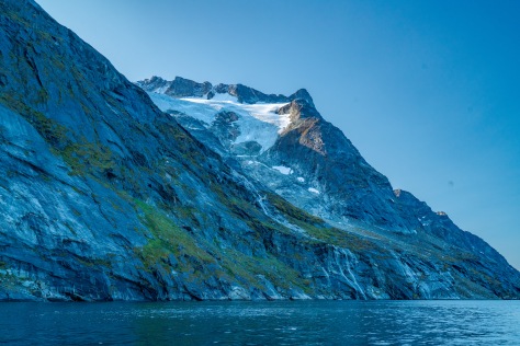
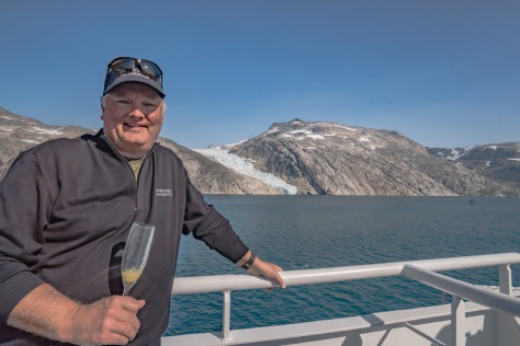
Jim and I arose with the dawn on this, our last day in Greenland. And what a grand day it was!  We bundled up to survive the cold wind off the glaciers, and rushed up on deck. At 7 this morning, we began our 7 hour passage through Prinz Kristian Sund (Prince Christian Sound), named for the late Prince, and later King of Denmark.

Prinz Kristian Sund-3

Prinz Kristian Sund-7


As Wikipedia says: “The Prince Christian Sound connects the Labrador Sea with the Irminger Sea. It is around 100 km (60 miles) long and it is narrow, sometimes only 500 m (1500 ft) wide. There is only one settlement along this sound, Aappilattoq.

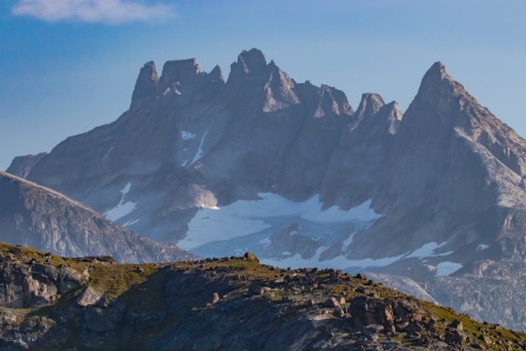
The long fjord system is mostly surrounded by steep mountains reaching over 1200 m height. Many glaciers going straight into its waters calving icebergs.”

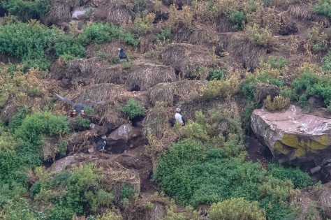
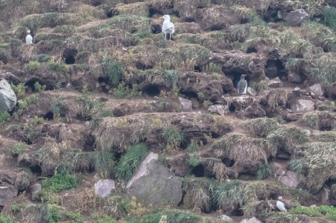
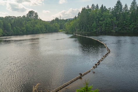
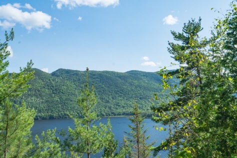
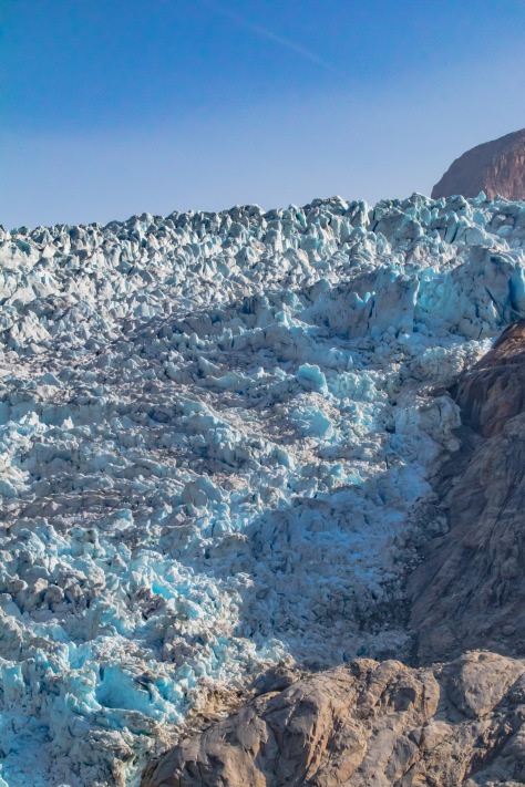
Once again, we have been blessed with a glorious day for this passage. In fact, until last night, we were not even sure we were going to be able to do this part of our trip, as all the calving glaciers can create so much sea ice and glaciers that the passage can become unsafe, which happened to another ship just three weeks ago.  While there is a possibility of seeing marine life, and animals on the surrounding slopes, the real show of the day is the topography itself. The steep walls of the main fjords and those that branch off from them are crowned with numerous glaciers, both hanging, and some reaching the sea. The water itself is a mix of saltwater overlaid with fresh water laying on top from the melting glaciers. Jim and I watched awestruck as we glided through this incredible fjord.

Prinz Kristian Sund-10Prinz Kristian Sund-16

Prinz Kristian Sund-18

Prinz Kristian Sund-22Prinz Kristian Sund-29

Prinz Kristian Sund-33

Prinz Kristian Sund-88

Prinz Kristian Sund-126

Prinz Kristian Sund-148

Prinz Kristian Sund-151

Prinz Kristian Sund-186

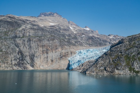
Jim and I have been fortunate enough to see both the Alaskan glaciers in the Bay of Glaciers and the Patagonian glaciers in Chile and Argentina. However, this is really a contender for the most awe-inspiring glacier cruise! To cap matters, the whole 100 kilometer channel is incredibly remote, with much of the passage blocked by ice most of the year. The only settlement of any size is the tiny town of Aappilattoq, which we passed about two hours into the transit. Waving goodbye to Aappilattoq, we allowed ourselves to go downstairs for breakfast. It was such a beautiful day, we actually ate outside with a prime view of the glaciers behind us.

Prinz Kristian Sund-186

Prinz Kristian Sund-205
Tiny Aappilattoq

Prinz Kristian Sund-32

Prinz Kristian Sund-207

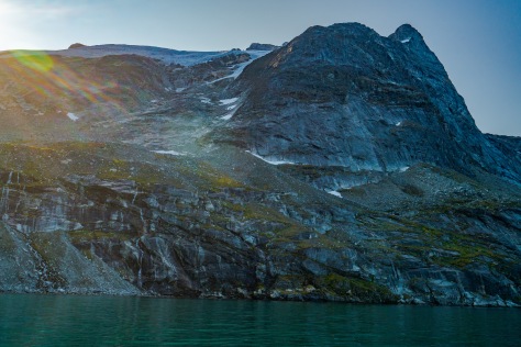
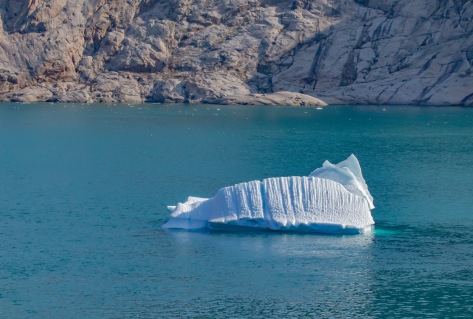
In addition to the incredible views of the glaciers, there were also countless icebergs, and a constant wash of “sea brash” (the smaller iceberg pieces that litter the surface of the water. At one point, we all became very excited because we thought we saw a large seal sunning itself on an iceberg. However, it was just a bit of dirty ice caused by the terminal moraine at as the iceberg relentlessly ground itself down to the water and calved from its glacier. Darn! However, in my opinion, by far and away the best feature we saw was a glimpse into the massive Greenland ice sheet.Prinz Kristian Sund-213

Prinz Kristian Sund-250

Prinz Kristian Sund-240

Prinz Kristian Sund-248

Prinz Kristian Sund-252

Prinz Kristian Sund-113

Prinz Kristian Sund-120

Prinz Kristian Sund-440
“Seal” fake out
Prinz Kristian Sund-162
Exiting Prinz Kristian Sund

Prinz Kristian Sund-239

Prinz Kristian Sund-264

Prinz Kristian Sund-313

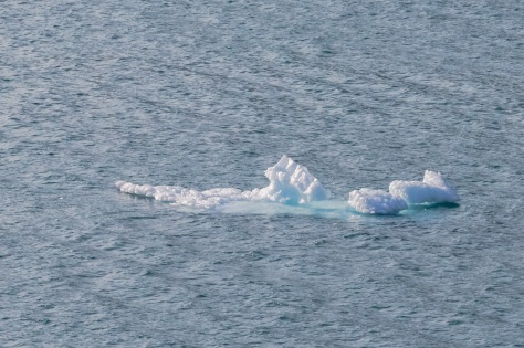
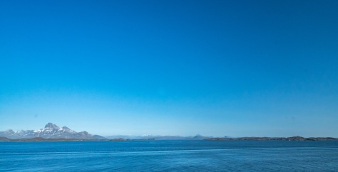
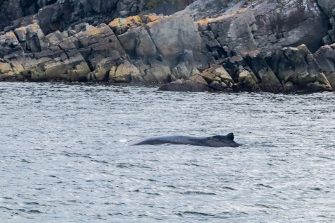
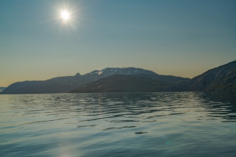
Finally, about 1:30, we exited fjord, and sailed out into the Irminger Sea.  Our naturalist aboard, Dr. Michael Scott, had told us that this stretch to Iceland is some of the best whale watching area in the world, so we didn’t want to miss a minute.  Jim and I took a break about 1:45 for a belated lunch. While we were eating on the stern veranda, sure enough, at least 25 whales passed by, spouting off like a calliope, but no photos as they were too far away (and my camera equipment was having a well-deserved nap).

Prinz Kristian Sund-335
Southern tip of the Greenland ice cap


Qaqortoq. Yes, It’s a Place.

August 29, 2017:

Although still chilly this morning, it is not the bone-chilling cold of yesterday as we pull into the harbor of Qaqortoq, on the southwestern coast of Greenland. This town is very small, but not as small as Paamiut. Fortunately, the sun is shining, as we have a hike planned along a lake, which lies just outside of town. The walk through town is charming and everyone seems to have flung open their doors to greet us (or maybe just the sunshine). We expected another cold day today, but we were shedding layers before we even started our walk/hike.

Qaqortoq-1

Qaqortoq-2Qaqortoq-11

We’re pretty much at the far southwestern tip of Greenland, which was originally populated by the Saqqaq people about 4300 years ago. There are some records of habitation dating from the Dorset peoples of NE Canada about 2300 years ago. However, recorded history dates back to the first Norse settlements established in the late 10th Century A.D., especially around the Hvalsey settlement, which is about 19 kilometers (12 miles) to the NE of Qaqortoq. However, for whatever reasons, those settlements died out in the 15th Century, and the current habitation dates only to 1774, when a Danish-Norwegian trader named Anders Olsen established a trading post here, originally called Julianehåb (Juliane’s Hope) after the Danish queen. Fast forward to the present day when we find Greenland a semi-autonomous state, still largely dependent on Denmark for trading and funding. The main industries are fishing and seal-hunting, and Denmark purchases about 60% of the economic output of this isolated town of just of over 3,000 people. Sadly, like in Paamiut, it appears most of the tourist souvenirs appear to be sealskin products. Sad!

Qaqortoq-16Qaqortoq-17

Qaqortoq-19

Qaqortoq-21

Qaqortoq-27

With that, we were happy to proceed to our walk in the outskirts of town! The hills ringing the town appear to be a combination of granitic and basaltic stones, on which lichens and mosses appear to be struggling to survive. There are no trees here, but, upon closer inspection, you notice a whole alpine-like ecosystem covering the hills. There are tiny streams everywhere, and furzes and heathers cover the rocky ground, punctuated by tiny wildflowers and wild berries including Icelandic blueberries and cow berries. The hills are open to anyone who desires to gather them and they are all ripening now. Because the day is so still and calm, the lake surface is like a mirror, which makes for some great photography! Jim and I walked about six miles in total along the rocky lakeside path, winding up back in town. We sampled one local beer at the local tavern, and then headed back for the ship.

Qaqortoq-29

Qaqortoq-39
Arctic vegetation

Qaqortoq-40

Qaqortoq-42Qaqortoq-57

Qaqortoq-61
Gathering Arctic Blueberries

Qaqortoq-62Qaqortoq-63

Qaqortoq-73Qaqortoq-80Once again, we are blessed with a beautiful sail away. It’s even warm enough that Jim strips down a shorts and flip flops, even though we can see little icebergs bobbing in the bay.

Qaqortoq-81

Qaqortoq-82

But, first, a lovely parting gift from Qaqortoq … as Jim and I were having a cocktail standing at the balcony of our cabin, a juvenile humpback whale surfaced right below us, and spouted off. What a fun send off!Qaqortoq-86

Juvenile Humpback surfacing right under our balcony

Qaqortoq-88Qaqortoq-89

Qaqortoq-106
Bye bye, icebergs!

Tomorrow, we are looking forward to a day-long transit of Prinz Kristian Sound; a deep fjord system that bisects the lower tip of Greenland from its southernmost Cape Farewell archipelago.

“Madam: There’s an Iceberg in My Sea”

August 28, 2017:


Yes, that’s the view that greeted us when we threw open the shades this morning as we sailed into the glacial bay in which the harbor of Paamiut is located. We appear to have lost our sunshine in Nuuk, and it’s a foggy, overcast morning here in Paamiut. Whereas Nuuk is the major city in Greenland, Paamiut is tiny; consisting of only about 1,500 inhabitants. In fact, there are only about 50 vehicles here!

Paamiut-1

Paamiut-3

We bundled up well, because it’s only 38 degrees outside, and there’s a light wind blowing, which intensifies the cold. Then we took the tender into the town for a short walking tour to get to know Paamiut. This tiny town was established in 1742, as a trading post by a Danish trader named Jacob Severin. The town was originally named Frederikshåb (Frederick’s Hope) after Crown Prince Frederick (later King Frederick V) of Norway. The town prospered mostly on fur and whale products. In the 1950s, it boomed following the cod fishing boom, and in the 1960s, the town was consolidated and a number of larger apartment blocks were built to lure people living around the town to come into the center to help in the cod fishing industry. However, when the cod fishery almost died out in the early 1990s, so did the town.

Paamiut-13

Paamiut-8

Paamiut-17
Regional Administrative Office
Paamiut-14
Nursery School
Paamiut-16
Main Street, Paamiut

We were met at the docks by a local guide. She walked us around, and proudly pointed out all the buildings of importance in the town. One thing you notice right away is how many schools and activity centers there are for the youth. Our assumption is that they must be pretty heavily subsidized by the Danish government because there just isn’t that much industry of any kind here, and tourism is merely an afterthought. However, like in Nuut, all the buildings are painted bright cheery colors.

Paamiut-19

Paamiut-26

Paamiut-33
Fredenskirche with its memorial graveyard


There is one building, in particular, of which the villagers are really proud. It is the local church, Fredenskirche, built in 1909 in the Norwegian Hansel and Gretel style. Looking at it, you could see where model for gingerbread houses comes from! The graveyard in the churchyard and a monument across the street memorialize fishermen lost at sea. There is also a replica of a traditional Greenlandic sod house. Also, exactly one supermarket, one grocery store, a café, one gift shop, and a couple of bars. Residents all seem to carry cell phones, but the ship has had no Internet since yesterday (sporadically), and there is nowhere in town to get WiFi. Having concluded our tour, we were happy to head back to the ship and thaw. Hopefully, there will be more warmth and sun tomorrow as we head south about 150 miles to Qaqortoq.

Paamiut-40
Replica traditional Greenlandic sod house

Paamiut-42

Paamiut-44
Tiny interior of same

Look! Look! It’s Nuuk!

August 27, 2017:

After two days at sea, with rough, foggy and cold weather, we pulled into Nuuk, Greenland this morning to gorgeous clear skies and a balmy 42 degrees. I spent most of the last two days editing puffin pictures from St. Johns, which I wasn’t able to upload over the last two days at sea, but we were both glad to see the sun again!

Nuuk-1

Nuuk-9Nuuk-19

Nuuk-23

Nuuk-35

Our excursion today takes us into the fjords surrounding Nuuk, the Greenlandic capital. We’re about 150 miles south of the Arctic Circle on the southwest coast of Greenland. This area was first colonized by Eric the Red, the Icelandic Viking. He brought with him 14 boats of Icelandic and Norwegian settlers, who primarily settled to take advantage of the incredible fishing off the Great Banks. He named the island “Greenland”, because as opposed to Iceland, there were actually areas along the coasts of this Arctic island which actually thawed long enough to become partially green (at least for a few days a year). This may have been the first recorded example of real estate puffery known to man because everyone who has visited this region will tell you that Iceland is way more green than Greenland!

Jim and I caught the first tender to the shore a short way from where our ship is moored in a glacial bay some ways inland from the actual coast. We were met at the dock by a small, but powerful, speed boat captained by a native Greenlander named Eric. Most of the people here show the mixed heritage of their Scandinavian and Inuit backgrounds, and both the captain and his first mate, Lena, also show the strong influence of their Inuit roots.

The approach to Nuuk is lovely, with the rising sun shining on postcard perfect houses painted in vibrant colors! The whole coastal area of Greenland was carved by the glaciers, some of which still meet the coastline. Many of those glaciers still calve icebergs into the bay, and the coast is carved into watery “arms” where the glaciers passed. We are searching for both whales and icebergs as we head out to cruise in this fjorded wonderland.

Nuuk-103

Nuuk-150

Nuuk-104

Nuuk-37
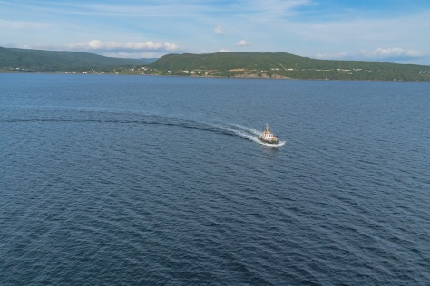
Almost right away, we see out first iceberg; a baby by Antarctic standards. This is a beautiful day for a harbor cruise, and the water is almost glass-like. However, what we all most want to see are whales; most likely humpbacks, at this time of year. We keep our eyes peeled, and I go outside periodically to snap photos as we fly across the fjords.

Nuuk-39

Nuuk-40

Nuuk-52

Nuuk-46

Nuuk-66


Nuuk-81


Sadly, it was not to be! Although there are 8-10 whales usually in the fjords surrounding Nuuk, it is a huge area encompassing miles. Eric tells us that finding them is like finding a needle in a haystack. On our way back to the ship, we stop briefly at a waterfall created by glacial melt, and Lena hops to the land to harvest some wild Greenlandic greens. We all taste what passes for salad in Greenland, and then head back to town.Nuuk-78

It’s Sunday here in Nuuk, so not much is open. Nonetheless, Jim and I walk up the slopes into to town and we climb the hill up to the monument of Hans Egede, one of the early missionaries to this area. From there, we walked to what passes for the “mall” in town, and tried to find passable Internet to upload yesterday’s post. As you can no doubt tell from the belated post, we were not successful! Oh, Well! I used the opportunity to do a little shopping. We stocked up on some carved soapstone gifts for our relatives in Sweden, and I purchased a new warmer cap made from woven musk ox fur. Items made from seal fur were everywhere since they are not endangered animals, but I couldn’t bring myself to purchase them.

Nuuk-106

Nuuk-110

Nuuk-107

Nuuk-122
Hans Egede Monument

Nuuk-133

Nuuk-139

Then, it was back to the boat! Jim and I enjoyed a gorgeous sail away from Nuuk harbor up on the bow deck high on the 12th floor of the ship. We searched vainly to see any whales in the harbor as we sailed away, but it was not to be. After searching for nearly an hour, and freezing to death, we retreated back to the cabin to get ready for dinner. Tonight, newly made shipboard friends, Rob and Sarah, will join us for a specialty Indian dinner prepared just for us in the main dining room. Tomorrow, we land in Paamiut, Greenland.

Nuuk-143

Nuuk-149

Nuuk-155

Nuuk-167

Power Puffin Watchers!

August 24, 2017:

Jim and I awoke this morning to glorious sunshine, which was quite the relief after a dreary day yesterday. It was all the more surprising when you consider that St. John’s, Newfoundland, has well over 100 days of fog every year, making it the most foggy place on Earth. Many of the businesses in town incorporate “fog” into their names; my favorite was a coffee shop called “Fog Off”.

St. John’s Visitors’ Bureau had certainly rolled out the red carpet for us, up to and including a beautiful Newfoundland dog. Jim and I wandered about the town and saw some of the key sights, including the town hall, the Anglican Church, the Roman Catholic Cathedral, and the Supreme Court of the Province of Labrador and Newfoundland. However, my favorite was all the brightly painted row houses that dot the hillside of this neat and friendly town.

St. John's -3
Signal Hill on the entrance to St. Johns’ Harbor
St. John's -916
Newfoundland Dog Greeter

St. John's -917

As bright and sunny as it is today, it is not terribly difficult to imagine the town cloaked in snow; there are as many taverns and restaurants as there are churches, and many of the stores in town exist in indoor malls like you find in Toronto and Minneapolis. Jay Menzel: this poutine shop is for you! Once again, though, my primary mission this morning was to find a powerful Internet connection so I could upload the last two days blog posts.

St. John's -919

St. John's -921

St. John's -926

St. John's -928
Anglican Church


St. John's -930
Typical street scene in St. John’s
St. John's -997
St. John’s Harbor
St. John's -934
Jay: This shop is for you!

Mission accomplished; Jim and I were ready for our excursion today: a whale and puffin watching boat trip into the Witless Bay Ecological Reserve! The Ecological Reserve is about a half hour to the southeast from St. John’s accessed from the harbor town of Bay Bulls. I’m so excited I can barely wait to get on the boat. We’ve never seen puffins in the wild, and the Witless Bay sanctuary is the largest nesting ground of the Atlantic Puffins in the world. About 260,000 nesting pairs of puffins return to the Reserve each year between late spring and summer. The islands are also home to huge colonies of Common Murres (called Guillemots in Europe), Leach’s Storm Petrel, and Black-legged Kittiwakes. There are four islands in the Reserve: Gull, Green, Great and Pee Pee islands.

St. John's -158

Today, we will visit Gull Island and go by Green island on our return. As you might imagine, with a name like Gull Island, this nesting ground is also home to thousands of different gulls, which, sadly, feed on baby puffins. Our tour operator for the cruise is O’Briens’ Whale and Puffin Watching Tour; run by the descendants one of the numerous Irish families in this area. Our tour guide, Con O’Brien, is also a very well-known local and national singing star. On the very rough trip over to Gull Island, Con serenaded us with an Irish ballad, and the boat’s sound system played several numbers by his group, the Irish Descendants.

St. John's -938.jpg
One of the O’Brien Whale & Puffin Watching Boats in Bay Bulls

As we approached Gull Island, you first saw puffins in the water, and then in huge swarms flying overhead. As we pulled in closer to the island, you could see them and their hundreds of burrows stretching up the slopes of the island. In many spots, hungry gulls would perch on the slopes near those burrows, just looking for a chance to pick off an unwary puffin. Although I know these are a ton of photos, please appreciate that I took over a 1,000 photos today!


St. John's -436
Herring Gulls
St. John's -62
Flying Puffins
St. John's -307
Puffin Burrows
St. John's -315
Herring Gull hunting young puffins

St. John's -324

St. John's -512

As we piloted around the island, and the topography changed, so did the kind of nesting birds we saw. While the puffins nest in burrows they dig into the grassy banks of the islands, murres lay their eggs right on naked rock ledges. We didn’t see any storm petrels of great auks, but we did see some kittiwakes, which also nest in the rock crevasses, but actually build grassy nests to shelter their eggs.

St. John's -348
Common Murres

St. John's -733

St. John's -744


St. John's -385
Black-legged Kittiwake

St. John's -740

St. John's -757

St. John's -789

St. John's -771

Then it was time to return to port, and the serious hunt for whales began. Jim took the opportunity to try a local specialty beer called “Iceberg Beer” which aptly describes its water source. In the spring and early summer each year, Arctic icebergs wash down along the east coast of Newfoundland, and the icebergs are harvested to provide the water for the beer. 20,000 years pure, as the Newfoundlanders like to say!

St. John's -865

St. John's -877St. John's -870

St. John's -888

St. John's -981

However, it wasn’t until we got back into Bay Bulls that we saw our first (and only) whale. This was a humpback grazing in the harbor, and it accommodatingly surfaced several times so we could record its passing.

On the way back to town, we stopped briefly for a photo opp in the scenic little town of Petty Harbor. Had we gone a couple more miles to the east, we would have seen the lighthouse at Cape Spear, which is the eastern-most point in North America. But, no worries! We will sail out within view of it tonight.

Petty Harbor-919

Petty Harbor-920

Petty Harbor-921

Petty Harbor-927

Once we got back to the ship, Jim and I headed up to the top deck to snap some final pictures of the terraced skyline of St. John’s. Jim and I enjoyed the sail away from the beauty of our balcony deck. We are pretty darn sure that as we enter the Labrador Current tonight enroute to Greenland, that this is the last night we will be able to enjoy the balcony in a long while! See you in a couple of days when we pull into port in Nuuk, Greenland!

St. John's -999

St. Johns-1036

St. John's -1002

St. John's -1005

St. John's -1008St. John's -1015


St. John's -890
St. John’s Lighthouse
St. John's -911
Cape Spear Lighthouse
St. John's -912
Easternmost Point of North America

Sacre Bleu! It’s Saint-Pierre and Miquelon!

August 23, 2017:

Today we are visiting the French territory of Saint-Pierre and Miquelon. This territory is a small archipelago of islands laying about 12 miles to the south of Newfoundland in the Gulf of the St. Lawrence River. Over the centuries, it has passed back and forth in ownership between England and France. However, for the last two centuries, it has been held by France, and the islanders consider themselves resolutely French. Indeed, when given the chance to become fully integrated with France, become a self-governing state within the French Community, or stay a territory of France; the islanders voted overwhelmingly to stay a territory.

Saint-Pierre-2

Saint-Pierre-3
The cruise ship dock

Saint-Pierre-31

I confess that having seen the island of Saint-Pierre, I am wondering why anyone would fight for ownership of this territory. Jim and I walked from the ship’s berth into the town and wandered around for about and hour. Fishing was the lure that originally led to the establishment of this colony, and remains the main industry today. However, the decline in cod stocks has seriously damaged this industry. The island had a brief shining moment in the 20th Century, when in the wake of Prohibition, Al Capone established a smuggling outpost here. In fact, so much liquor was smuggled through the island during Prohibition that at one point, the town was completely awash in wooden liquor cases, and one resident built a home out of them called the Cutty Sark house. The repeal of Prohibition hurled the town into recession, and it looks like it has barely recovered since then.

Saint-Pierre-12

Saint-Pierre-17
The fishing port
Saint-Pierre-19
Fishermen’s shacks to store their gear called “Saltines”

Saint-Pierre-22

Saint-Pierre-25

In the downtown area, we could see pictures of the place in winter, and it looks like an Inuit village in the Arctic. Definitely, not very inviting! Perhaps to stave off the depression those winter months must bring, many of the homes in town are painted lovely pastel colors. Today, the total population of Saint-Pierre hovers at about 5,500, and the tiny island of Iles aux Marins (Sailors’ Island) which lies just a few hundred yards off the port of Saint-Pierre is abandoned, with the sailors’ ghostly homes a reminder of years gone past.

Saint-Pierre-32
The Streets of Saint-Pierre in winter

Saint-Pierre-29.jpg

Saint-Pierre-33

Saint-Pierre-34

Saint-Pierre-35

Jim and I had been booked on an excursion to the island, but since the main activity was just wandering among the abandoned buildings, which would could see quite well from the ship’s deck, we opted to go back to the ship and take in the view from our balcony instead. Tonight we enjoyed a lovely view of the sun setting on Iles aux Marins as we sailed to our next port of call, St. John’s Newfoundland.

Saint-Pierre-48
Iles aux Marins

Saint-Pierre-54

Taking a Look at Corner Brook, & Captain Cook

August 22, 2017:

Yesterday was a much-appreciated day at sea, although we pretty much missed the entire eclipse.

Today, we had a change of schedule. We were originally scheduled to land at Prince Edward Island in the town of Charlottesville; home of the much-beloved Anne of Green Gables.  I had really looked forward to mentally re-living those stories as we had AGG-centric tours scheduled. However, we can’t really complain about the rationale for the change. Apparently, it was necessitated by a new shipping law intended to protect the extremely endangered North Atlantic Right Whales.  Scientists predict the remaining worldwide population of North Atlantic Right Whales may number as few as 400, and all previous conservation attempts to reverse their declining numbers have been unsuccessful. Therefore, as of August 11, 2017, all shipping traffic within a large area of the ocean around Prince Edward Island was ordered to reduce speeds to 10 MPH in order to minimize the danger of ship strikes to the whales. This change meant we were not able to get to PEI in time for our visit there, and still make the rest of the stops on our itinerary, so we diverted to Corner Brook on the west coast of Newfoundland instead.

Corner Brook-1

There is a lot of cool stuff to know about Newfoundland. For one thing, the geology is so old, it predates the Rocky Mountains by hundreds of millions of years. It was originally inhabited over 9,000 years ago, and was discovered by Leif Eriksson about 1,000 AD. It was the first discovery of the North American territory by Europeans, and predated Columbus’ “discovery” by over 400 years. The whole of Greenland and Labrador was extensively explored and charted by Captain James Cook from 1763-1767. The island was settled by many different European settlers, but they all had one thing in common; they were drawn here by the incredibly rich fishing grounds in the Great Banks which are made possible by the Labrador current running down from Artic Canada and Greenland down the Labrador coast on the NE Canadian mainland and around most of the island of Newfoundland.

For our visit today, we are visiting the town of Corner Brook, which is located at the far eastern end of a deep bay lined with islands. In fact, Captain Cook named it the Bay of Islands; a name he liked so much that he reused it when he discovered New Zealand. Because the excursion staff was scrambling to come up with suitable outings for our nearly 500 guests in a small town which not part of our original itinerary, many of these last minute options involved bus trips for between 2 and 8 hours on school busses. Instead, Jim and I decided to explore some of the scenic walks in town.

We started off by hiking up a steep hill overlooking the town to visit the monument to Captain James Cook. The walk was quite a bit more rigorous than Jim or I had planned, but we were rewarded by some great views over the town and the bay. The other good outcome of the hike was that we met a really nice couple from Cambridge in England (Chris and Heather) and they hiked with us.

Corner Brook-18
Captain Cook Monument

Corner Brook-13

Corner Brook-12
View over Corner Brook and the Humber Arm

Then we were able to catch one of our tour busses back to the ship. I must say, the tourist bureau of Corner Brook was scrambling to give Saguenay a run for their money in the competition to be the “nicest port in Canada” (yes, that IS a thing here)! Everyone we met was exceptionally nice, with the prevailing language being English, spoken with what sounded like a kind of a rounded Irish accent.

Since I had been having trouble to get the photos for the blog to upload on the ship, we found a really nice coffee shop and café right next to the ship called Harbor Grounds, and I parked myself at one of their tables for most of the afternoon to upload photos and get a couple of blog posts published using their really good WiFi. After having a yummy raspberry lemonade, Jim ditched me to go out and enjoy laying by the pool on deck.

Having accomplished my mission, I dropped my computer back on the ship and caught the shuttle back to town so I could explore the highly touted walking path running through the center of town. It runs right next to a brook and originates at a large pond called Glynmill Pond. In all the reviews I had about it, they all mentioned bird life at the pond and featured pictures of swans. That was enough for me, so off I went. The walk was really great and shaded by forest. As you can see, the pond is really lovely and the big building at the end of the lake is the Glynmill Hotel, a local gem of a hotel, and still lovely. The swans were just the icing on the cake!

Corner Brook-27
Glynmill Pond

Corner Brook-31

Corner Brook-33

Corner Brook-39

Corner Brook-46
Glynmill Inn

Corner Brook-56

Corner Brook-69

Corner Brook-72

Corner Brook-78

Corner Brook-82

Corner Brook-85

Tomorrow, we actually sail into France for a day (at least the French territory of Saint-Pierre et Michelon, which is a small archipelago of islands to the south of Newfoundland, and which is the last remaining French Territory in North America. Au revoir until tomorrow!

Corner Brook-48

Corner Brook-49

Corner Brook-52

Sailing into Saguenay

August 20, 2017:

During last night’s sail, we took a detour off the St. Lawrence seaway into the Saguenay Fjord; a deep glacial fjord which has an intriguing mix of very rich cold tidal water flowing in from the Labrador current running through the St. Lawrence estuary, overlaid with a much thinner layer of fresh river water  running into the fjord down the Saguenay River from Lac St. Jean. Since the fjord is open to the ocean, it has very abundant sea life, and whales follow that sea life up the fjord most of the way to Saguenay. Notably, the fjord is home to a small population of Beluga whales, which have probably populated the fjord since the last ice age. Sadly, this particular population is highly endangered, with only about 1,000 of them remaining. For this reason, the entire fjord area and some of the St. Lawrence estuary beyond has been named as a national marine park (with attendant restrictions on human interaction with the whales) in order to protect them. Overlaying the marine park is a national land park, stretching several miles inland from the shores of the fjord. This map generally shows the area we have entered.

1024px-Parc_marin_Saguenay_fr

Saguenay-1
Coming in to the beach area in Saguenay

Saguenay-3


Our activity du jour consists of a hike up into the national park in order to better see the fjord. However, since that didn’t happen until later this afternoon, Jim and I had time to walk into town and wander around. One thing you notice immediately is how many greeters are on hand to welcome you to the Saguenay region. All the greeters are volunteers, and there are about 50 of them that spring into action every time a cruise ship comes into town. As we later learned from our guide, tourism is now the number one industry here, although historically, the town was originally a huge logging and lumber/paper/pulp processing area. More recently (and still), the town is also home to a large aluminum smelting operation, which is crazy when you consider that bauxite does not naturally occur here, thus requiring it to be shipped in constantly. This enterprise only makes sense financially because of the abundance of cheap Canadian power, which is made possible by the numerous dams creating hydropower.


The guide was quick to tell us that the Saguenay region sees tourists for all four seasons, which seems hard to believe, given how remote it is (about 3 hours by car from Québec in the best of conditions), and that the town regularly gets 9 meters of snow, while the surrounding hills routinely get 30 meters! Apparently, ice fishing is also a big winter sport, but with temperatures that get down to minus 40 degrees every winter, the prospective charm of this is lost on us.

Jim and I wandered around town, and visited a local craft market. Then we hiked up to the upper elevations of the town to get the best views of the fjord, and returned to the ship through the lovely seaside park. There were numerous cafés with outside seating, but all I could think of was the snow accumulations soon to come.

Saguenay-7

Saguenay-8
Local school
Saguenay-9
Artisans’ Market

Saguenay-10

Saguenay-11
View of Saguenay Fjord

Saguenay-16

Saguenay-18

Saguenay-23

We boarded school busses for our tour out to the Fjord du Saguenay National Park. There, a park ranger met us, and led us on a hike up a very rustic path, climbing about 200 meters up to a lookout overlooking Cape Trinity inlet. The Park is home to abundant wildlife, including moose, beavers, marmots, foxes, snowshoe hares, lynx, grey wolves and black bears. However, we saw none of them, but enjoyed a very fragrant hike through the woods nonetheless!

Saguenay-32Saguenay-33

Saguenay-39

Saguenay-43

Saguenay-51

Saguenay-54

Saguenay-57

Upon our descent, it was time to beat feet back to the ship, because tonight was “Block Party” night aboard. This means that everyone gathers in the hallways outside their bedrooms to meet their neighbors, while the ship staff passed wine and appetizers. It was really nice meeting our cabin mates, and we learned that several of them are also from Southern California.

Saguenay-63

Saguenay-85

Saguenay-88


Saguenay-96

Saguenay-97

Saguenay-100

Then Jim and I went up to the top bow of the ship to watch the sunset cruise out the fjord. I was fortunate to catch a carved statue of the Virgin Mary high atop the entrance to Cape Trinity just as we lost the light. We ended the day with a lively dinner with a British couple we met earlier on the hike, Rob and Sarah, which made for a really special cap to a super day.

A Quest to Québec

August 19, 2017:


This morning we awoke on the St. Lawrence seaway, sailing into the port of Québec. The area now known as Québec was discovered by French explorer Samuel du Champlain in 1608, and takes its name from an old Algonquin word “Kebec”, meaning “where the river narrows”. Champlain was the first to coin the phrase “le  Canada” to describe the newly “discovered” lands, and Jacques Cartier was the first to claim the area for France. Champlain built a fortification on the cliffs overlooking the river settlement, and started the fortifications (called Fort St. Louis) in 1620.IMG_0032

The approach from the water is striking in that old Québec sits upon a fortified hillside complete with encircling stone ramparts up to 35 feet thick. In fact, the walls date back to the 17th Century, and make them the oldest fortified ramparts still standing in North America. That fact earned Québec UNESCO World Heritage status, and guarantees a steady stream of tourists daily to the city. In fact, Jim and I thought we could have been back in Assisi for the volume of tourists we saw wandering around in the old town.

Quebec-2
The suburb of Levís across the St. Lawrence from Québec

Atop the old town is the towering Chateau Frontenac, a lovely grand old hotel which dominates the Québec skyline. The hotel has been added onto several times, but retains its old world charm. During World War II, President Roosevelt and Winston Churchill met there twice in secret to plan both the European and Pacific war theatre offensives.

Quebec-6
The dock side area complete with amphitheater

Our activity for the day consists of a walking tour through the old city (complete with funicular ride up to the old city) and a horse-drawn carriage ride through the newer and old parts of the city.

The port area in Québec has been nicely upgraded and includes a waterfront park through which we walked to get to the funicular. The lower city built around the outside of the ramparts is called Basseterre. From the vantage point there, you can even see a giant slide area wrapping around the outer rampart, which children use to sled down in the wintertime. Québec hosts a Summer Festival and Winter Carnival in the old town and there are activities going on all the time. In fact, there is even a huge amphitheater on top of the ramparts which can accommodate up to 120,000 festival goers.

Quebec-12
Waterfront park looking up at the fortifications and Chateau Frontenac
Quebec-15
The entrance to Basseterre

Quebec-22

We rode up the funicular and walked out onto a beautiful esplanade area with great views overlooking the cruise port, Basseterre and the St. Lawrence River. From this standpoint, the Chateau Frontenac basically dwarfs everything in the old town. Then it was time for our carriage ride. Sadly, it was raining a bit, so we had to have the tops up on our carriages, and that impaired the photography opportunities somewhat. However, wherever we went, beautiful flowers were in bloom and the old architecture of the homes and shops was charming.

Quebec-23

Quebec-25
From the esplanade looking at Chateau Frontenac with statue of Samuel de Champlain
Quebec-27
Salvatore Dali sculpture on display outside the Chateau Frontenac

Quebec-34

Quebec-35

Quebec-36


Quebec-44.jpg

Quebec-59


Quebec-64
Map of the ramparts around the old city

We met our guide back beside the Chateau, and then wandered through the old town, stopping briefly at the Notre Dame Cathedral and the Anglican Church. There is a nice artisans market right next to the latter.

Quebec-83
Anglican Church


Quebec-81
Craft market to the left on the church grounds
Quebec-88
Notre Dame Cathedral

Following our tour, Jim and I chose to have lunch at one of the many open air cafés scattered through the old town, and then wove our way down through Basseterre and back to the ship.

Quebec-108
Basseterre

Quebec-109

Our sail away was really spectacular this evening, as the clouds had largely lifted, and the sun was striking on the old town. We look forward to sailing down the St. Lawrence and into the Fjord of Sagenay on our way to visit Sagenay tomorrow.

Quebec-121Quebec-127Quebec-134